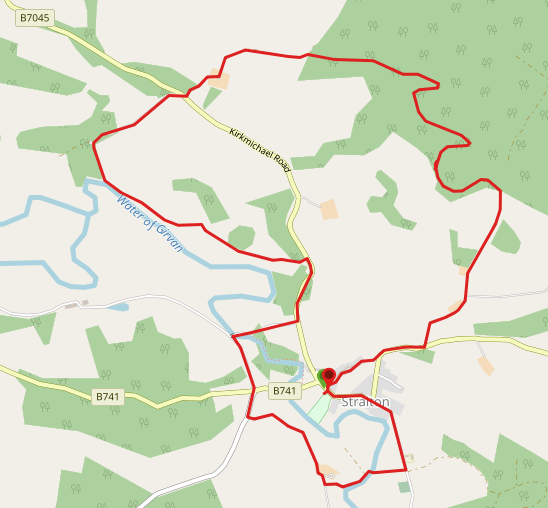
Terrain: Farm tracks, forestry trails, grassy fields, surfaced roads. First part of the walk mostly uphill. Several gates. No stiles.
Livestock: field sometimes contains livestock – be a responsible walker.
![]() Car park off Kirkmichael Road, Straiton (KA19 7NF). There is an information board in the car park and some leaflets about walks in the area. Local bus service stops on Main Street, 1 minute from the walk start point.
Car park off Kirkmichael Road, Straiton (KA19 7NF). There is an information board in the car park and some leaflets about walks in the area. Local bus service stops on Main Street, 1 minute from the walk start point.
View full route description
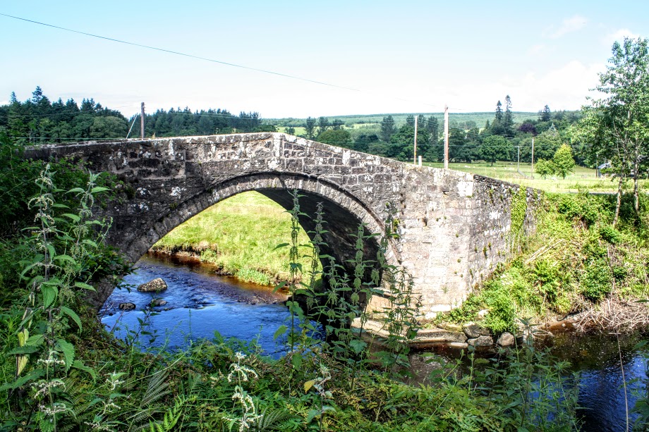
Leave the car park from the main entrance, cross Kirkmichael Road and turn left (NW). Almost immediately take the road on your right (NE) signposted Fowler’s Croft. Walk along this residential street passing some pretty cottages on your left-hand side and a small burn on your right-hand side. At the end of the road follow a narrow track straight ahead along the edge of some trees (path not shown on map). You will emerge onto B741/Dalmellington Road.Turn left (E) and walk along the roadside for 240m before turning left again (N) to cross a stone bridge onto a minor road. The road heads uphill past Hazel Lodge, just beyond which there is a fork. Keep left (N). Follow this track uphill. You will pass another cottage, beyond which the track turns grassy. Eventually you will arrive at the edge of a forest and here you turn left (NW) onto a wide grassy clearning in the trees (boggy underfoot at the time of writing and somewhat overgrown in summer months). Stay on the main forestry track ignoring any off-shoots. After approx 2.5km you will emerge at a gate. Go through the gate and turn left (S) to follow a track downhill to Altizourie farm. Turn right outside the farm house. This road leads you to the B7045/Kirkmichael Road. [For 4 mile option and to avoid the field crossing, turn left (SE) here and return to Straiton via the B7045]. Crossing the road, continue almost straight ahead (W) onto a gravel track. Soon after passing Bishopland Lodge, turn left (S) at a fork and after 340m you will reach a gate at the entrance to a field. Note the Water of Girvan on your right-hand side! Continue straight ahead to cross the field using quad tracks on the edge of the slope. The tracks fairly closely follow the field boundary fence all the way to a metal gate leading into another field on your right. Go through the gate then continue straight ahead (SE) along faint tracks on the edge of the slope. The ground is quite tussocky here and hard going. The tracks lead you to a gate with “Private Garden” signage on it – here veer left up the hillside, roughly following the field boundary fence-line. You will begin to see a gate ahead – go through the gate and follow the track straight ahead to reach the B7045. Turn right (S) along B7045, then take the second road on the right (W) at the Lady Hunter Blair shelter. Walk along this road to reach The Old Bridge of Blairquhan over the Water of Girvan. Cross the bridge then turn left (S). You will reach a crossroads at the B741. Continue straight ahead (S). Take the first road on your left (E), signposted Bennan Farm. Stay on this road until you have passed through Bennan farm (ignore an earlier marker post pointing to the car park, unless you want to take a short cut!). Turn right when you reach the farm cottage, then just before the field turn left (E) onto a track. Follow this around the edge of some paddocks, emerging onto Newton Stewart Road. Turn left (N) onto Newton Stewart Road and when you reach the war memorial turn left (NW) onto Main Street/B741. Walk through the village to reach the car park, 400m along on the left-hand side.
WALK REPORT: 11th July 2017 and 10th January 2024
A while back I picked up a leaflet containing several walks in the Straiton area, one of which was the Hill Wood Walk. I’d enjoyed my previous rambles in the area so knew this one would be no different.
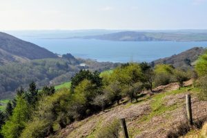
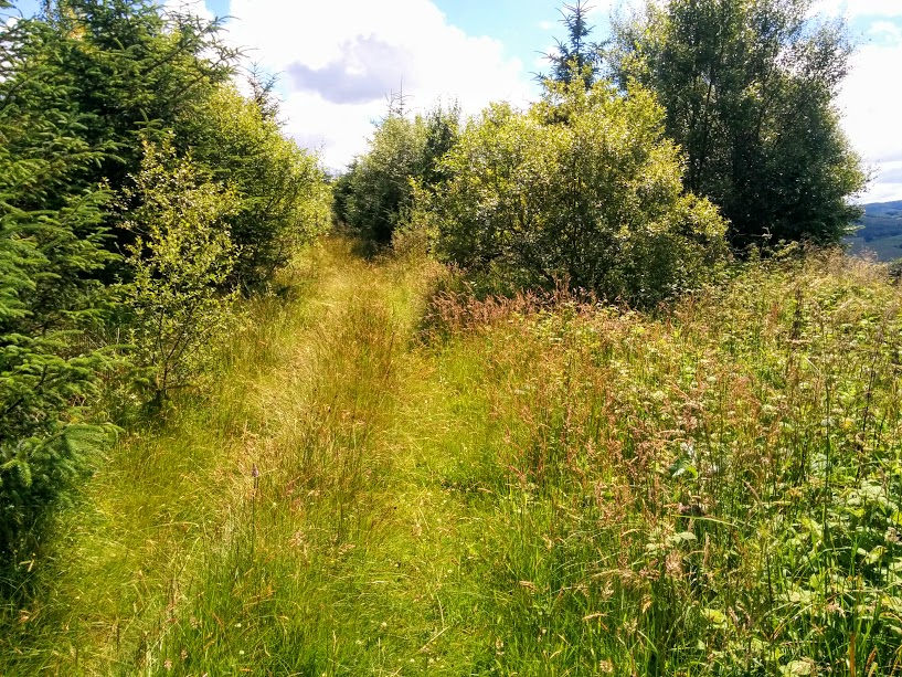
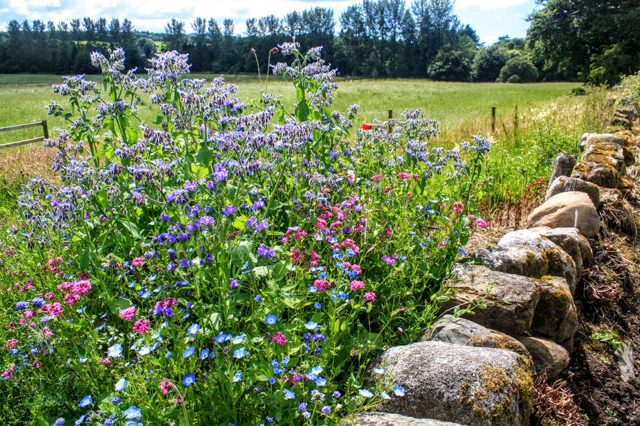
The initial climb out of the village was perhaps steeper and longer than I had anticipated, so we were grateful for the lovely view at the top for a chance to catch our breath (see cover image!) After a little bit of confusion due to the Hill Wood path being quite overgrown and “not possibly where we need to go” we determined that it was indeed the way and set off into the jungle.
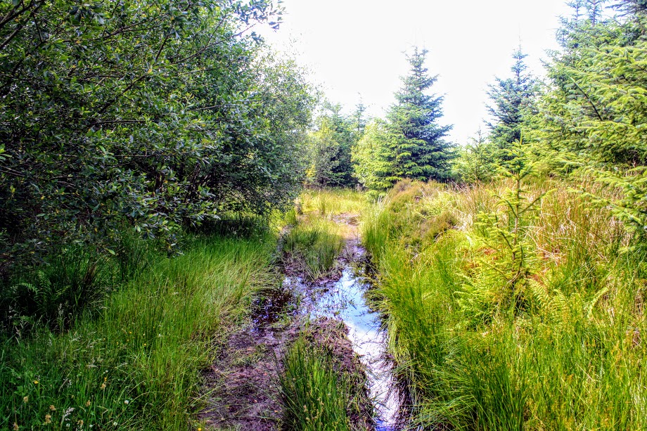
Somehow whilst inside the Hill Wood I managed to lose mum! It was the most impossible path ever to lose someone on, but we managed it….
I needed to use the bathroom, found a suitable spot, told mum, she said ok and continued along the path, I did my business, came out from the trees two minutes later and picked up the pace to catch up. Where the hell is she? I thought as I followed the path around yet another bend . No sign of her! I stopped and checked behind me. Nothing. I listened for crunching or swishing of grass or any sort of noise to signify another person was near…. just an eerie silence. Muuuum?! I called out…. not a peep in reply. I knew I hadn’t passed her, and I knew there had been no alternative paths, so she must be ahead of me. Yet I knew that she wouldn’t usually go so far ahead without waiting…. Has she been dragged into the trees by some mad man? All sorts of things went through my head and I didn’t know whether to keep walking or start heading back. I was going to have to try and phone her! Just as I reached for my mobile it rang, ‘Mum’ flashing on the screen. Turned out she had decided to go to the loo as well just along from where I’d stopped! Could only happen to us….!
When we returned a whole 7 years later we expected to find the Hill Wood route in a different condition: for one thing it was now winter so it shouldn’t be overgrown and for another we were hoping that the previous night’s hard frost would reduce the bog factor. Not only were both of those expectations met, but the trail was almost unrecognisable! Some large machinery had evidently been along it and torn out some of the trees, widening the path. Pieces of shredded tree lay all over the ground – we assumed a technique to help with drainage. About halfway through the forest even more work had been done: a huge (and very effective) drainage ditch had been dug to the right-hand side of the track, and the track itself had been built up. Like a motorway, mum exclaimed!
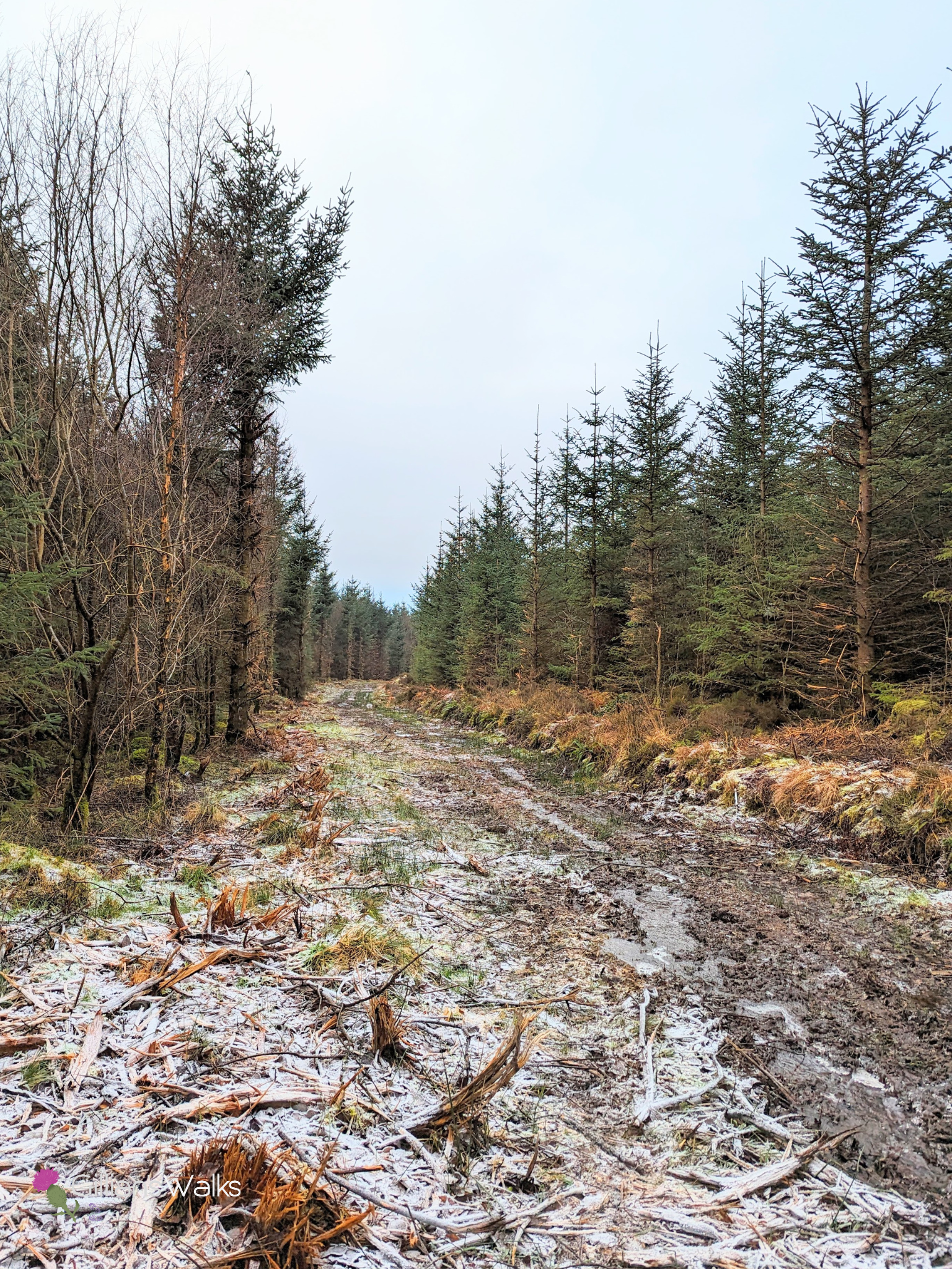
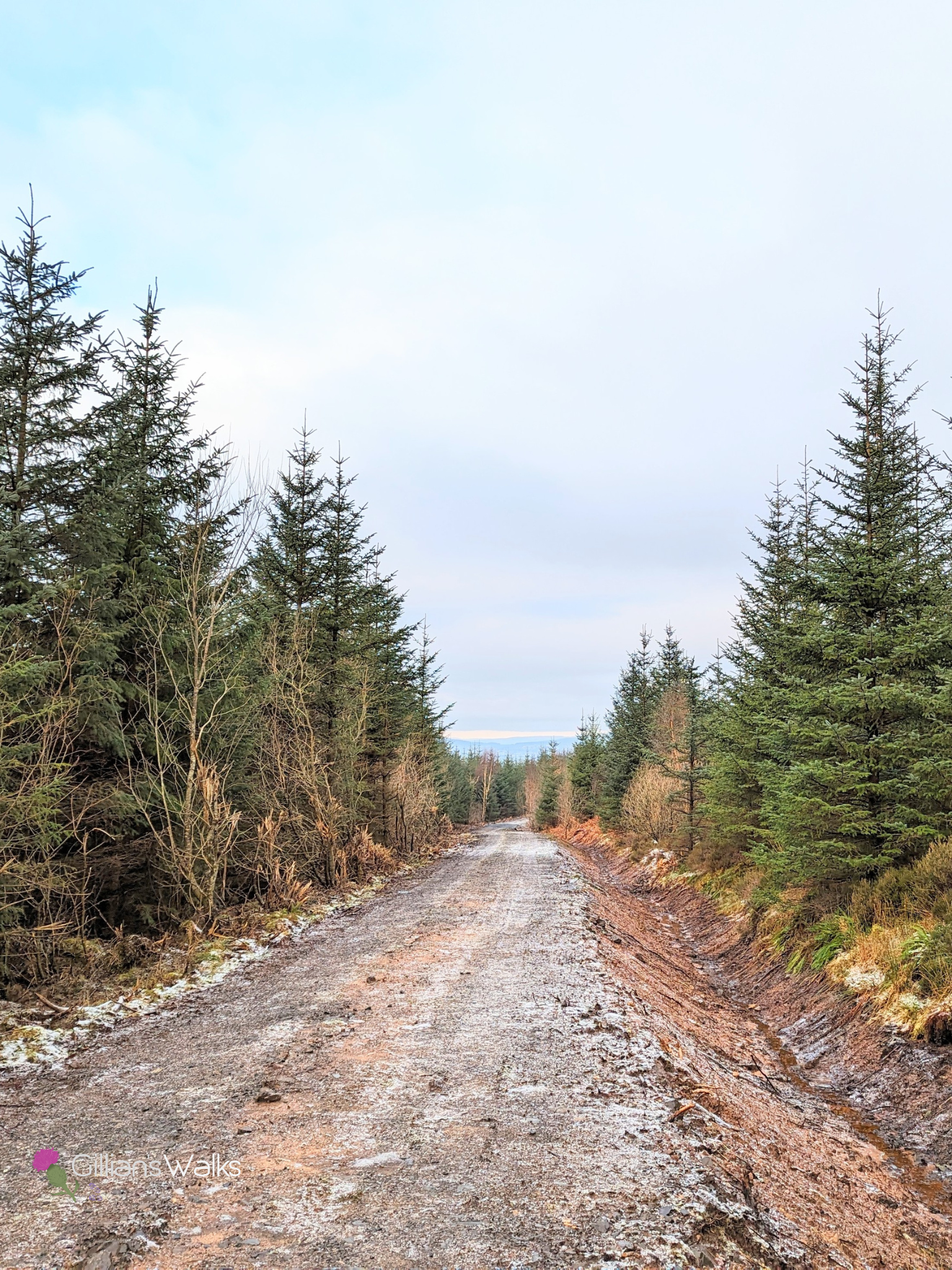
We had questions…. Was this work being done simply to improve drainage along the trail? That would be amazing but seemed unlikely… Are there bigger plans: is the access through the forest being improved to allow other equipment in perhaps to carry out some felling, or are there plans for a windfarm or similar? Is the work complete or do they plan to extend the drainage ditch all the way through?
I have since found out that it is to allow access for a small amount of tree felling, possibly in relation to the nationwide programme of removing diseased Larch trees, although that has not been confirmed to me. More information about the programme can be on the Forestry and Land Scotland website.
Back to our first visit in June 2017…..
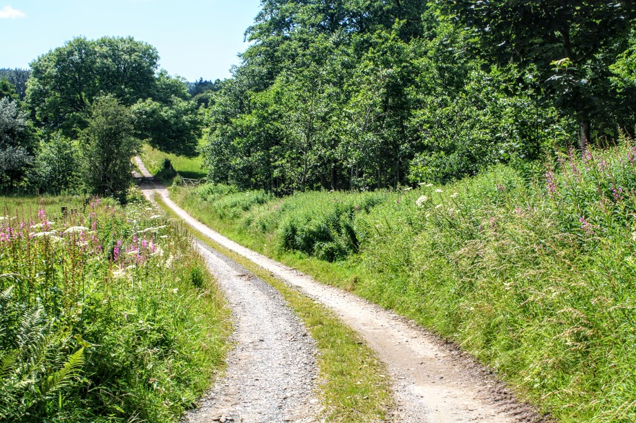
The route described in the leaflet was not a circular – it appeared to end when you emerged out of the Hill Wood at the main road. The return options seemed to be to retrace your steps back through Hill Wood or walk along the busy B road, neither of which appealed to me. So I devised my own circular walk from here, and the result was better than I could have imagined! (I did boast to my mum that in my very biased opinion the return section was far more interesting and enjoyable than the published walk from the leaflet 😉 ) There was wildlife-a-plenty: dragonflies, bees, butterflies, heron, a bird of prey (need to swot up on my birds!) and some beautiful areas of wild flowers.
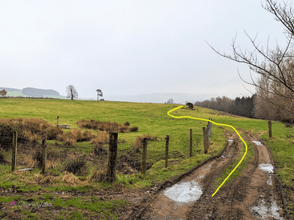
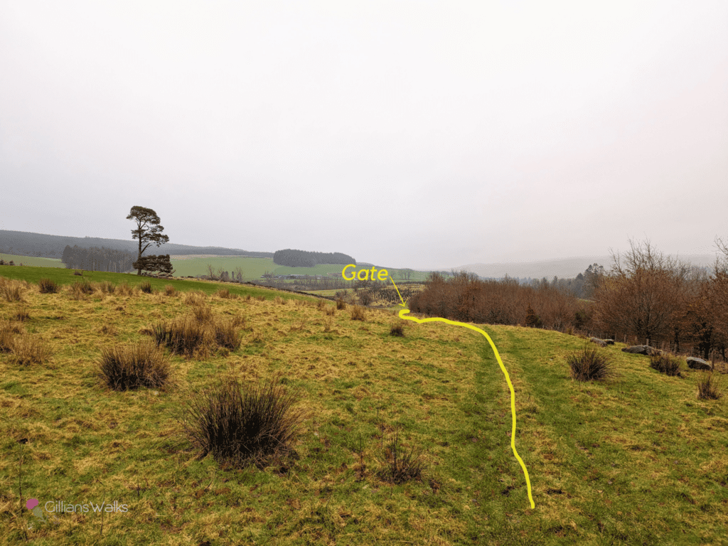
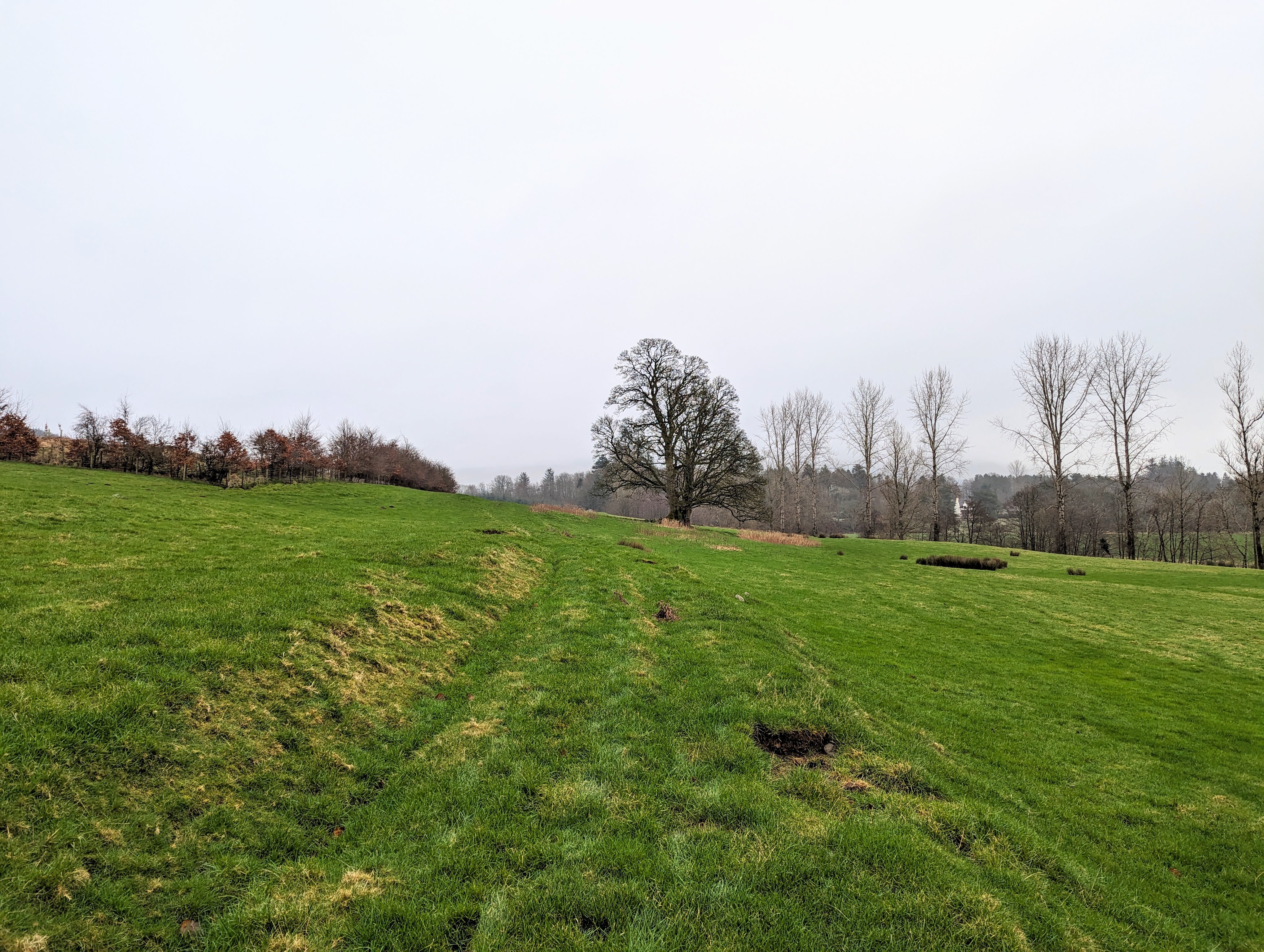
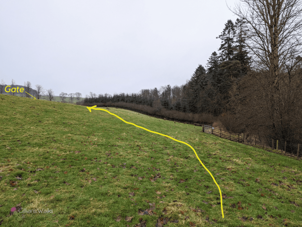
When we reached the field I became a little nervous as there wasn’t actually a path or track across it. Although on our particular visit there were what appeared to be fresh landrover tracks which had flattened the grass enough to leave a trail for us to follow. We soon found out why: the farmer was out. He turned out to be really nice and even paused, puffing away at his pipe, to hold a gate open for us. This was reassuring, as was the fact that we were following a track shown on my map as opposed to randomly crossing a field. There were sheep present, but they didn’t bother with us.
This is definitely the trickiest part of the walk to navigate, so do follow the route description above closely so that you don’t lose your way. There are two fields and both are small hills which means you can’t see where you are aiming to get to until you are well on your way there. The annotated photos below should help if you’re in doubt, although you may have to alter your route if there is livestock in the fields when you visit.
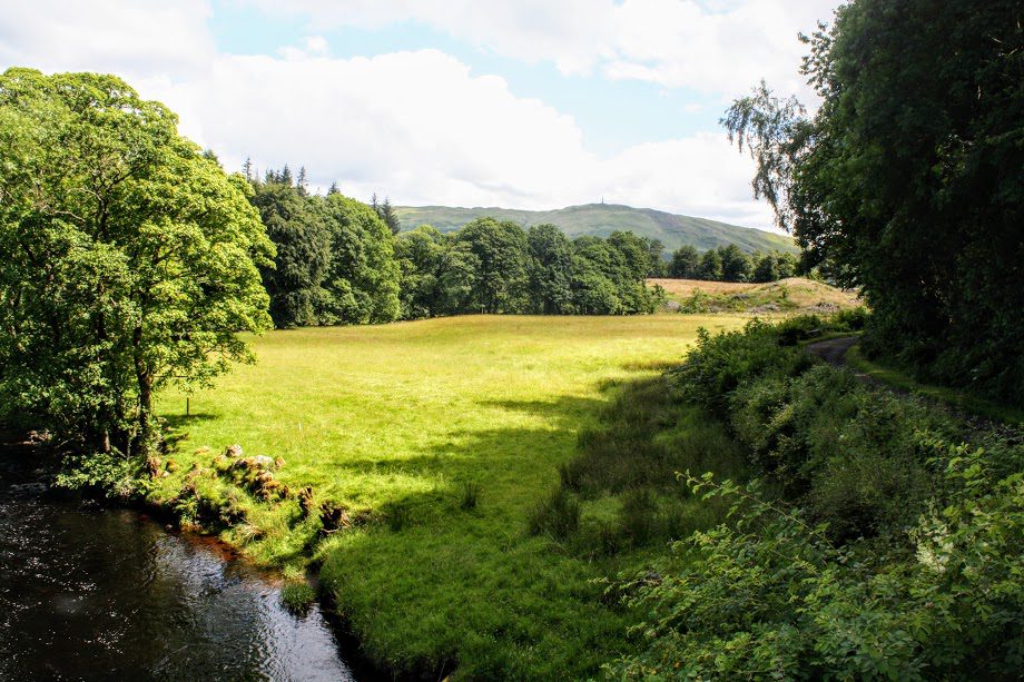
After coming off the fields we were back onto surfaced minor roads and gravel tracks. Highlights included crossing the Old Bridge of Blairquhan and fine views across the fields to Monument Hill (a walk for a different day!)
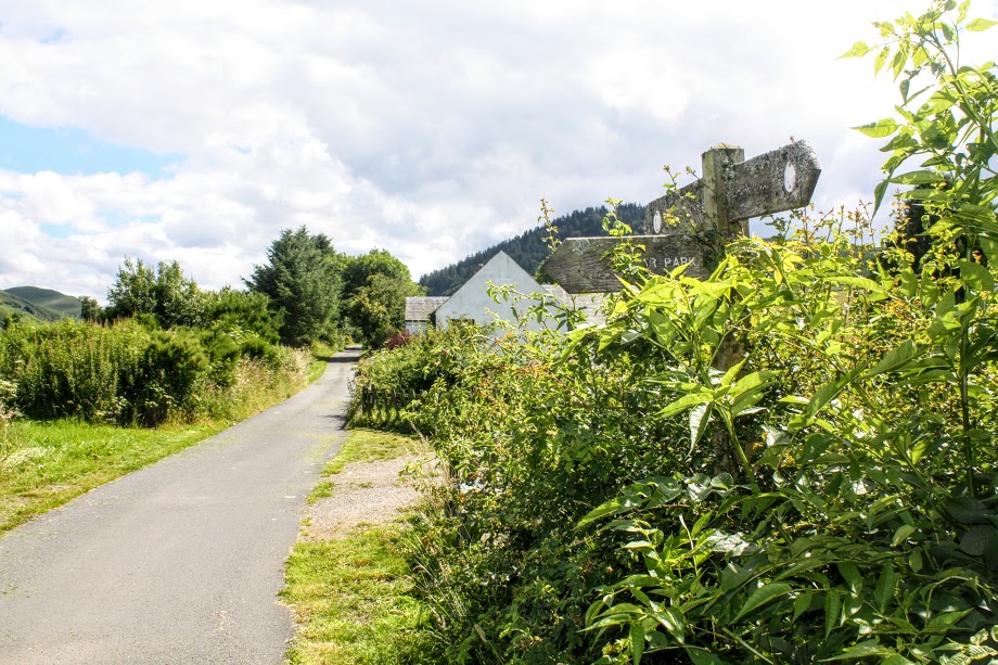
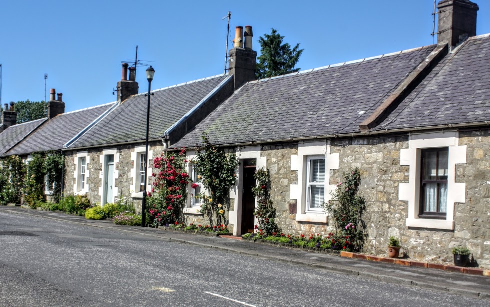
We both loved the very last section of the walk through Straiton. Despite parking next to the recreation ground several times in the past for walks or visits to the play park, this was my first time actually passing through the village itself. Rows of quaint cottages with tiny little gardens to the front. A real ‘olde worlde’ feel about it.
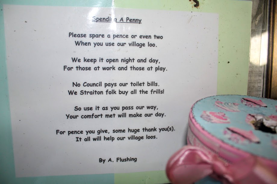
And no walk would be complete without a visit to the local public toilets (even though, as you have read, we definitely shouldn’t have needed to go yet!) It turns out that they are run by locals, having been closed by the council in 2008. Apparently it costs £3500 to run every year and they rely solely on donations. We loved this little poem inside which got the message across in a lighthearted way 🙂