![]() Dog-friendly walk
Dog-friendly walk
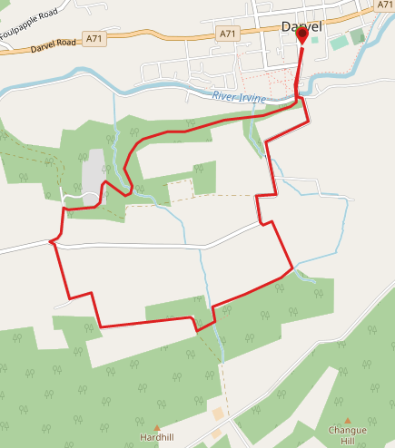
![]() Car park off Randoldcoup Road, Darvel (KA17 0JU). Bus services from Kilmarnock stop on A71/East Main Street, a couple of minutes walk from the start point.
Car park off Randoldcoup Road, Darvel (KA17 0JU). Bus services from Kilmarnock stop on A71/East Main Street, a couple of minutes walk from the start point.
View full route description
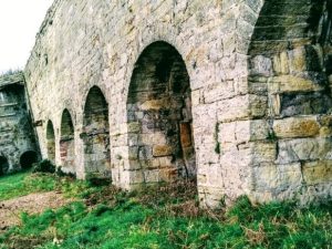
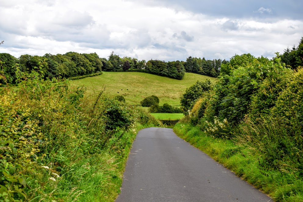
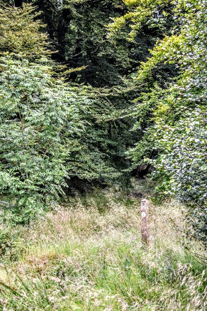
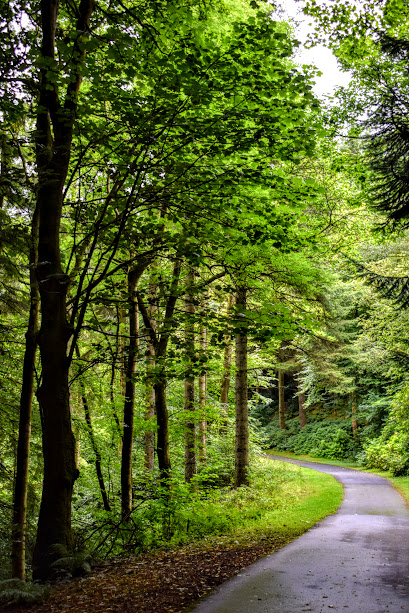
From the car park turn left onto Ranoldcoup Road and after crossing the bridge turn left followed by right. This country road immediately starts to climb and continues to do so all the way to Dyke Farm. On reaching the farm come off the road just where it starts to bend to the right. There is an ‘Irvine Valley Paths Network’ sign attached to the fence which indicates the continuation of the route to the left, through a kissing gate. Follow the grassy path between two fences and then uphill through a tree-lined corridor to another kissing gate which you should pass through. From here the trail continues to the right along the fence-line and through the woods, with regular way-markers keeping you on track. After an uphill section, the path emerges at a clearing in the trees. Turn right here and after a short walk you will emerge onto a forestry track. Turn right to follow it as it zigzags downhill for just under 1 mile towards Lanfine Estate. On reaching a T-junction in the road, turn left and then right as indicated by a black way-marker. You will now pass through some iron gates marking the entrance to Lanfine Estate. Follow this road along to another way-marker ‘Lanfine Deliveries / Darvel’ – turn right here then left at a 3-way fork a little further along. You will pass through a small cluster of houses before the road swings right and then winds it’s way out of the Estate via the impressive Newlands Bridge and the wild boar enclosure. At the gates continue straight ahead to cross Ranoldcoup Bridge and retrace your steps back to the car park.
WALK REPORT: 28th July 2017
I love exploring the Irvine Valley, so finding myself with a few child-free hours I set off to ‘quickly’ check out this route which sounded very promising from what I’d read on the Ayrshire Paths website. I estimated that I could do it in approx 1.5 hours and so off I went with a small backpack containing waterproofs, some drinking water and a tub of salted peanuts…..
All was well until I got to the car park and realised that I had forgotten my walking boots! I was going to have to do it in my trainers then. The walk sounded like it is mostly on roads anyway I justified to myself, and it was a dry day so I should hopefully be fine.
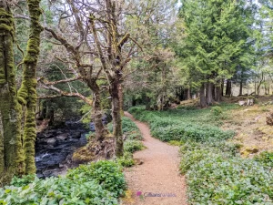
I may well have been fine, had I been able to follow the intended footpath through the woods. However the start of the trail up behind Dyke Farm was so overgrown with nettles and other vegetation that I dared not even attempt it. In my wisdom I chose to follow the field boundary which ran parallel to the woodland and hopefully be able to cross over to the correct path at some point. The field was empty and full of lush green grass so looked far more appealing. I didn’t account for all the cow dung I would encounter, nor the fallen tree which was surrounded by ankle-deep bog. Suffice to say that my lovely pink trainers were no longer that colour when they arrived home! It was torture walking through all of that whilst the whole time being able to see the way-marked woodland path (now dry and free from nettles) at the other side of the impassable barbed wire fence! Impassable, that is, until I reached said fallen tree, which had forced it closer to the ground allowing me to clamber over it more easily.

From this point the going was far easier and I it gave me the chance to wonder why on earth people would take the time to come up here with so many way-markers, provisions to build boardwalk and small bridges etc to then allow it to become so overgrown that walkers are unable to enjoy it?! Not only that, but there is a website dedicated to promoting these trails! Unfortunately I suspected that I already knew the answer: often it is volunteers who are left the arduous task of maintaining these paths in their own time and with only donations as funding. I would happily keep such trails maintained as my job, if only such a job existed! I feel that East Ayrshire Council should do more to help keep these local path networks open for business for the enjoyment of residents and visitors alike. What the Irvine Valley has in it’s network of paths is truly special and should be preserved and promoted to encourage people to come and spend time here. It was a real shame because once I was able to use the path I could tell that a lot of work had gone in to creating it at some point. Rant over.
All this thinking had made me hungry so I dug around my backpack to find my peanuts….. something else which I had apparently left at home :-/ Perfect!
What the heck is that red thing? I asked myself out loud… Ahead of me, barely visible through the trees was something big and bright red. Too big to be a person. A tent? A cattle feeder? Neither suggestion made sense. As I got closer I realised that it was a guy sitting on a quad bike at the side of the road! VERY unexpected sight! After a brief conversation about him having seen some deer in the field, I went on my way. I am guessing this person stays in the Lanfine Estate because he passed me on his quad 3 times before I had left the grounds. Nice place to call your home! Perhaps he could take a strimmer up to the path next time and trim back the vegetation? 😉
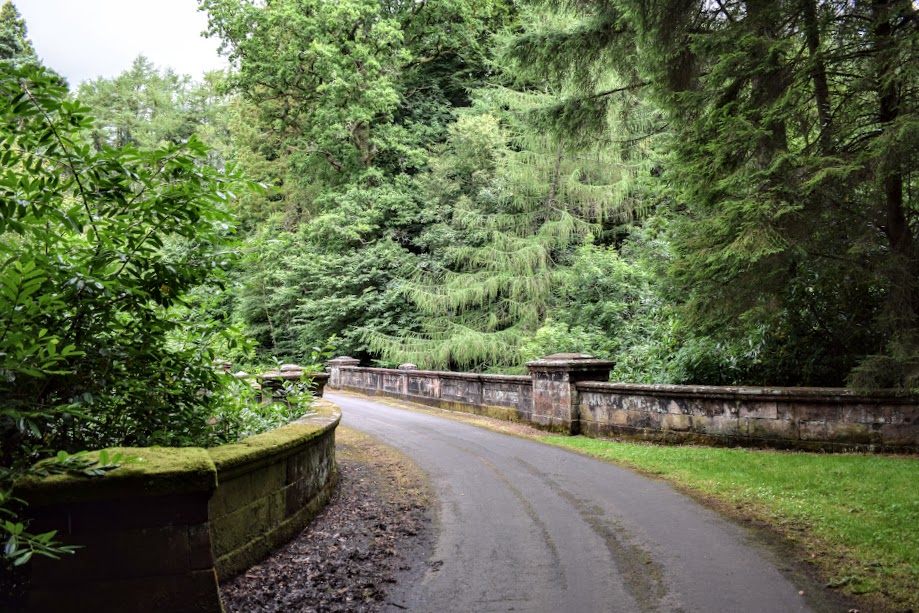
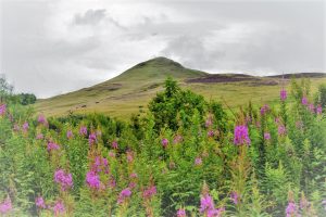
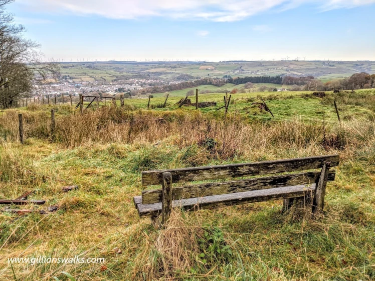
Despite all of the things I have said, I would definitely do this walk again (the right way! or with gloves & secateurs in my bag!) In fact, I am looking forward to trying it on an upcoming frosty winter morning when there will be no concerns about nettles. The views were excellent, the trail was very peaceful and I liked the surfaced roads/earth tracks combo that it offered. I would perhaps extend the walk to pay the Darvel transmitter mast a visit next time, or by-pass Lanfine and instead return via the Brown’s Road along the River Irvine.