TERRAIN: A mixture of grass and gravel tracks with a few boggy bits, especially on the hillside.
![]() Dog-friendly route
Dog-friendly route
![]() At the start of this walk there is an unnamed road close to Nether Wellwood Farm just off the A70 (KA18 3NG) where there is space for 1 or 2 cars to park at the side of the road. Please park responsibly without blocking passing places. Near the end of the walk there is a large car park at Glenbuck Heritage Village (KA18 3SB). I recommend leaving a car at each end to do this walk.
At the start of this walk there is an unnamed road close to Nether Wellwood Farm just off the A70 (KA18 3NG) where there is space for 1 or 2 cars to park at the side of the road. Please park responsibly without blocking passing places. Near the end of the walk there is a large car park at Glenbuck Heritage Village (KA18 3SB). I recommend leaving a car at each end to do this walk.
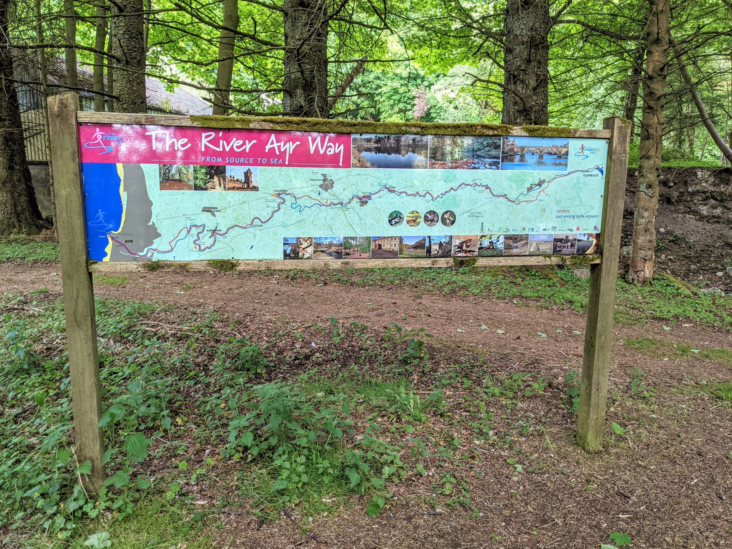
You can download individual River Ayr Way route sections from the East Ayrshire Leisure website (scroll to the bottom and click on sections 1 and 2 for Wellwood to Glenbuck)
View Full Route Description
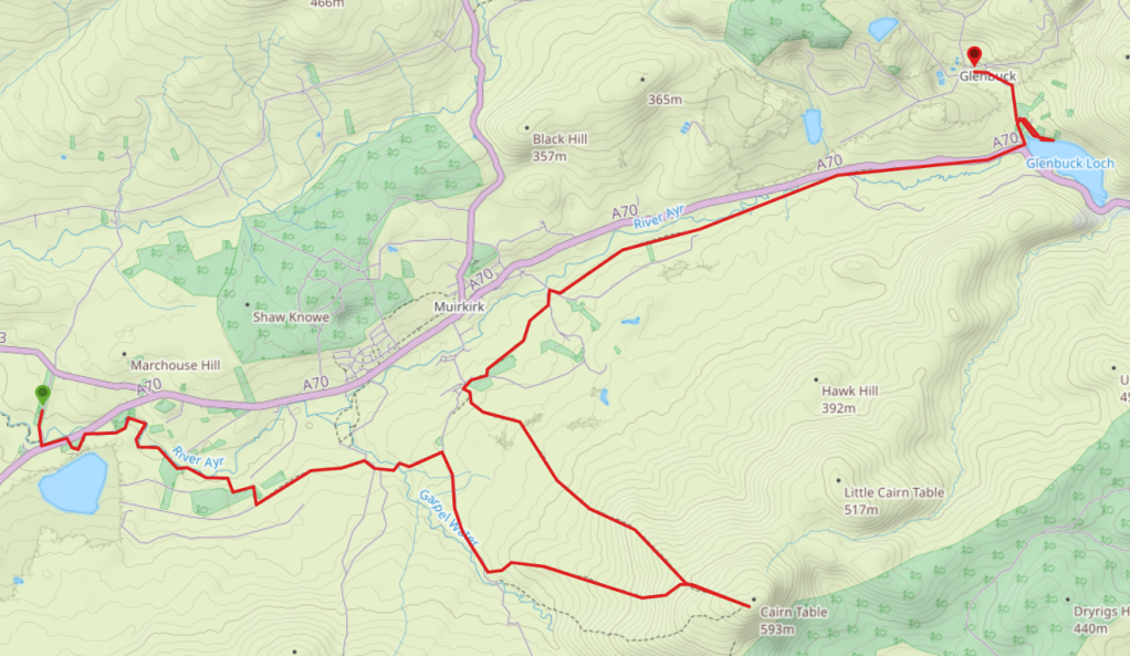
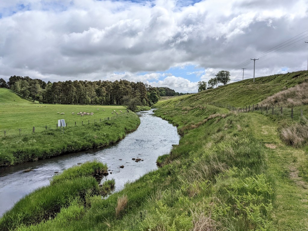
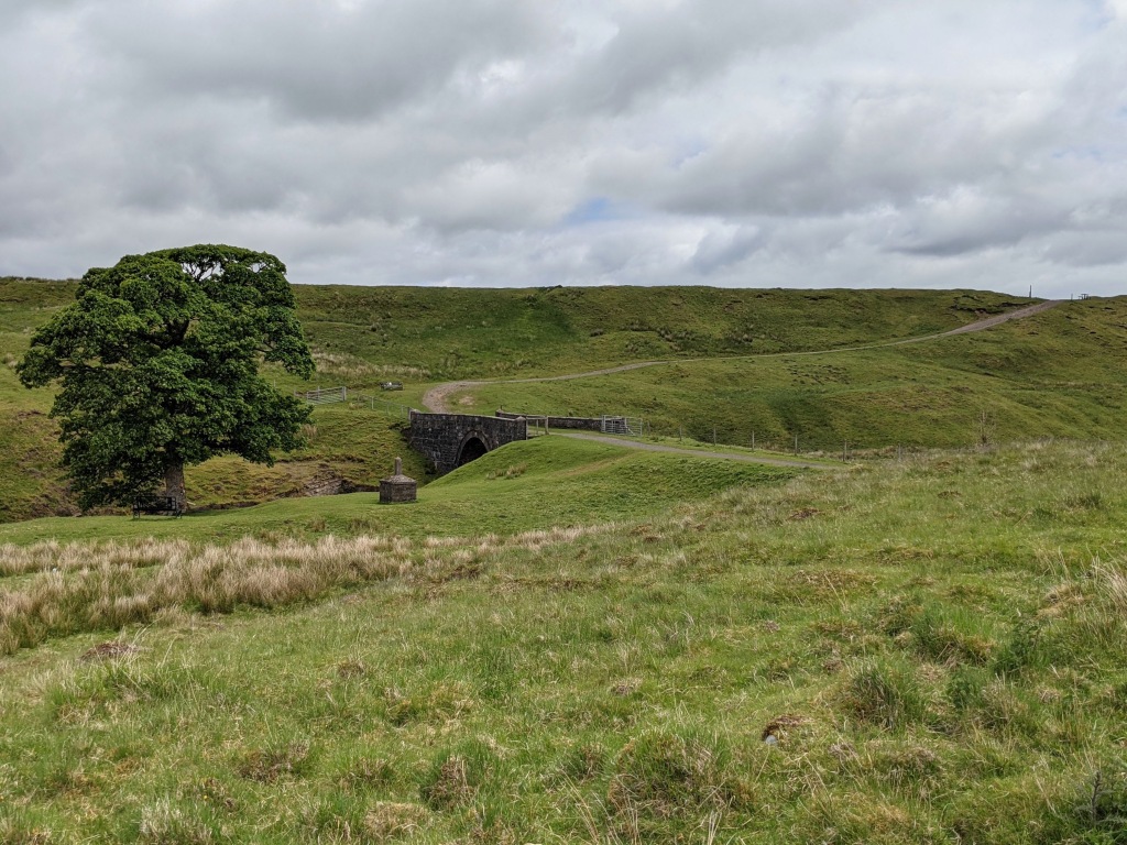
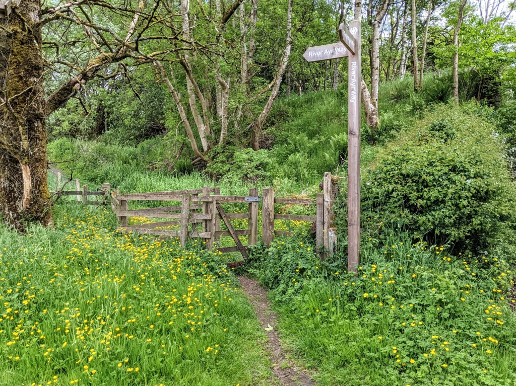
Head south along the unnamed minor road to reach a bridge over the River Ayr. Cross the bridge then just before reaching the A70, turn left (E) through a kissing gate. The path leads you across a wooden footbridge and into some trees, running parallel to the A70 to another kissing gate further along. Take care crossing the A70 and pick up the continuation of the trail at the other side of the road (SE). The path heads into the trees then bends left and runs behind the tree plantation, meeting up with the River Ayr again close to the A70. The next section hugs the river on a grassy footpath – a beautifully scenic and tranquil area. After 2km the path begins to veer away from the River Ayr. It bends to the right along a fenceline and joins up with another track. Turn left (E) onto the track. At a crossroads next to Upper Wellwood farm, turn right (SW). You will soon reach a fork in the path – turn left (NE) along a disused railway track bed. At the bottom of some steps turn right (SE) onto a wider, gravel track. You are only on this track for 130m before there is a fork, keep left (E). 270m along this path you will reach Tibby’s Brig. At the other side of the bridge the path heads uphill and onwards to a fork. [You can continue along the River Ayr Way – avoiding the hike up Cairn Table and cutting out 4.5 miles – by turning left (N) here – it takes you directly to Kames Racetrack.] To include the Cairn Table hike, turn right (S) at the fork and follow a grass and gravel footpath along a fence line for approx 0.8 miles (1.3 km), passing MacAdam’s Stone along the way. After 1.5km, turn left onto a fairly indistinct trail up the hillside through heather and tussocky grass. At 498m of elevation, you will arrive at the main “tourist” path to the summit – turn right (SE) to continue uphill. 700m (and 100m ascent) later, you will reach the large cairn on top of Cairn Table. Start your descent via the same path, heading north west for 700m. Keep right at the fork to pass the track by which you ascended and continue downhill for 3km in a north-westerly direction. You will pass some brick fortifications and a stone ruin before emerging at the walkers car park at Kames. Walk through the car park then just before you reach the road, turn right (NE) to follow the directional arrows for the River Ayr Way. This takes you onto a footpath between two fence lines. Turn left (N) at a fork 300m along. A further 1km along this path you will reach a minor road. Turn left (N) and at the end of the road turn right (SE) onto another road. 100m along this road look out for a River Ayr Way wooden marker post on your left. Go through the kissing gate and follow grass and gravel footpaths along a disused railway track bed for 4.7km, eventually emerging onto the A70. Cross the A70 carefully to another kissing gate directly across the road and turn right (E) along a path running parallel to the A70 behind a row of trees. The path ends on the minor road at Glenbuck Loch. Turn left (N) along the road. After 160m turn right (NE) onto another road leading towards a cottage. Pass through the gate (ignore the “Private Property” signs – this is the official River Ayr Way route) and continue along this road gently uphill to a small parking area. In the parking area you will find the Glenbuck Sculpture as well as the information board marking the official start point of the River Ayr Way. If you have time, I can recommend exploring the woods here and the path which heads down to the banks of Glenbuck Loch where there is a bird hide and information centre. If you are parked at the Glenbuck Heritage Village, retrace your steps to the cottage/gates with the private property signs and turn right (N) onto the road. Follow this road uphill for approx half a mile / 700m to the car park at Glenbuck Heritage Village.
WALK REVIEW: 12TH JUNE 2021
The best part of 14 miles and with a hill thrown in: definitely the longest walk I had attempted in many months, if not since the start of the pandemic. I knew it would therefore be a challenge for the old legs and feet, but I was desperate to explore somewhere new. The fact that this was within the boundaries of my home county East Ayrshire, and that Cairn Table had been on my “to walk” list for a looooonnnnnng time all added to the attraction. I also really badly wanted to complete the River Ayr Way and I was determined to get this final section ticked off. Any normal person walking the River Ayr Way would probably start at Glenbuck and follow the trail from the source of the river, heading west section-by-section, experiencing the small burn slowly swell into a vast river where it meets the Firth of Clyde in Ayr. Not me. I started back in 2016 around the Ayr College area and gradually made my way to Glenbuck over a period of 5 years!! I cannot even claim to have completed the sections in order. That still counts, right?!
We dropped one car at Glenbuck Heritage Village and drove the other to our start point, on a minor road close to the A70 at Nether Wellwood Farm. My sister fessed up that there was a potential problem with her fuel gauge: despite just filling up, the “please refuel immediately” light hadn’t gone off. The monitor showed only about 5 miles left in the tank! With her car being the one parked at the end of the walk, we nervously set off telling ourselves it would be fine, slightly reassured by her explanation of it not being the first time it had happened…… If it turned out not to be fine, it was going to be a long walk back!
I was in full explorer mode, relishing in the opportunity to be somewhere I didn’t know, unaware of what was round each corner. I was glad to have plotted out the route in advance using my mapping app, because there were a few faded or missing signs at key points and the general rule of thumb, “just follow the river” didn’t always help. Despite never being far from the A70, it felt like we were somewhere remote.
We didn’t bump into a soul until we reached Tibby’s Brig about a third of the way along. It was peaceful, scenic, beautiful. I had heard of Tibby’s Brig a few times through general reading up on the River Ayr Way and also through social media. It was lovely to finally be there. What a tranquil spot steeped in history. A plaque on the bridge explains that Tibby was a local lady who used to live at this spot on the Garpel Water. She became famous in the area for composing music and poetry. You can read much more about this on the Muirkirk website.
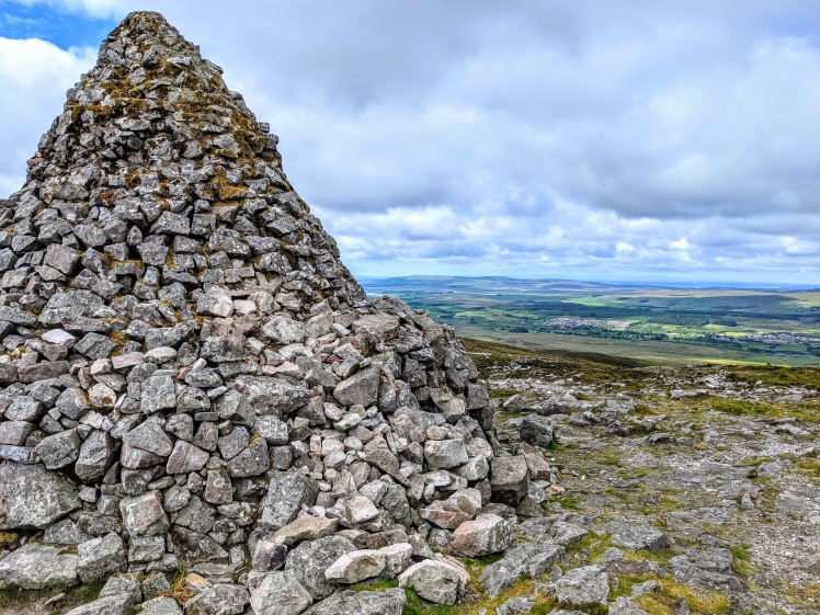
Next up: Cairn Table, which can claim to be both the most prominent and the 13th highest hill in East Ayrshire – yes there are more than 13 hills in East Ayrshire – there are quite unbelievably 304 named hills in East Ayrshire!
In any case, I’d heard a lot about this one and it was frankly ridiculous that it had taken me so long to get to it. My excuse is mostly that I was waiting for it to be dry enough….. I’d heard from many sources that the lower slopes are a bog-fest most of the year. The only reasonable times to do it, I concluded, were when the ground was frozen, when there was snow lying, or after a prolonged dry spell. Not confident enough in navigation to make my inaugural ascent whilst the paths were hidden by snow (nor keen on the idea of a snowy drive through rural East Ayrshire to get to the start), I opted to wait for the latter scenario. Those don’t come along very often it would appear. I did know that there was a less-boggy option up the hill’s heathery western slopes and that is in fact what we ended up doing since we were approaching from that side anyway. It was pretty much bone dry all the way to the top – result.
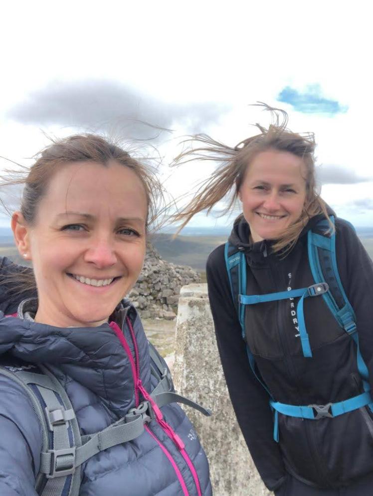
Unfortunately the same cannot be said for the way back down (more on that later). Turning onto the main path for the last short ascent to the cairn, a blustery wind caught us by surprise. We thought our plans for a hilltop lunch had been dashed when we reached the shelter of the cairn to find a family had taken up residence there already. In different times we might have huddled in and made some new friends but in this covid era that was to be avoided so we walked on a bit further and found a suitable spot behind some boulders.
We headed back down the main path. The lower we got the boggier the path became and the boardwalks had long since retired through wear and tear. I can only begin to imagine what it must be like after a lot of rain, and hopefully will never find out!
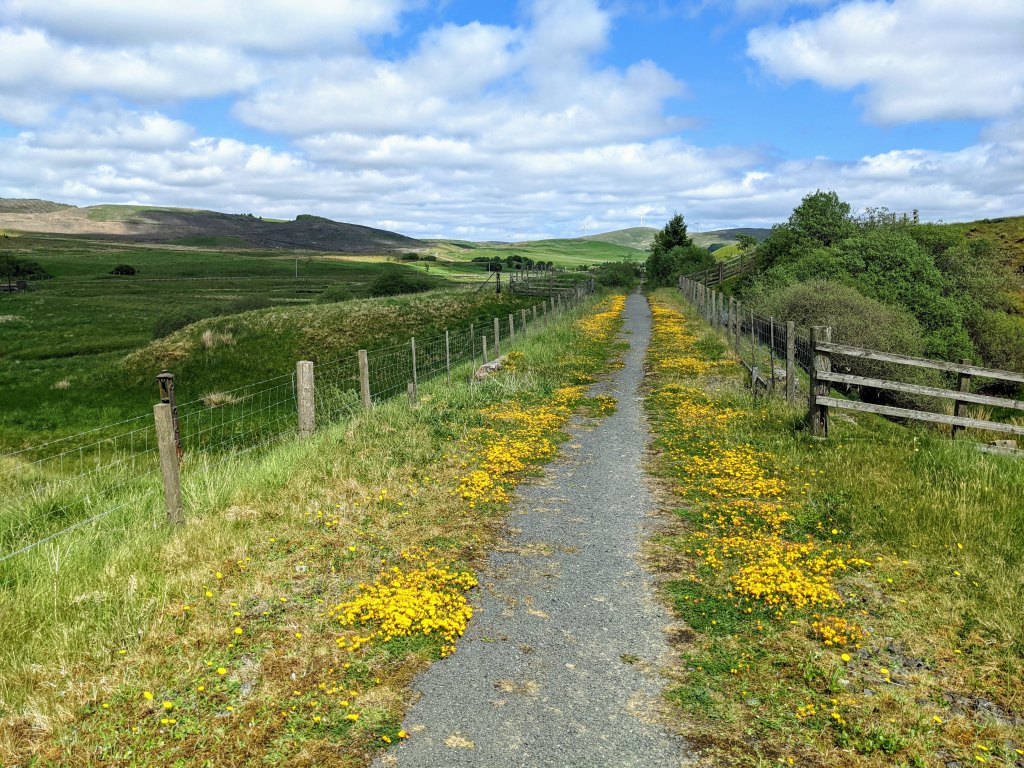
After a brief stop at some stone ruins to munch on some triple chocolate cookies, we found the path leading to the walkers car park at Kames Racetrack. From here we picked up the River Ayr Way marker posts again for the last section of the walk to Glenbuck Loch, much of which consisted of long and straight grassy tracks fenced in on either side with wide open views of the surrounding countryside.
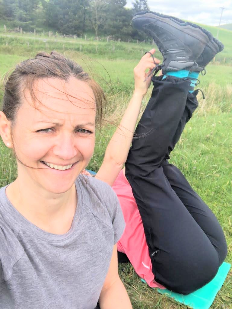
Admittedly I wasn’t able to fully appreciate this section because my body was starting to complain. My feet were throbbing and my legs tired. We decided that we should have another break to finish off the cookies and in the absence of any benches or conveniently-positioned large boulders on which to sit, we took our little square foam mats out of our backpacks and plonked them down right on the path where we stood. Being a bit of a yoga fan and having learned in a recent practice of the restorative benefits of the “legs up the wall pose”, I suddenly felt the need to lie back and lift my feet above my head to let the blood drain out of them and release some pressure. Highly recommend you give it a try sometime – sheer bliss! My sister was ready to capture the moment with her camera (for us to laugh at and now you as well!). The look on her face says it all. Thank goodness we were the only ones around. I’ll aim to get my legs a bit straighter next time…..
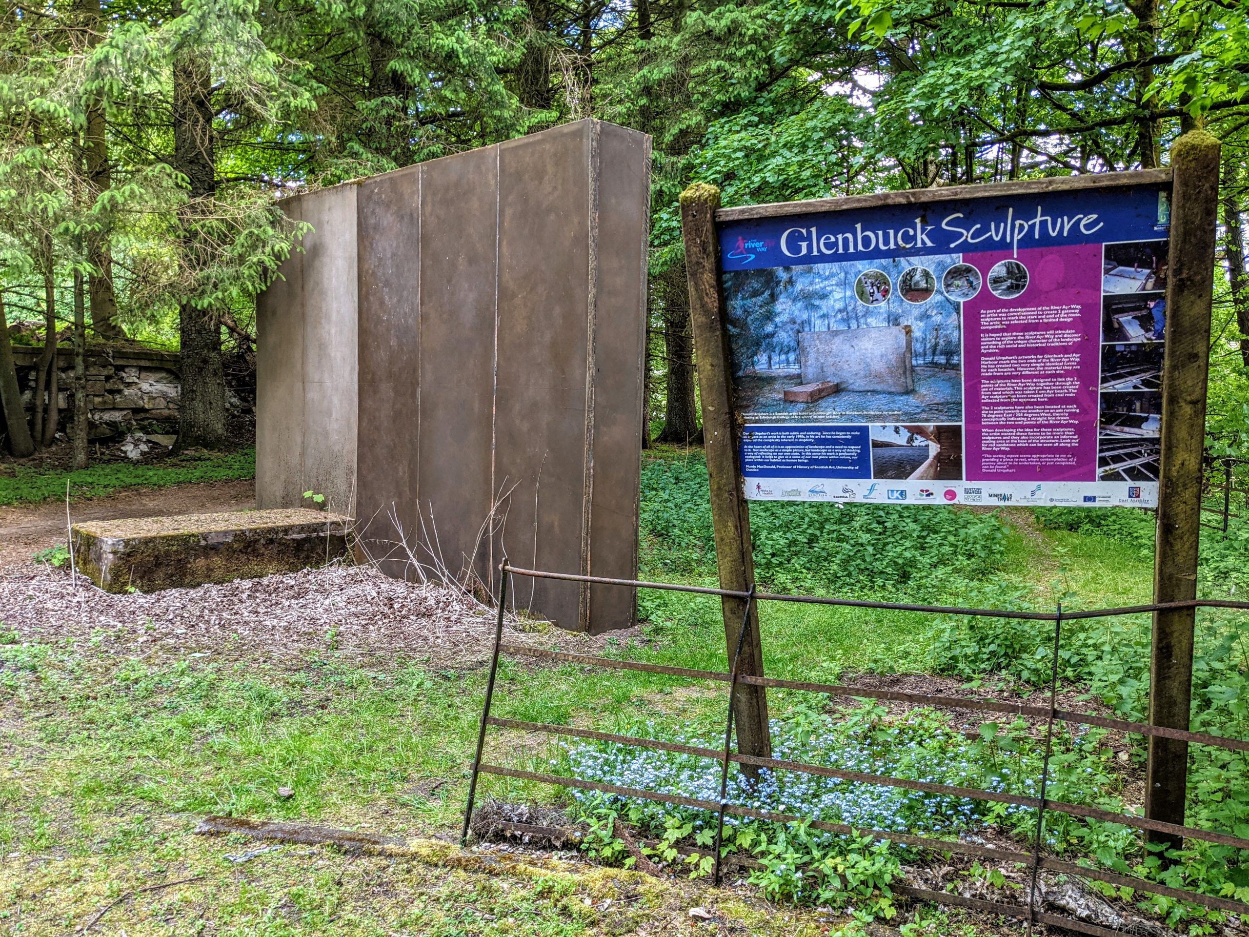
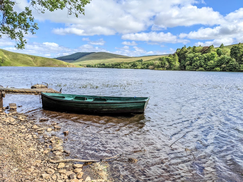
And so to Glenbuck Loch, the source of the River Ayr and hence also the official start point of the River Ayr Way! You could choose to declare job done on reaching its north western edge at the bottom of the hill, saving you around half a mile. However we had come this far and wanted to make sure we finished it properly so continued up the hill and along the road to the Glenbuck Sculpture. At first glance I thought it seemed a bit random: a very simple, tall, thin, grey, rectangular block made out of some sort of smooth stone. In fact it is really quite clever what has been achieved by the artist Donald Urquhart. An information board at the site explains that there is another one of these sculptures at the end of the River Ayr Way at Ayr Harbour. The two are positioned to face each other and are identical apart from one thing: this one at Glenbuck is made of sand taken from Ayr Beach, whilst the one at Ayr is made of coal resin taken from the open cast mine at Glenbuck.
We decided to follow a woodland footpath through the trees which led us down to the banks of Glenbuck Loch. Such a peaceful, idyllic area. I could imagine coming here with a book on a warm summer day and soaking up the tranquility. The loch overs an area of 57 acres and is actually a dam created in 1802 to power the cotton mill at Catrine, as well as a dozen other mills downstream. Between the 1830s and 1964, a railway line bisected the loch. Nowadays it is used for recreational fishing. If you are the lucky owner of one of my 2022 calendars then you can look forward to the below photo for the month of June. I do recommend coming to see it with your own eyes as well if you can! From here we had one final push back to the car at Glenbuck Heritage Village… and it was all uphill. A few moments of dread as my sister turned the key in the ignition and we set off back along the road to Nether Wellwood, hoping for more than 5 miles. The fuel gauge ticked down until it got to zero. The car kept rolling. Relief!