TERRAIN: The route to the dam and the hill track can both be very boggy but the remainder of the walk is along surfaced minor roads and through the village of Neilston itself. (Note on last visit there was one locked gate which needed to be climbed).
![]() Regular bus and train services to Neilston. There is a car parking available at Neilston Train Station (G78 3DY).
Regular bus and train services to Neilston. There is a car parking available at Neilston Train Station (G78 3DY).
View full route description
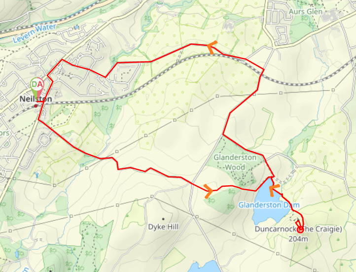
Head East out of Neilston Train Station towards Kingston Road / High Street. Turn right (South) onto Kingston Road / High Street and take the second street on the left – Kirkton Road. Continue along this quiet single-track road through peaceful countryside for 1.5km. The road bears left past Loanfoot Farm then passes a few cottages to reach the junction with Springhill Road. Cross Springhill Road, go through a gate into a field. At first there is a track but after less than 100m this wears out and there is no obvious path to show the way (despite their being one shown on the map). You are aiming to get to a gate at the bottom of the field, where the areas of woodland on your left and right meet together. Go through or climb the gate (sometimes locked). Descend East to a fisherman’s bothy beside Glanderston Dam. You will be able to see The Craigie ahead. Turn left (North East) and walk along the edge of the Dam. After 100m, and before reaching the road, go through a gate on your right which gives you access to a grass embankment beside the dam. Walk to the end of the embankment then cross a footbridge over Aurs Burn. At the other side follow a path South East to walk alongside a row of trees, keeping them on your right-hand side. After the last tree you will see a wooden stile at a wall ahead of you. Cross the stile and turn left (East) to follow a vague path around the base of The Craigie. As the path begins to climb turn right at a fork and ascend the steep slope to reach the summit. Descend via the same route and retrace your steps back to the gate at the north end of the grassy embankment. Go through the gate and turn right (East) to emerge onto a minor road. Turn left (North West) to reach Glanderston Road. Continue ahead (North West) on Glanderston Road for 450m until it meets with Springhill Road. Turn right (North) and continue along Springhill Road for approx 700m to just beyond the bridge over the railway line. Turn left (North West) along a road parallel to the railway line (not shown on map) for 200m to meet up again with Springhill Road. Continue ahead for 1.3km during which time Springfield Road becomes Sykes Terrace then Hamilton Place before arriving at a roundabout. Turn right (North West) at the roundabout onto Kirktonfield Road. At the road end turn left (South West) onto Main Street and continue for 180m to a crossroads at Neilston Parish Church. Turn left (South East) onto High Street and you will reach Neilston Train Station after 270m.
WALK REPORT: 26th November 2017
Nicola and I tend to have our catch ups during a walk these days so when she sent me a link to a leaflet containing 10 walks in East Renfrewshire (no longer in publication) we got a date in the diary, picked a route and went exploring! I had never been to Neilston before and the drive in from Ayrshire on our chosen date was somewhat precarious owing to black ice on the surrounding country roads. As a result I was a little late arriving and found Nicola waiting patiently in her car for me….. and her walking boots which had been left at home and would be arriving within the next 20 mins via direct courier otherwise known as her husband 😀 So we had our catch up in my car while we waited! The boots arrived and off we set.
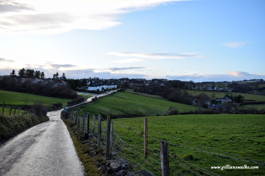
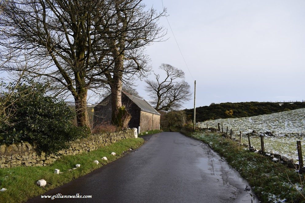
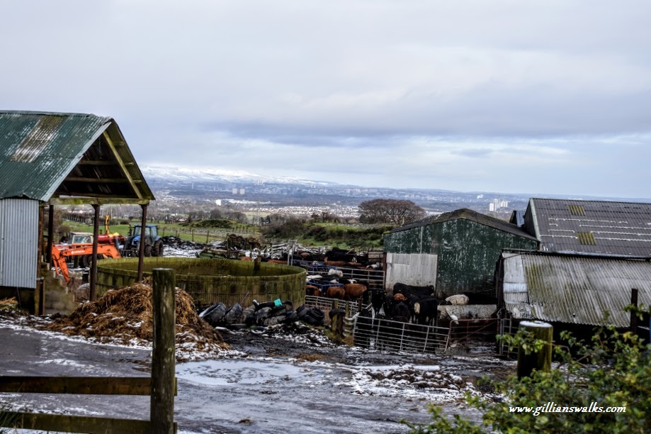
The first part of the walk took us over high ground along quiet country roads. We passed several farms and enjoyed views across to the snow-capped Campsie Fells as we went.
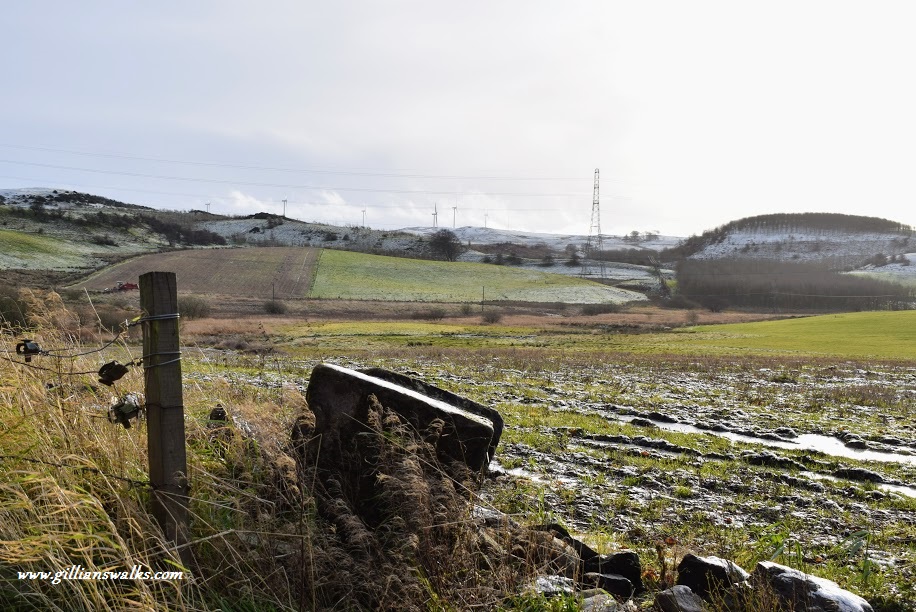
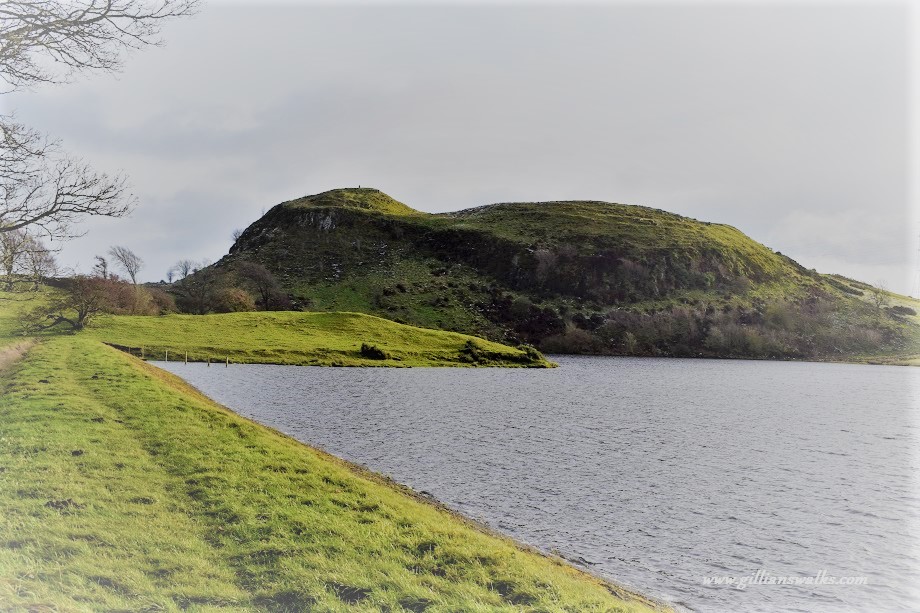
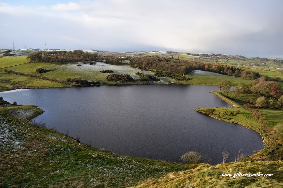
The muddy section came next as we went off-road onto farm tracks followed by very boggy fields and a slippery descent down the hillside towards Glanderston Dam. We were glad of the thick frost which had hardened the ground and considered how much worse it would otherwise have been! Down by the dam was such an incredibly peaceful place and had a lovely feeling of remoteness about it. We spent some time taking it all in. I just loved this part of the walk.
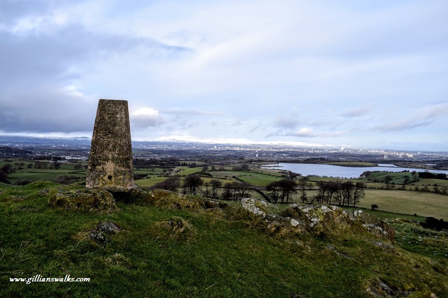
Onwards to the top of the hill next! It was very wet underfoot but after a fairly gentle ascent we reached the trig point. We were surprised at how little remains could be found of the iron age fort. Much of it appeared to be covered by grass or otherwise hidden from view. There were a few collections of large boulders dotted around…. was that the fort? The views from the summit made up for the lack of an obvious fort and we enjoyed a bite to eat up there whilst identifying landmarks visible from our vantage point.
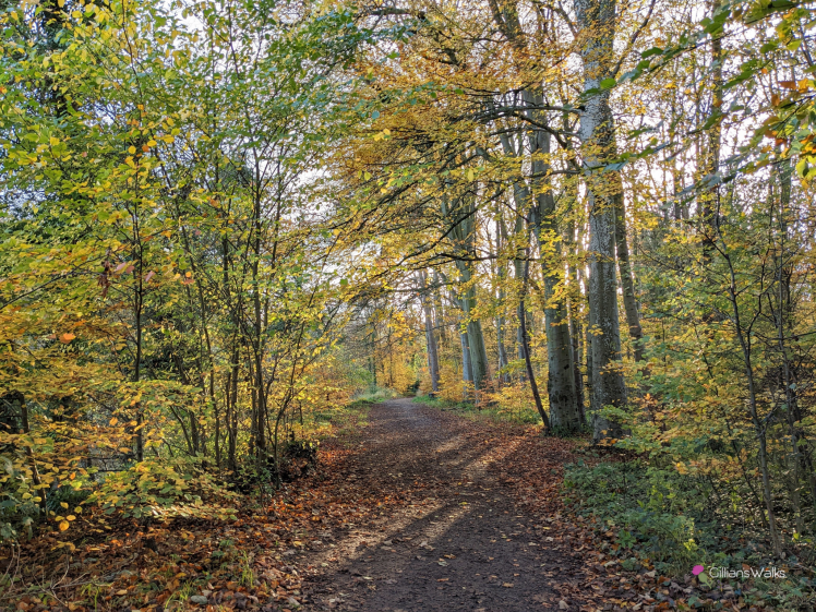
We retraced our steps back to the other side of the dam to pick up a minor road skirting around Glanderston Woods (I believe used as a filming location for the Outlander TV series!) The rain had come on by now but not ones to let a bit of water dampen our enthusiasm, when faced with the option of a shortcut back to the car (we took a wrong turn when too busy chatting) we were both enjoying ourselves sufficiently to continue with the planned route. Quiet country roads turned more urban as we reached the village of Neilston, where we were surprised to come across a woman training her bird of prey in a large field! Honestly, the sights you see when out a walk with me….. 🙂