![]() There is a car park at Caprington Golf Club, Ayr Road, Kilmarnock (KA1 4UW) however PLEASE AVOID USING THE CAR PARK IF IT IS BUSY. I recommend parking on Caprington Avenue, a short walk from the start of the route. It is also easily accessible by public transport with bus stops on the Ayr Road.
There is a car park at Caprington Golf Club, Ayr Road, Kilmarnock (KA1 4UW) however PLEASE AVOID USING THE CAR PARK IF IT IS BUSY. I recommend parking on Caprington Avenue, a short walk from the start of the route. It is also easily accessible by public transport with bus stops on the Ayr Road.
View full route description
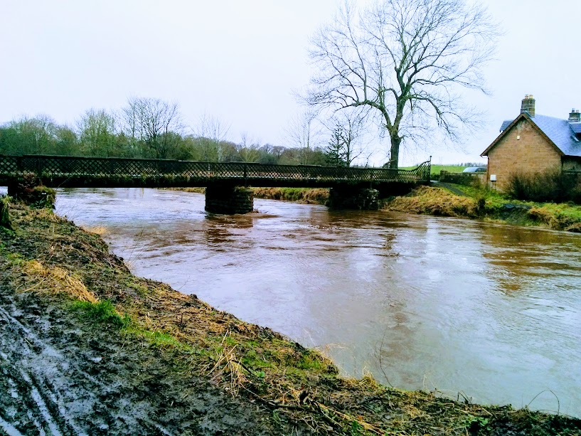
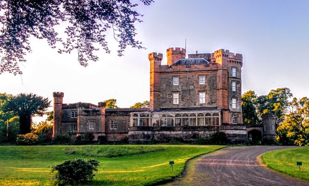
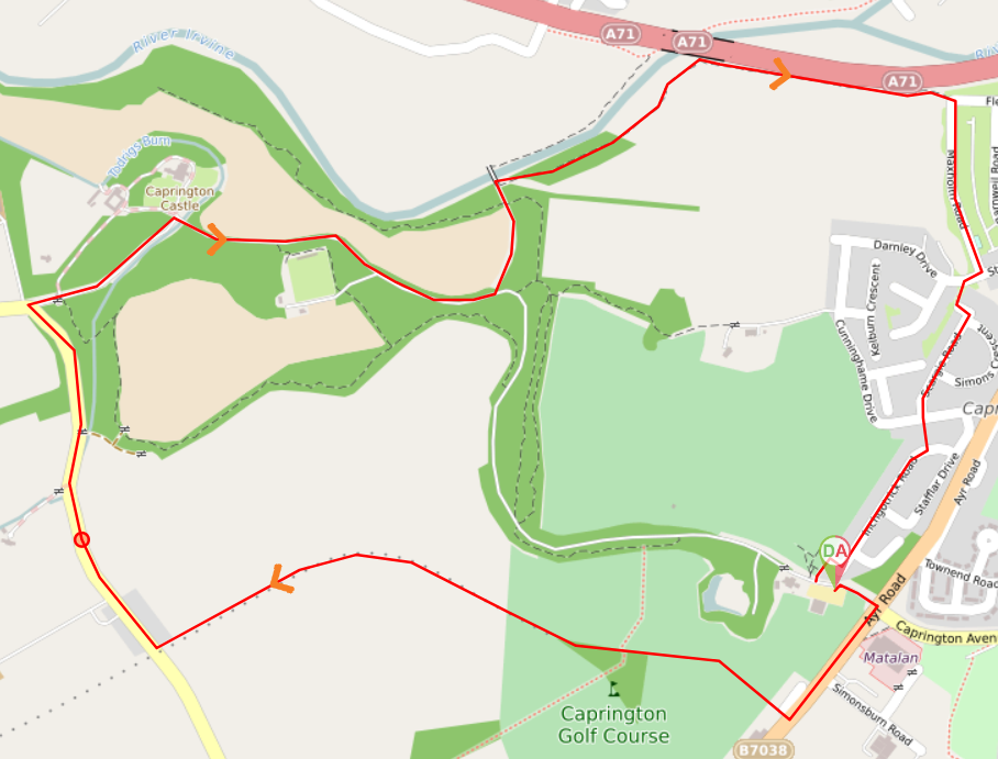
With your back to the entrance of Caprington Golf Club car park, turn right (SW) to walk along B7038/Ayr Road. Just before reaching Dewaldens Garden Centre look out for a lane on the right leading on to Caprington Golf Course. Go down the lane. Cross the golf course using the grassy footpath straight ahead, picking up a track between two hedgerows. Along this track you will pass the remains of Blackskye Tower. Continue ahead for another 200m to reach a fence with a stile leading onto a field. Cross the stile and follow the row of hedges on your right-hand side across the field, emerging onto a minor road. Turn right to walk through the small hamlet of Earlston. 800m along the road you will reach a crossroads. Turn right to walk towards a gated entrance into Caprington Woods. After going through the gate continue straight ahead along a tree-lined driveway. Caprington Castle will soon come into view. In front of the castle you will be at another crossroads where you turn right to cross Todrigs Burn and follow road/track through the trees. Stay on this road for 1km. There will be a field on your left-hand side and at the end of the field the road bends to the left before arriving at a bridge over the River Irvine. You are not going to cross the bridge; instead look for a (often very muddy) path heading off to the right alongside the river. Follow this, with the river on your left-hand side. After 500m the path turns right to run parallel to the A71 along a pleasant pathway, emerging onto the corner of Maxholm Road/Fleming Street another 500m along. Turn right to walk along Maxholm Road. At the end of the street cross over Stonyhill Avenue then turn right. Almost immediately turn left onto a lane which leads to Scargie Road. At the end of Scargie Road cross over Cunningham Drive and pick up a lane at the other side which leads to Inchgotrick Road. Turn right and walk to the end of Inchgotrick Road. Turn right to a lane which leads to Caprington Golf Club car park.
WALK REVIEW
In order to publish this route I ended up having to do it twice and almost 3 months passed between each trip. The first time I was with my mum and friend LJ and there were a couple of concerns I had with that route, namely a busy B road with no pavement which wasn’t enjoyable and us getting lost on a minor road inside Caprington Estate which suddenly ended at a large house despite the map showing it as a through-road. The owner came out and showed us through his garden onto what looked like an overgrown field and pointed out where to cross into the woods. Neither of these sections were ideal when it came to publishing a walk other people might like to try so I wanted to return another day to find a way of avoiding them.
“Do you fancy going a wee walk?” asked my husband one child-free afternoon 12 weeks later. “I would love to” was my reply and I immediately thought about my unfinished Caprington Castle walk which was within walking distance from our home. Turns out we do not go by the same definition of ‘a short walk’: my husband was thinking of a 20 minute stroll, not the 4 mile walk complete with route tracking and photography that he got! Oops…..
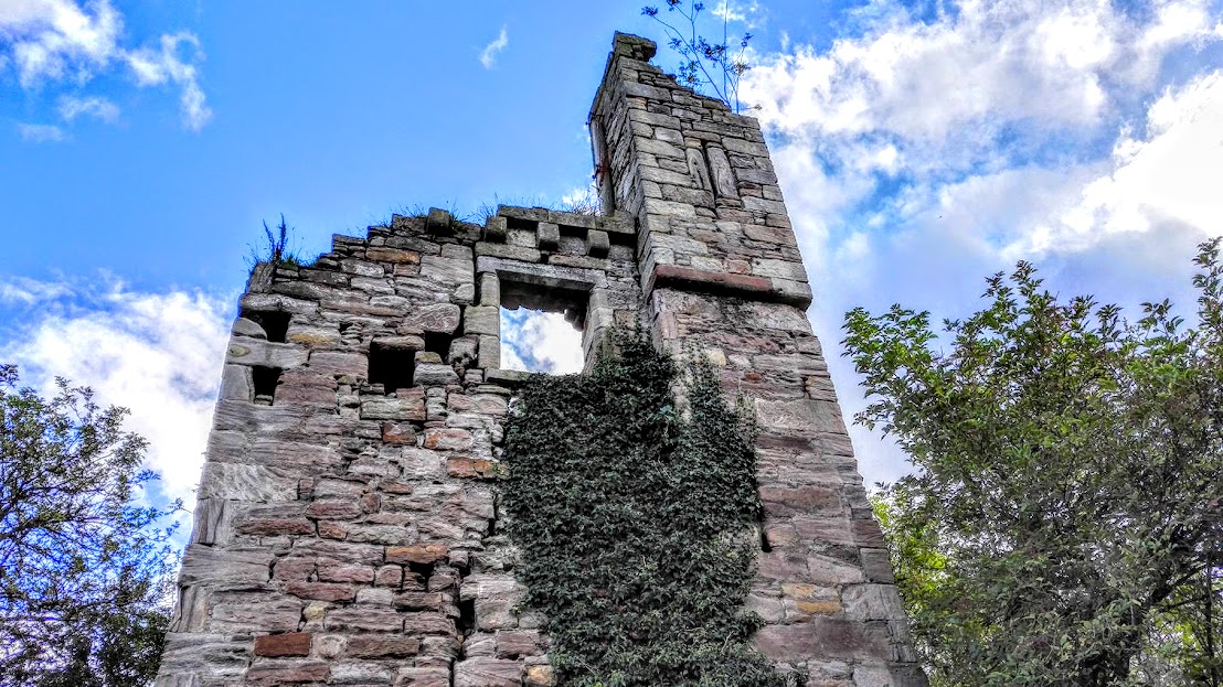
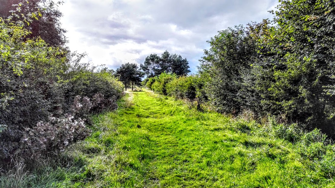
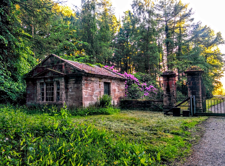
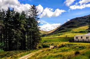
The walk across the golf course is really interesting, and it isn’t long before you feel as though you are far from the town out in the open countryside. The path is wide and grassy and you pass some ruins along the way. It wasn’t until years later and having passed these ruins probably a hundred times that I finally did a bit of research into them. It turns out it is a building of national significance! Named Blackskye Tower, it was an engine house built during the times of the Caprington coal mines. Seemingly it is a rare example of it’s type in the UK. Fascinating!
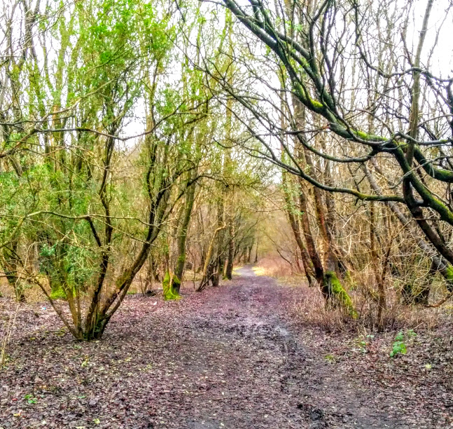
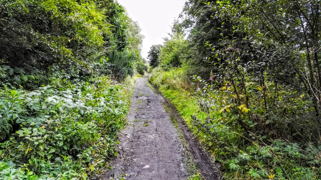
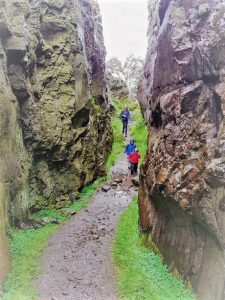
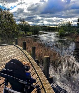
Enjoy my photo tour of the route below.