TERRAIN: Expect a mixture of earth paths, pavements, cycle tracks and some mud!
![]() Dog-friendly walk
Dog-friendly walk
![]() Car parking at Milngavie Train Station (free). Good public transport links between Milngavie and Partick Train Stations.
Car parking at Milngavie Train Station (free). Good public transport links between Milngavie and Partick Train Stations.
View full route description
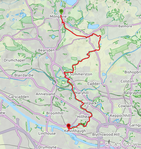
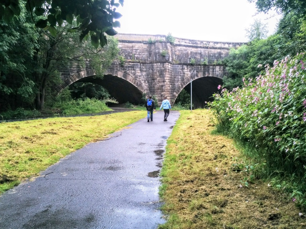
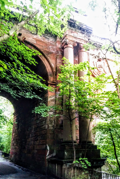
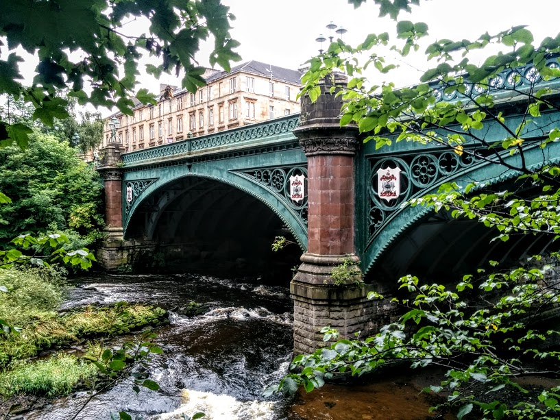
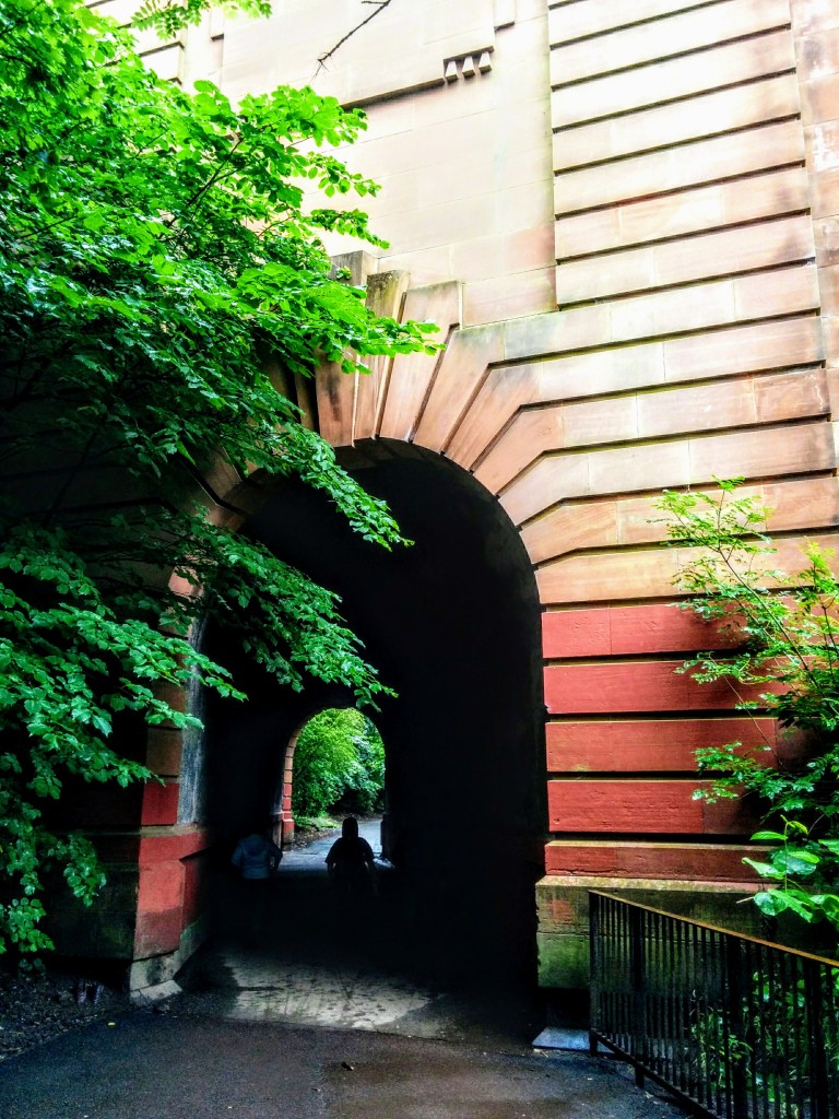
With Milngavie train Station car park behind you, and the entrance to the station in front of you, turn right (North) to walk to the end of the station then turn left (West) before reaching the main road, to follow a path around the back of the station. Turn left again (South) to walk down the back of the station. You will pass a parking area and into some trees. Go down a set of steps then across a bridge over the Allander Water. Turn left (East) along Keystone Avenue to the A81/Glasgow Road. Turn left (North) to cross the railway bridge, looking out for the continuation of the route on your right at the other side of the A81. Cross over onto this path. The path now closely follows the Allander Water for 2.2km, crossing over twice along the way, until it reaches the B8049/Boclair Road. Turn left (North East) and walk along the B8049/Boclair Road, again looking out for the continuation of the route on your right a short distance along. Cross the road onto the path. The river should be on your left-hand side. After 1.5km the Allander Water joins with the Kelvin to become the River Kelvin which you now follow downstream for 1km to reach a large bridge onto A879/Balmore Road. Cross the bridge. The walk continues at the opposite side of the road and runs alongside the Kelvin for 2.7km (keep the river close to your right-hand side, ignoring any paths off to the left). You will come to a small footbridge over a stream, immediately followed by a crossroads where the river veers off to your right but the trail continues straight ahead (South). Where the path ends turn right (West) which gradually takes you out of the trees and into a built up area. Continue West along Acre Road to reach a small roundabout – turn left (South West) to stay on Acre Road. At a larger roundabout on A81/Maryhill Road turn left (South East) and follow the roadside pavement along for 280m, crossing over when safe. Just after a bus stop the Kelvin Walkway continues on the right, signposted ‘West of Scotland Science Park’. At the crossroads turn left (South West) across some cobbles and left again (South East) onto a wide surfaced path through a corridor of trees. At the bottom of the hill turn right (South) then right again (West) to enter Dawsholm Park. Keep left (South) at a fork, following a wall along to meet up with the River Kelvin. With the river close to your right-hand side the entire time (ignore any paths which take you away from it), follow the now way-marked path along for 3.5km, passing through several impressive road and rail bridges as you go, as well as the beautiful iron bridge which leads across to Glasgow Botanic Gardens. On reaching the ruins of North Woodside Flint Mill, use the footbridge to cross the Kelvin and enjoy the last section of woodland walking. The river should now be on your left-hand side. After passing beneath the cast iron Kelvinbridge, the path once again crosses the River Kelvin. Stick to the paths closest to the river at all times (without crossing it) until reaching the Kelvingrove Park Play Area 800m along. Turn right (North West) to cross the bridge. Turn left after the bridge (signposted Kelvingrove Art Gallery and Museum) and follow the riverside path to emerge at Kelvin Way. Cross Kelvin Way to pick up the path at the other side of the road. There are numerous footpaths all over this area but stick to the one closest to the river and after 500m you will arrive Sunlight Way. Turn left (South West) on Sunlight Way then left again (South) to cross Snow Bridge. Come off the bridge and turn right (South West) to cross over Argyle Street onto Burnhouse Road. At the end of Burnhouse Road turn right (West) onto Old Dumbarton Road. At the end of Old Dumbarton Road turn left onto Ferry Road. At the end of Ferry Road walk beneath the railway bridge then turn right (North West) onto the cycle path. Walk along the cycle path a short distance. Keep right at a fork to loop round and pass beneath the Clydeside Expressway and across Castlebank Street to arrive at the entrance to the Riverside Museum, the end point of the Kelvin Walkway.
WALK REPORT: 6th August 2017
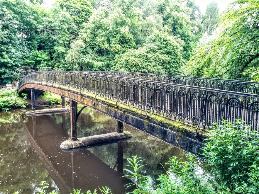
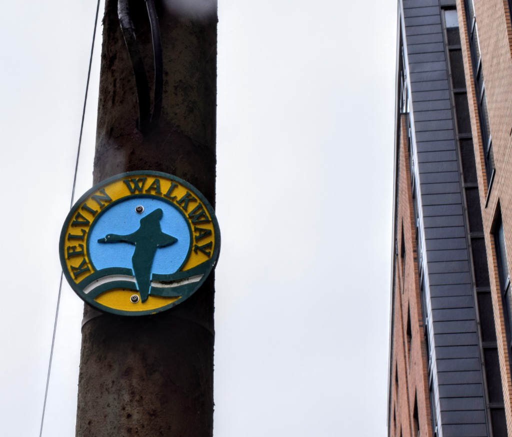
Sneaking down a woodland path during a family visit to the Botanic Gardens one weekend, my youngest son and I found ourselves next to a beautiful iron bridge across the River Kelvin. A natural adventurer, I was drawn to the way-markers for a closer look. “Kelvin Walkway” one indicated. “Interesting“, I thought, and after taking a few photos we rushed back up the hill before my husband and eldest son could miss us. “It’s amazing down there….” I recalled, “….so peaceful, its like going into another world!” Compared to the buzz of people around the gardens it had been surreal to take a few steps off the main path and suddenly find myself in such a beautiful, tranquil spot. The river was almost glass-like, everything was silent. I was going to HAVE to research this Kelvin Walkway!
And so it was that a couple of months later I made the 1 hour drive to Milngavie Train Station with my mum to meet Gaynor, Celline, Gerry, Vicki and Geoff to get started! The lack of signage became immediately apparent and I was forced to follow the little arrow on my phone mapping app to get us moving in the right direction. In fact, the first proper way marker didn’t appear until around the point of crossing the Forth & Clyde Canal Towpath, approx 2/3 of the way in to the trail!! I even took a photo of it to mark the occasion. Moral of the story: plot the route out in advance and use a GPS device/mobile phone to follow it once there (or just download the free route I have already prepared for you!)
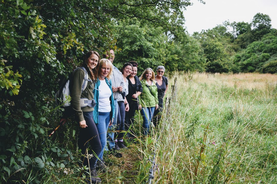
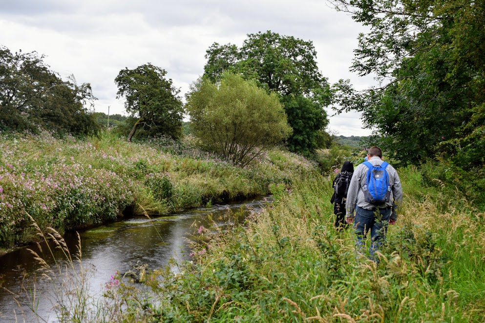
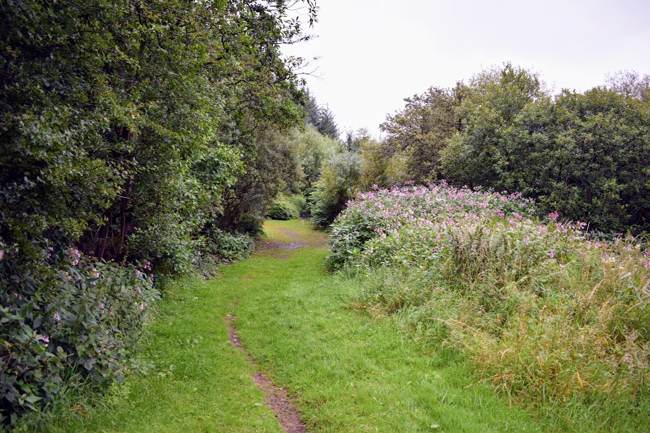
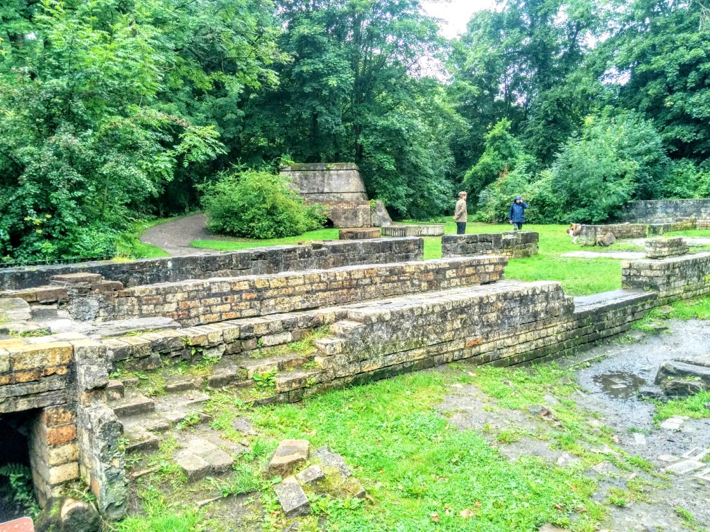
All in all, we had a fantastic morning walking this trail and in particular the first half really surprised me. I couldn’t believe how quickly we were out in the countryside; I had expected a far more urban feel to the walk. It was a strange feeling, a relief actually! Having said that, it was clearly also the less-used section of the route with much of it unfortunately very overgrown. Having only met the majority of my co-walkers that morning, I worried what they would be making of it all. Perhaps not quite what they had signed up for…. I needn’t have worried: they fought through the overgrown vegetation upfront, shrieks and screams of laughter filling the air! Even a fall in the mud and the constant drizzle didn’t seem to dampen their enthusiasm
As we neared the Maryhill area, the route started to take on a completely different feel, with wide surfaced footpaths being the order of the day. This was the point where the Kelvin Walkway joined the NCN756 cycle track. We passed beneath a variety of road bridges, each one seemingly more impressive than the one prior. Amazing feats of architecture and engineering!
With official way-markers now visible at every turn, and all of us soaked to the skin, we marched on through Kelvingrove Park and down towards the Riverside Museum. Having left the car back in Milngavie, mum and I headed over to Partick train station to start our journey home. The benefit of city walks is not having to leave a car at each end! On that note, the car park at the Riverside Museum can be used for a fee however there is a maximum time limit (4hrs at the time of writing) so it would be possible, if you are a speedy walker, to start the walk at the southern end and take a train back from Milngavie to Partick, only 1 mile from the Riverside Museum.