TERRAIN: Graded moderate. Mainly good surfaces with approx half a mile of boggy field and moorland trails. Undulating once in the glen. There are at least 6 gates and one stile (photos included at bottom of page).
![]() This walk starts near the marina in Port Bannatyne, which can be reached from the Rothesay ferry terminal using the local bus service 490. Use the same service to return to Rothesay from Rhubodach, however note that bus times are very limited, with only 5 runs per day and none on a Sunday. My experience was that the 1640 service from Rhubodach does not arrive into Rothesay on time to catch the 1700 ferry sailing to Wemyss Bay. Other services may be the same.
This walk starts near the marina in Port Bannatyne, which can be reached from the Rothesay ferry terminal using the local bus service 490. Use the same service to return to Rothesay from Rhubodach, however note that bus times are very limited, with only 5 runs per day and none on a Sunday. My experience was that the 1640 service from Rhubodach does not arrive into Rothesay on time to catch the 1700 ferry sailing to Wemyss Bay. Other services may be the same.
![]() There are public toilets in the ferry terminal at Rothesay and at Port Bannatyne marina. Customer toilets at the Ettrick Bay tearoom (500m de-tour off the route). There are no facilities at the Rhubodach end, but if time allows, nip across to Collintraive on the short 5 minute ferry crossing – there are toilets on the ferry and customer toilets at the Collintraive Hotel.
There are public toilets in the ferry terminal at Rothesay and at Port Bannatyne marina. Customer toilets at the Ettrick Bay tearoom (500m de-tour off the route). There are no facilities at the Rhubodach end, but if time allows, nip across to Collintraive on the short 5 minute ferry crossing – there are toilets on the ferry and customer toilets at the Collintraive Hotel.
View full route description
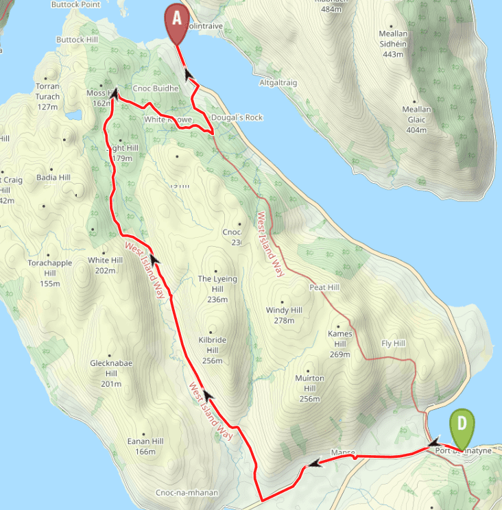
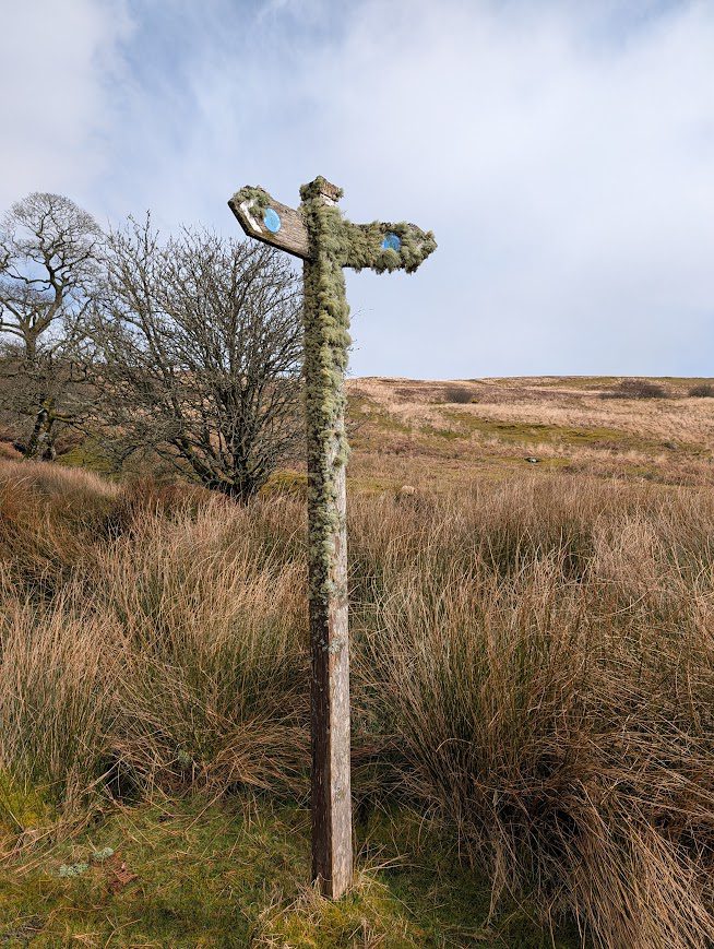
Begin your walk in Port Bannatyne close to the marina. With the sea on your right, walk along Marine Road, turning left onto A844. Follow the roadside pavement for approx 1km after which you’ll come to a pedestrian gate leading to a track (the old tramway) which runs parallel to the road but with a separation – it takes you round the Cnoc an Rath Earthwork and then through a series of gates. There are good views of the standing stones in the adjacent field, as well as the Isle of Arran.
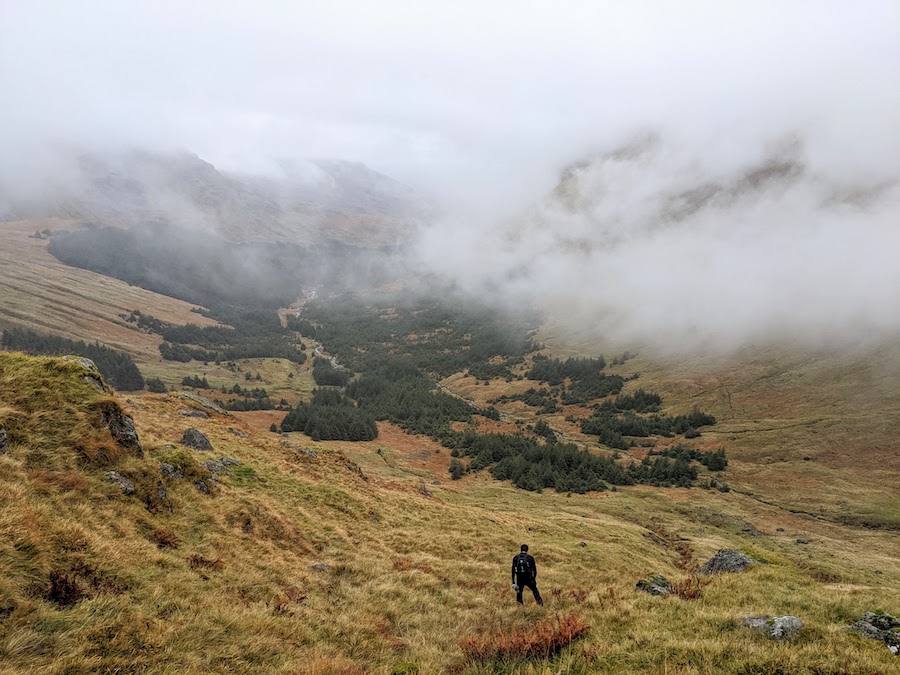
After passing Ettrick Smiddy, come off this track, turning right to start an undulating walk up Glen More in a general NW direction (recommend a short 500m de-tour to see Ettrick Bay first!). At first there is a surfaced road and then beyond Glenmore Farm, rough tracks and boggy moorland with some sections of boardwalk for approx 1 mile. When I visited there were sheep grazing this section of the route.
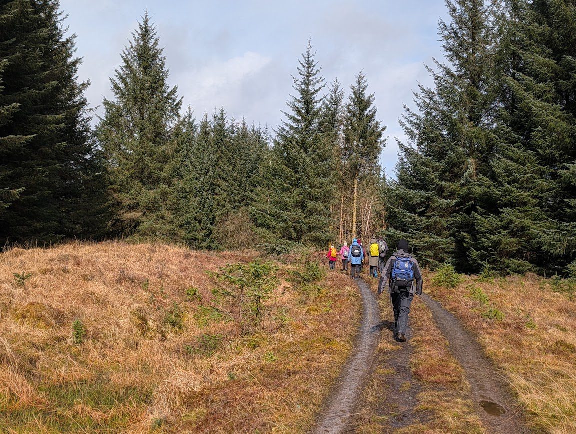
Follow the marker posts across the moor to enter the forest at grid ref NS 016 711. Approx 1km along the forest track, keep left at a fork. After a further approx 1.5 km turn right at another fork, to begin your descent to sea level (option to turn left instead for a more adventurous/rewarding route through Balnakailly Woods – navigation skills recommended). Approx 2 km down the forest track, at another fork, turn left. This track drops back towards the coast, ending at the A866. Turn left along A866 for around half a mile to reach the ferry terminal and bus stop at Rhubodach, where this walk ends.
Walk Report: 28th March 2026
Our final section of the West Island Way! Some people choose to combine this route with the Rothesay-Rhubodach one on the east of the island, forming a longer circular walk, however we decided to split it into two more manageable days out of around 9 miles each. We also decided to do both of these walks walking north, in order to tie in with local bus times and daylight hours.
We hopped on the 0905 ferry from Wemyss Bay, arrived into Rothesay at 0940, and jumped onto the awaiting bus which took us the short 10 minute drive along to Port Bannatyne. We were delighted to benefit from the new £2 bus fare pilot being run by Transport Scotland – a nice surprise – and thanks to the driver for pointing this out.
After a quick group photo in the sunshine, we were off. Five minutes later we were hit with an almighty hail shower, which went on for ages, leaving one side of our faces stinging and soaking us. Then the sun came back out. And that’s how it continued for the rest of the day! We had plenty of warning ahead of each incoming hail shower – we could see them all coming for us and then as the sky turned almost black above us down it came. This combination of sunshine and showers made for some dramatic scenes, such as in the cover photo above!
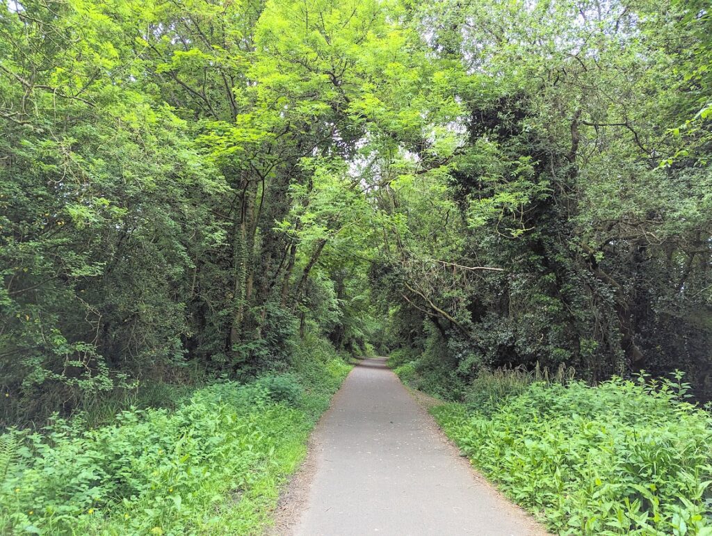
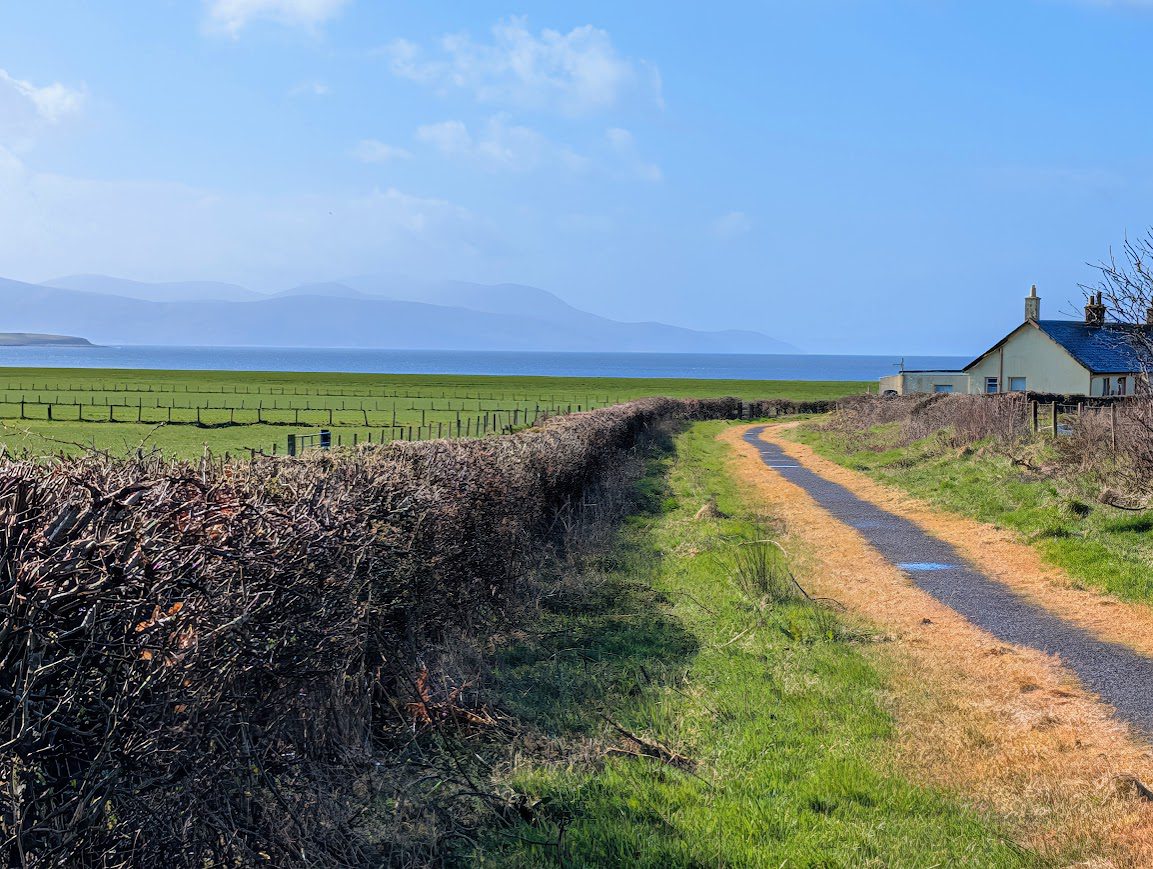
The first stage of the walk was nice and easy, along the old tramway which, according to the info I had read from the official WIW website, used to transport holidaymakers between Rothesay and Ettrick Bay to the tearoom there. Presumably also to visit the beautiful beach, which we made the short de-tour to see. Absolutely stunning!

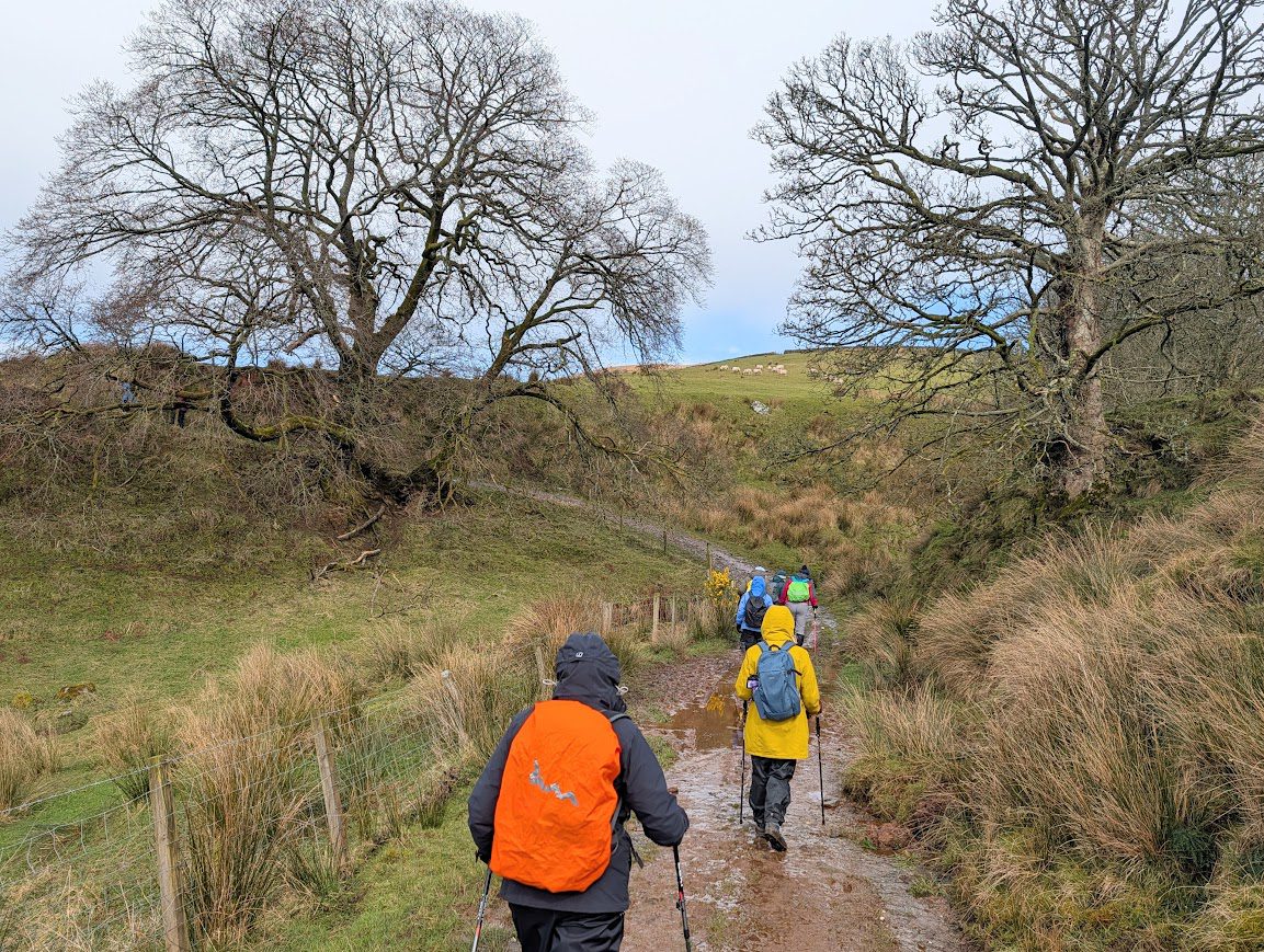
From there the route took us into Glen More, at first on a surfaced road and then onto rough tracks as we arrived at Glenmore Farm. Most of the group were ahead of me at this point, and I could see that they had all gathered around a picnic bench at the side of the farmhouse for some reason – presumably they were planning to have a rest and maybe suggest lunch here. It was raining though, so unlikely…. As I got closer I could see that they were speaking to a lady who must have come from the farm, and there were lots of cupcakes on the table! The farm operates an honesty box outside, with a variety of free first aid items, midge repellent, dog treats and that sort of thing, as well as cake slices available to purchase. On this occasion they must have been watching us advance up the glen and met us as we arrived, offering cupcakes for £2 each. Lemon drizzle sold out quickly followed by chocolate chip. What an unexpected, but welcome, experience! After a quick chat with the lady, we were on our way again.
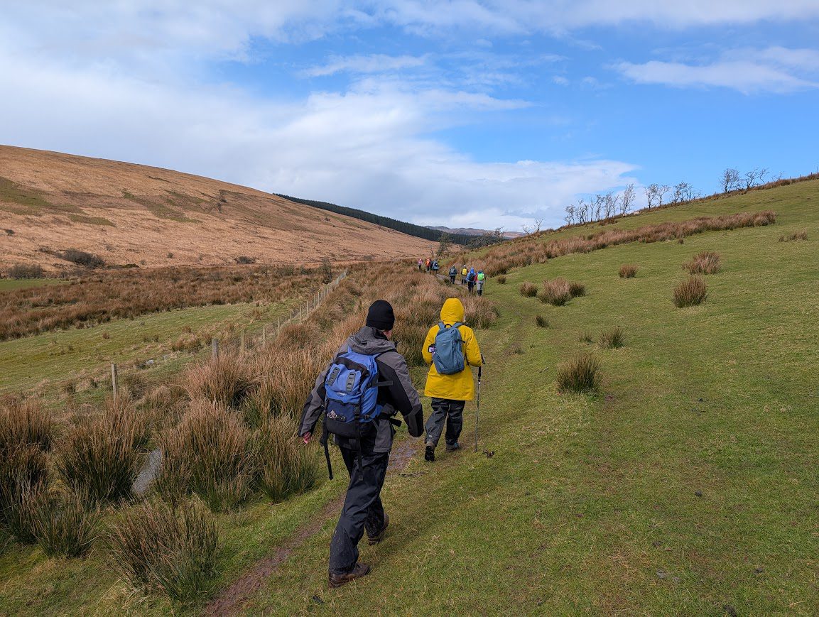
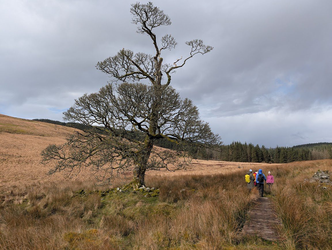
From here on, the brilliant underfoot conditions we’d become used to got immediately worse: muddy, waterlogged farm tracks, followed by boggy moorland, helped by some useful sections of boardwalk. Some would call it exciting! This was a really scenic and remote-feeling stage of the walk, and for some the most challenging. Some photos below…
We stopped for lunch once inside the forest, sheltering from another heavy hail and snow shower. It had been a long time since breakfast, considering the travel time to reach the walk start point and now with 3.5hrs (9 km) of the walk under our belts! So it was a welcome break and we even managed to find a large fallen tree trunk to accommodate us all as a bench. Life was good.
The forest track made a nice change from the boggy moorland and refuelled, we made good progress along the last part of the walk. On reaching the decision point about whether to try the ‘more interesting’ route through Balnakailly Wood or stay on the forest track, our group opted for Balnakailly. We had walked about half of the remaining section of forestry tracks when we did the Rothesay to Rhubodach section of the WIW, and we could see from the map that it would take us away from our end point before doubling back, which felt counter-intuitive. Despite that being the easier option, we voted to try something new with the lure of an old farming settlement to be found, and an ancient oak woodland to be enjoyed.
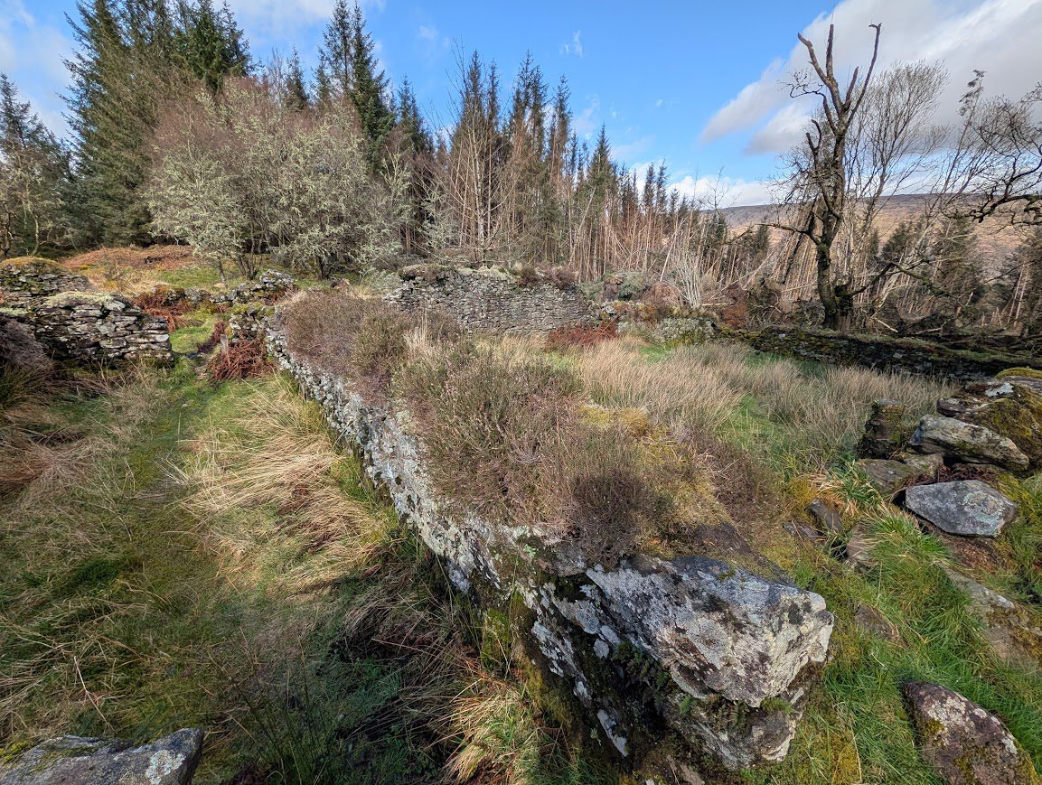
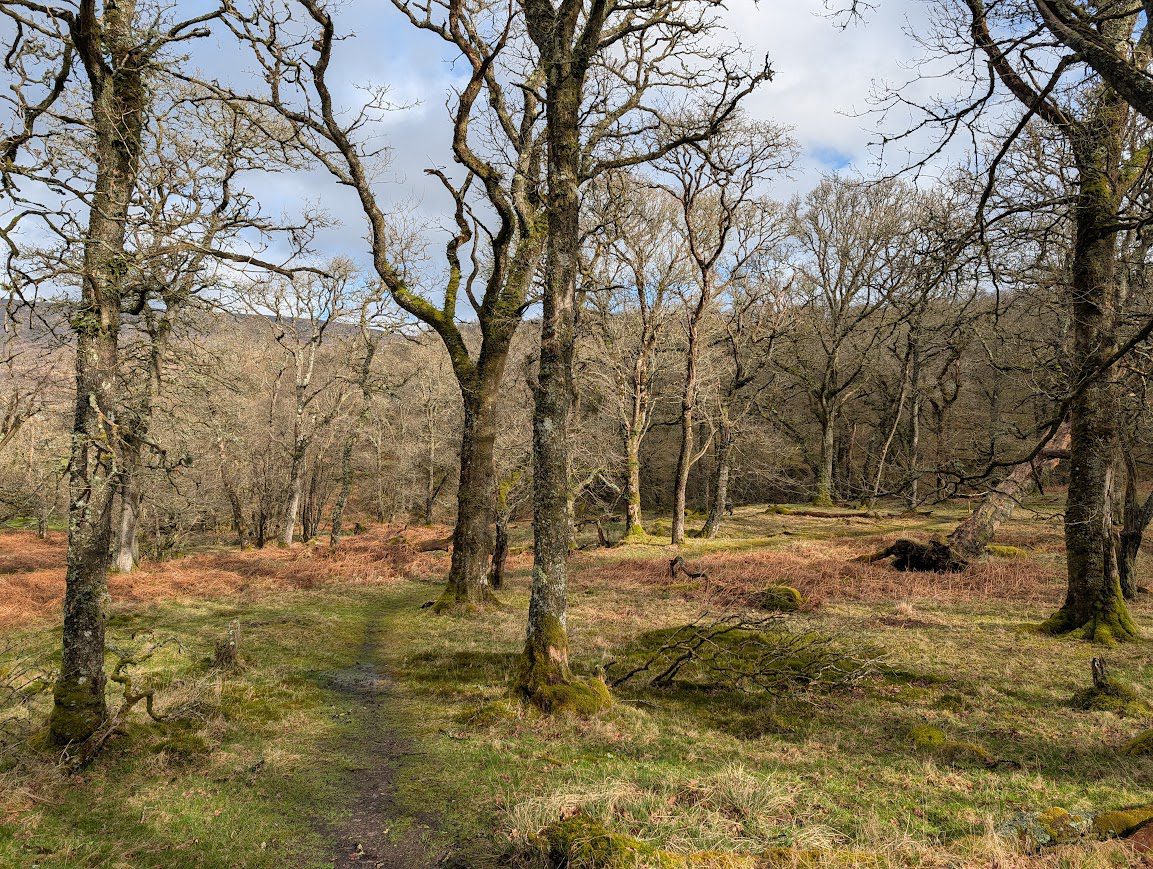
All went well to start with and we found the remains of the old Blanakailly community. Beyond here though, the path was blocked by a dense network of fallen trees. I could see on my map that there were alternative paths within these woods and suggested we try following them rather than going back up to the forestry track. It turned out to be a real adventure as we zig zagged along narrow muddy trails dotted with handmade wooden signs indicating a ‘kayak shelter’ and ‘bunker’ of all things. It would be easy to get lost in there – the paths we followed weren’t always obvious or intuitive – I was very much relying on the Visorando app and my experience using it in exactly these situations, to navigate us through. It was beautifully scenic, quirky and fun and I wouldn’t have changed it. Well maybe apart from the brief encounter with some cows when on the field track in the final 5 minutes of the walk! We tried to keep a distance, but they had calves and really weren’t happy with our presence so kept coming towards us and following us, presumably to ‘see us off their land’.

In spite of thoroughly enjoying the route through Balnakailly, on my route guide I’ve opted to describe the easier forestry track route down to Rhubodach because the Balnakailly Woods route which we took was so convoluted I couldn’t even begin to explain what way we went. Up to you what you decide to do 🙂 -i f you’re confident with using a map I’d say give it a bash!
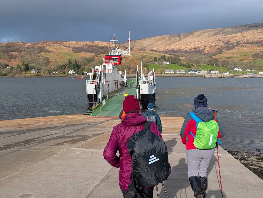
As we neared the ferry terminal at Rhubodach, a quick check of the timetable told us that we had the opportunity to repeat a previous jaunt over the water to the Collintraive Hotel for a quick beverage, returning on the ferry half an hour later to meet our bus back to Rothesay. It was honestly the best Corona I’ve ever tasted in my life.
Gates and stiles on this route
There are 6 gates on the tramway path between Port Bannatyne and Ettrick Bay – the first photo shows what they are like. The second photo is the (locked) gate and stile on approach to Rhubodach at the end of the walk.


Other walks in the West Island Way series:
Walk 249 – Kilchattan Bay Circular (5 miles)
Walk 259 – Rothesay to Kilchattan Bay (9.5 miles)
Walk 257 – Rothesay to Rhubodach (9 miles) – east side of island
The West Island Way is maintained by the Bute Conservation Volunteers. You can keep up to date with their work via the WIW Facebook page. You will also find the official West Island Way website here.