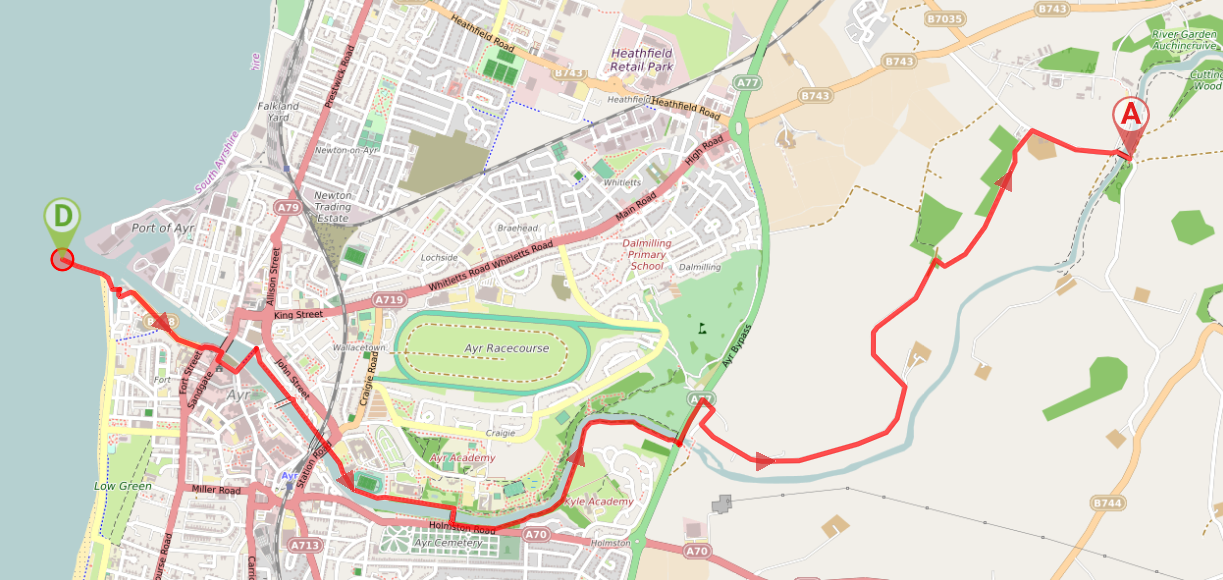
Want to walk back to Ayr? Try this 11.3 mile route – you will retrace your steps from Auchincruive back through Mainholm Smallholdings to the A77 but then follow the south bank of the River Ayr and a pedestrianised area beside the historic Citadel to return to the harbour.
TERRAIN: A mix of roadside pavements, surfaced paths, woodland trails (blaze, earth) country roads and farm tracks. One short section along the busy A77 trunk road where there is a narrow pavement with no railing. One set of shallow steps with handrail. No steep hills.
![]() Buggy-friendly walk (Note: one set of shallow steps after crossing Craigholm Bridge, possible to bump up them. Parts of this walk can also become very muddy underfoot, in particular the farm tracks just outside Auchincruive)
Buggy-friendly walk (Note: one set of shallow steps after crossing Craigholm Bridge, possible to bump up them. Parts of this walk can also become very muddy underfoot, in particular the farm tracks just outside Auchincruive)
![]() The town of Ayr has a train station, located approx 1 mile away from the walk start point. There are buses between Auchincruive and Ayr – the bus stop is on B743, 0.8 miles NW of Oswald’s Bridge. Car parking available close to the start point on Ayr Esplanade (free) or in Queens Terrace Lane car park, outside Horizon Hotel, Ayr, KA7 1DT (free but limited time Mon-Fri, fine all day at weekends). At Auchincruive there are a few parking spots around about Oswald’s Bridge, just small lay-bys. There is also a small car park a little off-route at this office building (always quiet at weekends).
The town of Ayr has a train station, located approx 1 mile away from the walk start point. There are buses between Auchincruive and Ayr – the bus stop is on B743, 0.8 miles NW of Oswald’s Bridge. Car parking available close to the start point on Ayr Esplanade (free) or in Queens Terrace Lane car park, outside Horizon Hotel, Ayr, KA7 1DT (free but limited time Mon-Fri, fine all day at weekends). At Auchincruive there are a few parking spots around about Oswald’s Bridge, just small lay-bys. There is also a small car park a little off-route at this office building (always quiet at weekends).
![]() There are no public toilets on this route. The closest near the start point are at the Pavilion/Low Green on Ayr Esplanade, approx 700m south of the harbour (chargeable /limited opening times). At the Auchincruive end, if you continue further upstream along the west bank of the River Ayr from Oswald’s Bridge for about half a mile, you will reach the Bothy Cafe which has customer toilets.
There are no public toilets on this route. The closest near the start point are at the Pavilion/Low Green on Ayr Esplanade, approx 700m south of the harbour (chargeable /limited opening times). At the Auchincruive end, if you continue further upstream along the west bank of the River Ayr from Oswald’s Bridge for about half a mile, you will reach the Bothy Cafe which has customer toilets.
View full route description
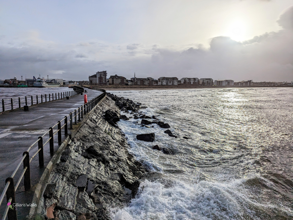
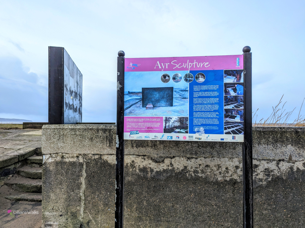
The walk starts from the end of the pier at Ayr Harbour or at the River Ayr Way sculpture at the north end of the Esplanade (look for a large notice board). Cross the footbridge then turn right followed by first left onto South Harbour Street.
Continue along South Harbour Street, with the River Ayr on your left-hand-side, until you reach New Bridge Street/A719. Turn right (away from the bridge), then take the first left onto High Street.
Just before Marks & Spencer, turn left onto Old Bridge Street and across the ‘Auld Brig’. At the other side of the bridge turn right onto River Terrace (signposted River Ayr Walk). You will soon find yourself on a slabbed walkway with the river on your right-hand side.
Continue along the riverside for a little over a mile, passing beneath several bridges, and eventually Ayrshire College and University of West of Scotland buildings.
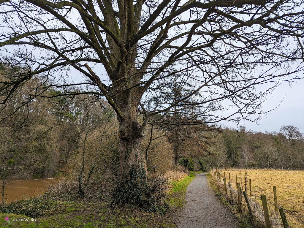
Once past the University of West of Scotland building, turn right to cross Craigholm Bridge. Turn right then go up the steps on your left. Turn left at the top and follow this woodland trail for approx 1 mile with the River Ayr close to your left-hand side all the way to the A77 road bridge.
Walk beneath the bridge and use the ramp/stairs at the other side to go up onto the A77. Once at the top, turn right to walk along the pavement, the A77 on your right-hand-side. Turn first right onto a minor road (signposted Mainholm Smallholdings and cycle route).
Keep right at a fork, and then left at the next fork. Continue through Mainholm Smallholdings for approx 2 miles. The road becomes a track and just after this point takes a sharp bend to the right, downhill and then along flat ground between some fields. This section can be quite boggy at times.
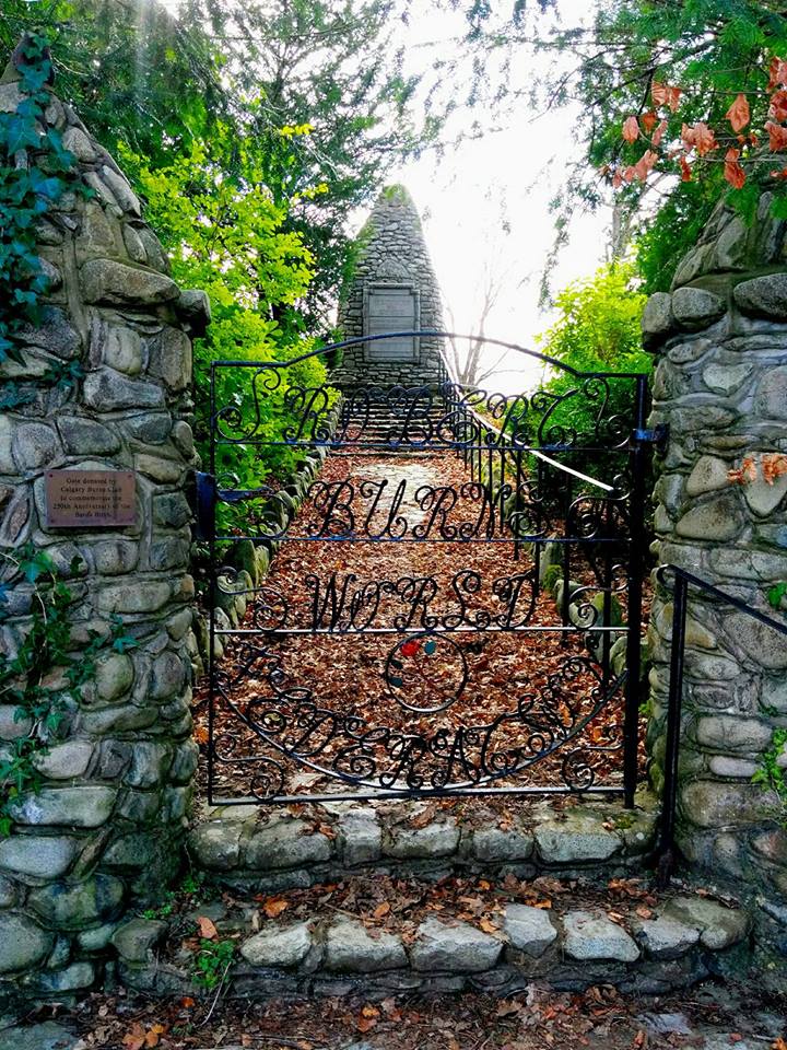
You will emerge onto a road – turn right (signposted Oswald’s Bridge). Once across the bridge look out for the gated entrance to the Wallace Burns Cairn hidden away on your right – a good spot to enjoy a well-earned rest!
WALK REPORT
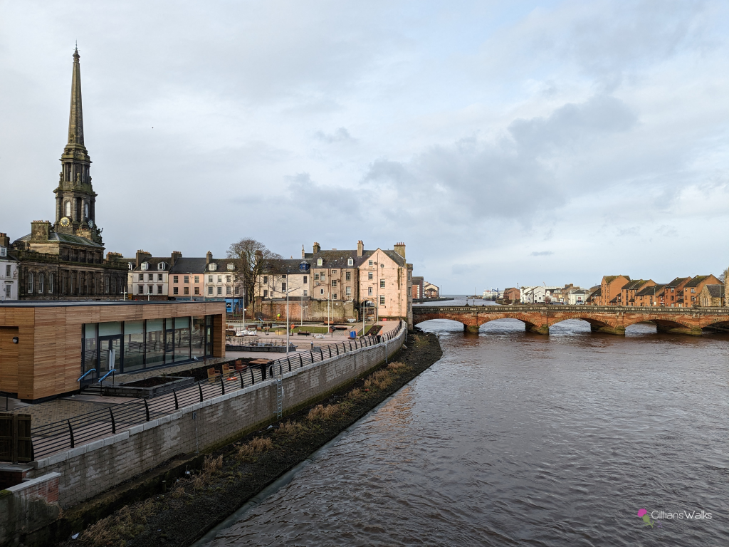
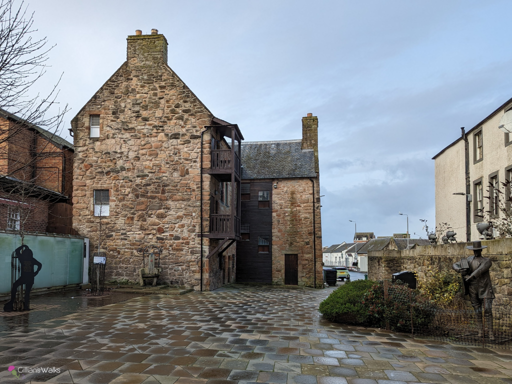
This walk took us to parts of Ayr we didn’t know existed, right from the get-go. We had never for example, walked right along to the end of the Esplanade and out to the little lighthouse building on the end of the pier. Nor had we ever taken the time to walk through and appreciate Auld Ayr. So many sculptures, statues and plaques to read. So much history. I loved the effort that has obviously gone in to preserving it and informing visitors about it.
We had some path and street closures to negotiate and there was a fair amount of building work going on. First up, a small section of South Harbour Street was closed due to a broken sewer pipe. I knew about this before we went because it had been all over social media and seemed to be causing havoc for drivers (as we found out when we tried to get out of Ayr later to go home!), but for pedestrians it was not an issue. Our de-tour actually took us through a lovely area beside historic Loudoun Hall which we’d have missed out otherwise. We spent a while there reading the information boards and admiring the artworks and building itself.
Next up was the area around the new Cutty Sark Centre which was all still under construction. There was metal fencing around it and lots of people hard at work on the site. It looked close to completion with the whole area mono-blocked and benches and planters dotted around. We could imagine loads of people relaxing here on a warm summers day, enjoying the view over the River Ayr.
One thing which was striking when I first walked this route was the lack of River Ayr Way marker posts. At the very start there was the Ayr Sculpture and an info board explaining its significance to the River Ayr Way. But no directional signs to tell us where to go from there. In fact, the first one we noticed was at the A77 road bridge, about 3 miles into the walk. On returning in November 2024, I saw that South Ayrshire Council had been busy installing new marker posts which was good, although I did point out my annoyance a few times to my walking buddies that some of the way markers were not really necessary (on long straight sections with no alternative paths), and that in other places where you could do with one, there was none (such as at the A77 road bridge where the one and only marker had been the last time!).
Had it not been for me plotting out the route on my mobile mapping app in advance, we’d have been unsure where to go at times, aside from trying to stay close to the river! I’ve made the route plot available for you to download too via the Visorando app – RAW Ayr to Auchincruive.
As we made our way gradually out of town, I was amazed at the number of bridges spanning the river over a short distance.
Near the harbour you have New Bridge Street which is one of the main roads in and out of Ayr town centre.
Then there is Old Bridge Street – a charming stone pedestrian bridge which is part of the River Ayr Way.
A little further along the metal railings of Turner’s Bridge appear – another pedestrian bridge which I had crossed often as I used to park in a small car park at the other side of it when coming shopping in Ayr! That car park was out of use at the time of writing due to the demolition of two high rise apartment blocks next to it.
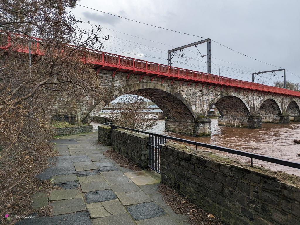
Then you come to the railway viaduct. This is a beautiful stone bridge with perfectly-painted red railings along the top of each side. We remarked at how it must be quite a job to keep them looking like that!
Right beside this is the comparatively ugly road bridge transporting traffic travelling on the A79. This one was drippy to walk under!
So that’s 5 bridges all within approx a 1 mile distance along the river.
Leaving the town behind, it wasn’t long before we found ourselves in peaceful woodland next to the college and university, and then crossing a footbridge so that the river was now on our left.

There is a short circular walk which starts from this point and takes you through the woods and back along the other side of the river. It is particularly scenic in autumn! Check it out here: River & Golf Circular from Holmston Road.
I always have to think carefully when I reach the A77 road bridge so that I don’t make a mistake. A lot of people ask me where the River Ayr Way route goes at this point.
There are stairs and a ramp at each side of the bridge and there is also a path which continues along the river. I’ve investigated the riverside path before, because it is the most tempting one to follow when doing a River Walk. However it just fizzles out when you reach the stepping stones, and then you’re on the wrong side of the river…
The next most tempting thing to do is to go up the first set of stairs/ramp, however doing that then presents you with the impossible challenge of crossing the busy A77. Even on a mid-week afternoon there is a constant flow of traffic.
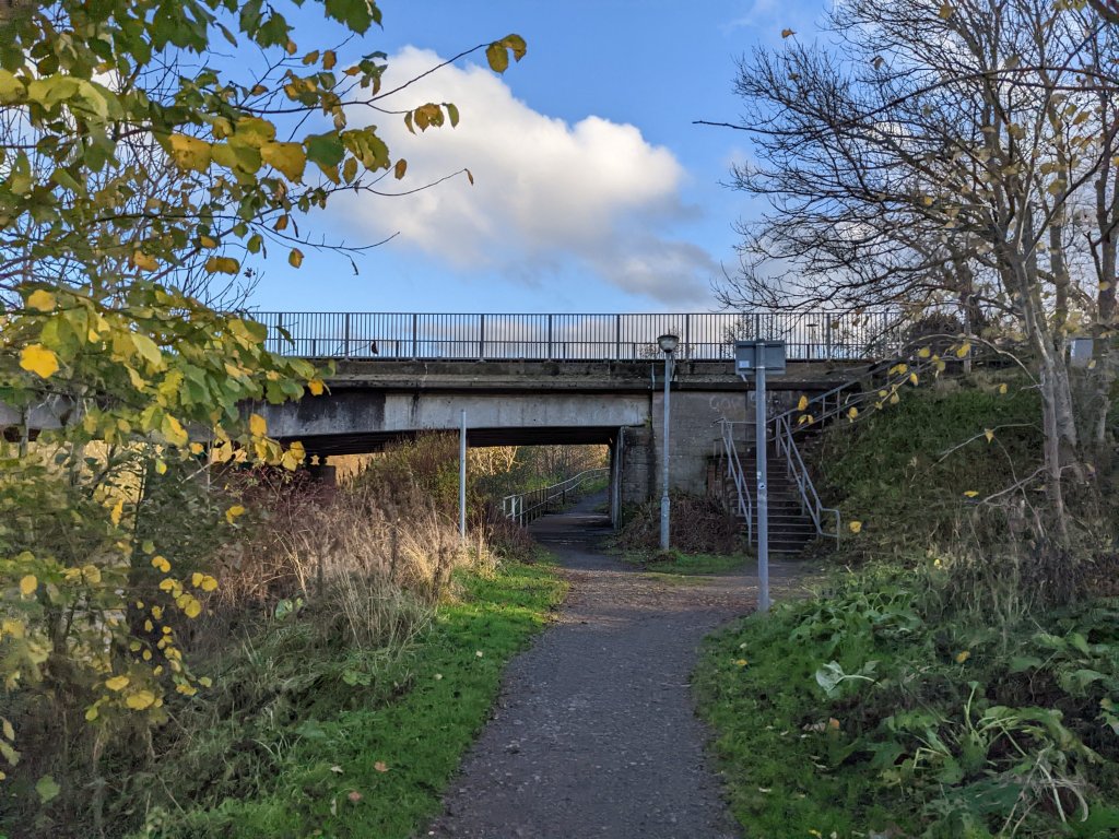
The correct way to go is to continue beneath the bridge and use the ramp or stairs to go up the other side. Tadaaa… you are safely across the A77.
Now you just have a short walk along the narrow pavement beside the A77 before you leave the busy traffic behind you for the rest of the day. A top tip: look out for puddles at the road edge and stay in if there are any – I have had the unfortunate experience of being splashed here!
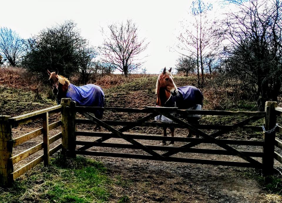
If you are a horse-lover you will enjoy the next section of the walk through Mainholm Smallholdings to Oswald’s Bridge: I lost count how many we passed along the way! It’s a lovely peaceful section, though be aware that it does become quite muddy underfoot at times the further along you progress.


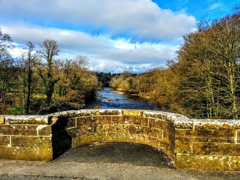
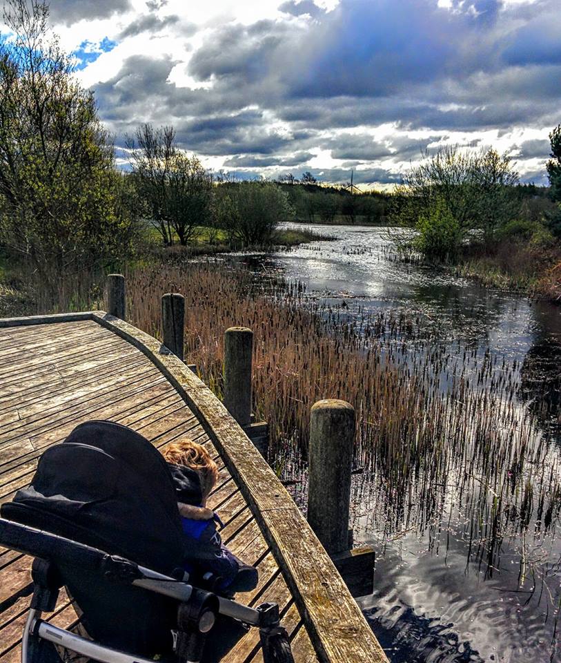
On my first time doing this route, I had my 2 year old in his buggy and on arrival at Oswald’s Bridge, my mum and I in our great wisdom attempted to take the buggy down a trail at the opposite side of the river looking for a potential circular walk back.
The result was us carrying a ton weight down steps, bumping it over a narrow trail and pushing it through thick muddy tractor tracks. We finally admitted defeat in front of a stile (!!) leading off onto a field with grazing lambs.
I won’t deny that I was gutted to realise the path ended here and we were going to have to go through all of that again to get back to the road! However…. every cloud has a silver lining and I got some lovely photos of Oswald’s Bridge from the path and satisfied my curiosity as to where it leads.
Always an adventure when you go out with Gillian’s Walks!
And that’s it – stage 1 of the River Ayr Way (west to east) complete!