NOTICE – There is a permanent diversion in place on this section due to several landslides on the riverside trail around Stair. The diversion is signposted – it takes you along the B730 and onto pleasant country roads and farm tracks to re-join the river at Daldorch Farm. It doesn’t add on any distance but does take you away from the river for approx 1.5 miles and is quite hilly. Diversion has two stiles and a cattle grid.
Need a shorter walk? Option to split this section in two by stopping in Stair. Annbank to Stair is approx 3 miles, then Stair to Failford 4.5 miles. Note that the village of Stair is approx half a mile off the official route. No public transport to Stair so you’d need a car at each end or walk back.
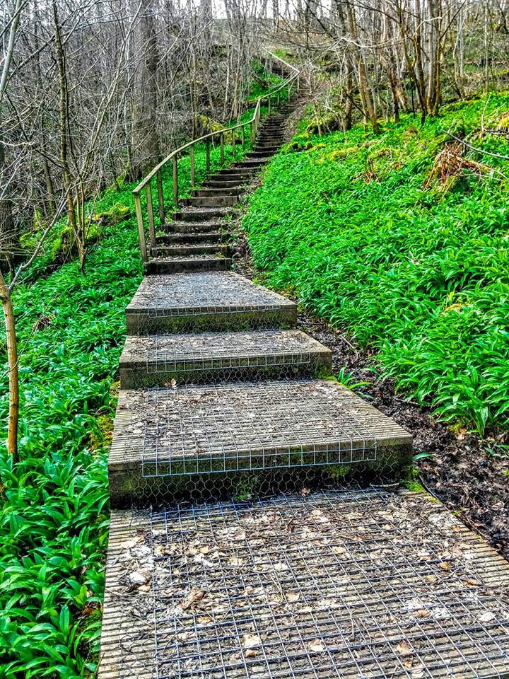
TERRAIN: This is a moderately challenging route – it’s pretty hilly (500 ft ascent/descent) and there are lots of steps, some with handrails and many without. There are at least 4 kissing gates, mostly close to the start of the walk, and there are 2 stiles at Daldorch, the first of which has quite a high step onto the lower level. This route has a mixture of woodland trails, surfaced roads, and farm tracks. Several sections of boardwalk. Two particularly boggy parts: the worst one is where the route leaves the river just south of Stair (can be avoided by walking along the field-edge instead – there is a wooden gate at the other side, or the wire fence can easily be climbed) and the other just south of Ayr Gorge Woodlands.
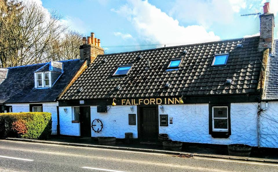
![]() There is no public transport between Annbank and Failford. I recommend using the town of Ayr as a base in order to use public transport for this route. There are regular buses between Ayr and Annbank, and between Failford and Ayr. If you have the benefit of two cars, there is plenty of on-street parking available in Annbank – I found a little parking area (fits 3 cars) at the top of Mill Road and there is a large lay-by in Failford opposite the Failford Inn.
There is no public transport between Annbank and Failford. I recommend using the town of Ayr as a base in order to use public transport for this route. There are regular buses between Ayr and Annbank, and between Failford and Ayr. If you have the benefit of two cars, there is plenty of on-street parking available in Annbank – I found a little parking area (fits 3 cars) at the top of Mill Road and there is a large lay-by in Failford opposite the Failford Inn.
![]() There are no public toilets on this route. Unfortunately both the Stair Inn and Failford Inn are also permanently closed. There is a pub at the north end of Annbank – Tap O The Brae – which may be an option.
There are no public toilets on this route. Unfortunately both the Stair Inn and Failford Inn are also permanently closed. There is a pub at the north end of Annbank – Tap O The Brae – which may be an option.
![]() Dog-friendly walk (see notes and photos below about stiles)
Dog-friendly walk (see notes and photos below about stiles)

View full route description
Starting at the top of Mill Road, Annbank, turn right to walk along Braeside. Just after this street bends to the right, go down a lane on your left to cross over to Dunlop Avenue. Turn right on Dunlop Avenue and at the end of the street go through a kissing gate to enter the woods.
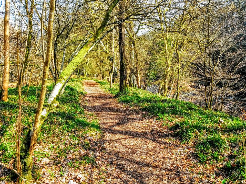
Follow the path past the picnic benches and then keep left – you will soon see the River Ayr. Follow this beautiful woodland trail for approx 700m. You will emerge onto B742 at Gadgirth Bridge . Cross the road and pick up the continuation of the trail at the other side.
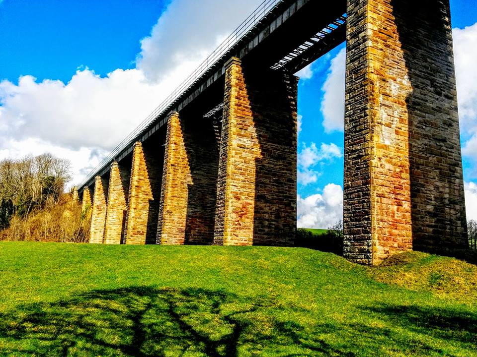
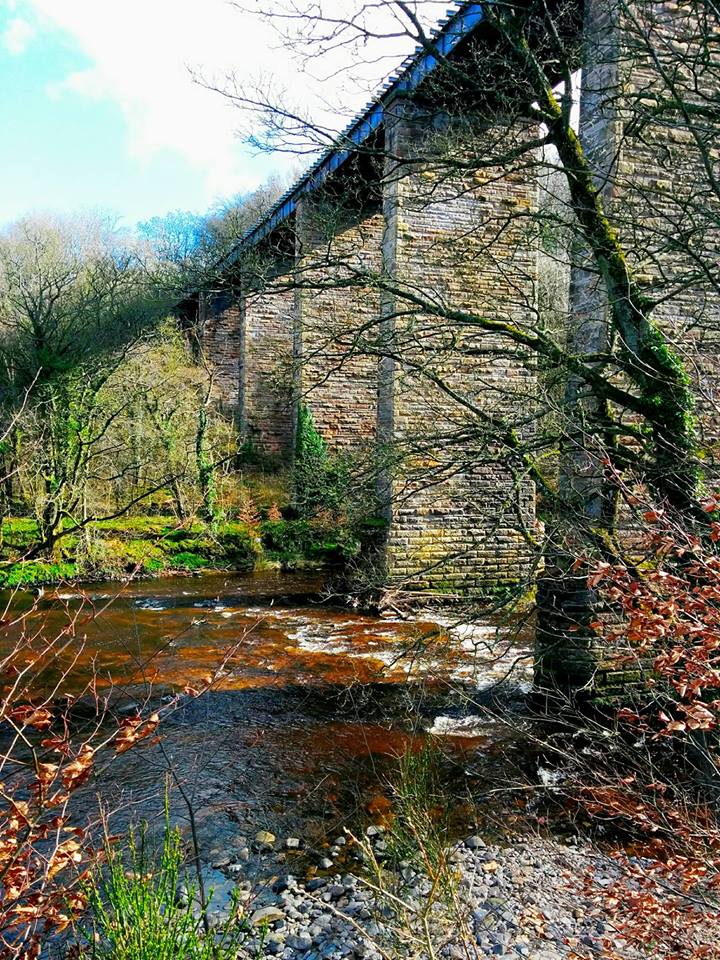
The footpath takes you beneath the Enterkine Viaduct then continues along the edge of the river on a series of boardwalks and earth trails. Look out for the Enterkine House Hotel up on the hill to your left.
Approx 2km beyond the viaduct, the River Ayr Way turns left to head away from the river. This section, which crosses the field between two fences, can be extremely boggy and waterlogged. If this is the case you can walk along the field-edge instead. At the other side of the field you can re-join the path via a wooden gate or by hopping over the wire fence.
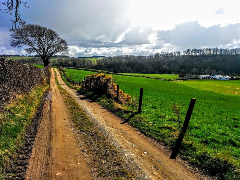
From here it is a short distance to the B730 at Stair. There is a diversion in place due to landslips, so turn left (N) heading uphill on the B730. After approx 600m turn right (signposted Trains Nursery) onto a minor road.
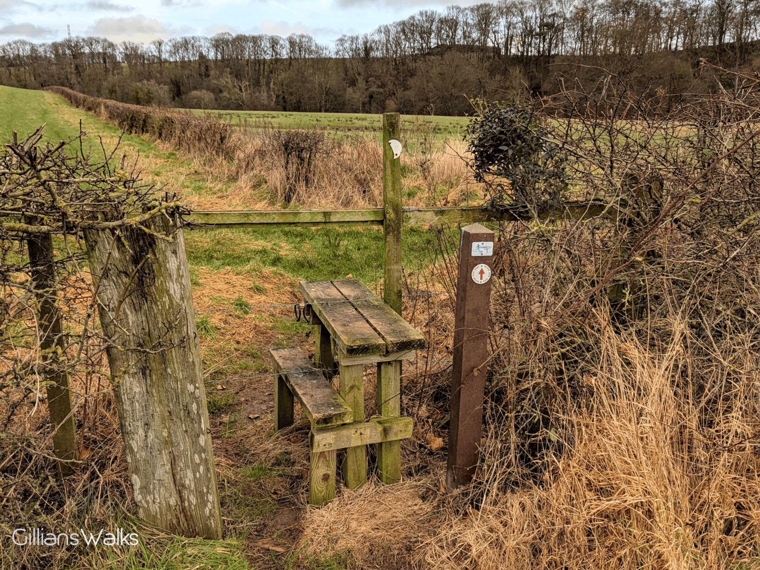
At the top of the hill take the next right (SE) (signposted Daldorch), to cross a cattle grid onto a farm track. Follow the track down towards the large farmhouse, crossing a stile on the left at the bottom of the hill.
Follow a desire line across the grass to the east side of the farm, to find another stile and re-join the riverside trail. Turn left along this trail.
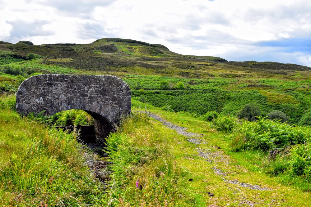
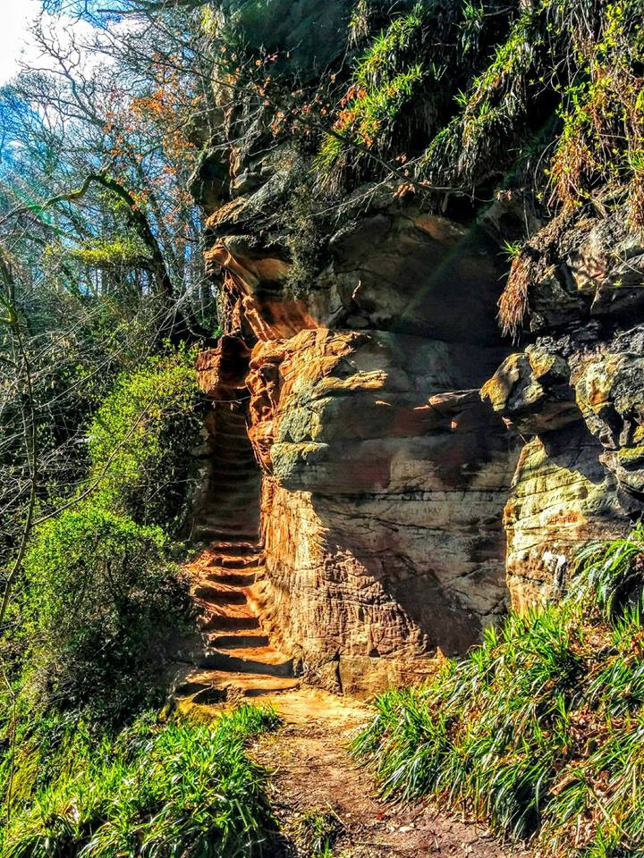
After a short 400m of walking along the river’s edge, the route turns left at a gate to head away from the water again. It takes you uphill on boggy tracks to enter Ayr Gorge Woodland. Go down the steps ahead and follow the riverside trail to another set of steps, this time going up. These are quite deep but there is a handrail.
At the top of the steps turn right and enjoy a high-level woodland walk. After crossing a boardwalk bridge you will arrive at a fork in the path beside a huge beech tree. Turn right here (E) – this takes you downhill again back to the river.
At the bottom of the hill there is the option to take a short de-tour to the Peden’s Cove viewpoint (highly recommend) and back again. It is an easy walk on a good footpath and only adds 600m in total. To do this turn right (W) to pass a marker post which says ‘Path Ends in 300m’. If not taking the de-tour, turn left to continue on your way to Failford.
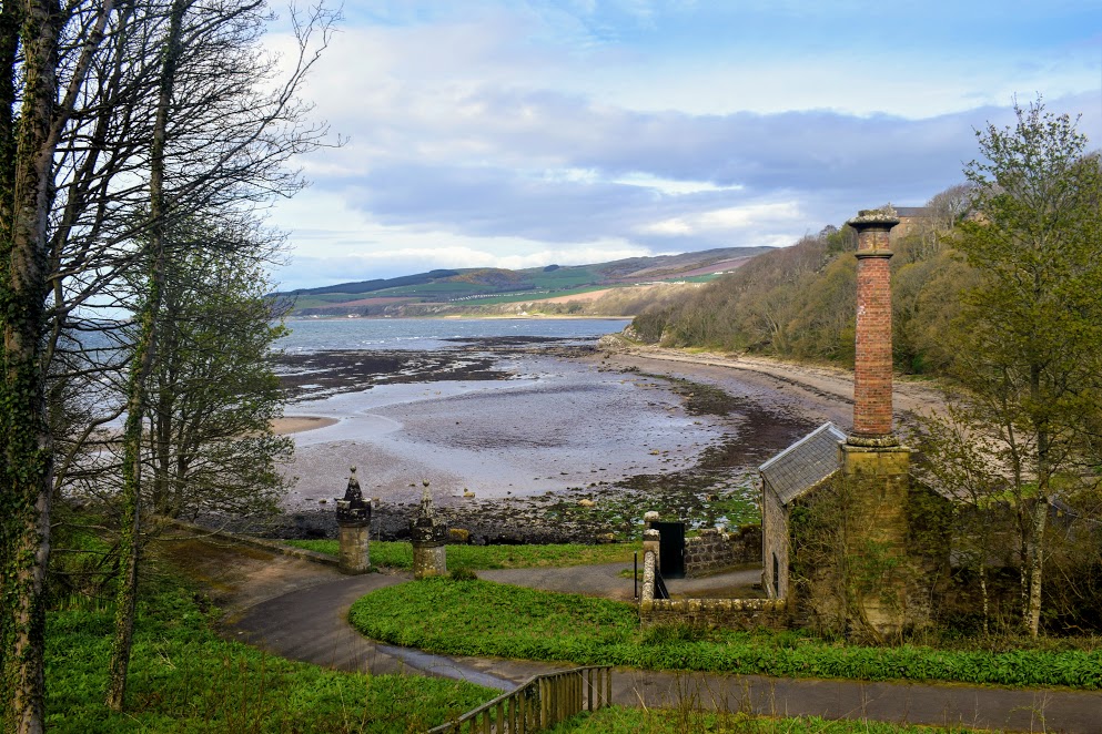
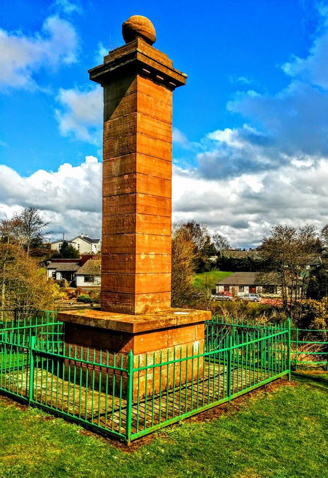
There is another long set of steps (downhill, with handrail) before you arrive in Failford, emerging on the B743. Beware of fast-moving traffic on this road. Optional short de-tour from here to visit Highland Mary’s Monument straight across the road. It is signposted and is just a short walk up some (slippery) steps (handrail). Otherwise turn right to pass the Failford Inn where you’ll find the parking area and bus stops.
Walk Report: March 2016 & December 2024
Wow – a fantastic walk! I thoroughly enjoyed every minute of this one. The terrain was varied, the scenery beautiful, I was beside the river for the majority of the way and it was just so quiet and peaceful.
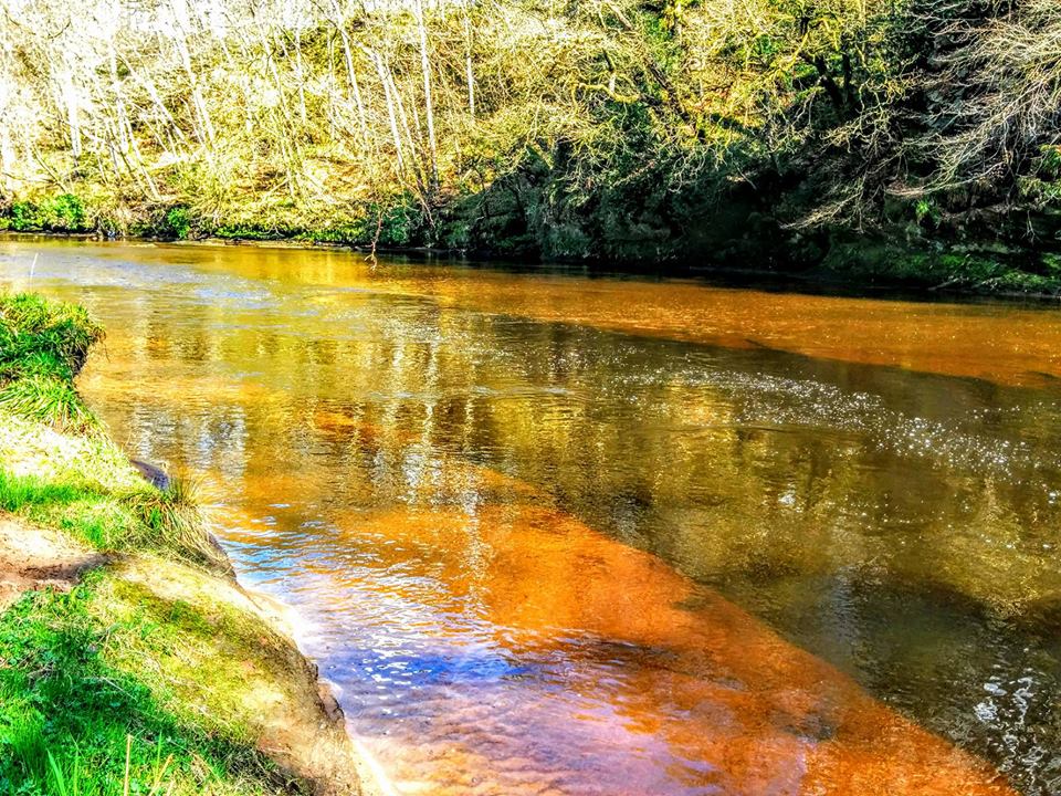
Most memorable parts: a beautiful red sandstone gorge, an impressive railway viaduct, quaint little villages, a lesson in Ayrshire history, and the muddiest field-crossing I’ve experienced to date! This is a beautiful walk along the banks of the River Ayr, taking in Peden’s Cove in the Ayr Gorge Woodland as well as Highland Mary’s Monument in Failford.
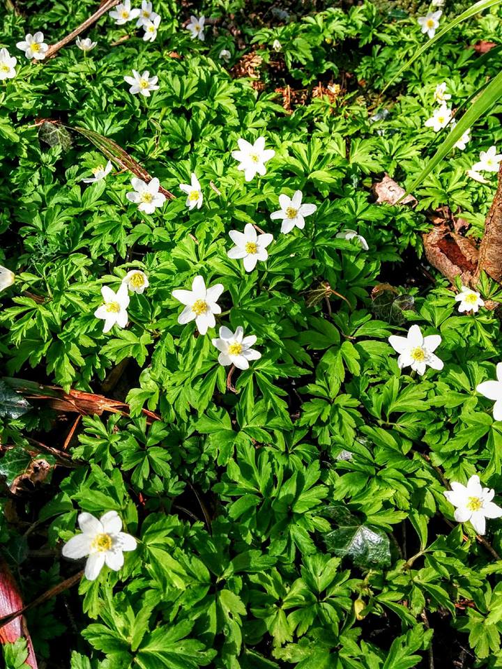
After a short walk through the village of Annbank I found myself in a lovely woodland. Even in late December there were signs of spring beginning to pop through the earth, and when I walked the route in March it was simply stunning – so lush and green with dainty little woodland flowers carpeting the floor.


Then it wasn’t long before I was heading for the Enterkine Viaduct. And how delighted I was to discover that the route went beneath it! The closer I got to this enormous structure the more in awe of it I was! The railway line on top of the viaduct was once important for transporting coal wagons to and from Killoch Colliery near Ochiltree and connecting them with the main train line to Ayr Harbour. Killoch is known for being the first Scottish pit to produce a million tons of coal in a year, back in the 1960s! From the roadside I counted 12 arches.
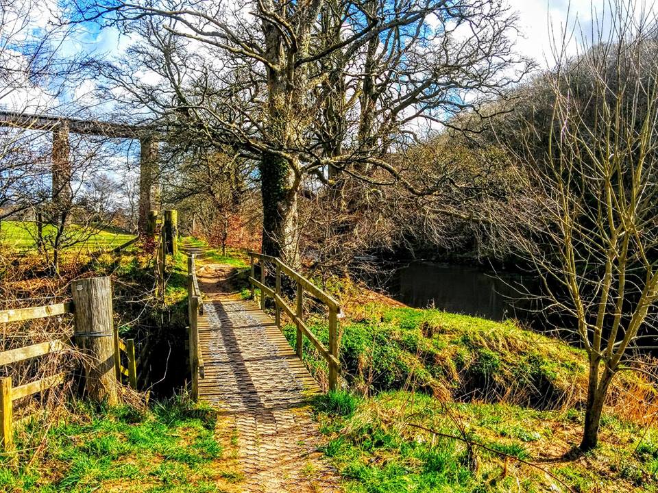
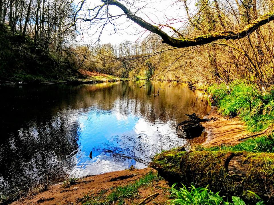
Between the viaduct and the Stair road there were some nice views over the River Ayr. A lot of work has gone in to making this section walkable at some point in the past, as can be seen from several sections of boardwalk, presumably making the going easier across some otherwise boggy parts of the path. One section of boardwalk was on a hill and built as long steps, although the slant of the top two steps was a little surprising! I was glad of the wire mesh over the wooden slats, and the handrail to hold on to.


And then as the path starts to head away from the river there is one extremely waterlogged and boggy stretch over a field. On my first walk here I persevered and walked through the bog, but on my most recent visit it was particularly bad so I diverted along the field-edge instead. It is a crop field, barley I think, and you can see that is the route most people take. In the winter what’s left in the ground after harvesting is flattened at the field-edge, presumably trampled by many pairs of boots. And in the summer there is enough of a gap at the edge of the crop to walk around without causing any damage. In fact it is positively lovely to walk through in the summer, the barley swishing gently in the breeze.


On reaching the main road just outside Stair, a sign on a gate explains that a diversion is in place due to several landslips along the riverside path. The diversion is fully signposted and doesn’t really add any distance on, but does take you away from the river for approx 1.5 miles. It is actually a lovely route once you get off the B road. Expect quiet country lanes and farm tracks and because they are up high you get lovely views over the surrounding countryside. There are two stiles on the diversion, the first of which has quite a high first step which some people might find tricky. The first stile has a good gap at the bottom most dogs would fit under, however the second stile has no such gap. Photos below. There is also a cattle grid at the start of the farm track.

The highlight of this walk for me was definitely Ayr Gorge Woodland. It is managed by the Scottish Wildlife Trust, in fact it is the ‘jewel in their crown’ – and no wonder! I actually only discovered it thanks to taking on a 100 walk walking challenge during which I had asked my social media followers to suggest some walks for me to include. Special mention to Michelle Stokes for recommending this walk to me and allowing me to discover this hidden gem right on my doorstep 🙂 It is outstandingly beautiful. It is worth noting that there are a LOT of steps, both up and down, and not all of them have handrails. But there is plenty to admire if you find yourself in need of a pit-stop 😉
And just like that I was in Failford! I have enjoyed an end of walk drink at the Failford Inn a few times, but sadly at the time of writing (Dec 2024) it is closed. I do recommend the short de-tour to see Highland Mary’s Monument, hidden just off the road-side. Take care on the access steps – they can get quite slippery with moss. Once at the monument there is an information board explaining the story of Highland Mary, her association with Robert Burns and indeed Failford.
Previous section: Auchincruive to Annbank
Next section: Failford to Catrine
Whole route: River Ayr Way