![]() Dog-friendly walk (some short sections along single-track country roads)
Dog-friendly walk (some short sections along single-track country roads)
![]() Parking available across from Barr Castle, Barr Street, Galston. Local bus service stops outside Galston Parish Church, a short walk from the start point.
Parking available across from Barr Castle, Barr Street, Galston. Local bus service stops outside Galston Parish Church, a short walk from the start point.
View full route description
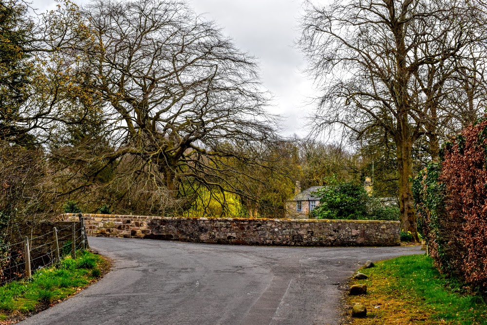
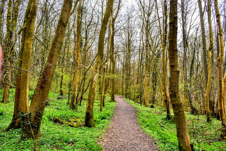
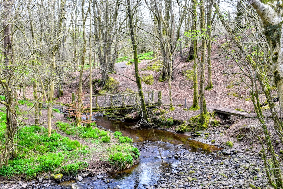
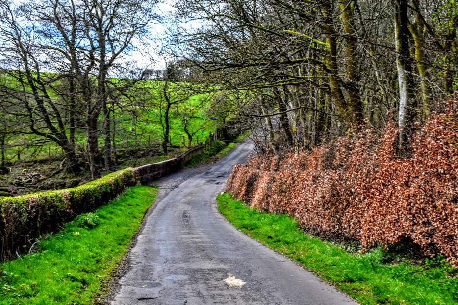
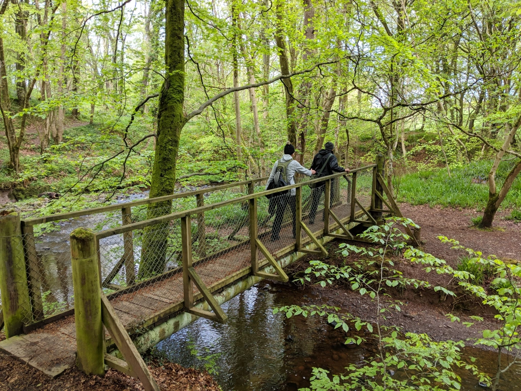
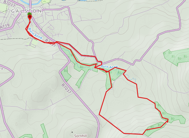
Starting from the Barr Castle car park, turn right onto Barr Street. At the end of the street turn left onto Cemetery Road, passing Galston cemetery and the Grants Foods offices along the way. Continue along this quiet road until it ends at the B7037/Clockston Road. Cross the road and turn right, looking out for a metal gate on your left taking you into Burnhouse Brae Wood. Immediately there is a wooden gate and then a fork – keep left and follow the track through this hilly section of woodland, eventually emerging at a minor road. Turn right to cross Burn Anne and go thorough the gate on your left into Cessnock Woods. At a fork in the path keep right and you will be led down to a wooden boardwalk followed by a large footbridge. Cross the footbridge, turn right and continue uphill until the path ends at another minor road. Turn right and after a short distance you will see an obvious Irvine Valley Paths Network sign directing you through a kissing gate on your left. This next section of the walk takes you onto more difficult terrain which can be boggy and exposed in poor weather. At this initial fork, go right to head uphill and onto a small footpath which skirts the edge of a field. Go through two sets of metal gates and continue along this woodland footpath to a kissing gate. There is now another field-edge path lined with a mixture of native tree saplings, much of which still have plastic tubing around the base. You will reach a fork in the path at a carved wooden marker post which is in a state of disrepair. Keep left to walk steadily uphill through a mixture of trees and gorse bushes on the open hillside – make sure you stop to take in the stunning panoramic views behind you! After passing a series of tree stumps and a wildlife information board (a good spot for lunch!), the path soon begins to level out and you will then reach a minor road accessed via a kissing gate. Turn right and follow the road downhill past several cottages. Take the first road on your right and continue gently downhill. Just after where this road bends to the right, look out for a sign on the left directing you back into the woodland at a kissing gate. This path meets back up with wooden footbridge you used to cross the burn earlier. This time you don’t have to cross, just continue straight until you come out onto a road. Here instead of crossing over into the woods again, turn right on the road then left and first left again onto Clockston Road. This meets up with B7037 where you crossed it earlier and from here retrace your steps back to the car park.
WALK REPORT: 24th April 2016
A morning spent with my mum and sis! It had been a while since the 3 of us bonded over a hike! Actually, some of this walk reminded me of our hillwalking days, particularly the uphill section where we sat on tree trunks to have our picnic lunch. I heard all my mum’s holiday stories for a second time as she told them to my sister and then we generally set the world to rights!
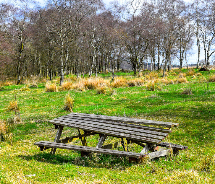
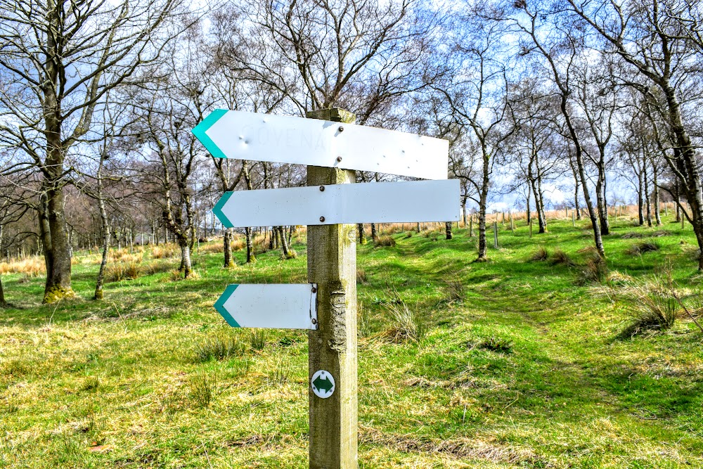
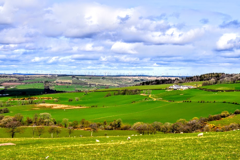
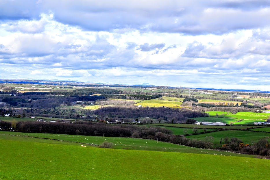
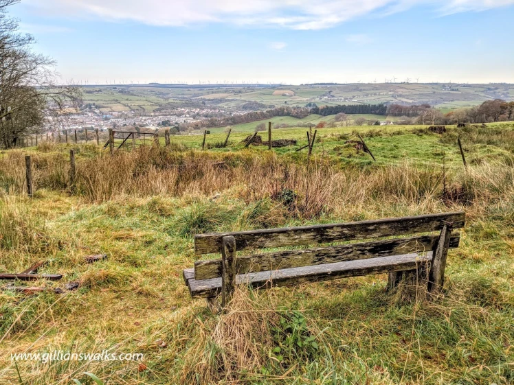
For me the most prominent thing about this walk was how run down the latter section was. It makes no sense to me: clearly a lot of work has gone into regenerating the area with new tree saplings being carefully planted, wooden way markers being carved to indicate places of interest along the route, and picnic benches being placed in very tranquil areas. HOWEVER much as we would have liked to eat our picnic at one of them, they were not safe to sit at…. some of the saplings had been blown over or snapped by strong winds and their plastic surrounds left to litter the landscape, and one of the signs is so weathered that you can’t even read what is written on it. The whole place just seemed like a bit of a once-loved-now-forgotten wilderness. All that said, it made things interesting! And the views made up for it!