![]() Dog-friendly walk (I would recommend returning to Sorn via the River Ayr Way rather than Chapel Brae to avoid the road section)
Dog-friendly walk (I would recommend returning to Sorn via the River Ayr Way rather than Chapel Brae to avoid the road section)
![]() Car park on corner of Wood Street, Catrine (KA5 6RJ) and at Sorn cemetery. No public transport between Catrine and Sorn.
Car park on corner of Wood Street, Catrine (KA5 6RJ) and at Sorn cemetery. No public transport between Catrine and Sorn.
View full route description
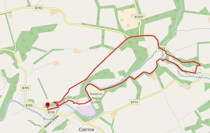
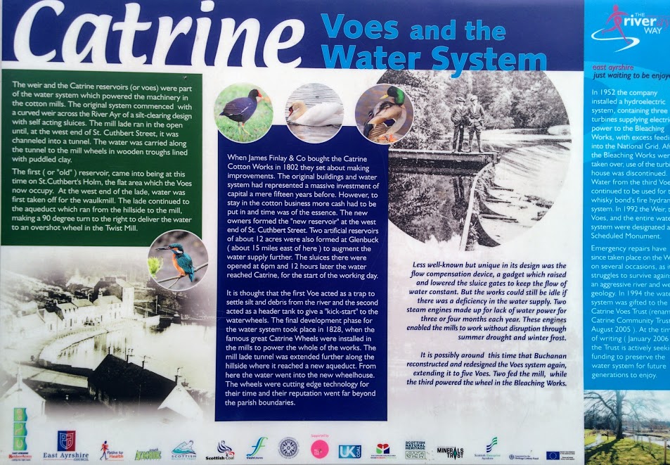
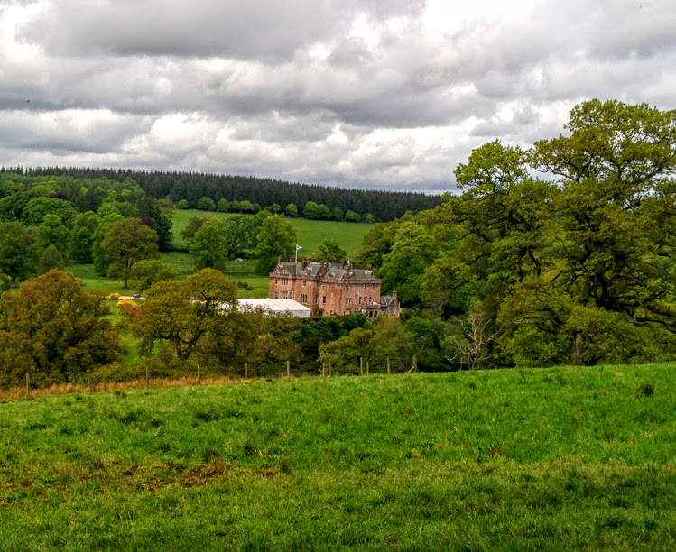
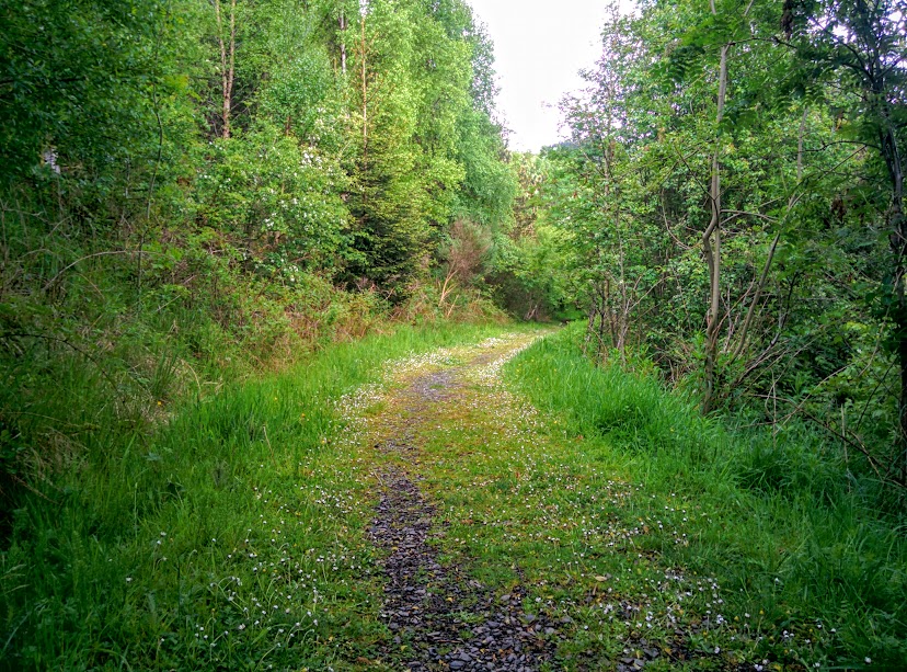
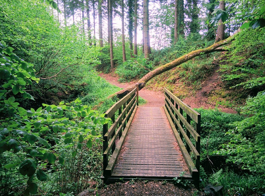
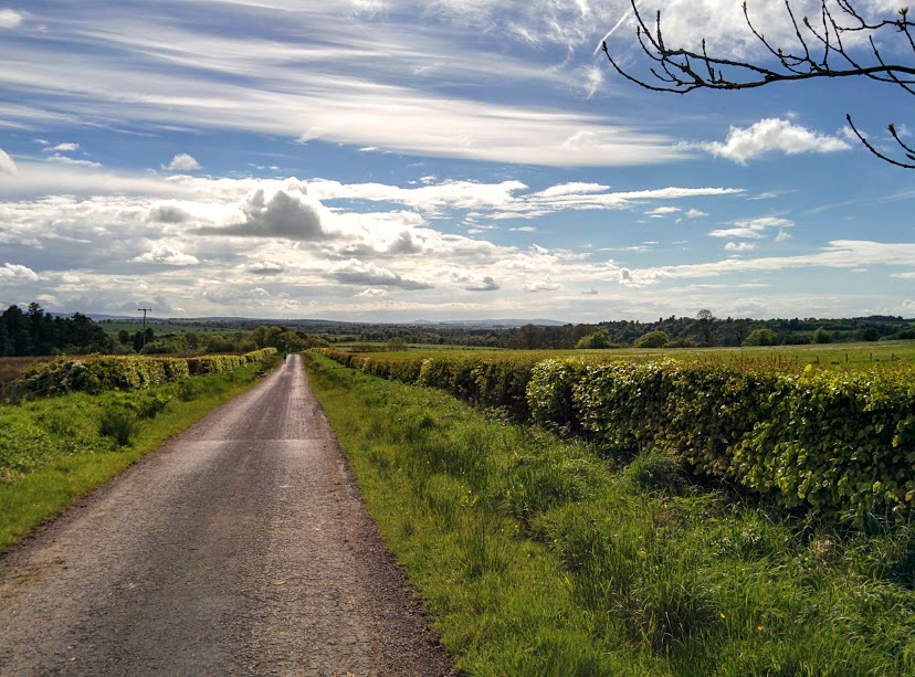
From the car park on Wood Street in Catrine, head North East along Wood Street then turn left onto Ayr Street, following the River Ayr along for 160m to a fork. Turn left (North East) and walk along St Cuthbert’s Street. At the end of the first terrace of houses 200m along, cross the bridge on your right (South) then turn left (East) to enter Catrine Voes and Woodlands Local Nature Reserve. At the end of the footpath continue straight ahead to cross a small car park then turn right (East) to cross a bridge over the River Ayr. After crossing the bridge turn left (North West) to pass Catrine Weir. The footpath then continues through a pleasant woodland with the River Ayr on your left-hand side to emerge onto a minor road after 1.7km. Turn left (North) and follow the road downhill for 300m to the Auld Brig in Sorn. Cross the bridge (North East) and turn right (East) onto B743/Main Street. Shortly after passing the Sorn Inn, (approx 600m) look for a residential lane on your left which leads North past a kids play area towards a wooden kissing gate on the hillside. Follow the gravel track as it zig zags uphill towards the “Spooky Woods”. After only 150m at a fork at the top of the hill keep left (West) onto a wider track. This pleasant woodland walk crosses a bridge after which you should continue ahead (North West) to emerge onto a minor road called Dalyearnoch Road. Turn left (West) to to arrive at the B743/Main Street beside Sorn Parish Church. Turn right (North) and take care walking along B743/Main Street for 830m, passing the entrance to Sorn Castle. Turn left (South West) onto the quieter, single track road – Chapel Brae. On reaching Catrine War Memorial approximately 1.7km down the road, move onto an earth track on your left-hand side which runs parallel to the road but passes through some trees. 100m along this path turn left (South East) to descend back into Catrine via a footpath and set of steps. Ignore a right turn about halfway down. On reaching the road turn right (South West) onto Ayr Street, and take the first turn on the left onto Wood Street. At the end of the road you will find the car park on Wood Street.
WALK REPORT: 20th May 2017
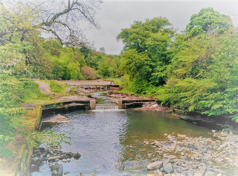
I was pleasantly surprised by this walk! Having done zero research into it before setting off (apart from planning out the route on my digital map app), my husband and I were completely oblivious to the fact that the Voes and Weir even existed! Not to mention the beauty of the woodland between the two villages of Catrine and Sorn!

I was aware that we would be walking in the vicinity of Sorn Castle and had caught glimpses of it whilst driving through the area in the past. That brief encounter had impressed me enough that I wasted no time in asking Google to tell me more and I instantly fell in love over the internet <3 Going as far as to announce to my husband that if I could go back and do our wedding all over again I would choose a venue like that one. The route I had planned out for today returned to Catrine through the castle estate and I was really looking forward to getting up close to it and having a proper look. However once we were there the ‘Private, no access’ signs at the Gatehouse put us off and we decided on the Chapel Brae option to be on the safe side.
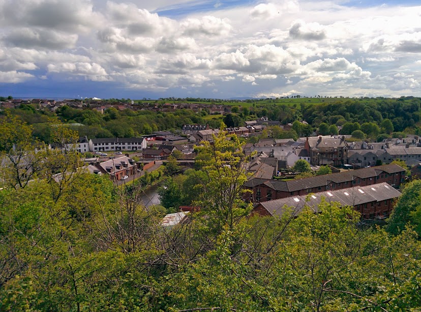
Sorn appeared to be a nice village, a mixture of modern living and historical features. The kissing gates were certainly a surprise, I had never come across anything like it before! The gates quite literally ‘kiss’ when closed over!
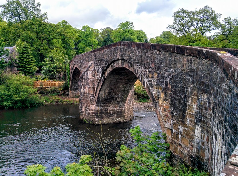
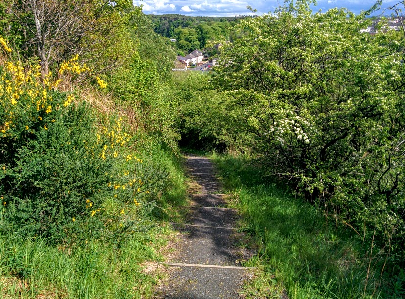
I hadn’t originally planned to do the Spooky Woods walk; I didn’t know of it’s existence. We were going to simply cross the Auld Brig and turn left along the main road and back to Catrine. As it would turn out though, Sorn has it’s own small network of paths, the Spooky Woods being one of them. I have no idea how this walk came to be given that name as there was no explanation given on the information board, nor can I find any online. If you know, do get in touch! I found it to be a very pleasant track, albeit with some curious features such as a giant purple foxglove hidden in the trees! Not quite sure what the purpose of it was but it certainly caught our attention. Towards the bottom of the woods we passed behind a gorgeous big cottage with the fattest sheep I have ever seen lounging on the garden grass…. I mean huge!
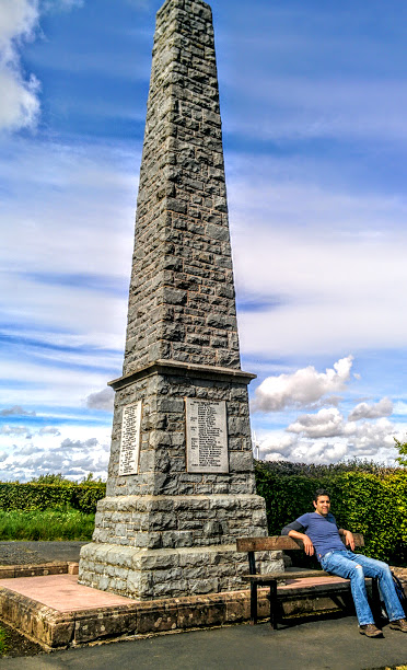
Leaving the woods behind for the day and emerging onto the main road out of Sorn, the short walk along to the start of Chapel Brae was the least enjoyable section thanks to the absence of pavement and fairly heavy traffic flow. The view really opened up when we turned onto the single track road of Chapel Brae, and with only the occasional passing car we were free to meander happily down the hill to the War Memorial. From there we had intended on continuing down Chapel Brae however we found a shortcut down a set of steps which took us almost directly back to the car park. Result!
Enjoying this walk as much as I did has left me itching to get back and finish the River Ayr Way trail! So far I have completed all the sections from Ayr to Sorn so only have the final 17 miles to Glenbuck to walk. Technically I believe I am doing the route in reverse so no doubt once I have finished it I will want to go back and do it the ‘right way’ too 😉