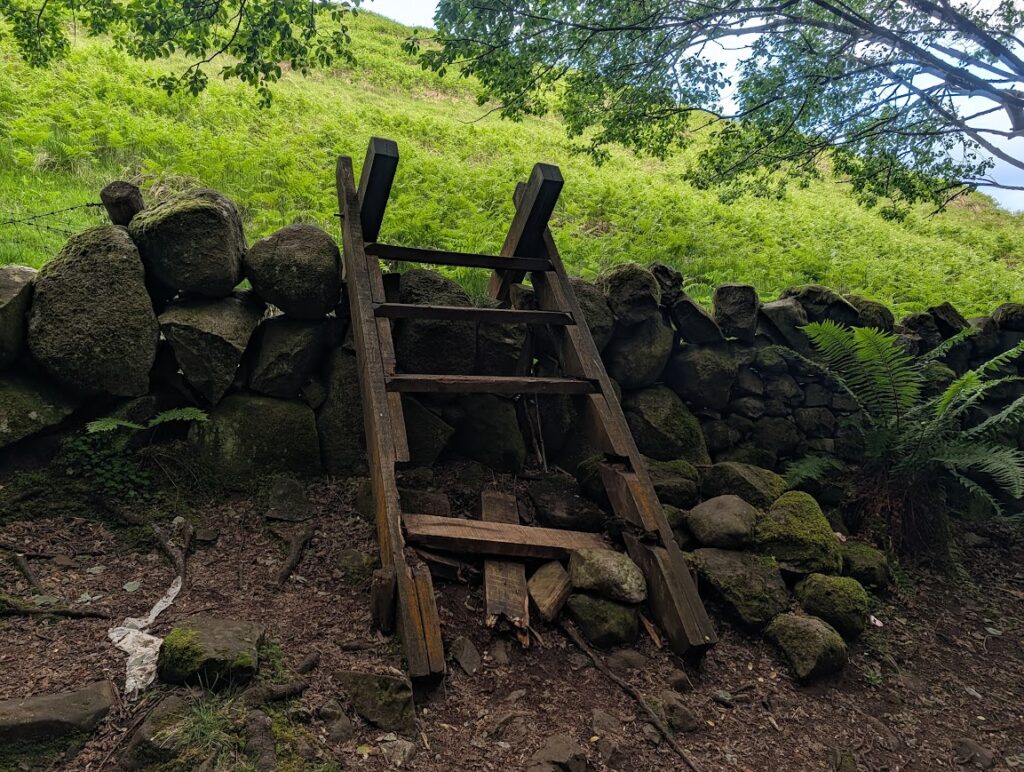
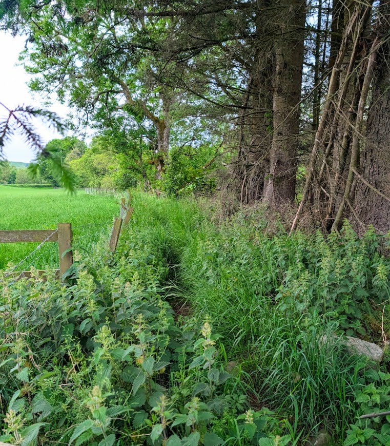
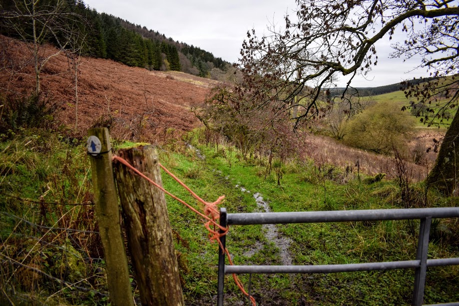
NOTE JUNE 2026: Parts of this route are currently in a state of disrepair although it is still possible to complete it with care. For example the ladder stile between the forest and hillside is missing the bottom few rungs, many of the marker posts helping you down off the S side of Monument Hill have fallen over or are missing their arrows, the riverside trail leading to Craigfad Bridge is very overgrown in summer, as is the forestry track through Bennan Wood.
TERRAIN: Mix of terrain including grassy fields, earth trails, gravel tracks, and surfaced paths/roads. This walk can be very boggy. Steep ascent/descent route. Several kissing gates and two stiles on the route. High chance of encountering sheep and/or cows. Distance of 5 miles includes an optional de-tour to Bennan Hill viewpoint (4.2 miles otherwise).
![]() Car park off Kirkmichael Road, Straiton (KA19 7NF). There is an information board in the car park and some leaflets about walks in the area. Local bus service stops on Main Street, 1 minute from the walk start point.
Car park off Kirkmichael Road, Straiton (KA19 7NF). There is an information board in the car park and some leaflets about walks in the area. Local bus service stops on Main Street, 1 minute from the walk start point.
![]() Public toilets in Straiton behind McCandlish Hall. These are community run – please leave a donation.
Public toilets in Straiton behind McCandlish Hall. These are community run – please leave a donation.
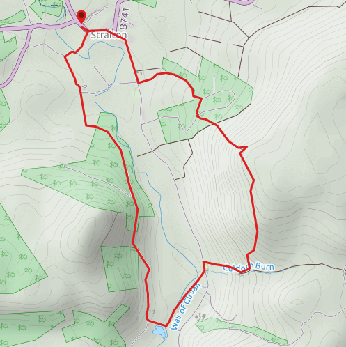
View full route description
From the public car park in Straiton next to the playing fields, turn right (SE) onto B741/Main Street. Walk through the village, past the church, village store and cafe and turn right (SE) at the war memorial onto Newton Stewart Road.
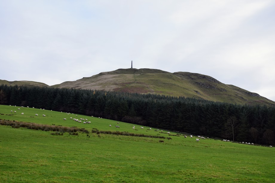
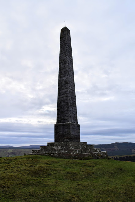
Just past the school go through the kissing gate on the left. Follow a grassy track up over the field towards the trees then follow the tree-line SE to a gate at the top of the hillside. Follow the trail through the forest to a stile leading onto the steep slope of Craigengower (note June 2026: stile broken but usable with care). The path to the summit is obvious ahead and emerges in front of the Obelisk.
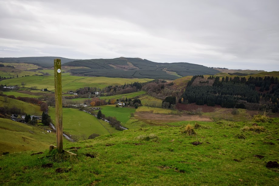
Descend S down the opposite side of the hill, following tall wooden way-marker posts (note June 2026: a few of these have fallen over and the descent track is not obvious at times. Recommend also using the digital route map).
On reaching a gravel track next to Kildoach Burn turn right (W) and descend to a steep grassy slope. There are sometimes cows or sheep in this field. Head towards a kissing gate in the hedge at the bottom of this slope. This leads directly onto Newton Stewart Road.
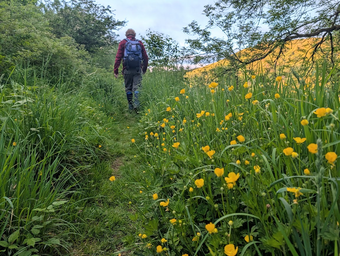
Cross the road and turn left (S) to walk along the grass verge for a short distance. Look out for a kissing gate on your right. Pass through the gate then pick up a faint path SW across the grass and a boardwalk bridge.
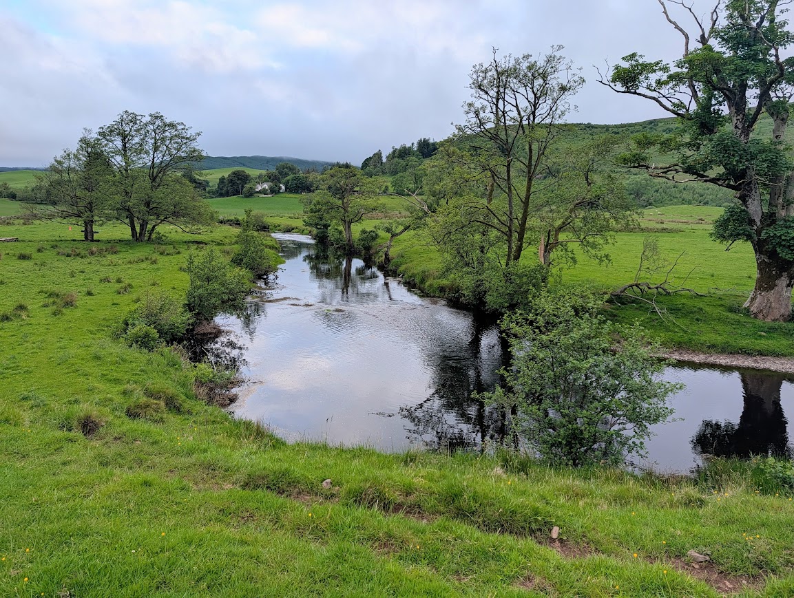
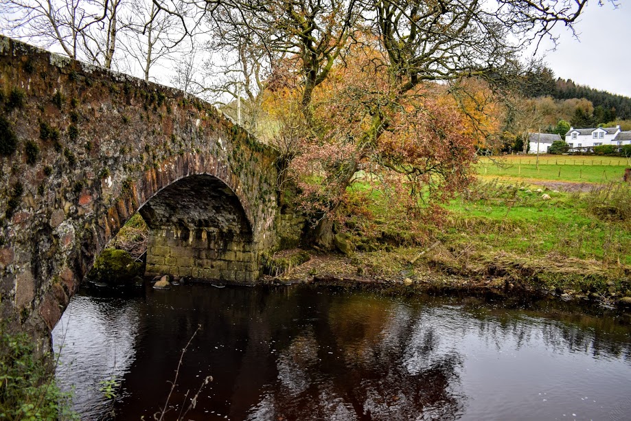
Follow the course of the Water of Girvan to another kissing gate. The river should be on your right-hand side. A narrow (sometimes overgrown) earth footpath takes you along the edge of the river and up some wooden steps (in need of repair at the time of writing) to reach a minor road at Craigfad Bridge.
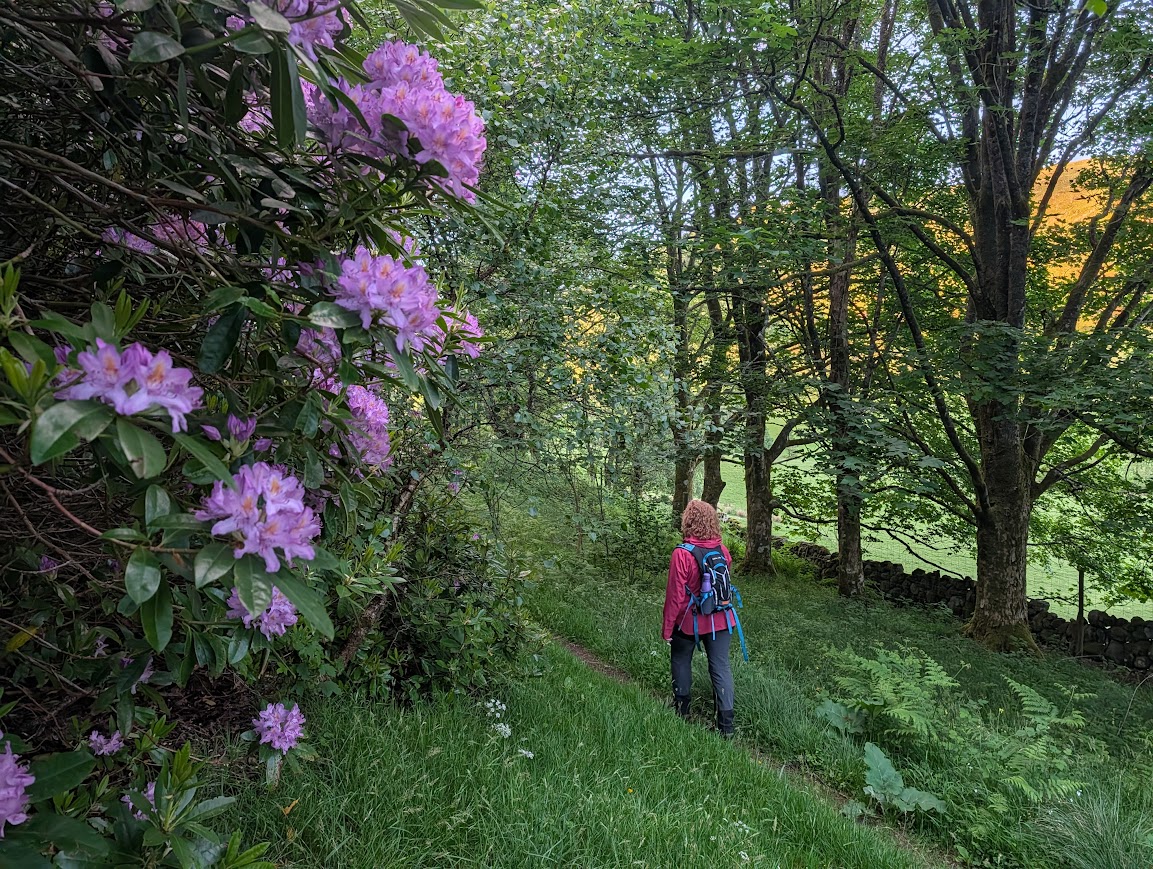
Turn right (W) to cross the bridge and at the first corner turn right (N) onto a farm track between Craigfad Cottage and Little Garroch. Continue along this track through Bennan Woods for approx 1 mile, passing through several gates. Keep left (NW) at a fork approx 500m along, follow the way-marked route along a (sometimes boggy) trail.
800m along, where you emerge onto a wider forestry track at a gate, there is an optional detour to the top of Bennan Hill – it is a fairly steep climb to the top with nice views en route although the trees block much of the view at the summit itself. If you wish to try it, take the left fork (NW) and look out for a left turn 150m along. This path takes you to the summit. Return via the same route.
If not taking the de-tour, keep right at the fork to continue along the main route.
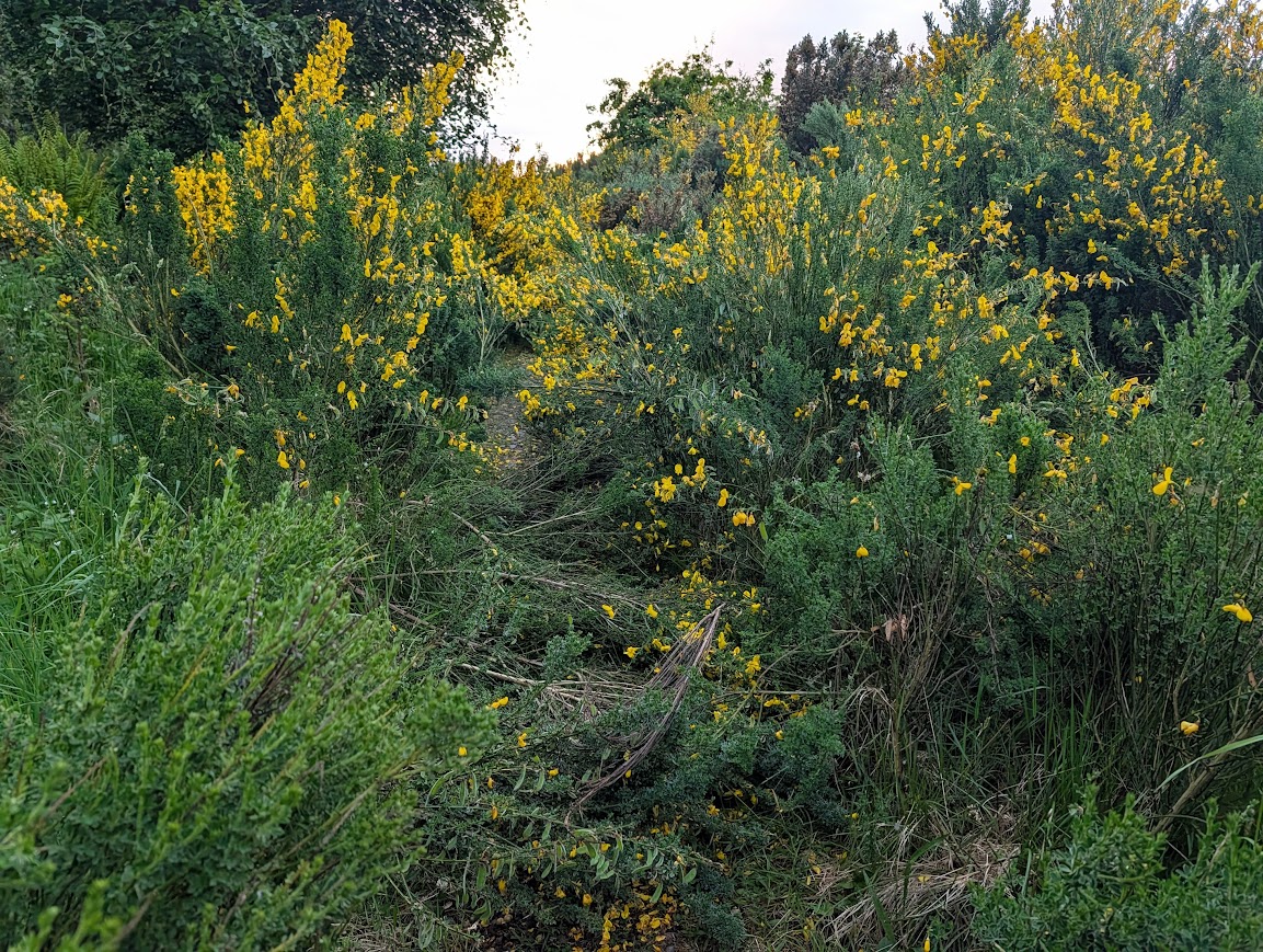
Beyond this point the forestry track becomes very overgrown with Gorse and Broom, but is passable with care. At the end of this track use the stile to cross the gate then continue along the field boundary for 100m before turning right (N) down the centre of the field towards Bennan Farm. There are sometimes cows or sheep in this field.
The track passes through the farmyard and 200m beyond it look out for a kissing gate on the right (signposted “Car Parks”). Follow this narrow footpath with a burn on your right-hand side, to reach the Water of Girvan.
Cross the large footbridge and continue walking straight ahead (NE) along the edge of the field, with the burn on your left. Go through the gate at the other side of the field and pass a cottage to reach Main Street. Turn left (NW) to return to the public car park in Straiton.
WALK REPORT: October/November 2017 (updated 2nd June 2026)
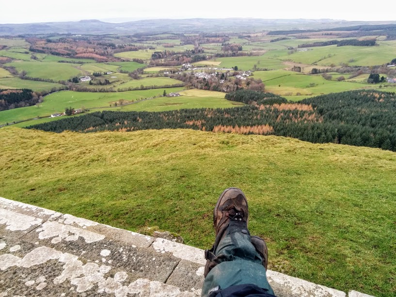
Straiton has become a firm favourite of mine when it comes to walkability. No wonder it is known as ‘Rambler Territory’: A quaint Ayrshire village, hills to explore, riverside rambles, boggy trails, woodland walks… Straiton really has it all. On all of my previous visits, Craigengower had teased me with its attractive curves and eye-catching obelisk. I had to get up there!
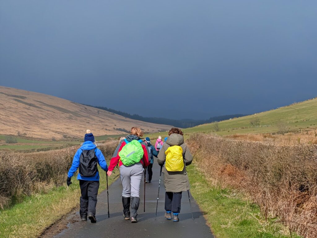
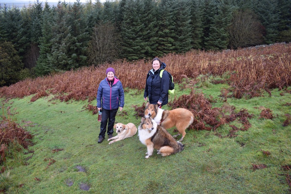
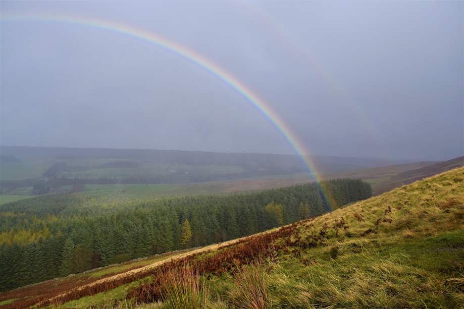
My first visit to the top of Craigengower (although at the time I didn’t know this was its name!) was with Sally, Shona and the pooches shown in the photo below, all of whom came along to explore the route with me. We had unfortunately chosen a rainy day so not only did we experience extremely boggy underfoot conditions but we also ended up soaked through. I think we all still enjoyed the day though, I certainly did! We were treated to a beautiful rainbow which was present for most of our ascent and the views opened up every now and again offering us a glimpse of what might be seen in better conditions. The descent was memorable: wind and rain blasted us straight in the face the entire way down. Why I thought it was a good idea to apply mascara that morning I have no idea! We live and learn….
I vowed to return on a better-weather day. I didn’t think that day would be 19th November but so it was to be! My friend Eve and I were in Straiton planning to explore the “hill track to Patna” which I had seen mentioned on the Ayrshire Paths website and wanted to check out. According to my research it was an ancient route across moorland which was set to become part of “The Carrick Way” at some time in the future. It took some effort but eventually I found a digital map of the route which I could transfer onto an app on my phone and off we set. I knew the first section already because I had walked it when doing the Hill Wood route in July. Thereafter we would be venturing into the unknown and to be completely honest we didn’t know whether it was even possible. It didn’t take long for the answer to become clear: a big, fat NO! Dense forestry coupled with saturated mossy moorland = no can do.
Plan B: take Eve up Craigengower! The weather was far better this time around and although the ground was still extremely boggy the views were stunning and it was even calm enough to sit on the base of the obelisk for lunch 🙂
On both occasions I was grateful for the way-markers making navigation down the south side of the hill really easy! Unfortunately as of May 2026 I have been advised that a lot of these way-markers have fallen over, so it may not be quite as easy to navigate down as it was previously. I recommend using the digital map which I have provided on Visorando for reassurance.
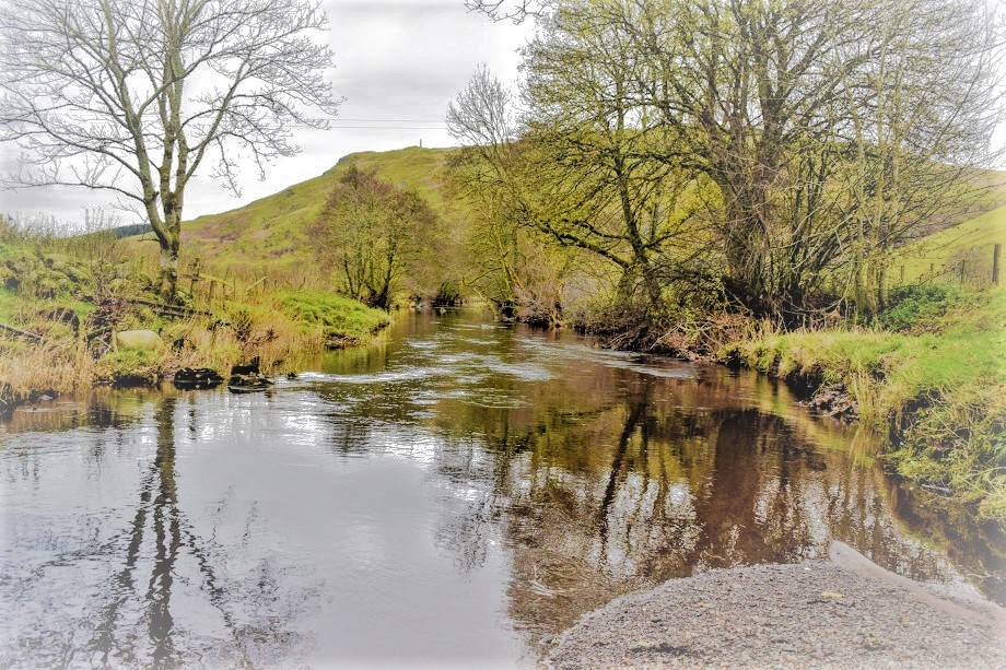
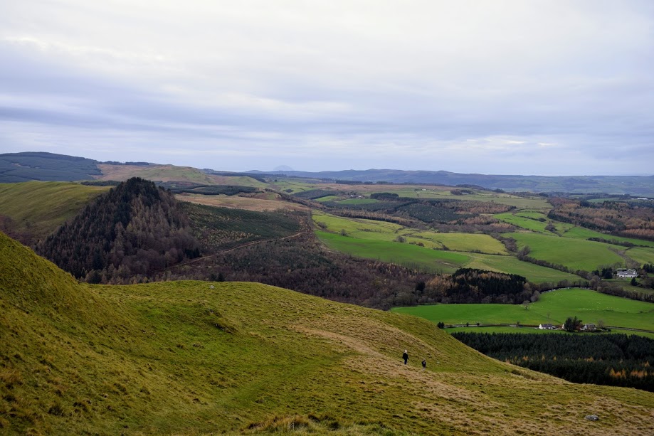
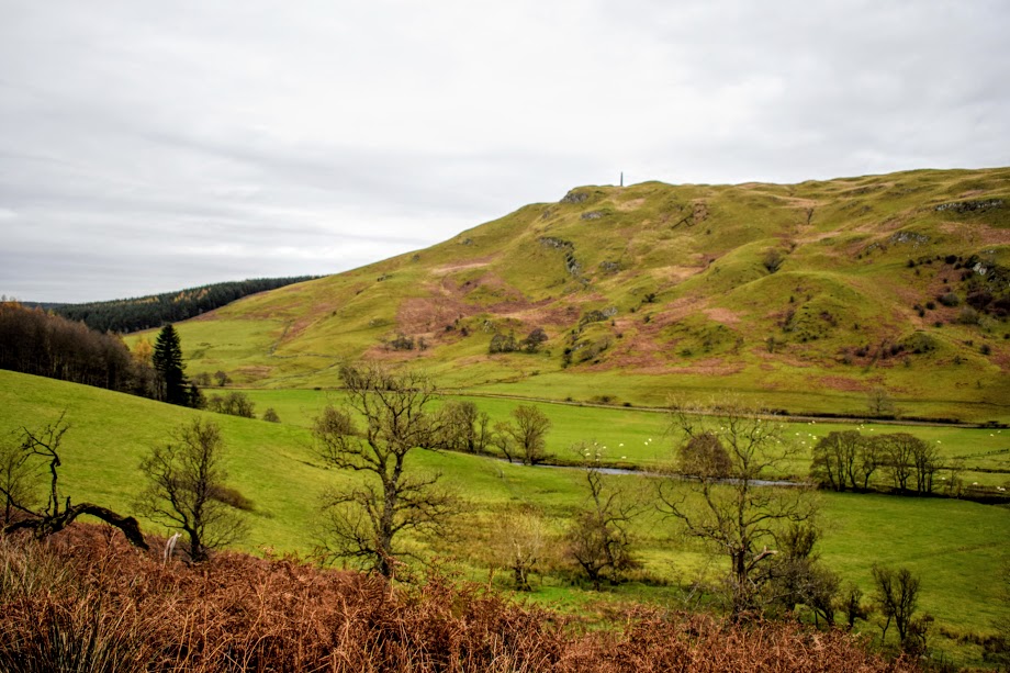
I also fell in love with the view across the Straiton hills (more of which I want to explore!) and the Water of Girvan winding its way through the valley below. South Ayrshire is just such an incredible walking destination!!
Coming down off the hill it felt really strange to turn left and follow the river in the opposite direction to the village where our cars were parked…. If it hadn’t been for my trusty pre-plotted route I would have had serious doubts! It turned out to be such a lovely walk though, very muddy in the winter months, but lovely. It is also worth noting that when I tried this walk again in early summer, the riverside trail was very overgrown including the odd nettle. It was passable with some care, but I would avoid shorts!
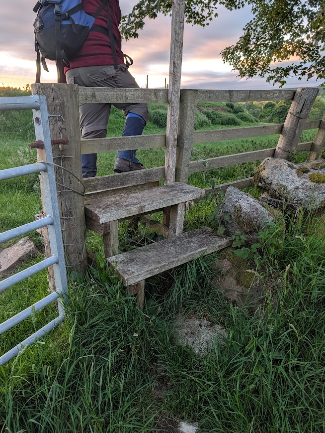
Below are some photos of the two stiles on the route. The ladder stile is located near the start, at the top of the forest path which leads to the base of Monument Hill. As you can see it is missing the bottom two rungs. The other is located towards the end of the walk, leading onto the field near Bennan Farm.