TERRAIN: mostly earth footpaths and quiet roads. Can be muddy at times. Reaching the ring and cup marks requires crossing very boggy and uneven ground.
![]() Dog-friendly walk (one wire fence to cross to reach the ring & cup marks)
Dog-friendly walk (one wire fence to cross to reach the ring & cup marks)
![]() Car park on corner of Wood Street, Catrine (KA5 6RJ). There is also a local bus service with stops at Mill Square, at the start of the route.
Car park on corner of Wood Street, Catrine (KA5 6RJ). There is also a local bus service with stops at Mill Square, at the start of the route.
View full route description
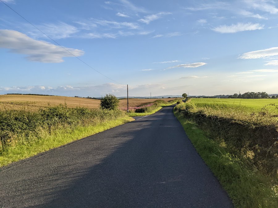
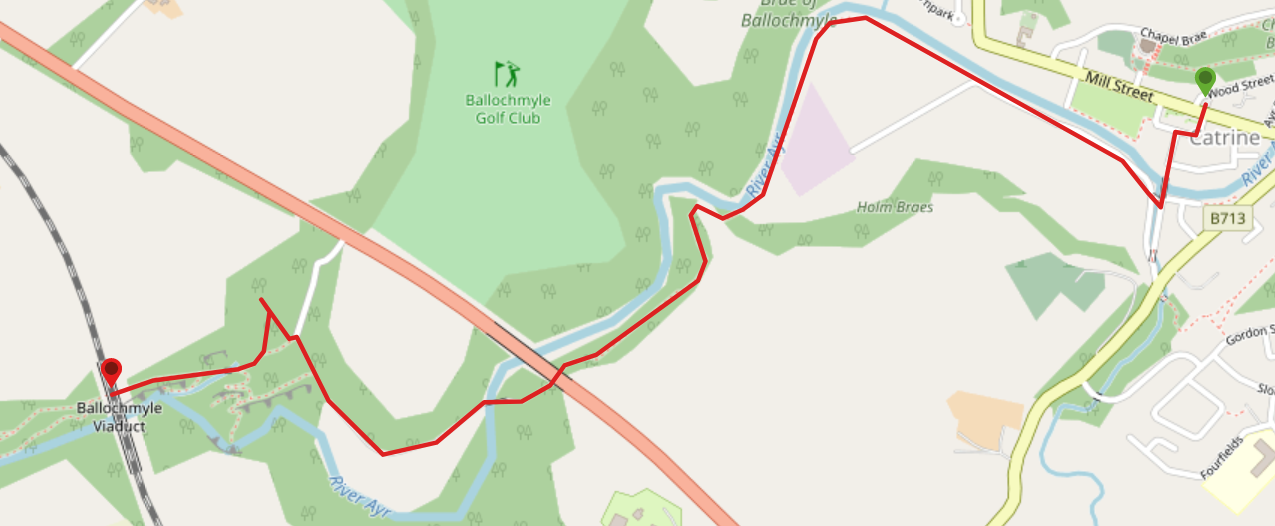
Route: The walk starts at Mill Square, Catrine. Exit Mill Square onto Bridge Street (opposite side from the main road). At the end of Bridge Street continue ahead (South) to cross the bridge over the River Ayr. Almost immediately turn right (North West) to cross a burn. Turn right (North) and walk along Holm Farm Road. The River Ayr should be on your right-hand side. After the last house at a bend in the road, continue straight ahead (North West) onto a narrow earth path. The River Ayr should still be on your right-hand side. Continue to follow this path along the river, passing beneath the A76 viaduct after 1.2km. Go down some steps to meet up with a minor road. Turn right (West) and cross a stone bridge over the river. Continue along the road for approx 500m until you reach a footpath on your left with River Ayr Way signage on the gate. At the other side of the gate is a large grassy area. The path takes you West across the grassy area and into the woods. Stick to the main footpath through the woods, crossing a footbridge and arriving at the Ballochmyle Viaduct after approx 300m. Return to Mill Square, Catrine via the same route.
WALK REPORT: 20th December 2017
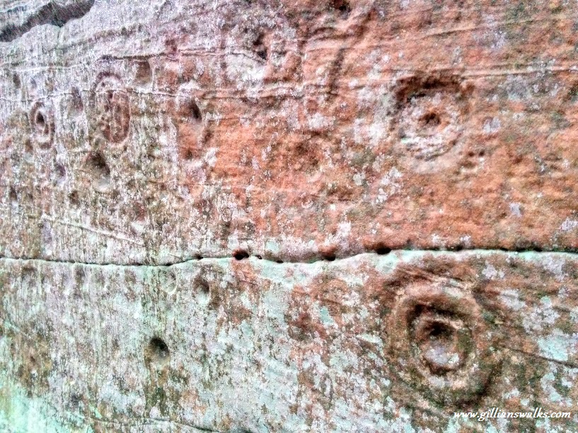
When I went out with the Scottish Wildlife Trust Ayrshire to do some volunteering for the first time, I certainly didn’t expect to be writing up a new walk report afterwards! Winding down for Christmas, the plan was to clean out some bird nesting boxes at the beautiful Ayr Gorge Woodland before stopping by Catrine House Coffee Shop (now closed) for some of their delicious home-made ice cream and finish with a short walk along the River Ayr to try and find some ancient ring and cup marks which Harry had read about online. I was delighted at the prospect of a day out and about exploring! I had already walked some of the River Ayr Way and the day I did the Failford to Catrine section I met someone who told me about the ring and cup marks and how to get to them but short on time, I hadn’t investigated any further, nor given any thought to them since….. Between Harry who had the location co-ordinates of the marks, me with my vague memory of what I’d been told almost 2 years ago, and directions given to us by a local dog-walker, we managed to find them without too much trouble.
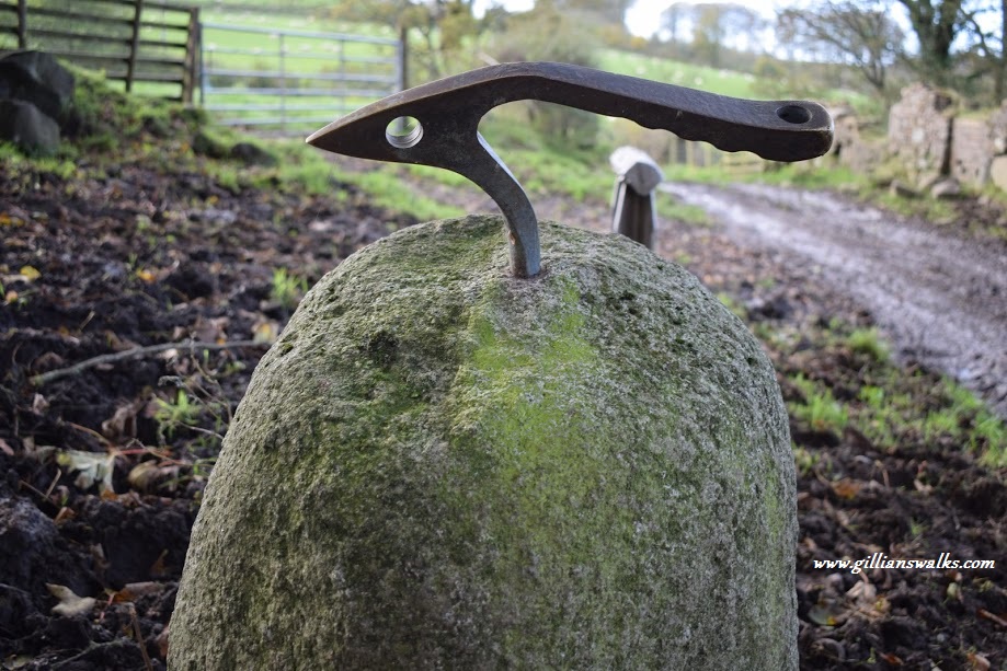
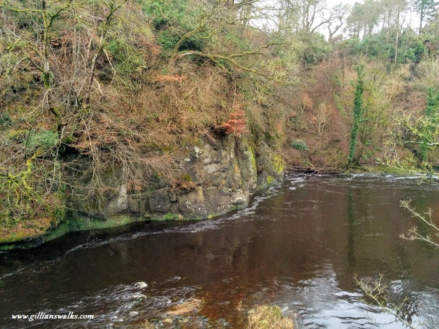
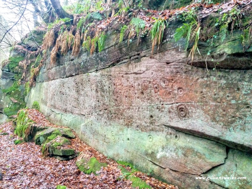
Across the grass, over the fence, jumped the stream, through the trees and mud, up the slope…. and there they were! Huge walls of red sandstone covered in various shaped rings and dents. Only found in 1986, the carvings are thought to date back to the bronze age and have now been designated a scheduled ancient monument.
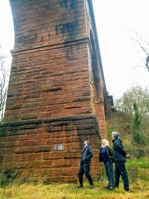
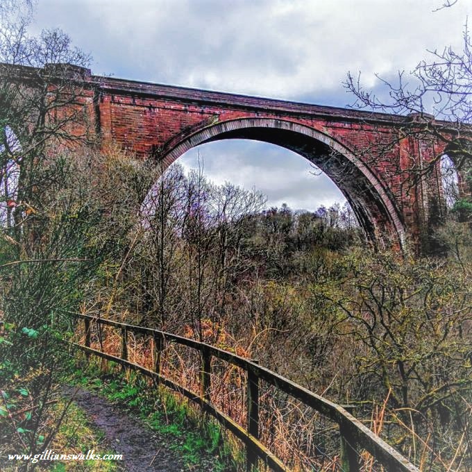
Before heading back to the cars I suggested taking a wander along to the railway viaduct which I knew was only a short distance away and an interesting feature of the area since it is the tallest masonry railway viaduct in the UK! Part of the Glasgow to Carlisle line, the viaduct is still in use today and standing beneath it really lets you appreciate it’s jaw-dropping height and the work that must have gone in to building it back in 1846.