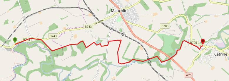
Need a shorter option? You could split this walk in two 3.5 mile walks, by de-touring into Mauchline. Failford to Mauchline: follow the River Ayr Way to Haugh Rd, turn left to end of the road then turn right on Station Rd, emerging at the Mauchline war memorial). Mauchline to Catrine: from Mauchline war memorial, walk down Station Rd, turning left onto Haugh Rd then continue along the River Ayr Way route to Catrine.
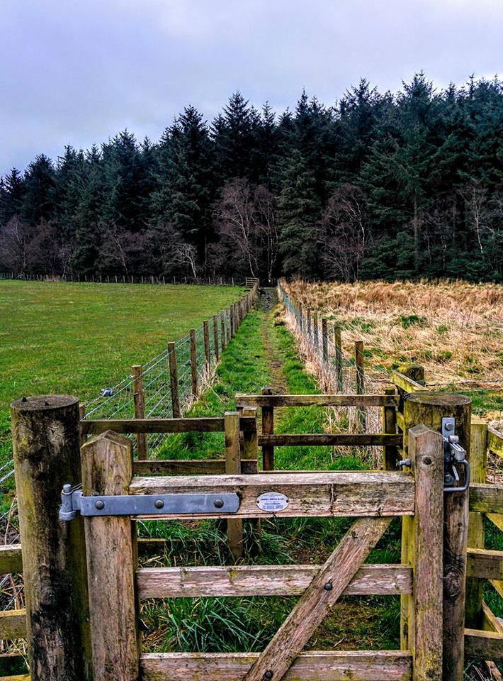
TERRAIN: This is a moderately challenging route due to their being lots of steps, some in a poor state of repair. Expect a mixture of surfaced roads and earth trails across fields and in woodlands (sometimes muddy). There are at least 9 gates, some of which are kissing gates. See bottom of the report for photos of steps, boardwalk and gates.
![]() Local bus services operate between Catrine and Failford, meaning you don’t need two cars. You can also use Mauchline as a base for accessing both villages by public transport. Parking options: lay-by opposite the Failford Inn, St Germain Street car park, Catrine and Loudoun Street car park, Mauchline (approx half a mile from the war memorial).
Local bus services operate between Catrine and Failford, meaning you don’t need two cars. You can also use Mauchline as a base for accessing both villages by public transport. Parking options: lay-by opposite the Failford Inn, St Germain Street car park, Catrine and Loudoun Street car park, Mauchline (approx half a mile from the war memorial).
![]() There are no public toilets on this route. Unfortunately the Failford Inn is also permanently closed. In Catrine there are customer toilets inside the A.M. Brown Institute and in the cafe on St Germain Street.
There are no public toilets on this route. Unfortunately the Failford Inn is also permanently closed. In Catrine there are customer toilets inside the A.M. Brown Institute and in the cafe on St Germain Street.
View full route description
With the Failford Inn in front of you, turn left and walk along the grass verge beside B743 for approx 1 mile before turning right onto a minor road signposted ‘Stairaird’. Beware of some blind bends.
After passing a cottage, look out for a River Ayr Way directional disc on a fencepost at the end of the hedgerow – this directs you onto a trail between the field and the hedge, which runs parallel to the road.
Continue to follow this trail as it zig zags through woodland, up and down steps, over various boardwalks, through many gates, and across fields. You can’t go wrong because you are between two fences the whole time!
Eventually reaching Barskimming Road, turn left and then first right onto a minor road which brings you out on Haugh Road.
Turn right along Haugh Road until you reach a small cluster of farm cottages (Haugh Farm). Here you need to take the track to the left which cuts through the farmyard and leads to a metal kissing gate and onto another trail wedged between two fences.
There are more gates about halfway along, and a final set of gates marks the end of the path. Turn left here to go steeply uphill into a woodland.
Follow the path through the woodland, crossing an impressive footbridge built over a deep gorge.
Soon the highlight of the day – Ballochmyle Viaduct – will come into view. Approx 400m from the viaduct the trail emerges onto a minor road at a gate.
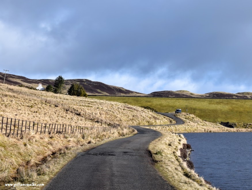
Turn right onto the road and follow it along, crossing the River Ayr on the Howford Bridge, and then turning left to go uphill via some steps (in bad state).
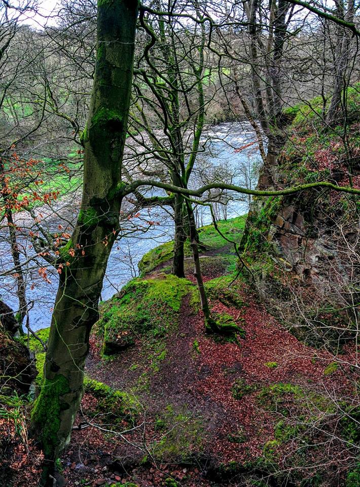
After two more sets of steps, one up and one down, the footpath follows the River Ayr into Catrine first on woodland trails and then on a single track road.
As the road bends to the right at some sort of electricity station surrounded by metal fencing, turn left to cross a footbridge over Bogend Burn, a tributary of the River Ayr. Then immediately turn left again to cross another bridge, this time over the River Ayr.
Walk along Bridge Street and across Mill Square to St Germain Street, where this walk ends.
Walk Report: 13th April 2016 and 2nd March 2025
The first time I walked this route my overall impression of it was as follows: “This walk has a few interesting features along it but overall it was not the most scenic part of River Ayr Way I have completed so far.”
Goodness – harsh! ‘Why?’ you might ask…
The main issues I had with it were that for a large part we were hemmed in between two fences (my husband described it as “an outdoor prison corridor”, for me it made me feel like I was a sheep being herded), the River Ayr was nowhere to be seen and the sewerage plant wasn’t the most attractive welcome into Catrine . I’d been grateful that I had my husband there to keep me company, not only because I love walking with him, but also because had he not been there I would have had no option but to repeat the whole walk in reverse to get back to the car, not something I fancied at all! We had cleverly taken 2 cars and left one at each end of the walk 😉
Now I have to say that having walked it again a few times since then, I’ve changed my mind somewhat… I don’t love the walk along the main road from Failford, and I still don’t particularly enjoy the fences both sides situation, however on the plus side it means there is no way you can get lost! I’d also much prefer to walk between two fences than be unprotected at the edge of any fields with sheep or cattle in them.
There’s also actually a lot to like about this route.
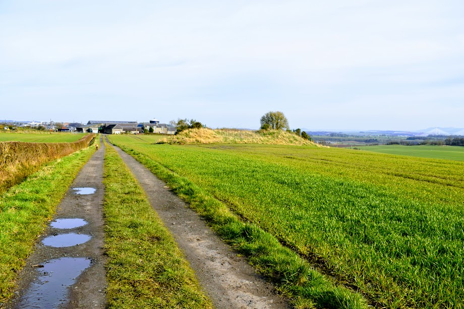
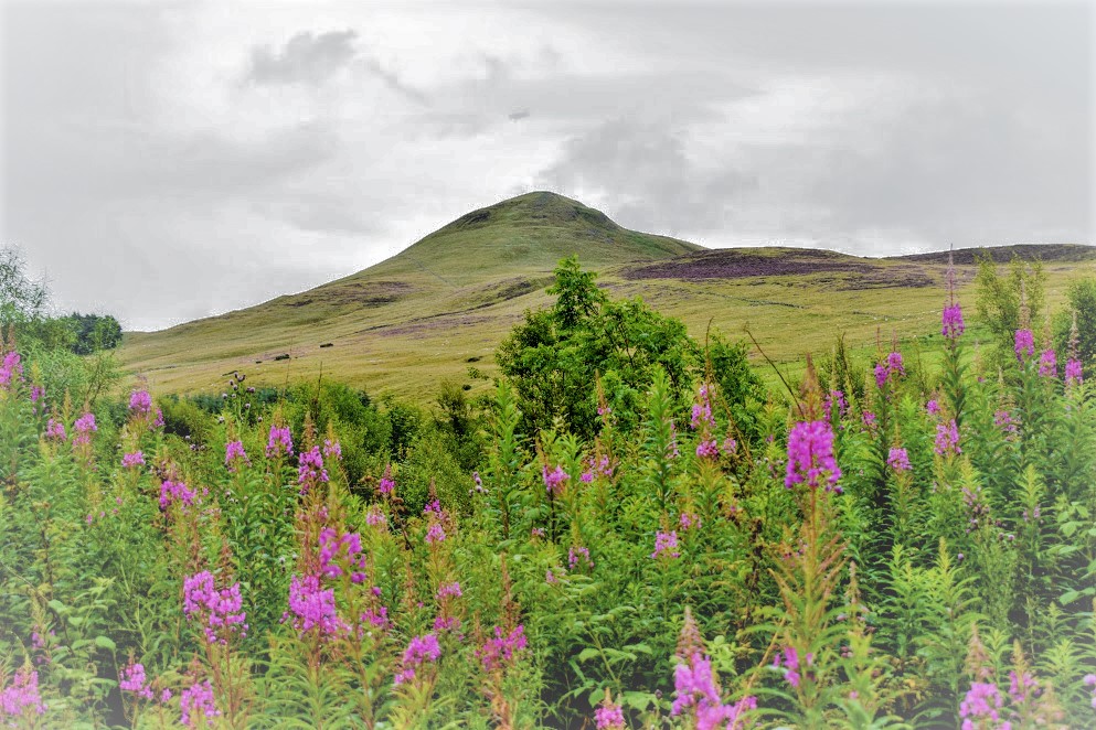
It’s varied for a start. Once you’re off the main road at Failford, you’re into the Barskimming Estate which is quiet, as has some wooded areas interspersed with open farmland and quirky boardwalks and steps and many, many gates (I’ve provided a gallery of images of these at the bottom of this report in case you are someone for whom a visual of what these are like is useful). There are views towards the nearby town of Mauchline: the Burns Memorial is particularly striking, towering above all else. There are small farms dotted along the way, and you get a glimpse into the old Barskimming sandstone quarry too.

There had been some tree felling since my first visit, and I do believe that these photos were taken at roughly the same place! Unrecognisable now to be honest, and a shame because I orginally had a caption against the photo with the trees saying that this was one of the most scenic parts of the walk! It still has a charm, but obviously very different…


Then there are some quiet country roads for a while, followed by a small bit of confusion around Haugh Farm where the way-marking isn’t great (you need to go through the farmyard, which feels wrong from the road – I was glad that I had plotted the route out in advance on Visorando!) and then up into ancient woodland where the River Ayr makes a brief appearance!

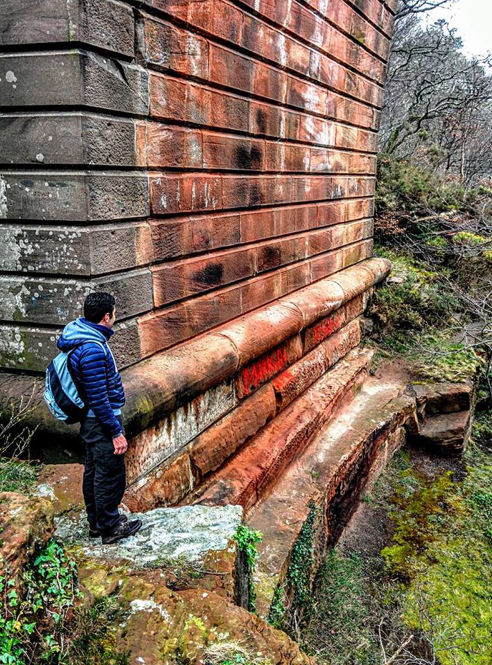
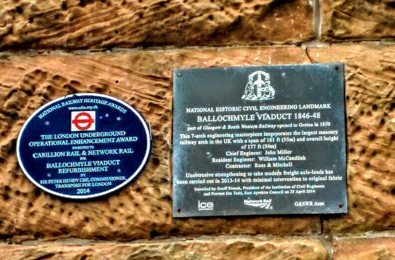
Then the majestic Ballochmyle Viaduct appears out of nowhere.
This is the highlight of the day. It’s very difficult to get a sense of the scale of it from photos, you have to be there I think. It is HUGE – truly jaw-dropping. Such an impressive piece of architecture. What I did not know at the time is that it is the highest masonry railway arch in UK at 54m high and 55m long (so pretty much as high as it is wide!). The whole thing took only 2 years to build, and was designed by John Miller of Ayr! A true feat of engineering and standing the test of time still with an active train line on top of it! And if that wasn’t already enough to lure you there, it also features in the film Mission Impossible!
The other thing I did not realise at the time was that I had found a geocache underneath it! The steps beneath the main arch provided the perfect lunch spot, and as we sat down to eat I saw a tupperware box. I wasn’t familiar with the game so reading ‘Ballochmyle Geocache’ on the box didn’t mean anything to me. It’s not until today as I write this blog article that I am having a massive lightbulb moment: a combination of googling some information about the viaduct, and reflecting on a conversation I had only yesterday with a friend who explained geocaching to me. The law of attraction at work! What a shame that I didn’t know I was supposed to open the box and log my details…

Beyond this point, the route passes through a dramatic sandstone wooded gorge filled with life. If you know where to look, and don’t mind some trickier terrain, there is also some fantastic Neolithic rock art close to this part of the walk which you could visit.
Having been absent for most of the day so far, the River Ayr accompanies you for the final walk into Catrine.

Catrine itself is a place rich in history. And if I may say so, a very underrated walking destination! You’ll discover more of it if you go on to walk the next part of the River Ayr Way, however today’s walk finishes on Mill Square – the site of the former cotton mill which employed some 900 people at its peak. In fact there are links between the Catrine mill and the famous New Lanark mill, both founded by David Dale (of Stewarton). Standing reading the information boards in the square, I couldn’t help play one off against the other: New Lanark with its UNESCO world heritage site designation, and Catrine…. well, now just a memory.
Boardwalk, steps and gates on this walk:


Next section: Catrine to Limmerhaugh (coming soon)
Previous section: Annbank to Failford
Whole route: River Ayr Way