IMPORTANT NOTE: IT IS ESSENTIAL TO CHECK THE TIDE TIMES BEFORE SETTING OFF, AS A HIGH TIDE COULD PREVENT YOU FROM PASSING THE COASTAL SECTION OF THIS WALK. Leave 2 hrs either side of an expected high tide.
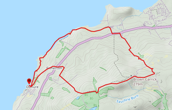
TERRAIN: Roadside pavements and verges, gravel tracks, grassy (sometimes boggy) farmland and hill trails, small section of felled trees, pathless section across the hillside, single track road, rocky shoreline and sandy beach. There is 1,020 ft of gradual ascent and descent, several stiles, and a long set of steps (downhill) with no handrail. There is a high chance of encountering livestock on this route, both on the hill and on the coastal path north of Dunure.
![]() Parking available at Kennedy Park, Dunure (chargeable, seasonal). Closest train station is in Ayr, 7.5 miles away with a local bus service operating between Ayr and Dunure.
Parking available at Kennedy Park, Dunure (chargeable, seasonal). Closest train station is in Ayr, 7.5 miles away with a local bus service operating between Ayr and Dunure.
View full route description
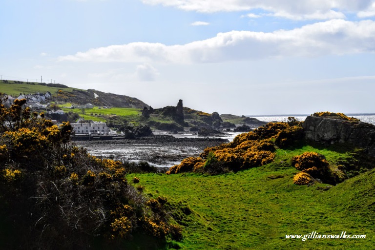
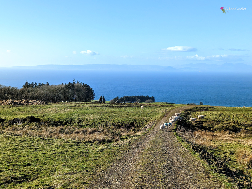
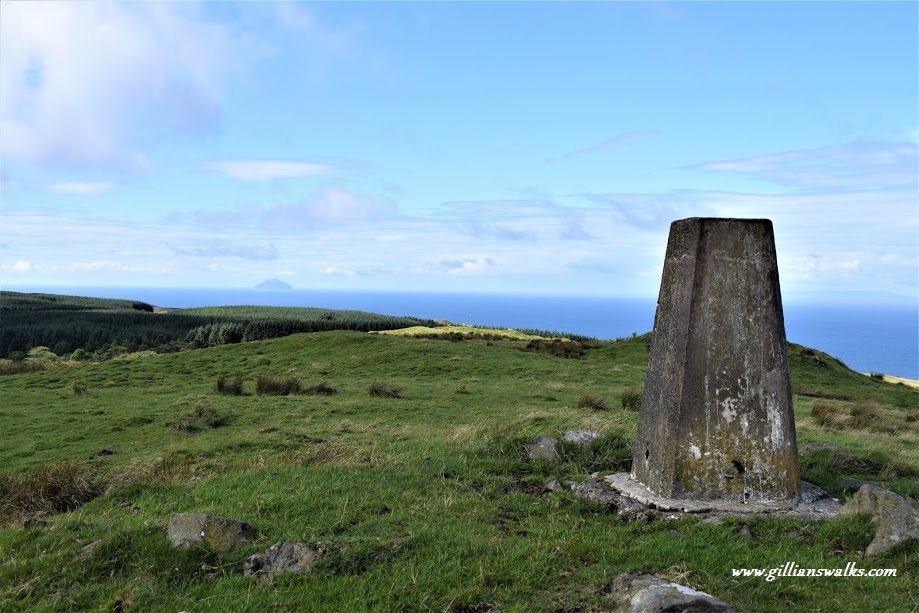
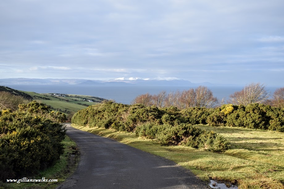
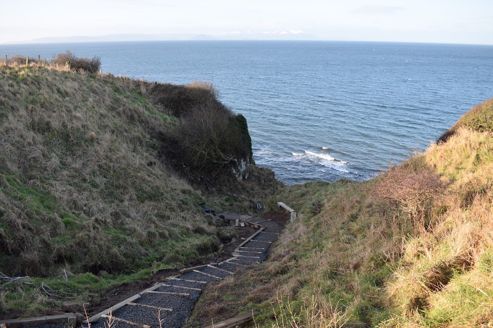
From Dunure Castle follow the path past the dovecot, across a small footbridge and then close to some cottages to reach Dunure Harbour. Turn right to walk up the hill towards Castle Road – the main road through the village – passing the Dunure Inn on your right-hand side. Turn left onto Castle Road and walk along the roadside pavement, through the village of Fisherton. When you reach A719/Ayr Road cross straight over onto the minor road next to Fisherton Primary School. After 270m at a path junction turn right onto a gravel track as indicated by the ‘Footpath’ sign. Before reaching Dunduff Farm turn left to start walking uphill again (notice the green arrow way markers on the fence to your right before the turn). There are a couple of stiles to cross as you ascend. On reaching a small fishing loch 1km up the hill, the path forks, keep left (East) to stay on the open hillside. The track soon disappears but you want to follow the tree- and fence-line on your right to a stile at the end of the row of trees. After crossing the stile turn left, to continue in the direction you have been. Felled trees make it difficult here as the path has been covered up: make your way over to the fence as best you can then turn right to follow it along a short distance to a kissing gate. Go through the gate and out onto the open hillside. Head north-east initially (towards the small hill), to avoid a marshy area to your right, then follow a set of quad bike tracks up and along the ridge to the trig point at the summit of Brown Carrick Hill. From the summit head north-east, towards the radio masts. As you descend towards the radio masts, the path becomes less obvious – after going through a gate continue downhill aiming for a second gate which takes you onto the hill with the masts on it. Aim to pass close to the radio masts with them on your left-hand side. When you reach the end of the metal fencing, climb over the wooden gate then follow a faint grassy path down the hillside, ignoring the surfaced road on your left. On reaching a minor road turn left and continue along it for approx 1.4 miles to reach A719. Carefully cross the road then turn left to walk along the roadside verge for 280m. Take the first road on the right towards Heads of Ayr Caravan Park. As you reach the entrance, keep left to pass behind some caravans, looking out for a kissing gate on the right at the gap in the high embankment. Turn left as indicated by the Ayrshire Coastal Path signage, to walk along the field edge beneath the caravan park and up onto the embankment of a disused railway. After following the disused railway track bed for 1km, a kissing gate is reached which leads onto farmland. Cross the field (West) to another gate close to the clifftops, then cross the next field, keeping the boundary fence close to your right-hand side, to reach another gate at the top of a steep gully. Take care descending the gully steps. Turn left at the bottom to walk along the rocky shoreline and across the Drumbain Burn at a waterfall. 400m further along the shoreline the trail goes up a grassy gully onto another cliff-top section. Instead of marker posts, look out for a series of white discs painted onto rocks to stay on the right course across the farmland and grassy clifftops. You will be led back down onto the shore through a gap in some rocks leading onto a sandy beach just north of the fishing village of Dunure. Walk across the beach to reach Dunure Harbour then retrace your steps to return to Kennedy Park/Dunure Castle.
WALK REPORT: 19th August 2017, 6th January 2018 & 24th February 2023
It took me two attempts at this walk to get it right, a tiny error on the summit taking me off in the wrong direction first time around! The result was a complicated descent and not one which I would encourage anyone else to follow, unless you like the sound of steep hillside fields full of cows and sheep?
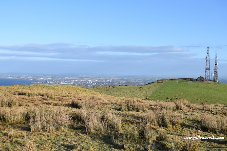
It was a beautiful warm summer day when I set off alone to try out this route. The radio masts atop Brown Carrick Hill can be seen for miles around and I had passed them by car hundreds of times so I was very keen to get up there! The Ayrshire Coastal Path official guide book suggests it as a high-level de-tour and with my local knowledge I knew that it could then be made into a loop using the coastal path trail to return to the start.
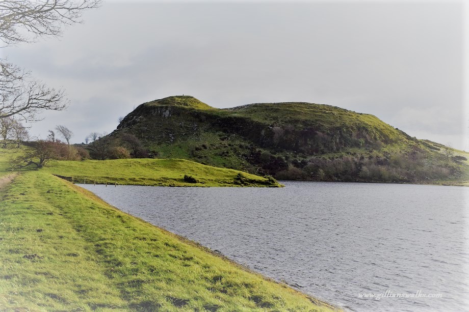
The walk was uphill from the get-go however good tracks facilitated things for most of the way. A lovely little fishing loch appeared out of nowhere just where the track joined with the Dunure-Maybole hill path (one for another day!) The light was hitting it just perfectly! I thought it would be a nice place to have a picnic some day but my husband has since informed me that I would need to share my sandwich with a swarm of midges so perhaps not…
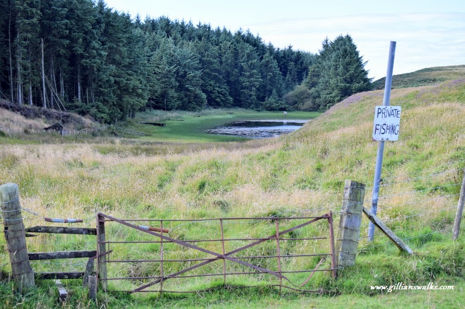
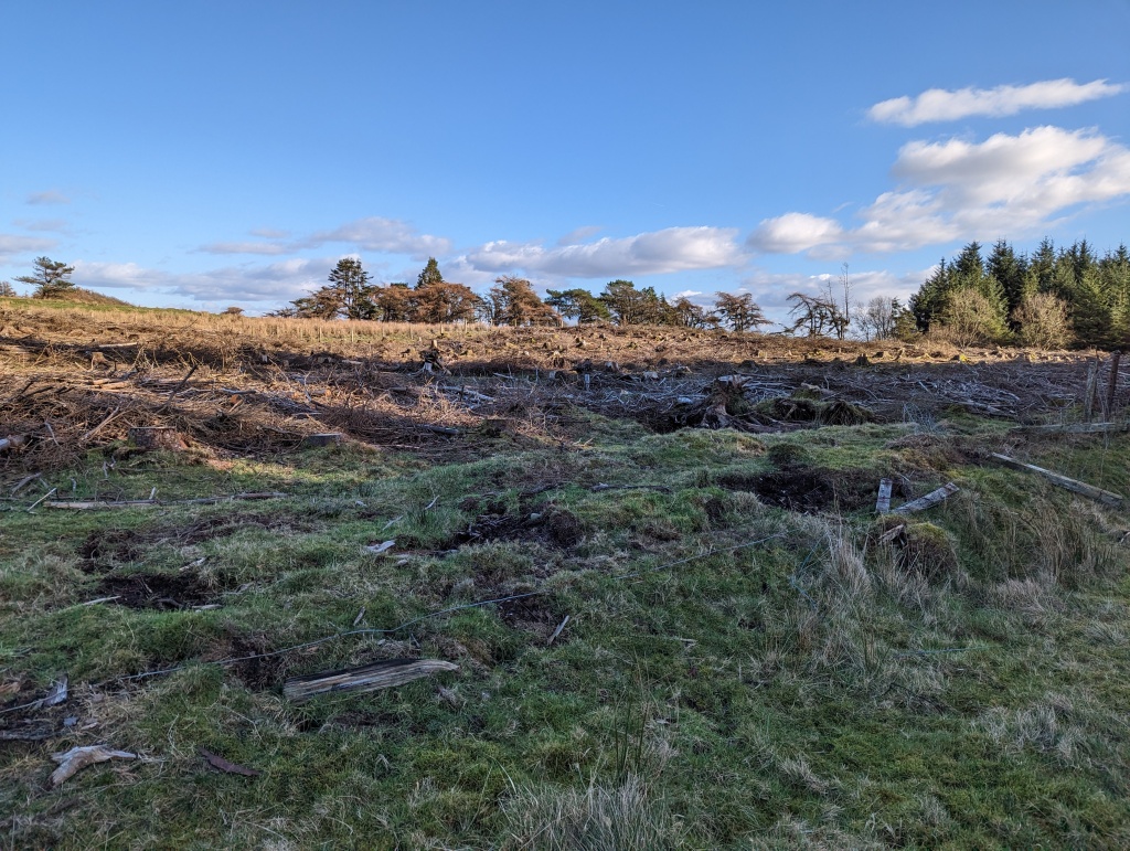
Between this point and the summit there was little by way of a path so I was grateful once again for my pre-plotted route on my mobile app, showing me what way to walk. It has been made all the trickier thanks to some recent (2022) tree felling just beyond the fishing loch, which has covered the ground in broken tree branches and stumps, making it fairly challenging to get through this short 200m section (not impossible though – just take your time, follow my instructions above and photos below to stay on track!)
Once out on the open hillside I heard the chatter of voices behind me and on turning around I saw two men approach from the same direction I had. For some reason I got spooked and started to imagine some neds from the villages following me up planning some nasty act and I practically jogged across the ridge to the trig point. From there the view was simply stunning, and I got so carried away taking photos that I was still there when the men caught up with me. To my relief (although I wasn’t really surprised) they were really nice guys, both high school teachers in the area, and we chatted for a while about the view, other walks we had done, where we were headed the rest of the day, etc. Silly brain playing tricks on me!
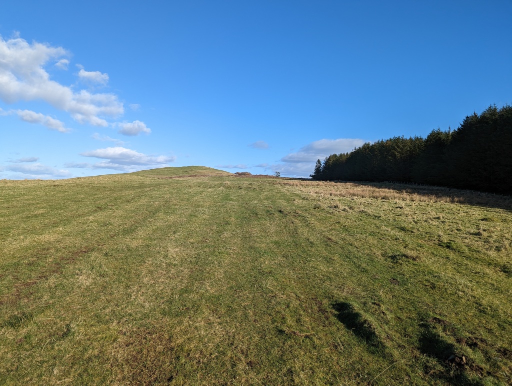
From the trig point I could clearly see the radio masts however I wasn’t sure whether I needed to aim for the seaward or inland side of them to pick up my route down to the road. The whole hill is farmland with barbed wire fences all over the place so I spotted a gate and headed for it. From here a path of some sort led me further downhill to another gate and so on until I eventually checked my position to realise I was way off course and was going to have to clamber down the hillside to meet up with the road further down than planned. Honestly this must be the steepest farmland in Scotland! Thankfully the cows and sheep were very friendly, moving out my way as I trampled over their grass.
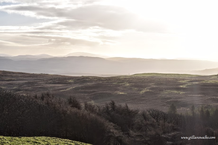
So I returned 5 months later to try the walk again, this time aiming directly for the masts via a different gate further along the fence. My friend Eve came along this time. She was new to hills but liked coastal walks and I knew that she would just love this whole route! Stopping at the trig point a little longer than we should have (we are on a trig bagging mission this year and this was #1!), we had fun taking photos from various angles and admiring the awesome view across to the snow-capped mountains of Arran, Ailsa Craig and all the way along the northern section of the Ayrshire coast. An early morning haze hid the view to the east which I was disappointed about as I knew that the Galloway Hills were out there! After finding shelter from the icy wind long enough to have an alfresco lunch, the haze began to lift slightly and the outline of the hills near New Cumnock and south to Straiton became visible. Just magical.
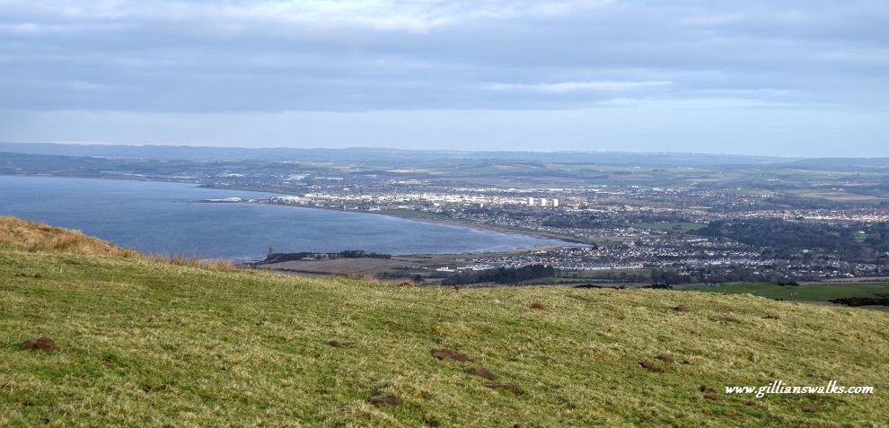
We stayed inland of the masts this time around and as though to make me look like an idiot, a surfaced road appeared at the other side, zig zagging right up to them! I knew that this was probably the one that led to the road. So easy…. We saw a grassy footpath leading downhill in a north-easterly direction which we decided to follow instead as it was more aesthetically pleasing! As expected it emerged onto the road, from where the walk down to A719 was really enjoyable, with views across to the Isle of Arran the whole way.
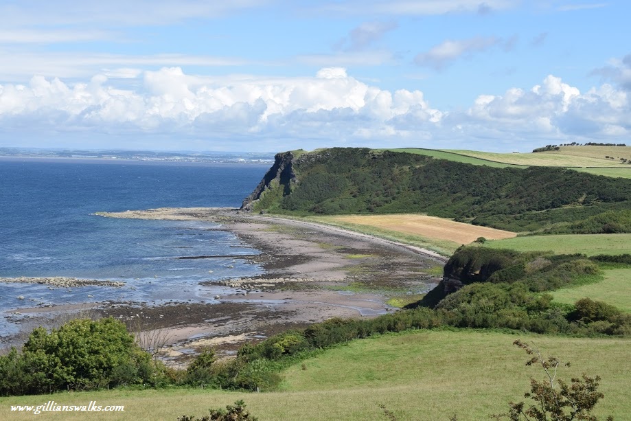
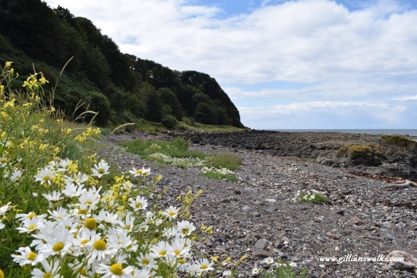
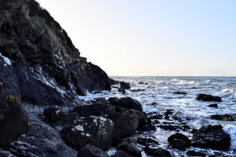
Now it was time for the rookie error! We headed past Heads of Ayr Caravan Park, along the dismantled railway, across the fields and down the steps of steep Fisherton Gully to the rocky shore. The views had been simply stunning the whole way and you can see some examples of this from the photos below, taken during my summer trip! Today however, I had been able to tell for some time that the tide was further in than I thought it would be, but I hoped that there would be enough shoreline left to pass safely the short distance to the next gully which would take us once again to higher ground. Alas, we were too late.
I had carefully checked the expected high tide time before setting off: 3pm. The time was now 2pm and at one tiny section which jutted out that bit more than the rest, the tide was already lapping the bottom of the cliffs. There was no way past. I was gutted, not least because I loved this section of the Ayrshire Coastal Path and I knew that just around the corner was another bay which would have been passable. Had we arrived at this point even 15 minutes earlier we would have been able to get round.
There was nothing else for it but to clamber back up Fisherton Gully. Fortunately, being a volunteer with the Ayrshire Coastal Path I had been out working on the gully recently, which meant that I knew of a way to access the main road without retracing our steps all the way back to the caravan park which would have been enough to make us both cry. We then headed back to Dunure along the grass verge of the A719. Not the best end to the day! It just goes to show… even though I knew to check the tide times, and did so, and even though I actually work along the trail and knew this area was prone to hide tide issues, I still managed to get caught out!
On both my earlier and later visits to this walk I did much better with the planning and learned that it is sometimes more sensible to do the route in a clockwise direction to get the tidal stretch out the way first on a rising tide.
A stunning section of coastline awaits with a real mixture of terrain: rocky shoreline, clifftops, disused railway, sandy beaches…. a little bit of everything! And the views…… wow.