APRIL 2026: Part of this trail is currently closed due to forestry works, due to reopen at the end of May 2026. The Water of Gregg track is open and access to High Changue is possible from the trails car parks, however the rest of the route is closed.
I recommend combining this walk with Kirstie’s Trail which only adds 1 mile.
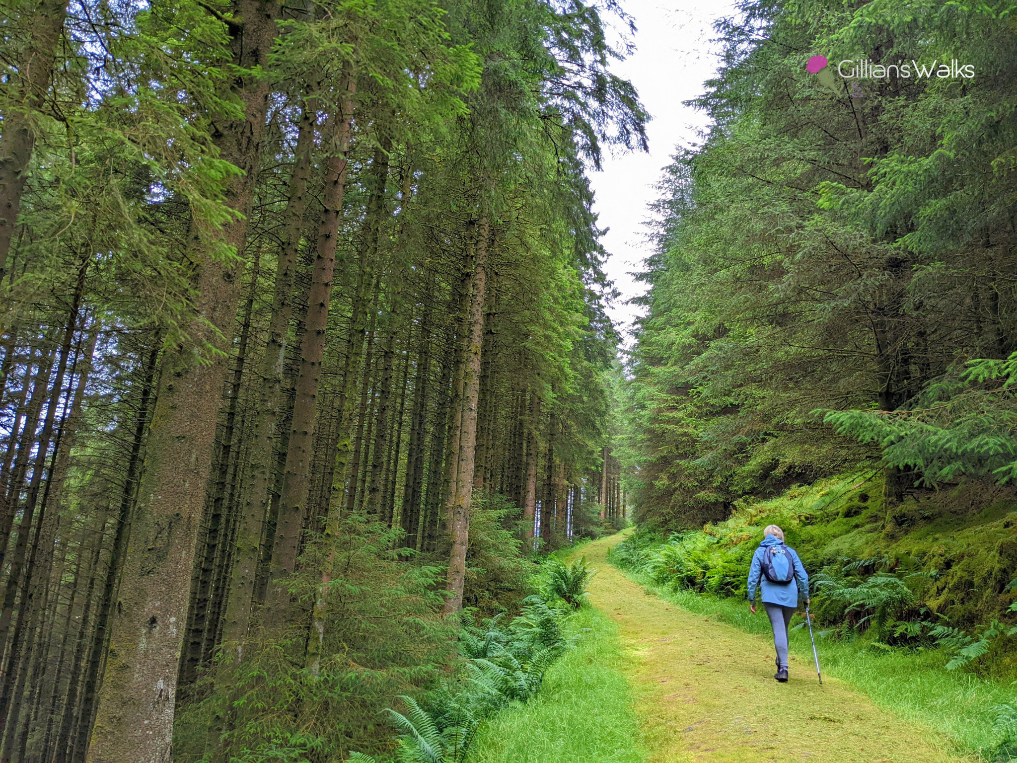
TERRAIN: A mix of forestry tracks and grassy/mossy trails with quite a lot of uphill walking. One set of steps (can be avoided by following the sign-posted alternative route).
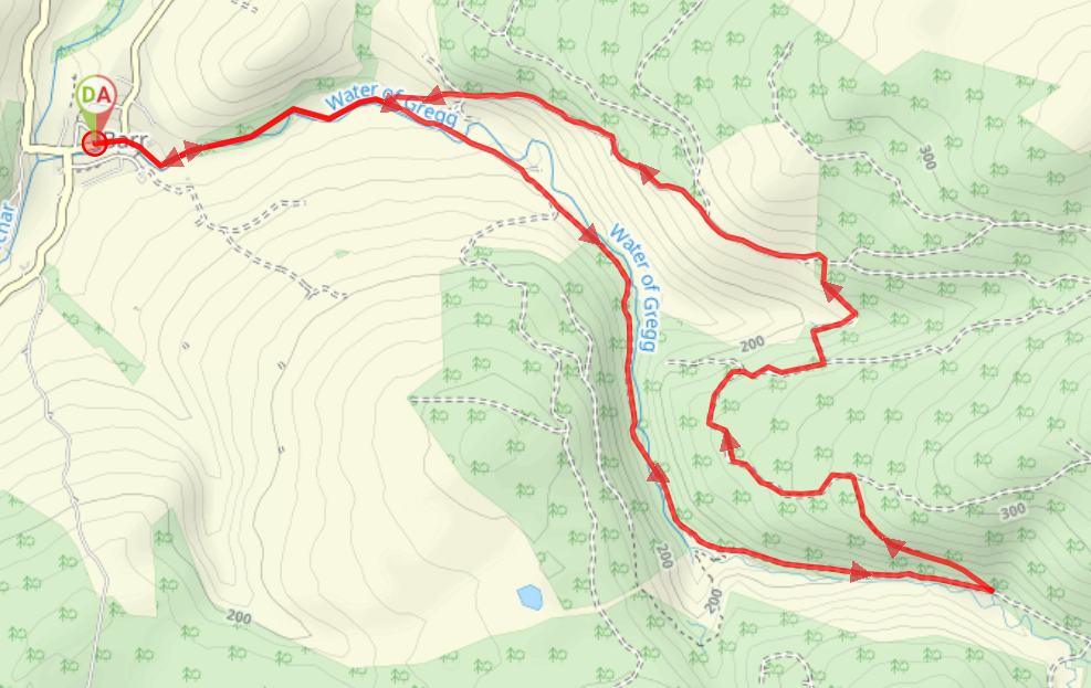
DISTANCE: Starting from Barr Village Hall (as described below), the walk is 5.6 miles. For a shorter walk, you can start at the Trails car park, making it 4.4 miles. In both cases taking the alternative route avoiding the steps will add 1 mile.
![]() Dog-friendly route
Dog-friendly route
![]() On-street parking opposite Barr Village Hall or head to the Trails Car Park, just off Changue Road (KA26 9TT). Parking in the trails car park will shorten the route by 1.2 miles. Closest train station is in Girvan, 7.5 miles away. From there you can travel by bus to Barr and stop at the Village Hall where the walk begins.
On-street parking opposite Barr Village Hall or head to the Trails Car Park, just off Changue Road (KA26 9TT). Parking in the trails car park will shorten the route by 1.2 miles. Closest train station is in Girvan, 7.5 miles away. From there you can travel by bus to Barr and stop at the Village Hall where the walk begins.
![]() Public toilets at Barr Village Hall
Public toilets at Barr Village Hall
Note: Barr Community Shop and Café can provide hot and cold rolls, light meals, drinks and home baked cakes to either eat in or take away. The contact details are: 01465 861221 / [email protected] or visit their Facebook page.
View Full Route Description
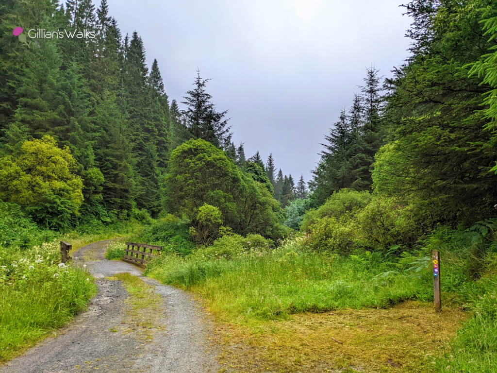
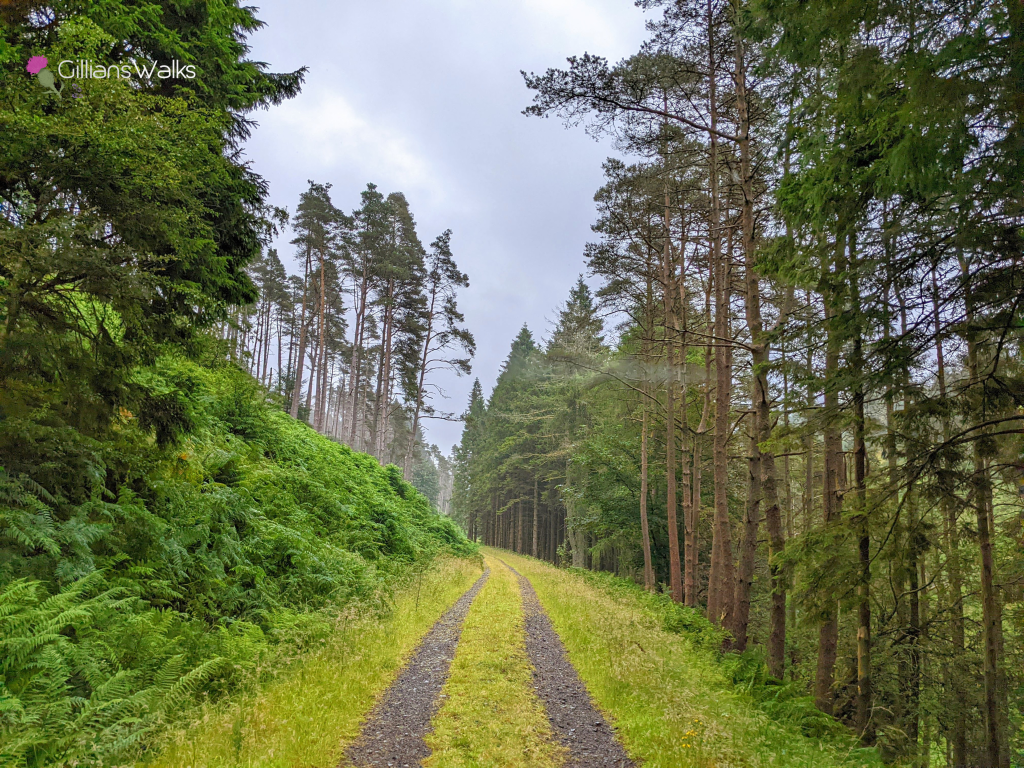
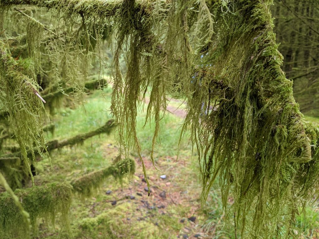
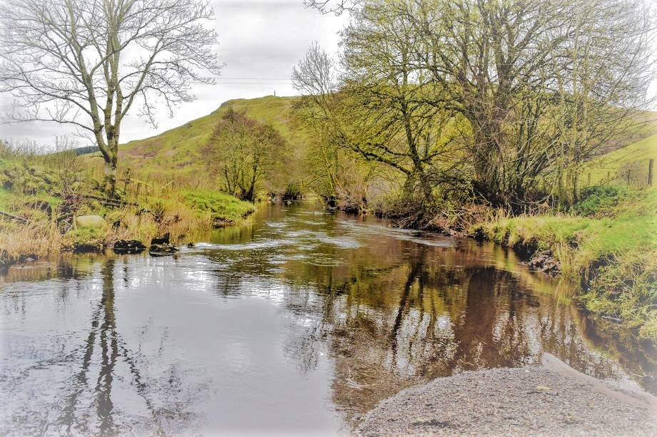
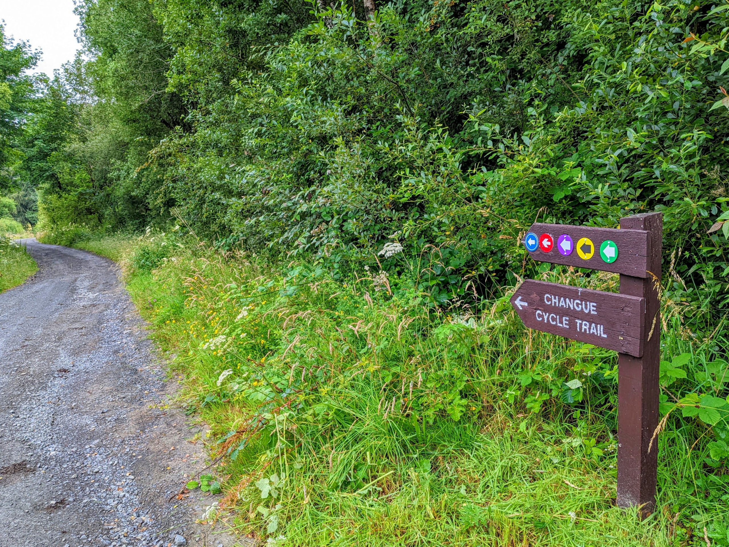
With your back to Barr Village Hall turn left (E) to walk along the roadside pavement. At a bend in the road keep right to continue ahead onto Changue Road, with the Water of Gregg on your right-hand side. Approx 1 mile along from the start you will reach a fork in the road signposted for the Trails car park – keep right/ straight on here. At another fork approx 300m along, keep left – following arrows for “The Devil’s Trail, Kirstie’s Trail, Changue Forestry Trail”. This track leads to a gate and across a bridge – look out for a view of the Fairy Knowe at a gap in the trees! Continue along the forestry track with the river on your right-hand side for approx 1 mile more, looking out for a left turn, signposted “Devil’s Trail”. At this point come off the forestry track to head uphill on a narrower, mossy trail. You will emerge onto a wider forestry track at the top of the hill – turn left. Approx 1 mile along look out for a left turn down some steps – signage points out an alternative route if you want to avoid those. These lead down a steep gully, across the Changue Burn and up the other side, emerging next to High Changue. Turn left onto the High Changue Road and follow it all the way down to the Trails car cark. At the end of the road turn right to return to Barr Village.
WALK REPORT – 23RD JULY 2022
I enjoyed a fab walk yesterday morning checking out the Devil’s Trail and Kirstie’s Trail in Barr. The way-marking of the Barr Trails has recently been upgraded by local volunteers and I wanted to check it out for myself. The verdict? It is spot on ![]()
![]() .
.
All walks start from the Trails Car Park and each is colour-coded – the Devil’s Trail is the purple one. Pick up a leaflet from beneath the information boards at the car park, or inside Barr Village Hall. It contains some interesting background info about the walks as well as an Ordnance Survey map which gives a high-level overview of where each route sits in relation to the others.
We found the map quite helpful, especially seeing the contour lines and the alternative route avoiding the steps clearly marked out. One criticism we had was that the blue trail (Fairy Knowe) and the purple trail (Devil’s Trail) were hard to distinguish from each other if you weren’t familiar with the walks already. It just seems to be the way the colours on the leaflets have printed, because the map on the car park information board is clear, as are the way markers along the route.
I love coming to Barr for a walk and always find it hard to believe I’m still in Ayrshire! The landscape feels more like something you’d expect to find up north.
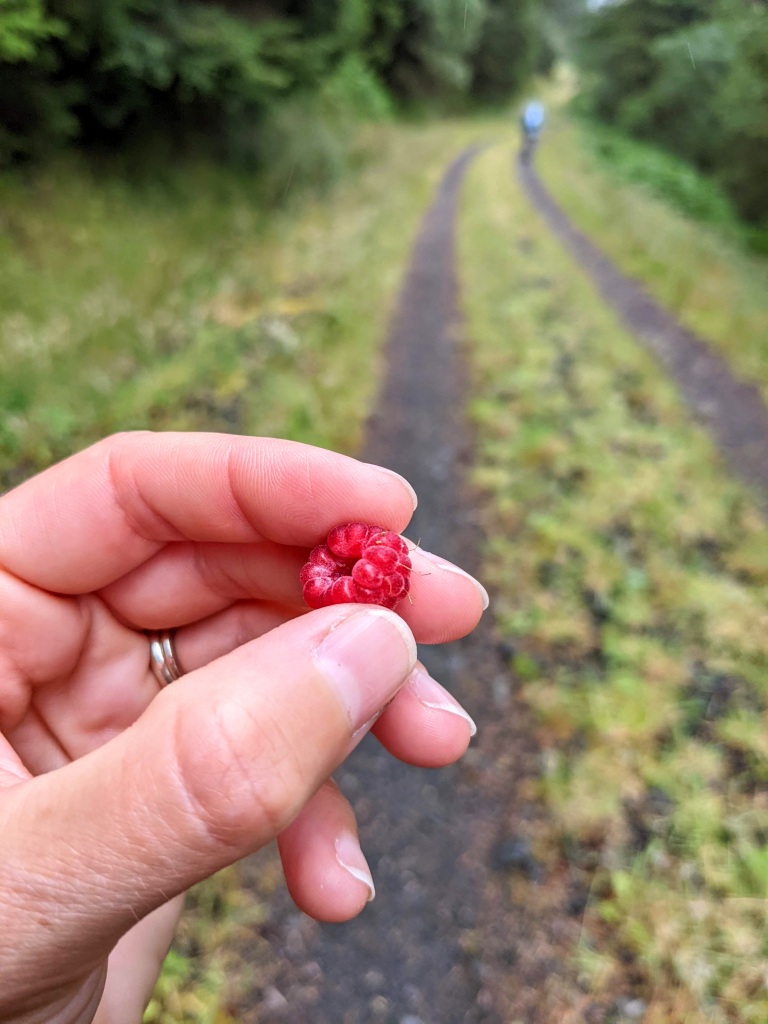
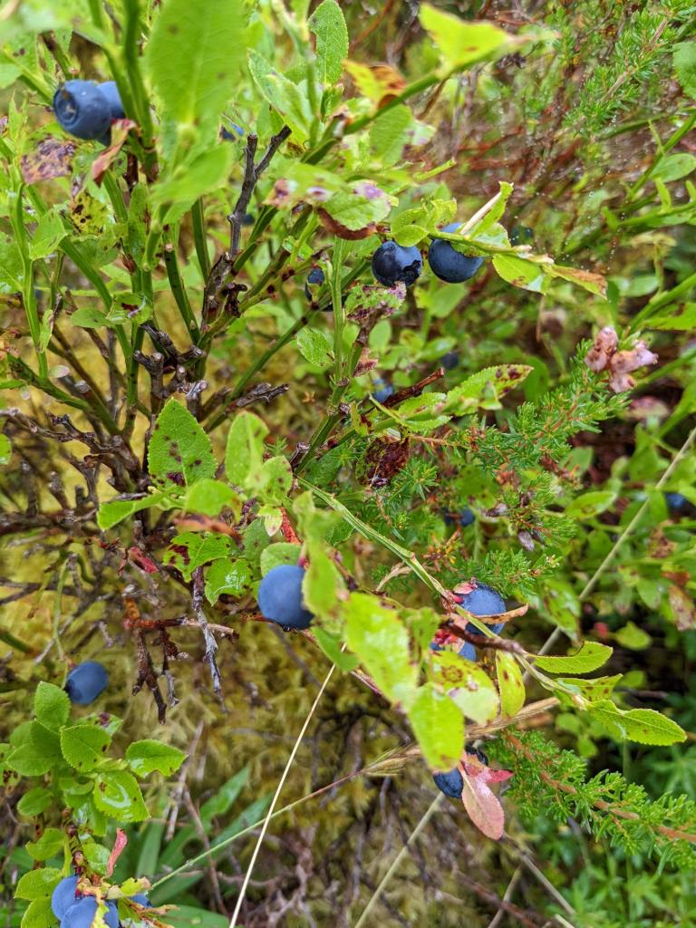
As we wandered along the forestry tracks I picked a few summer berries to snack on – wild raspberries and blaeberries. Delicious! In the autumn the trails are instead lined with many varieties of fungi.
Turning a corner, I was astonished to see the most remarkable view of the Fairy Knowe appear out of nowhere! I normally come BACK this way when walking the Fairy Knowe Trail in my usual anti-clockwise direction and I’d never once bothered to turn around and look behind me! A great reminder of why I should vary the direction I do walks in sometimes.
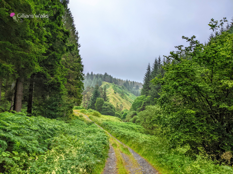
The paths had recently been strimmed when we got there (see cover image); it was as though they knew we were coming! Thank you to the people who keep on top of that – it’s an important, often overlooked, job which makes a massive difference to the accessibility and enjoyment of the routes and shows that they are well cared for.
We decided to take the alternative route, avoiding the steps. There were a few of reasons for that: one being that my mum isn’t too keen on steps following a bad fall a few years ago and another being that I had walked the steps route before so was curious to discover the alternative. We were also in no rush and since we had driven an hour to get to Barr we were quite happy to do a longer walk. So what was it like? Nice enough, just more of the same forestry tracks really. So if you were to ask my advice I’d say take the steps if you can manage them!
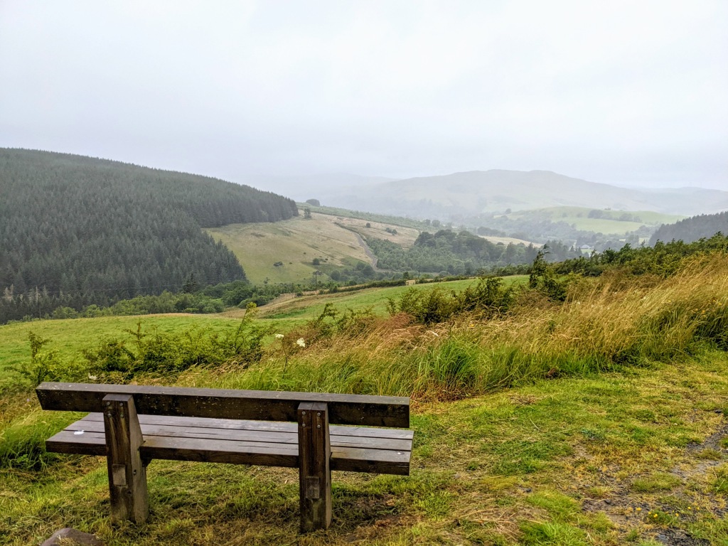
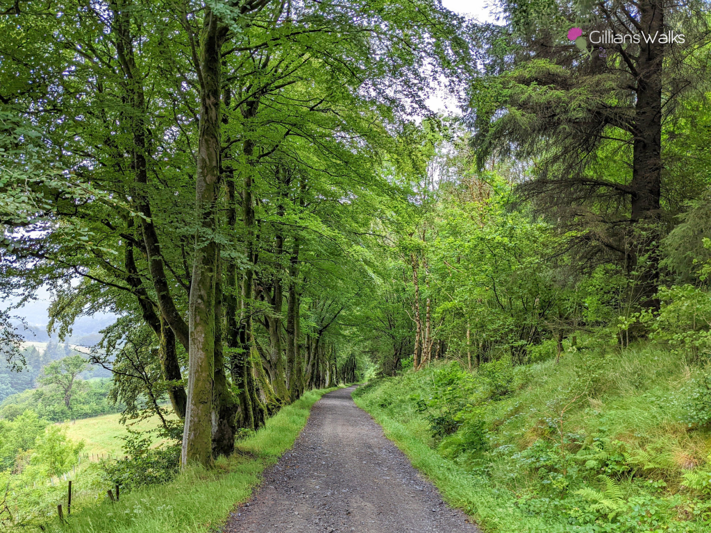
The last section along the High Changue Road is always one of my favourites. The view down the glen and the beech-lined gravel road look stunning at any time of year and in any weather. It is around about the viewpoint / bench where it is said that somewhere up on the hillside behind you are the marks of the devil’s footprints, following a legendary battle between the Devil and the Laird of Changue. I’ll let you read the full story on the Trails leaflet!
Returning to the car after a great walk, we wondered how it can be that we were the only car parked here on a Saturday morning?! It is such a beautiful area, it should be rammed every weekend. Although, if that were the case it would no longer be the peaceful home from home that it is now, so perhaps it’s best to keep it as our little secret… 😉