NOTE June 2024: Parking currently unavailable at Glenapp – recommend using the local bus service from Ballantrae to reach the walk start point. More information available from official Ayrshire Coastal Path website.
DIFFICULTY RATING: moderate/challenging. In my opinion this is the most challenging section of the Ayrshire Coastal Path. The first half to Currarie Port follows good gravel tracks with some gentle but sustained ascent. There are a couple of gates which are sometimes locked and need to be climbed. Second half is more challenging due to a number of steeper uphill sections and difficult terrain including tussocky grass, pathless grassy fields, and shingle beach (but the more people who walk this route the easier it will become!) This is also an exposed area in poor weather. Final section to Ballantrae follows surfaced single track roads and roadside pavement. There are several kissing gates on the route and a high likelihood of livestock. The route is way-marked however navigation skills would be useful around the Downan Hill/Langdale area due to unpredictable siting of electric fencing which is moved around to permit strip grazing.
See also Walk 121 – Glenapp to Ballantrae via inland route (9.3 miles) for a less challenging option.
![]() Small parking area across the road from Glenapp Kirk, just off A77 and also at The Vennel, Ballantrae (KA26 0NH). There are also bus services between Ballantrae and Glenapp Kirk. Recommend parking in Ballantrae and using the local bus service to travel to Glenapp to start the walk (10 min journey).
Small parking area across the road from Glenapp Kirk, just off A77 and also at The Vennel, Ballantrae (KA26 0NH). There are also bus services between Ballantrae and Glenapp Kirk. Recommend parking in Ballantrae and using the local bus service to travel to Glenapp to start the walk (10 min journey).
![]() Toilets options on this route: Foreland car park in Ballantrae (end of walk). Check opening times and charges on the SAC website.
Toilets options on this route: Foreland car park in Ballantrae (end of walk). Check opening times and charges on the SAC website.
 Purchase the official Ayrshire Coastal Path Guide Book
View Full Route Description
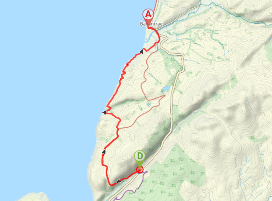
The walk begins across the A77 from Glenapp Kirk. From the Ayrshire Coastal Path information board, follow a gravel track gently uphill in a SW direction. After half a mile keep right at a fork to move onto a steeper track which leads up onto open moorland with fantastic views across the coast.
After 1.8 miles ignore a track off to the left. Approx half a mile further along, you will arrive at a junction with some Ayrshire Coastal Path finger posts offering a choice of onward routes. Turn left to follow the “cliff-top route”.
Keep right at a fork, passing through two gates and then follow the track downhill to Currarie Port. (Note that there are a couple of new ‘roads’ which have appeared here lately – at any forks always take the downhill option).
From Currarie Port follow the track as it heads away from the bay and keep left to reach a wooden footbridge across the burn, then continue up a steep slope which goes around the side of Donald Bowie hill.
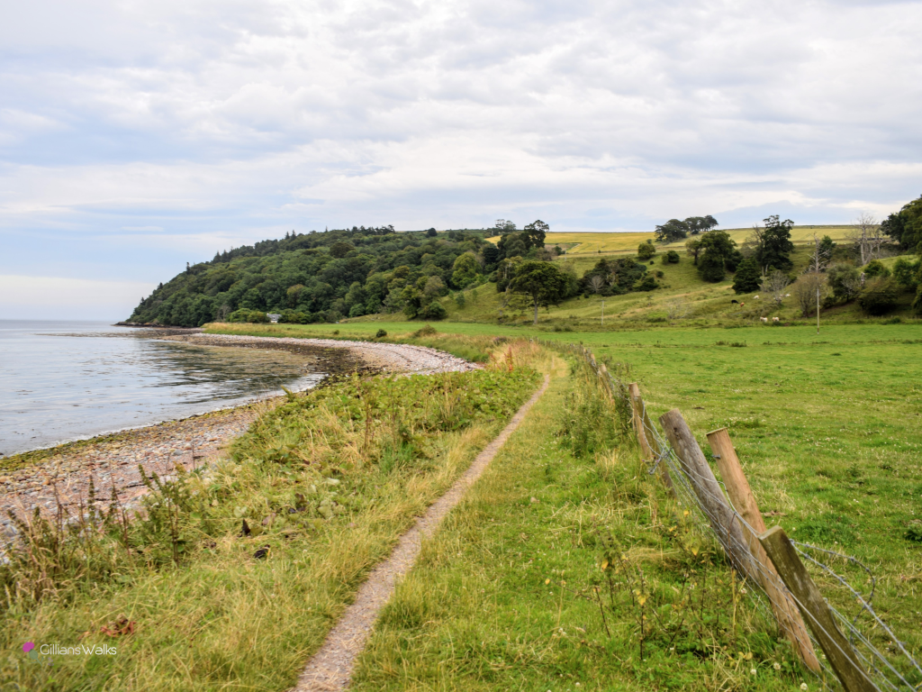
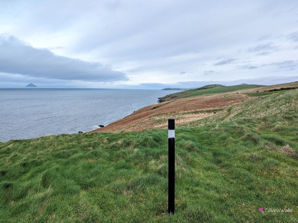
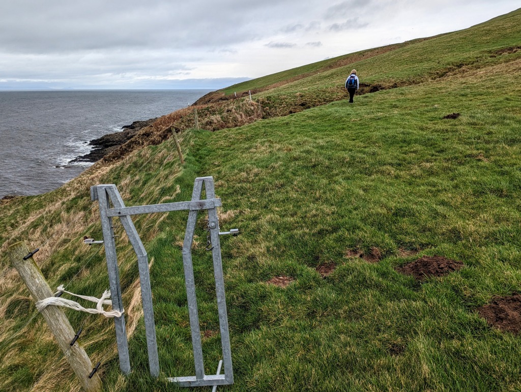
On arrival at a metal gate, turn left to follow the fence line uphill and through a gate. Follow the dry stone wall towards the water, turning right at the end of the wall, to begin walking along the grassy cliff-top in a NE direction.
After approx 1 mile you will arrive at a kissing gate and small footbridge. Turn left and follow the path downhill to another small footbridge which crosses Wilson’s Burn. Turn right to follow the fenceline along the clifftops, sticking to the field edges – follow the white-topped fence posts.
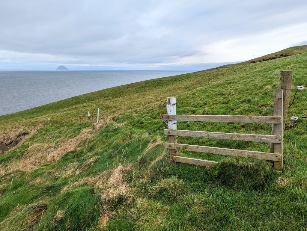
After approx half a mile, you will arrive at a kissing gate with two possible routes ahead. The one you follow will depend on where the farmer has his cattle grazing on the hillside – follow the sign not covered by a ‘closed for grazing’ sleeve. On all of my walks here so far, this has taken me through the kissing gate and across the cliff-top fields parallel to the coastline. On this section of the trail, the farmer uses movable electric fencing to control where his cows graze, and keep walkers separate from them. So the route you follow will very much depend on where the fencing is at that point, however when possible aim to follow the white-topped fence posts around the field perimeters.
Once across the fields you will arrive at a kissing gate, beyond which a faint track zig zags down on to the grassy (boggy on my visit) foreshore. A series of marker posts and white painted rocks lead you across the foreshore to another gate at a dry stone wall.
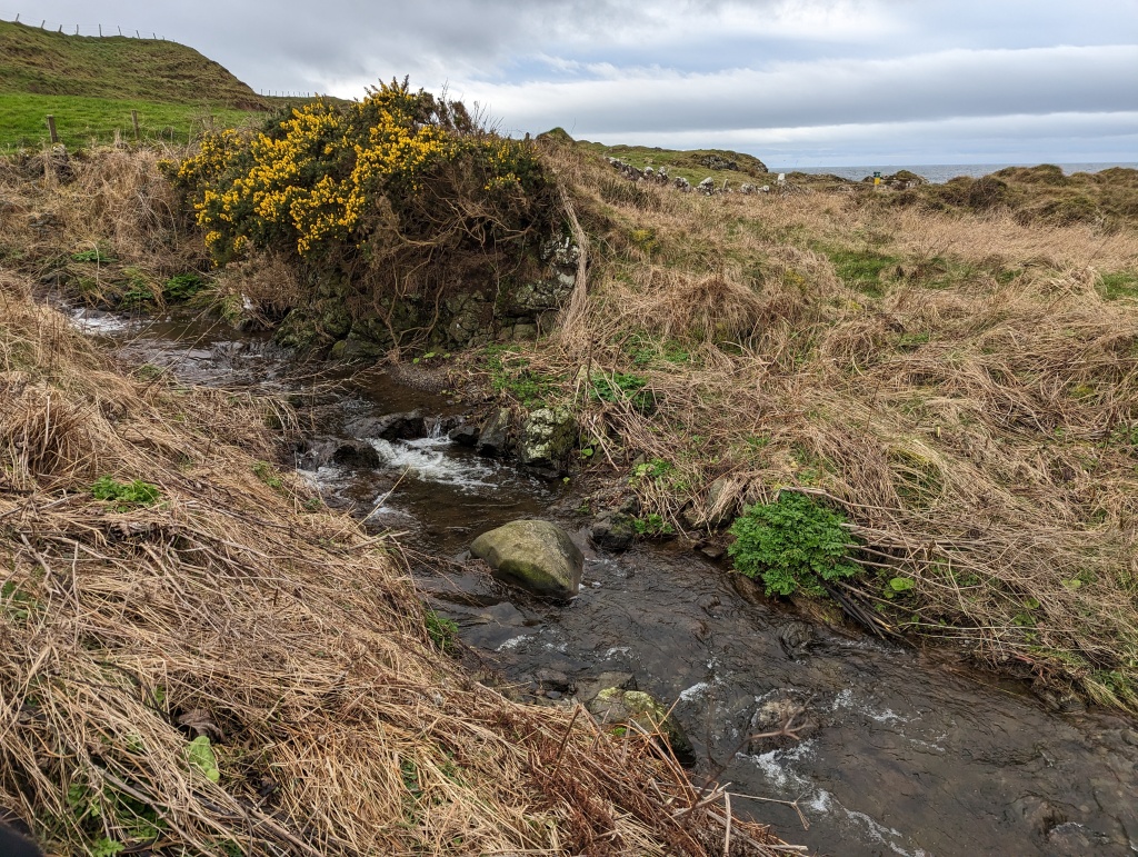
Approx 100m beyond the gate there is a footbridge over a small burn and from here the route goes along the grass between a field and a rocky shoreline.
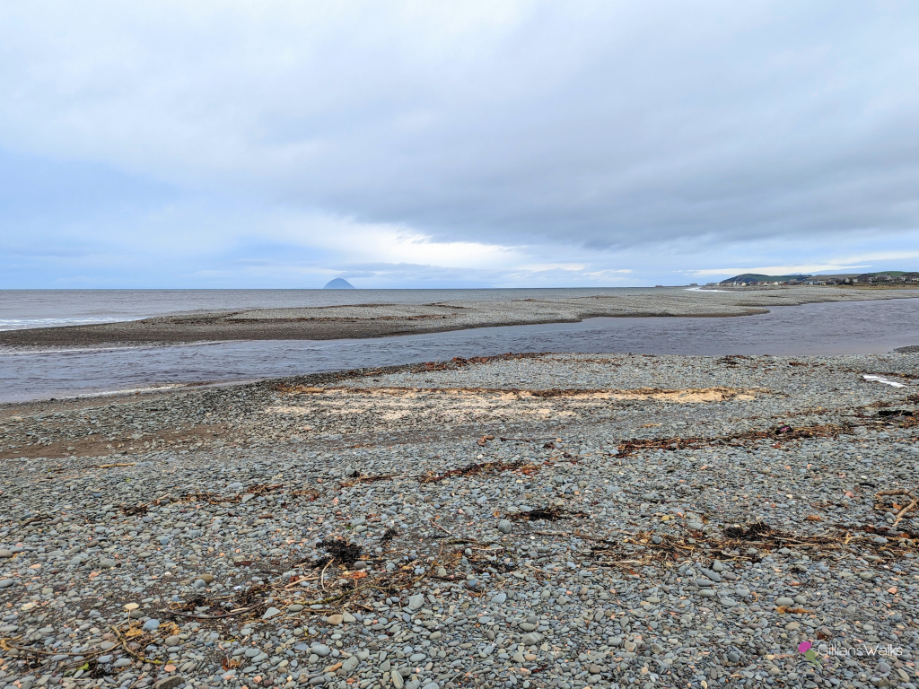
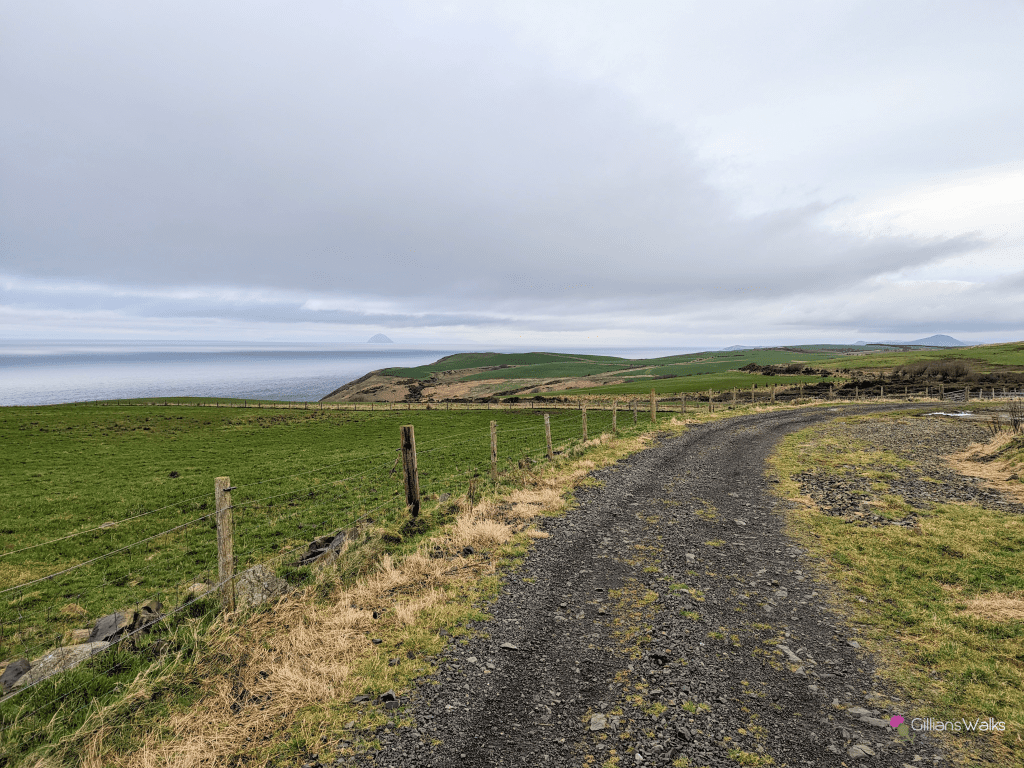
On arrival at a fence go around the seaward end of it and down onto the shingle beach. Walk along the beach for approx 300m, looking out for a gate over to the right at the fields. When you see the gate, make your way across to it, picking up a farm track.
Turn left and walk along the farm track for a short distance to another gate. Turn right here. At the end of the track turn left. Soon this becomes a surfaced single track road passing close to a few cottages. Turn left again at the end of the road.
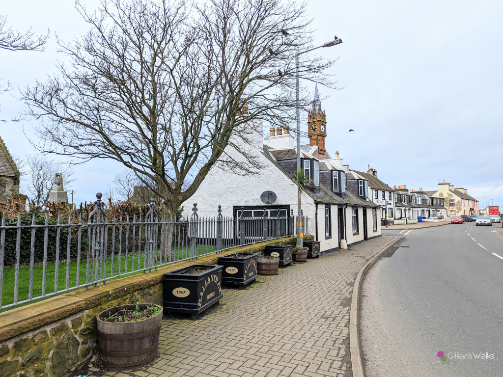
When you emerge onto A77 just outside Ballantrae, turn left. Follow the roadside pavement next to A77 across the River Stinchar and onto Main Street, Ballantrae. After 500m, at the church, turn left onto The Vennel. A short way along The Vennel there is a car park on the right where this section ends.
WALK REPORT: 19th February 2023
As a volunteer for the Ayrshire Coastal Path, I had watched on from behind my laptop as the hard-working Pathminder team spent 4 months at the start of 2022 on weekly work days down at Ballantrae establishing this cliff-top route. A total of 280 hours of volunteer time digging new paths, building kissing gates and bridges, and installing more than 20 new signs. I had seen many photos, kept our Facebook followers updated on progress, and imagined how spectacular it would be to walk along.
The fact that it took me 10 months to do so is shocking really…. A combination of starting a new business and then winter coming along, as well as the distance it is from home (over an hours drive) and the logistics of getting back to the car at the end. I’d also promised a few people I’d take them, and aligning our calendars proved difficult.
So I was delighted to arrive in Glenapp with a friend on a cloudy but dry Sunday morning. We were the only car parked up when we set off, and the only car there when we returned later. We also didn’t pass a soul during the walk until we were arriving into Ballantrae. Mixed feelings about that: I love walking away from the crowds and not meeting anyone is usually a sign of a great day out. At the same time, with one of my volunteer roles being PR for the Ayrshire Coastal Path, it made me sad that we were the only people out enjoying this magnificent section on a reasonable weather Sunday….
I had walked the first third of this route before, almost exactly 6 years ago back in Feb 2017. At that time the only option was the inland route between Glenapp and Ballantrae. With that first third under our belts again today, we set off excitedly into unknown territory.
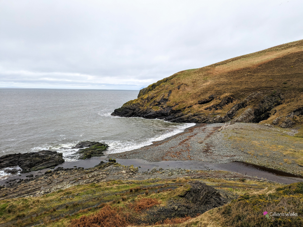
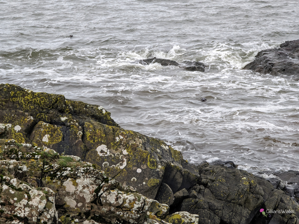
Before long we arrived at the isolated bay of Currarie Port. Wow, it felt incredible being down by the water for the first time on this coastal path walk. Pausing a moment to take it all in before continuing on, we spotted a black blob in the water. A rock? Or could it be….. “a seal!” we both shrieked in unison. In all the time I’ve spent walking on the Ayrshire coastline I have very rarely been treated to a seal sighting so this was peak excitement. There turned out to be three of them, and rather than swimming away from us their curiosity brought them in for a closer look – which delighted us even more!
Saying goodbye to our new pals, we headed onwards to tackle the second half of the route.
Next up was the cliff-top walk. It felt amazing to be out here in this remote and beautiful environment. Tussocky grass made this section quite hard-going and we took it easy to avoid any twisted ankles. There was a faint path which hopefully with more boots walking on it will become more distinct.
I found this field section quite challenging for the old heart and lungs: the white-topped fence posts guided us along the field edge and let’s just say the field edge doesn’t run in a straight line! Lots of zig zagging downhill to go back uphill negotiating around the top of steep gullies. I used the old “stopping to admire the view” trick more than once (and a gorgeous view it was)! It was very tempting to cut across the field rather than stick to the edges, in fact it eventually became disheartening going down and up, down and up. I will admit that we eventually did do so – we could see that there was no livestock in the field nor any sign of crops growing so taking that into account we felt that under these circumstances we were still behaving responsibly (and saving ourselves a lot of energy).
It wasn’t long before we were heading back downhill towards the water and after some unexpected boggy foreshore and fording a burn (update summer 2023: there is now a footbridge here!) we had our sights firmly set on Ballantrae.
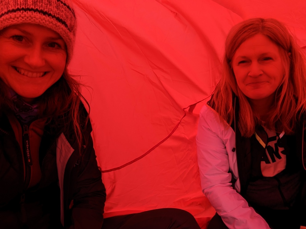
Not before stopping for a bite of lunch though! We picked a spot with a nice view and got stuck in. Always looking for an opportunity to get the emergency bothy shelter out, I suggested we try it to cut out the wind whilst we ate and after looking at me like I was daft, and several minutes of me trying to convince her of the benefits, my friend hesitantly agreed. Being a 4-person shelter it didn’t do too well in the wind with only two of us however it was good practice and my friend knows to bring ear plugs with her next time 😀
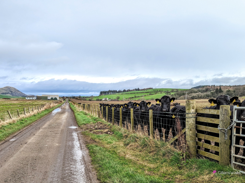
The shingle beach presented a nice change from the grass and tracks we’d experienced so far. A small van parked up ahead indicated to us where our track must be so we headed towards it. The owners were collecting wood from the beach, presumably for a coal fire. After stopping to say hello to some curious young cows (thankfully behind the field fence), we began the final easy walk into Ballantrae.
A brilliant day out!