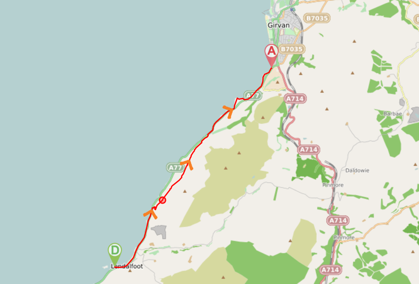
![]() Car park at the Varyag memorial, Lendalfoot (KA26 0JG) and at Ainslie Park, Girvan (KA26 0HW). Bus service between Girvan and Lendalfoot. Girvan is also served by a train station, 1.5 miles further along the coast from Ainslie Park.
Car park at the Varyag memorial, Lendalfoot (KA26 0JG) and at Ainslie Park, Girvan (KA26 0HW). Bus service between Girvan and Lendalfoot. Girvan is also served by a train station, 1.5 miles further along the coast from Ainslie Park.
![]() Purchase the official Ayrshire Coastal Path guide book
Purchase the official Ayrshire Coastal Path guide book
View full route description
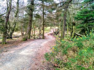
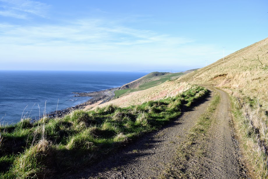
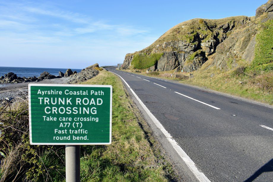
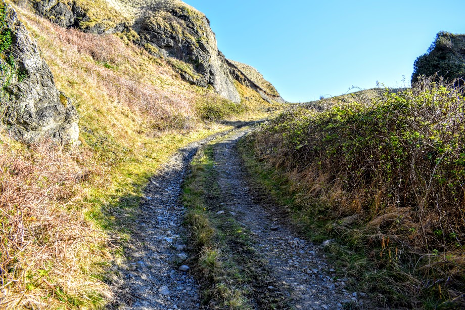
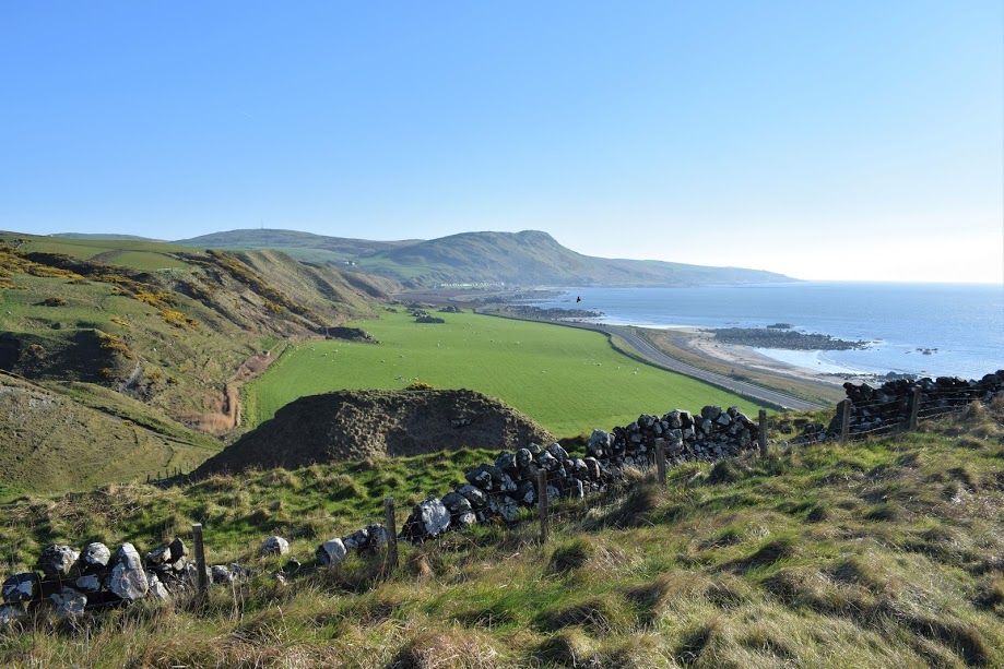
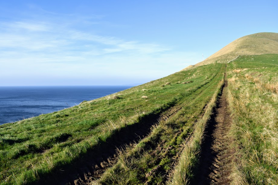
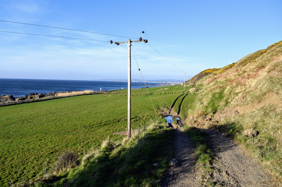
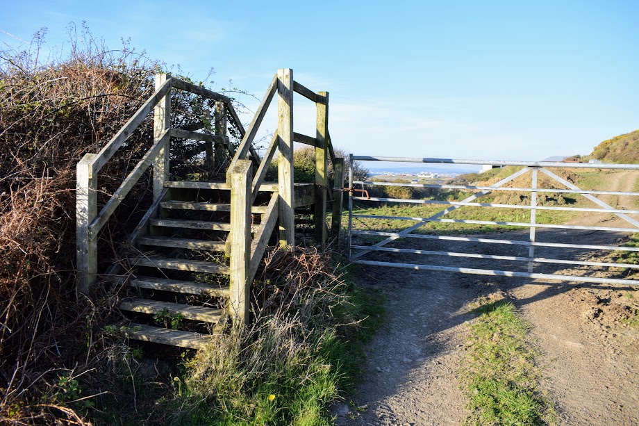
From the Varyag memorial car park, go down onto the beach and head north for approximately 3km. Keep an eye on the A77 Trunk road: just before it takes a tight bend to the right round a rocky outcrop in the hillside you will see Ayrshire Coastal Path signage at the roadside asking you to cross the A77 and pass through a gate at the other side. Beyond the gate, a gravel track leads you steeply uphill before becoming grassy and leveling out. Traverse the hillside North on this high-level old coach road, enjoying the views across the Firth of Clyde. After 2km, at a farm building and mast keep left (North) at a fork. For the next 600m the track descends towards A77. Keep heading North East, ignoring two tracks on your left which would take you onto A77. Towards the bottom of the hill the path disappears slightly to become a set of tractor tracks across some (sometimes muddy) fields (North East). You will come to a gate with a large stile next to it. Go over the stile then continue North a short distance before turning left at a fork to reach A77. Cross the road carefully then turn right (North East) and complete the final 3.7km on the (sand, pebble and rocky) beach. Just beyond Ainslie Manor Nursing Home, you will reach a car park at Ainslie Park on the very southern edge of Girvan where this section ends.
WALK REVIEW: 8TH APRIL 2017
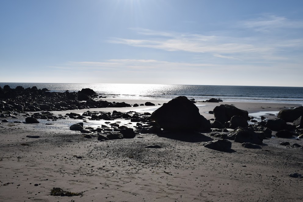
For me, this walk was the last third of a 27 mile hike which had started 6hrs prior in Glenapp. Despite being physically tired, I just absolutely loved it. The beaches were pristine with huge numbers of seabirds, interesting rock structures and gorgeous white sand. The high-level section broke up the beach walking perfectly and I was lucky to experience bone dry conditions underfoot going across the fields.
What annoyed me somewhat was that the Walkhighlands route description didn’t specify distances between different points: for example it told me to “drop down onto the beach (in Lendalfoot) and continue until Pinbain Burn is reached” at which point I should cross the A77 and head inland. The problem was that there were several burns running down onto the beach so I kept worrying that I had missed the turn-off and this resulted in a lot of to-ing and fro-ing and worrying. It turned out that it is almost 2 miles along! If I had known that I could have enjoyed it better. I know now for next time and have made sure to include that info for you in my route description above …. 🙂
It had been a relatively breezy day even at a low level, but I became aware of how exposed I was on the hillside path when I needed do don an extra layer and tie my hair back to see where I was going! Traversing the hillside was simply spectacular, the views to die for. As had been the case for the majority of my day so far, I had the track to myself with the exception of some sheep and a lone Roe Deer which ran across the field ahead of me!
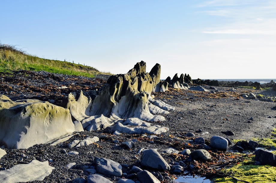
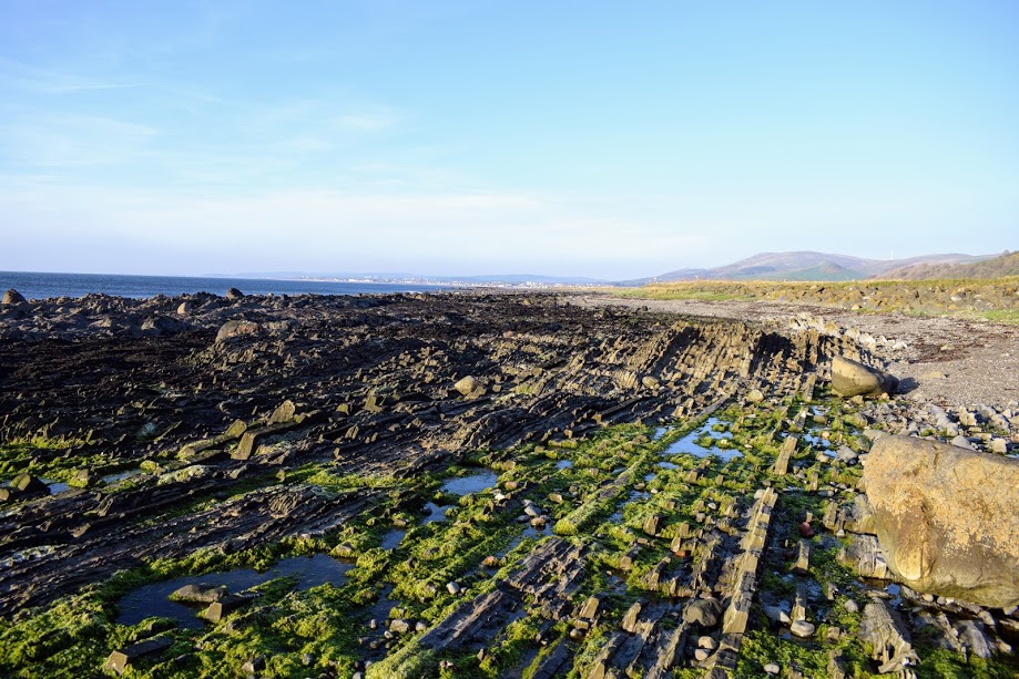
Back down to sea level for the final 2 miles, I chose to walk along the shore into Girvan (there is also a pavement along the A77 should you prefer: easier walking but not so peaceful or scenic!) I was fascinated by the rock structures along this beach – an area known as Kennedy’s Pass, named after T. F. Kennedy of Dalquharran who was the first to pass through it. There was row upon row of flat narrow rocks running perfectly parallel to each other, as well some larger spiky ones emerging from the sand. I do have to wonder at how all this came to be! Mother Nature at her best <3
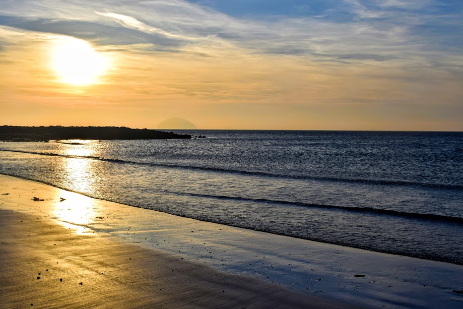
Arriving in Girvan I was treated to the most gorgeous sunset behind Ailsa Craig whilst awaiting my chariot home. Perfect end to an amazing day!