DIFFICULTY RATING: Easy. All on the flat and mainly along surfaced paths and cycle tracks, with one grassy track between Portencross and Hunterston which often gets boggy. One gate (see photo below).
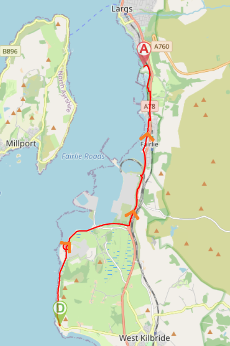
![]() Car parks at Portencross (KA23 9QA) and Largs Marina (KA30 8EZ). No public transport to Portencross – closest train station is West Kilbride 2.3 miles away. Largs train station is 1.5 miles from end of walk, so travelling by train makes the walk 11 miles in total. A shorter option is to stop in Fairlie and take the train back to West Kilbride from there – walk distance 7.5 miles. Then come back and do Fairlie to Largs another time!
Car parks at Portencross (KA23 9QA) and Largs Marina (KA30 8EZ). No public transport to Portencross – closest train station is West Kilbride 2.3 miles away. Largs train station is 1.5 miles from end of walk, so travelling by train makes the walk 11 miles in total. A shorter option is to stop in Fairlie and take the train back to West Kilbride from there – walk distance 7.5 miles. Then come back and do Fairlie to Largs another time!
![]() No public toilets on this walk. The Village Inn, Fairlie, has a customer toilet or you could continue into Largs where there are public toilets at Broomfield and Gallowgate (adds approx 2 miles – check opening times on North Ayrshire Council website).
No public toilets on this walk. The Village Inn, Fairlie, has a customer toilet or you could continue into Largs where there are public toilets at Broomfield and Gallowgate (adds approx 2 miles – check opening times on North Ayrshire Council website).
![]() Purchase the official Ayrshire Coastal Path Guide Book
Purchase the official Ayrshire Coastal Path Guide Book
View full route description
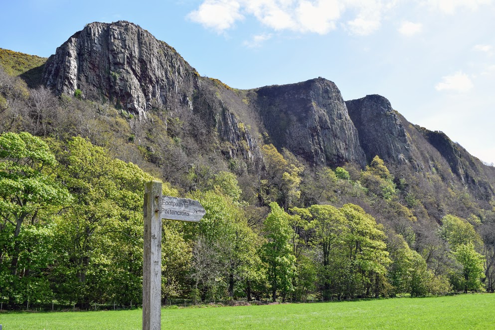
Exit Portencross car park onto the road and turn left. Continue along the road for 100m, turning left along a lane leading towards Portencross Castle. Turn right and walk along the track to the old pier, keeping right here to continue on the track. The steep cliffs known as the Three Sisters will be on your right-hand side.
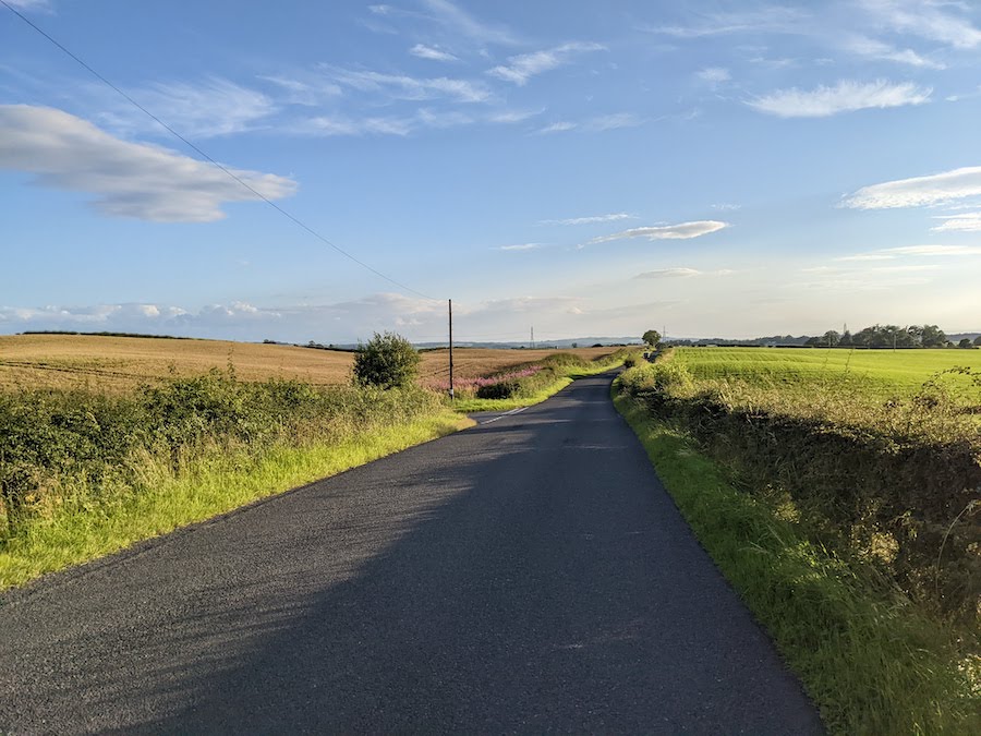
After 1.3km you will arrive at a gate and a small parking area. Continue ahead along Power Station Road. After 1km at a roundabout continue ahead to stay on Power Station Road. Another 1.2km along the road you will reach a fork. Keep left to continue along Power Station Road.
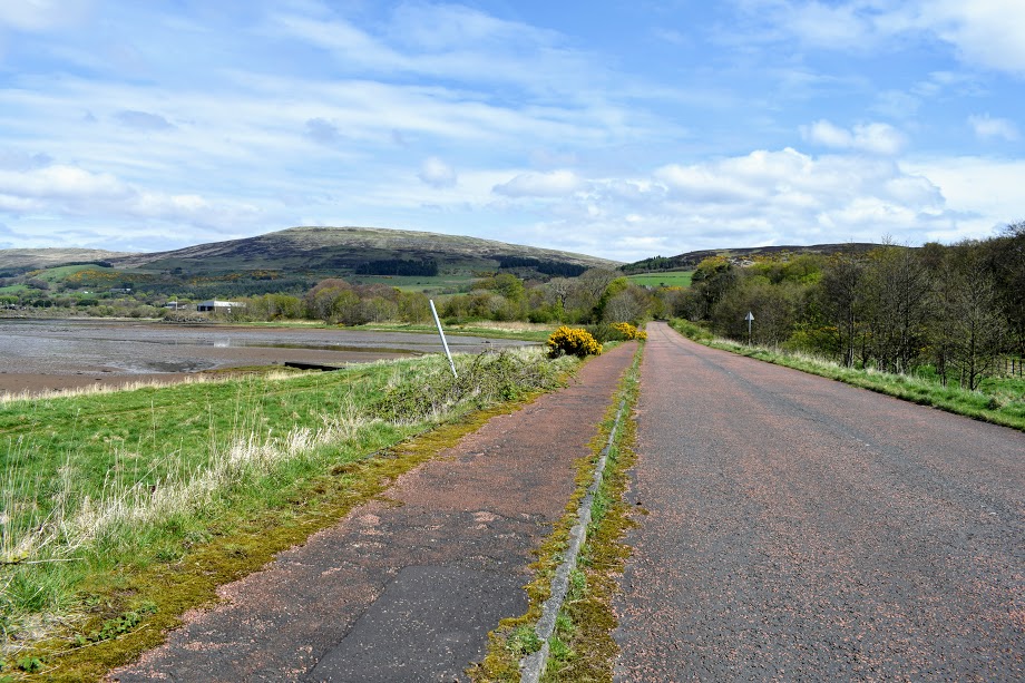
Approx 900m further turn left to come off the road and onto a tree-lined path which leads to a pavement along the busy A78/Irvine Road. Turn left and follow the NCN757 cycle path for 2.5km to the outskirts of Fairlie.
Once in Fairlie, take the first road on the left towards a small parking and picnic area . Skirt past the car park and picnic area to cross a footbridge over Fairlie Burn. From here a path runs alongside a high stone wall, allowing easy progress around the bay.
After 800m use the slip to access Bay Street. Turn left along Bay Street and after passing a small car park on your right, turn right onto Pier Road, heading towards Fairlie Parish Church. Before the church, turn left onto the A78.
Continue along the pavement for approx 600m to just beyond the bowling club where you can move onto a cycle track on the left, away from the road. Shortly after crossing the Kel Burn turn left go to through a railway underpass (watch your head, it’s low!). Continue along the cycle track from here to Largs Yacht Haven car park.
WALK REVIEW: 23RD APRIL 2017 (updated 14th April 2025)
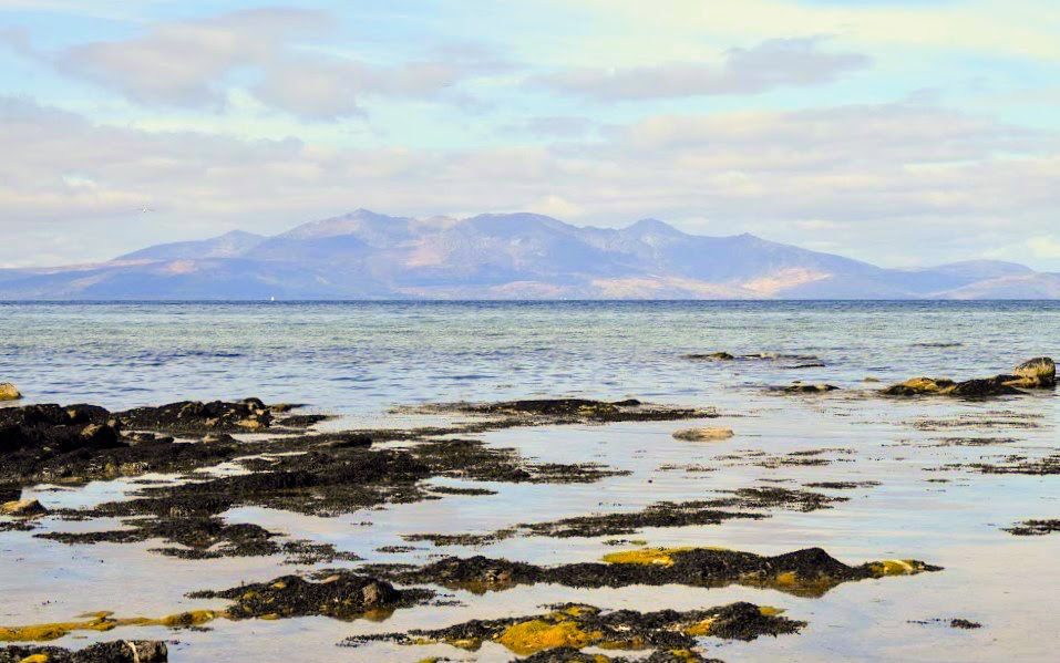
We were blessed with beautiful weather and a crystal clear view across to the Isle of Arran. I remember standing in the car park at Portencross taking it all in, completely mesmerized by my surroundings. My mum was with me today for the final 17 miles of my adventure along the Ayrshire Coastal Path. I was hiking the whole 100 miles to raise funds for the Mark McCloskey Foundation and today would see me complete it! I had already walked 6.5 miles from Ardrossan by the time I met up with my mum in Portencross and I was in good spirits, excited to find out what lay ahead!
Portencross Castle is always a delight. It seems to appear out of nowhere, nestled right on the edge of the water with an idyllic bay beside it and its very own fishing harbour. Built in the 1200s by Robert Boyd of Kilmarnock, it is nowadays looked after by a charity called Friends of Portencross Castle who open it up for visiting between Easter and October. I can highly recommend a look inside and the view from the rooftop is spectacular! The proximity of Portencross to the much bigger Rothesay Castle on the Isle of Bute, held by the Stewarts, gives it particular historical significance: Scottish Kings would stop off here en route between Dundonald and Rothesay. It is also said to have been the final resting place of many of Scotland’s great Kings, as their bodies were brought here during transportation to the Isle of Iona for burial.

Beyond the castle, its fishing harbour and old pier, a set of giant cliffs appear with our track running along the base of them. These are ‘The Three Sisters’ – so-named, legend has it, after three sisters who were thought to be witches who whipped up the storm on the night of the Battle of Largs! Waterside Hill, Ardneil Hill & Hawking Craig are the names of the hills. Keep your eyes and ears peeled for possible sightings of birds of prey here.
The first time I walked this route, I wasn’t sure what to expect from the 2 miles of road through the grounds of Hunterston Nuclear Power Station. I was intrigued as to what it looked like, having passed the entrance in the car countless times en route to Largs. Although certainly possessing an industrial air, I was pleasantly surprised. I had imagined it to be a really ugly area, very built up and noisy. Not sure why I expected noise, I knew it was no longer in operation! In fact I found it to be very peaceful, clean and on the whole very enjoyable. We met a few other walkers there too and I got the impression it is a route well-used by locals. Now I look forward to this section as much as any other: I have become fascinated by the decommissioning process and always enjoy seeing the staff out and about wandering off to enjoy their lunch break beside the sea.
The area seaward of the power station is actually a SSSI due to the mudflats here providing an essential habitat for many plants and birds. I have often seen Shelduck on the mudflats, for example, which I don’t often see elsewhere on the Ayrshire Coastal Path.

There is a short woodland section as you leave the power station area behind, adding variety to the walk! If you know where to look, there are bee hives in here, and depending on the time of year you might find bluebells and wild garlic growing.

What I enjoyed less was the cycle track alongside the A78 between Hunterston and Fairlie. Too much traffic noise, no coastal view. Good thing it is a short(ish) section. We met a man who had walked from Ardrossan, like me first time around, and he admitted this was his least favourite part of the whole 14 miles…. says a lot considering we had all just walked through the grounds of a decommissioned power station!!
But actually there is also a lot to enjoy about this part of the day. It’s easy-going for a start, and unless you’re there in the depths of winter, there is a wide variety of trees, plants and flowers to brighten up the path: cuckoo flowers, lesser celandine and dog violets in early springtime; horse chestnut trees, broom, and hawthorn flowers in summer; conkers and sea buckthorn berries in autumn…. To name a few!

There is a picnic area at Fairlie which I normally aim to stop at for lunch, or a snack. It’s right by the water and comes complete with picnic benches, seats and a view to die for 🙂 The route passes right through it so you won’t miss it!
Beyond the picnic area is the new ‘Fairlie Coastal Path’ – a fully accessible walk and cycle way which runs along the water’s edge, replacing a more uneven and quirky version of the past (which I actually really liked but understand not everyone could enjoy it). The path was made possible by the charity Sustrans and North Ayrshire Council and was completed in 2024.
At the end of this path there is a slip giving access to Bay Street – on which I recommend looking out for a sculpture marking the location of the former Fife Yachtbuilders yard. This is another important piece of local history as three generations of the Fife family designed and built world-class racing yachts right here. After 150 years in business, the yard closed in 1985 and was demolished to make way for housing. Fife yachts won more races than any other British boat designer and still sell (second hand) for up to £2 million!


A brief spell on roadside pavement is up next, before you are back on the cycle path and away from the traffic.
If you like boats you will love the final part of the walk along the cycle track between Kelburn and Largs Yacht Haven: it is lined with different types of anchors each with a plaque explaining its history! Like a mini outdoor museum 🙂 And if you aren’t particularly into boats, you might enjoy the views over to the wooded hillside of Kelburn Country Park instead!