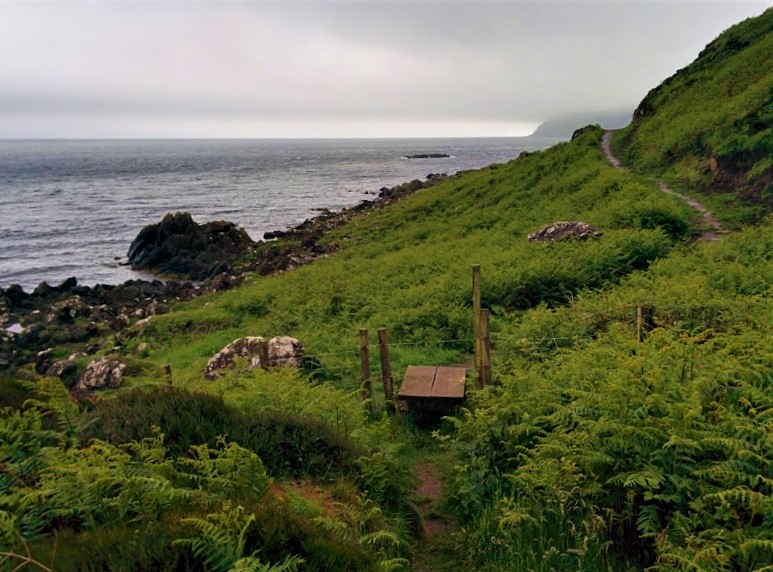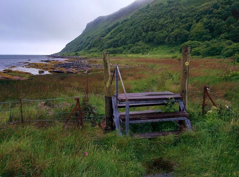
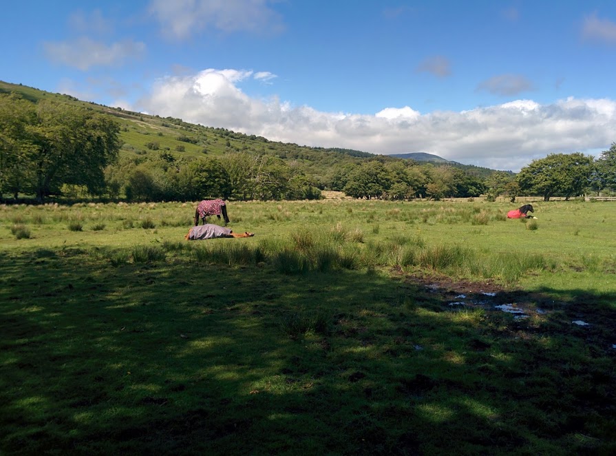
![]() Dog-friendly walk (two stiles to be aware of, and one short field crossing which had horses at time of my visit – see photos)
Dog-friendly walk (two stiles to be aware of, and one short field crossing which had horses at time of my visit – see photos)
![]() This route is designed to be walked from the ferry terminal without the need for other transport. However if you have a car, on-street parking is available in Brodick.
This route is designed to be walked from the ferry terminal without the need for other transport. However if you have a car, on-street parking is available in Brodick.
View full route description
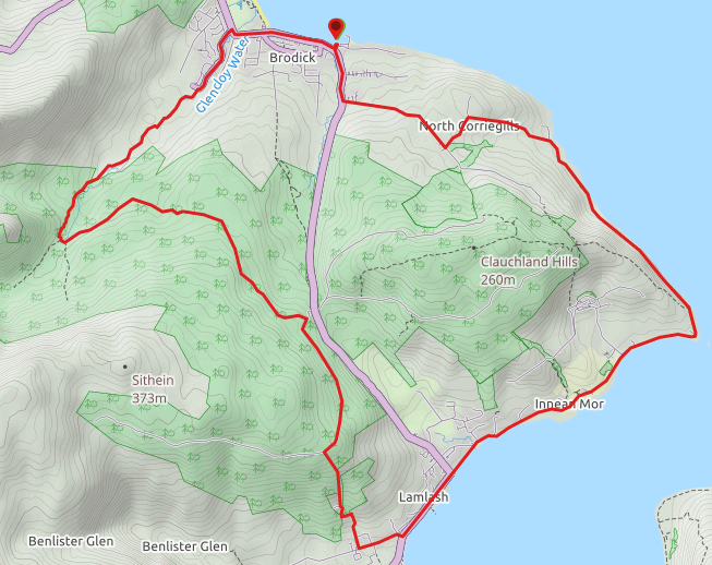
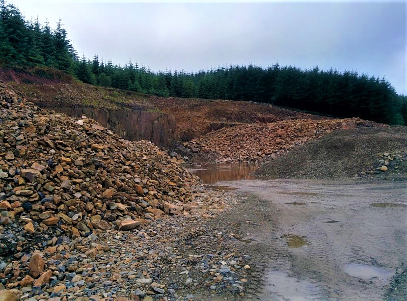
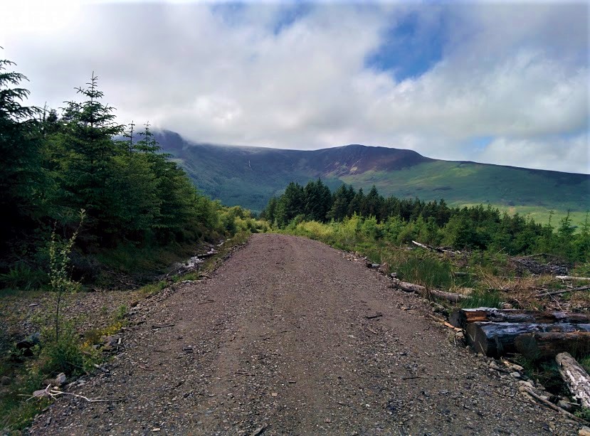
From the ferry terminal turn left onto the main road. Take the second street on your left (just past Carrick Lodge Guest House) and continue along this minor road for approx 0.7 miles before turning left towards North Corriegills. Keep right at a fork and follow the track downhill until you emerge at sea level. Turn right to walk parallel to the shore and where the track runs out head down onto the beach to pick up a grassy path just inland of the rocks. Follow this narrow, boggy path for 1.5 miles around the coast, crossing a couple of stiles along the way. At the tip of Clauchlands Point you will emerge onto a wide earth track which soon becomes a minor road leading to the village of Lamlash. Enjoy easy walking on the roadside pavement as you pass through the village and just before reaching the Co-op store turn right onto Benlister Road. Keep left at the fork to continue along this residential street. Take the second right (at an obvious group of palm trees and blue fence!) onto the aptly named Hillside Terrace and follow it uphill until you reach a closed metal gate. On your right there will be a narrow earth track making it’s way up the grassy slope. Follow this as it ascends steeply through fern and along the edge of a forest to reach a wide gravel forestry track. Turn right and enjoy the fine views from this elevated position. At a fork turn left (signposted ‘Glencloy‘) and continue for 2 miles, past a large quarry, until you reach a crossroads. Turn right here onto a much narrower but very well maintained trail to follow the Glencloy Water through a peaceful woodland. Cross into the field via a kissing gate and keep right to arrive at a second kissing gate next to a cottage. From here continue straight ahead along the wide earth track to pass the Auchrannie Spa Resort and emerge onto the A841. Turn right and follow the main road through Brodick and back to the ferry terminal.
WALK REPORT: 12th June 2017
One of those walks which had been pre-planned months in advance to accommodate three different people’s schedules! Of course, as the date approached it became clear that it was to be pouring of rain all day and so with that in mind I arrived at Ardrossan ferry terminal in full waterproofs and hiking gear. Imagine my surprise then when my walking companion turned up in shorts and trail shoes! We couldn’t have looked more different and I even joked if we were going to the same place. He was to be the one laughing by the end of the day however, as the clouds lifted to reveal blue sky and warm sunshine. Ah well, first outing for my new jacket and it stood up well to the initial drenching we got!
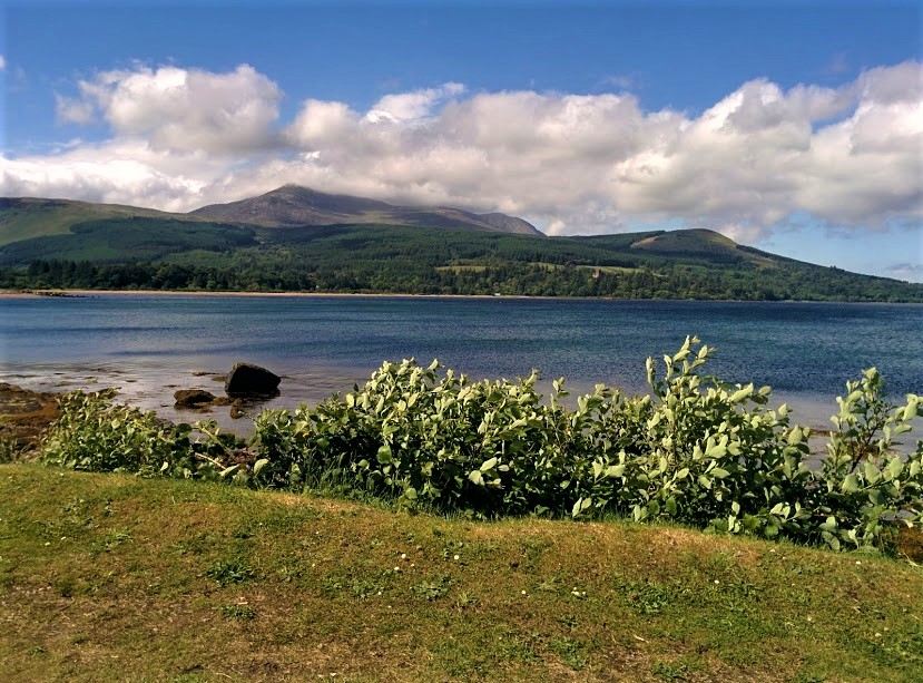
Unfortunately one member of the group had to cancel (we missed you Salima!) and so Gleb and I set off to discover what Arran’s coastal path had to offer. It was only Gleb’s second time on the island (the first being our Glen Rosa walk a year prior) and he was quite keen to change plans and attempt Goatfell again, however much to his disappointment I wasn’t up for it: A combination of a VERY choppy ferry crossing, the poor weather and the fact that I had been up that mountain countless times… sorry Gleb! Another time for sure 😉 Just to tease him we were treated to a lovely view of said mountain from Brodick as we awaited the ferry home later in the day!
I have Dougie Russell to thank for this route! He had kindly plotted it out on a mapping app for me, making navigation super easy. There is nothing better than walking a route suggested by a ‘local’ (read ‘someone who has moved to the island in recent years and has a habit of posting photos from his walks on social media rendering me insanely jealous!’) Can’t thank him enough for taking the time to plan this one out for me though, it was a cracker!
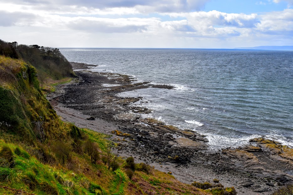
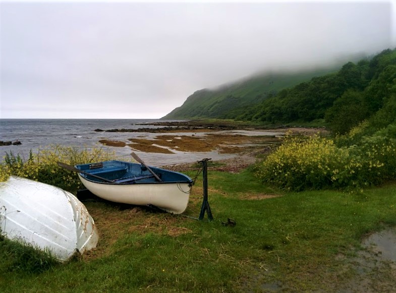
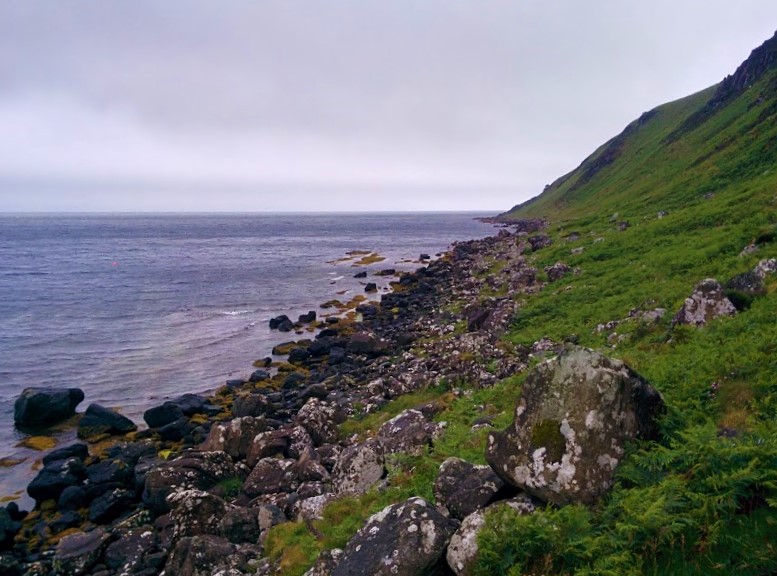
Part One: the coastal walk (my favourite!) Wet underfoot but beautiful, remote, rugged….. and we saw a seal!
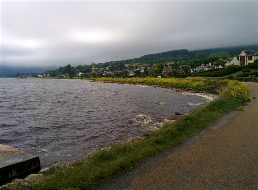
Part two: around Clauchlands Point and through Lamlash village.
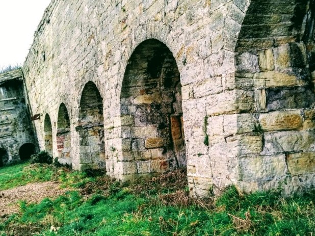
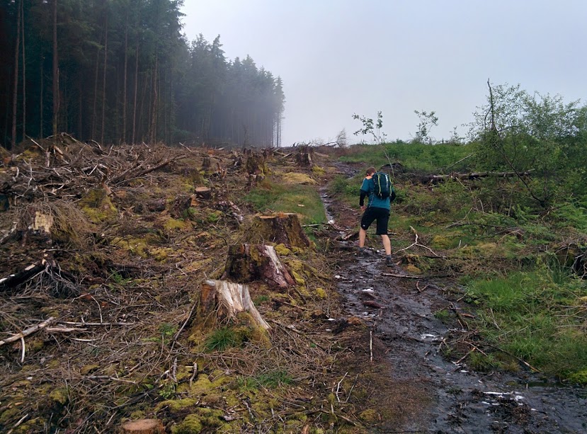
Part three: the forestry and woodland tracks returning to Brodick.
I don’t normally like forestry tracks much, I get bored of them quickly. I was grateful that this one wasn’t too bad thanks to it’s elevated position which afforded lovely views down into Lamlash, across to Holy Isle and then later over to Cnoc Dubh (425m high and now on the to-do list!) All of this on a low-visibility day, remember!
Arran has so much to offer the walker, I don’t even know where to begin deciding on the next one! The 65-mile Arran Coastal Way is certainly on my list, and being a circular walk gives it extra brownie points. I will of course accompany Gleb up Goatfell at some point, as well as tackle all the other peaks the North of the island has to offer….. And I am sure my friend Dougie will have a few other suggestions for me too – remember that Guest Blog we mentioned back in June, Dougie?? hint hint 😉