TERRAIN: Half of the route follows the NCN73 cycle path whilst the remainder is along a mixture of earth tracks, surfaced footpaths and urban areas.
![]() Buggy-friendly walk
Buggy-friendly walk
![]() Dog-friendly walk
Dog-friendly walk
![]() The easiest way to travel to Eglinton Country Park is by car. There is plenty of free parking onsite. If using public transport the closest train station is in Kilwinning, 2 miles away. From there it is possible to cycle (approx 10 mins) or walk (approx 40 mins) or take a bus to Irvine Road/A737 to Eglinton Country Park. From the bus stop the start point is approx half a mile /15 minutes away on foot. If travelling by public transport you could choose to start the route at a different point. For example Irvine train station is approx 500m from the closest entry point to the walk at the Rivergate Centre and there are bus stops in some of the outlying residential areas which this route passes through (eg Bourtreehill or Dreghorn). Much of the route is on the NCN73 cycle path, making connections to/from Glasgow and Kilmarnock possible by bike.
The easiest way to travel to Eglinton Country Park is by car. There is plenty of free parking onsite. If using public transport the closest train station is in Kilwinning, 2 miles away. From there it is possible to cycle (approx 10 mins) or walk (approx 40 mins) or take a bus to Irvine Road/A737 to Eglinton Country Park. From the bus stop the start point is approx half a mile /15 minutes away on foot. If travelling by public transport you could choose to start the route at a different point. For example Irvine train station is approx 500m from the closest entry point to the walk at the Rivergate Centre and there are bus stops in some of the outlying residential areas which this route passes through (eg Bourtreehill or Dreghorn). Much of the route is on the NCN73 cycle path, making connections to/from Glasgow and Kilmarnock possible by bike.
Download the official New Town Trail leaflet from the North Ayrshire Council website
View full route description
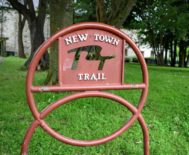
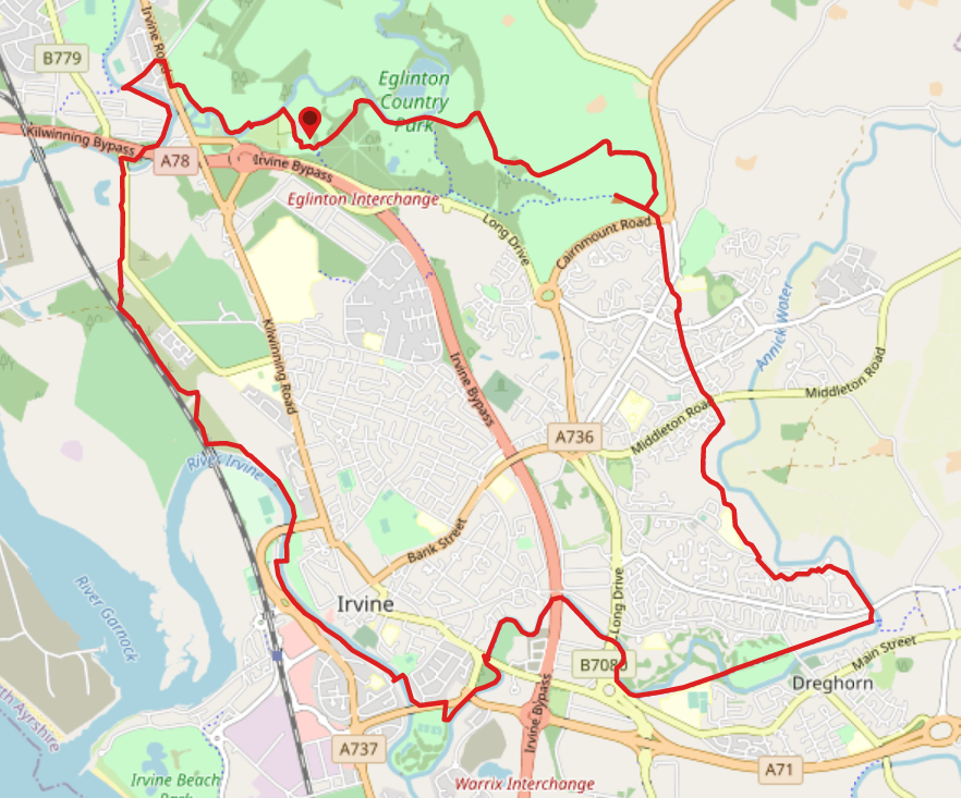
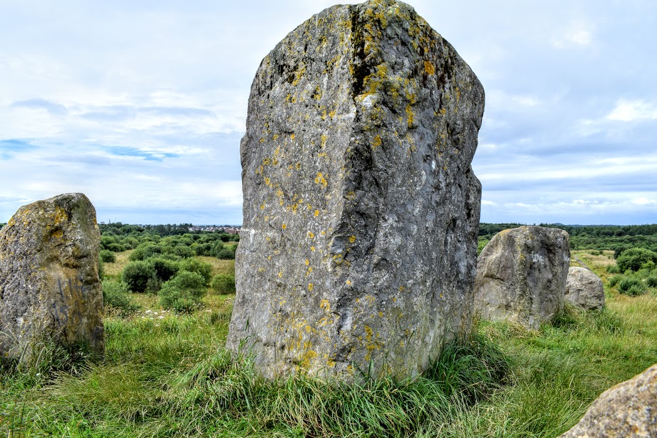
Start the walk at Eglinton Country Park at a wooden gateway with “Visitor Centre” marked above it, close to the main car parks. There is also a statue of a horse here. Facing away from the Visitor Centre, turn left (South East) to follow the road towards a car park. Walk into the car park then move across to a footpath on your right. Follow this through the trees to pass the remains of Eglinton Castle and then after a short uphill section you will reach the Lugton Water. Turn right (South East) at the Lugton Water (don’t cross the bridge) and continue on this gravel track. This section is well way-marked so follow the New Town Trail marker posts to stay close to the river at first, keeping right at two forks. The path will start to veer away from the river, skirting the edge of a field to arrive at a crossroads after 800m. Turn right (South East) and after 300m keep left at two forks to enter a small area of trees. The path continues along a fence line, bending right to cross a small burn then veers right, away from the fence and into Sourlie Wood Wildlife Reserve. Follow the main path through the woods and just as you leave Sourlie Wood, there is an optional short de-tour of 230m to the right to see the Eglinton standing stones with lovely views over the Dalry Moor – if doing so, turn right (North West) at the Eglinton Country Park information board. Return to the main path via the same route. The path leads you through the A736/Cairnmount Road underpass. From here use the New Town Trail marker posts to stay on track, along a variety of the tree-lined surfaced paths. At each road crossing (Lochlibo Road, Littestane Road and Girdle Toll and B769/Middleton Road), continue straight ahead to pick up the trail at the other side of each. The trail then leaves that urban area onto more open countryside and approx 700m from Middleton Road you will reach a confusing crossroads where the way marker appears to point both left and right. Technically you can go either way, but the “correct” course is to turn right here (West) and then almost immediately left (South). This takes you through some trees then across a large area of open ground. After a short uphill section at the far end of the area of open ground, you will emerge at a road. Cross it and turn left (South East) along the pavement. After approx 150m at a bus stop, look out for a way marker inviting you to cross back over the road (left – North East) and into the Bourtreehill residential area on Heatherstane Way. Where the pavement runs out, head to the right onto the road and continue along Heatherstane Way until you see a sign for Lowther Bank. Note: approx halfway along Heatherstane Way there are New Town Trail way markers directing you off to the right at a metal barrier – do not follow these as they just take you round in a circle back to this point! From the Lowther Bank sign turn left (North East) and you will reassuringly see the New Town Trail way markers once again. Turn right (South East) to come off Lowther Bank and onto a footpath. This footpath crosses a grassy area and heads into the trees. Stay on the path closest to the Annick Water to cross over Towerlands Road and join up with the NCN73 cycle track. Turn right (West) and follow the NCN73 signage for the next 10km… The cycle path leads you through Annick Park, behind Greenwood Academy, then follows the Annick Water on your right-hand side until passing a hotel and out onto the B7081/Annick Road close to a roundabout. From here the cycle path continues with the river on your left-hand side for 600m before taking a right turn (West) just as it reaches Milgarholm Park. Almost immediately turn right again (North) to reach A71. Cross over at the pedestrian crossing then turn left (West) along the pavement. Before reaching the bridge, turn off the pavement to the right (North West) onto a riverside path. Cross a bridge after 250m then turn right (North West). With the River Irvine on your right-hand side, stay on the cycle path for just over 1km, passing under the Rivergate Shopping Centre and emerging onto a residential street called Waterside. Cross the River Irvine via the footbridge on Waterside, to arrive at Irvine Low Green. Turn left (North) to continue on the NCN73. It follows the course of the river from an elevated position until it meets up with the railway line, then follows the course of the railway line until emerging onto B779 next to Bartenholm Recycling Centre. Turn left (North) on B779, passing Garnock Floods Wildlife Reserve and crossing the River Garnock via a road bridge. After crossing the bridge, turn right (East) to cross the road and enter a small wooded area. You will pass underneath the A78/Kilwinning Bypass before following the Garnock along for 700m to a crossroads. Turn right (North East) to cross a bridge, signposted ‘Eglinton Country Park 1.25 miles’. You will then reach the A737/Irvine Road. Cross using the pedestrian crossing and turn right (South), ignoring a tempting entrance to Eglinton Country Park straight ahead of you. Cross a minor road and shortly after this turn left (East) onto a lane which brings you safely onto the minor road a little further along. Turn right then almost immediately turn right again (South East) at the Eglinton information board. This takes you onto a pleasant earth footpath through the woods. The path meets up with the Lugton Water which you follow along for approx 400m to a large suspension bridge. Cross the bridge then turn left (South East then North East). The Lugton will now be on your left-hand side. After 240m turn right (South East) to follow the path around the camping ground. You will reach a large kids play area, followed by a smaller play area. The entrance to the Tournament Cafe and toilets are through the gate on your left-hand side if you need them. Otherwise continue to the end of this footpath to a road. Turn left (East) to return to the wooden gateway with “Visitor Centre” marked above it.
WALK REPORT: 30th July 2017
I first noticed signage for the Irvine & Kilwinning New Town Trail on a visit to Eglinton Country Park and naturally I was keen to check it out! I had heard from a couple of people that navigating it was tricky and I knew friends who had set out to do the entire trail and ended up walking round in circles. Up for a challenge, I knew that if anyone could crack it, it was me!
Eve was one of said friends and it seemed only polite that I should invite her along on my trail of discovery. Off we set, armed with my trusty navigation app complete with pre-loaded route which I had pieced together using the Ayrshire Paths website. The beauty of this app is that you can see in an instant if you have taken a wrong turn. The pre-loaded route is shown in one colour, and your own route in another. If they don’t match, you’ve made a mistake! There is also a handy arrow which points in the direction you are supposed to be walking and flashes red if you aren’t on track. Foolproof, right?! Well, yes, assuming you check your position regularly. Even with the use of my app we still managed to go the wrong way a few times. This was no fault of the app, it was simply a case of us plodding along assuming we were going the right way and eventually I would check the map and realise we had been supposed to turn off somewhere half a mile back. Moral of the story…. way markers alone will not guide you to complete this loop! My personal recommendation is to download the free route I have plotted out for you and follow it, regularly checking that you are on track.
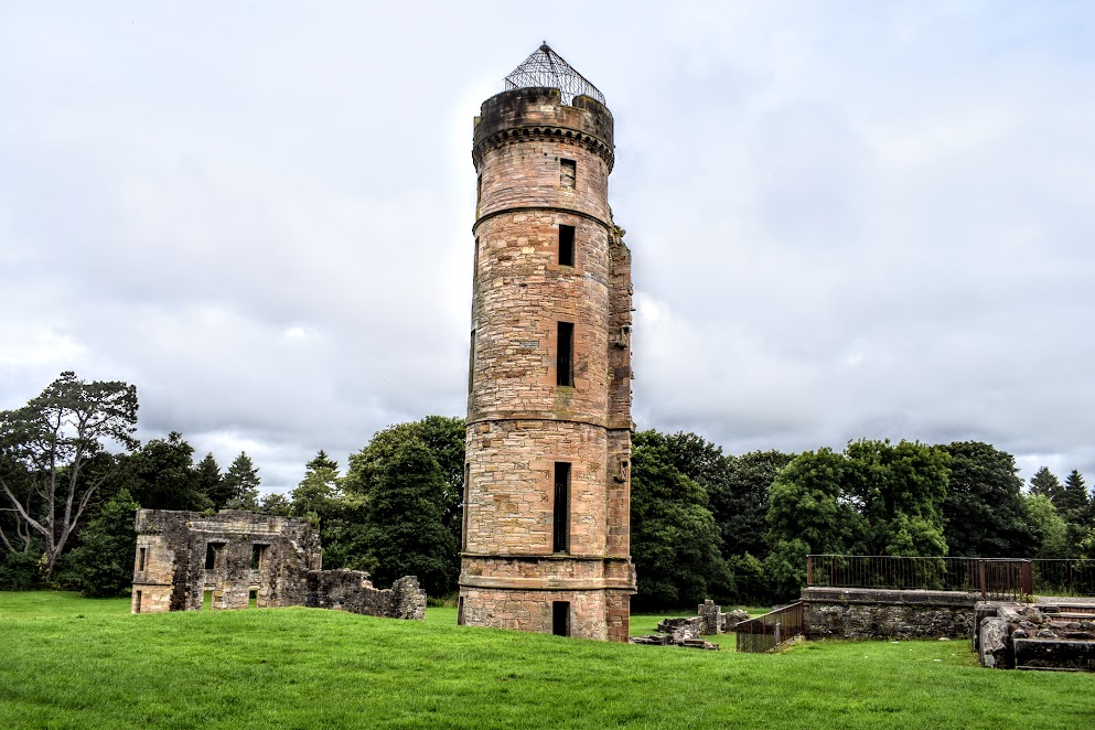
Eglinton Country Park is amazing, one of my favourites in Ayrshire. I found it a shame that the route missed out some interesting areas of the park, most importantly the castle. You could easily walk along and not know it was there at all. I had been before so knew that it was nestled behind the trees and sneaked off-route to take a quick snap.
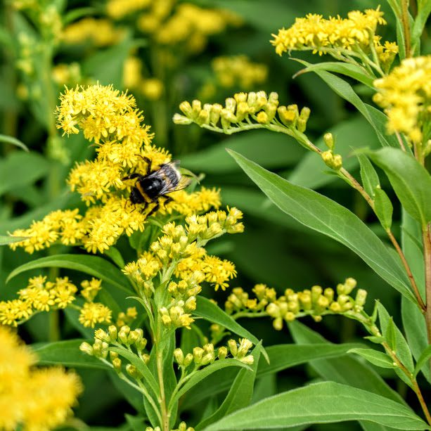
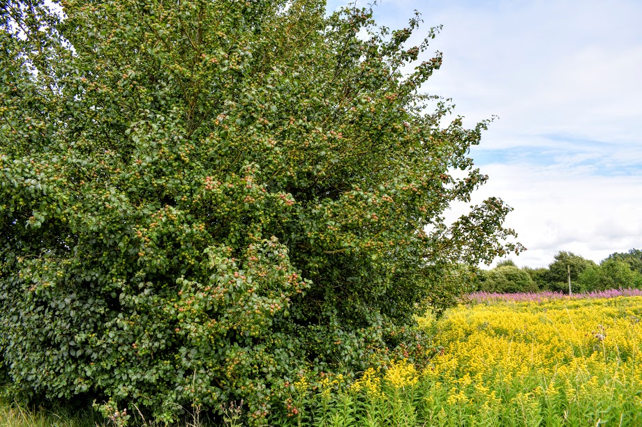
The trail was alive with colour and full of life: wildflowers lined the paths, teeming with bees going about their work. At one point an unspoken competition began between Eve and I, to see who could take the best ‘bee on a flower’ photo. My entry is below…. 😉 Whilst walking along the cycle track between Towns Moor and the B779, we passed some apple trees. I was simply awestruck by the sheer volume of apples on them, just incredible. It was like nothing I had ever seen in my life before. There is a photo below but I am not even sure that it accurately reflects the abundance of fruit that was present… A lot of them were green and so blended in well with the foliage. If you zoom in you may be able to see what I mean. I pondered for a moment the incredible journey these apples would have come on from their humble beginnings as buds and the growth period to become fully fledged and delicious-looking pieces of fruit. What a shame that most of them must just fall on the ground and rot :-/ My apple tree knowledge is limited but if these are edible then I’ll be back next year with some carrier bags!
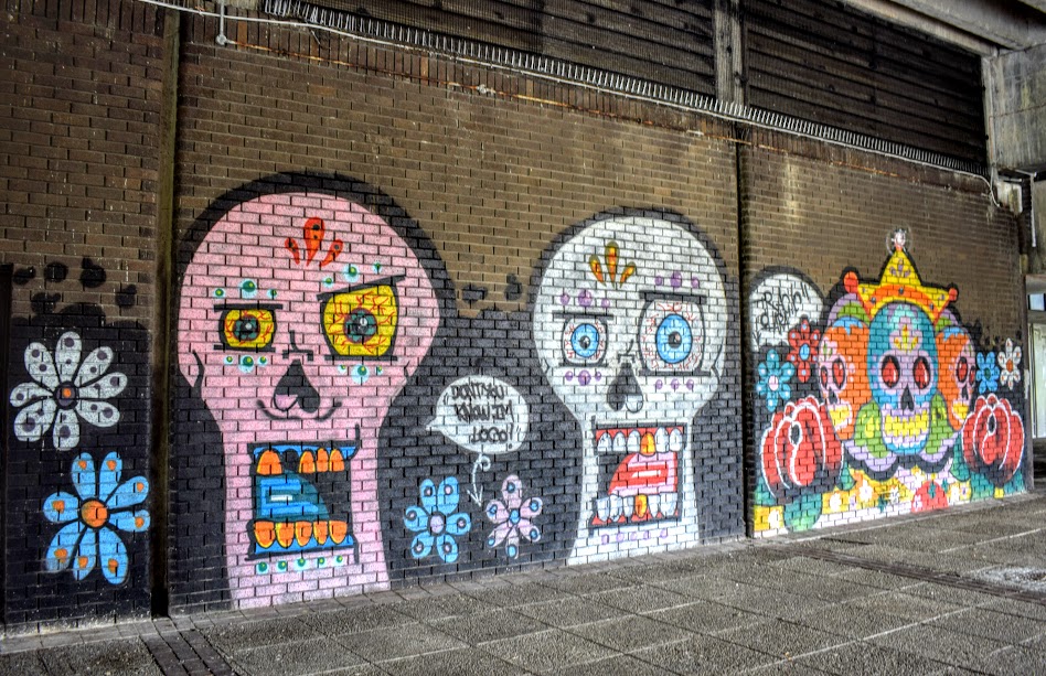
The short sections through residential areas didn’t appeal to me so much, but I do tend to prefer walking ‘off-the-beaten-track’. In fact, one of the biggest boo-boos Eve and I made was missing a turn-off in Bourtreehill and we ended up spending a while trying to find a way through the maze of houses back onto the trail. We agreed that we were glad we weren’t there alone! Urban proved that it can also be fun though, when we stopped to admire this wall art beneath the Riverside Shopping Centre. Certainly brightened up a dull area!
A highlight of the walk for me was unexpectedly coming across the standing stones on Cairnmount Hill. It was a short de-tour from the main path but well worth it for the views across Dalry Moor!
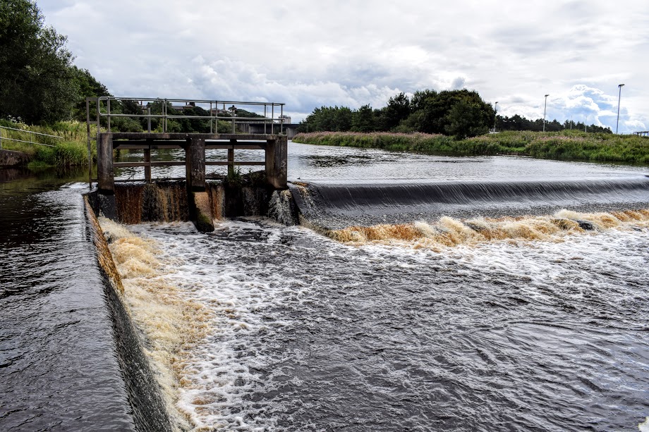
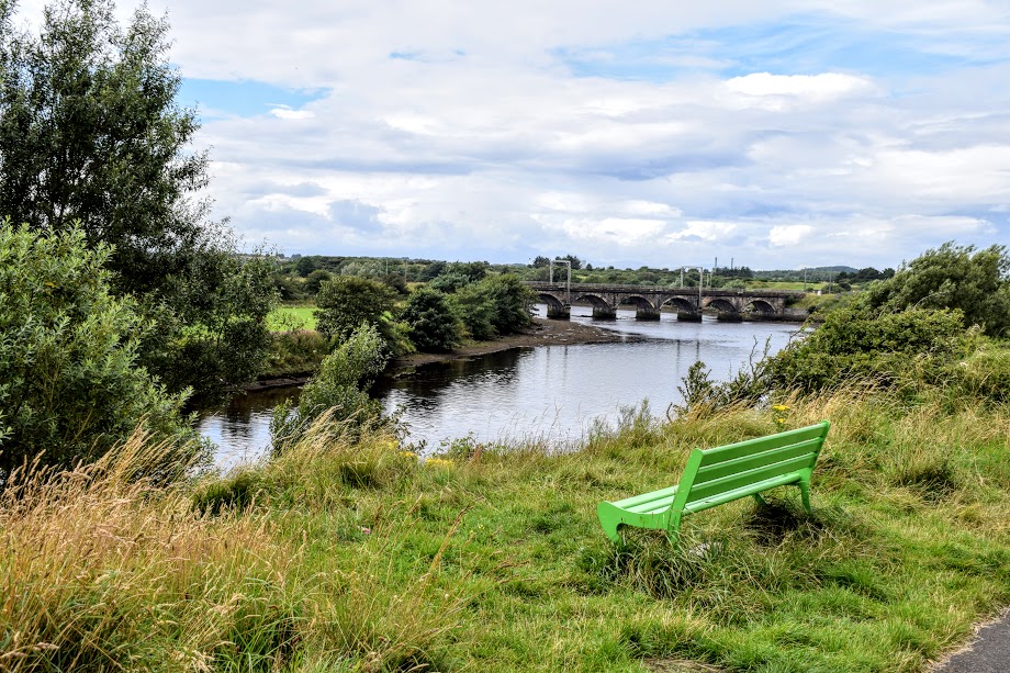
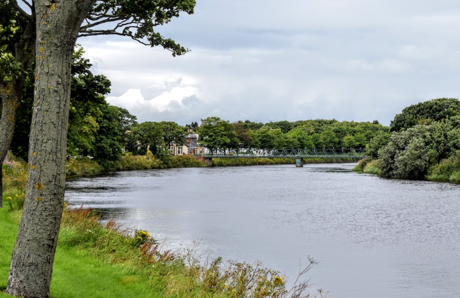
In summary, the Irvine & Kilwinning New Town Trail was easy-going, flat and had a surprise around every corner. Navigating it required considerable concentration and an electronic map with GPS but this made conquering it all the more rewarding! Lots of lovely views along the trail as well as some hidden gems just off-route. Although we didn’t enjoy the residential sections, they were short and sweet so didn’t dampen the enjoyment of the walk as a whole.

