![]() Parking available for a few cars on the grass verge off Old Largs Road at the start of the Corlic Hill path, half a mile above Whinhill Golf Course (PA16 9LN). No public transport to start.
Parking available for a few cars on the grass verge off Old Largs Road at the start of the Corlic Hill path, half a mile above Whinhill Golf Course (PA16 9LN). No public transport to start.
View full route description
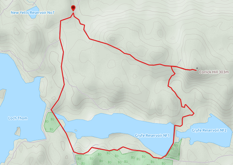
Route: Starting at the Corlic Hill Path marker post on Old Largs Road, head South up a single track road. 1.6km along, after passing a mast, keep right (East) at a fork to move onto a gravel track. Corlic Hill soon comes into view. After 570m you will reach a stile at the corner of two dry stone walls. Cross the stile and follow a clearly visible grassy path directly ahead (East) up to the summit of Corlic Hill. Descend via the same route back to the stile. Cross back over the stile and walk along the track with the dry stone wall on your left-hand side. 100m along go through a gate on your left which takes you on to a grassy area. Head South towards an obvious cluster of trees where you will find the ruined farmstead of Burnhead. From here head South West for 200m on a grassy path, to a gravel track. Turn left (South East) onto the track heading downhill for 400m to arrive at the larger Glenbrae ruin, again hidden amongst a cluster of trees. You will find a gate to the east of Glenbrae ruins which you should pass through. Head South across the field to another gate at the bottom of the hill. Go through the gate, across the stream then turn right (West) to walk along a raised embankment and onto a path between Gryfe 1 and Gryfe 2 reservoirs. Turn right (West) onto a forestry track. After 1.6km keep right (North West) at a fork. Continue on the forestry track for a further 800m to reach Old Largs Road. Turn right (North East) and walk along Old Largs Road for 1.8km to return to the Corlic Hill Path marker post on Old Largs Road.
WALK REPORT: 25TH FEBRUARY 2018
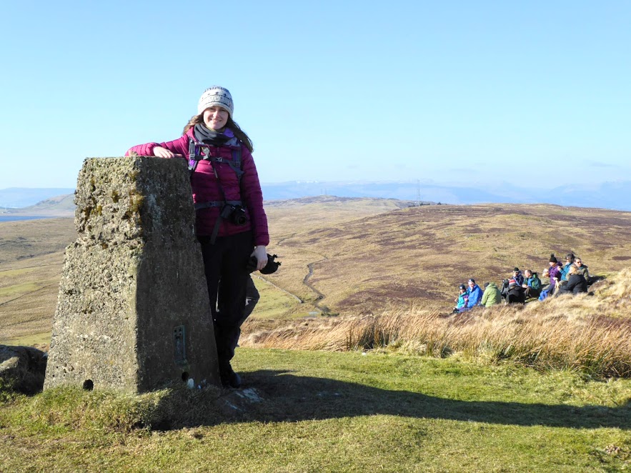
Mention Clyde Muirshiel Regional Park to people and most will think of The Greenock Cut. But with 108 square miles to explore, there is far more on offer than one may realise. Encompassing a vast expanse of moorland, reservoirs and rolling hills, Clyde Muirshiel extends from Overton in the north, to West Kilbride in the south; Fairlie on the Ayrshire Coast to Howwood and Glengarnock on it’s eastern perimeter. Its huuuuuge! It was with this in mind that I signed up for the free ranger-led walk to Corlic Hill, a top I had never heard of beforehand but which I knew had a trig point on it’s summit (and I am trig bagging this year!)…..
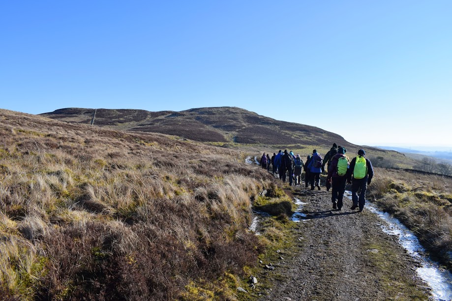
On arrival Ranger Mike and Ranger John met us at the designated parking area and after completing the usual briefings a group of approx 12 of us set off to discover a tiny corner of this immense area.
It was a beautiful dry sunny day, one of those crisp winter mornings I love. It struck me that this probably wouldn’t be the most hospitable of places to find yourself on a sodden wet windy day, given how exposed it was. We definitely got lucky! Not only did the high pressure reward us by freezing up normally boggy moorland areas, but we were also treated to stunning views of the Cowal Peninsula and Southern Highlands.
The walk towards the foot of Corlic Hill was a mix of concrete road and gravel/earth track, with the hill path itself being of the grass/heather combo so prevalent in this area. Rather than head straight up the hill our group first made a short detour to the site of the Lurg Moor Roman fortlet. Although nowadays merely resembling a grassy mound with surrounding ditch (If I hadn’t been on a guided walk I would have walked past it without a second glance) we experienced some of the best views of the day from here and Ranger Mike was very knowledgeable and enthusiastic about the history of the site. The group agreed to make a bee-line for the Corlic trig point from here rather than retrace our steps to the track. This meant plodding across the heathery landscape and a couple of fence/dry stone wall crossings. Adds to the sense of adventure! (Note: the route description and map above take you straight to the summit without the de-tour and heathery scramble) It did cross my mind what my Monday walkers would think if I took them off-course like this! I could hear the terrified screams of the health and safety dept! It made me recognize the stark difference difference between leading a one hour health walk and guiding people on a hill walk. It was a few levels up from what I am used to. “One day“, I thought… 😉
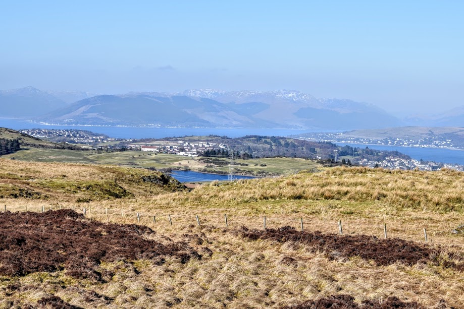
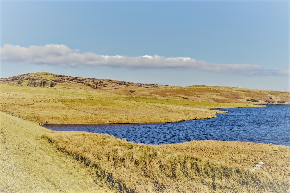
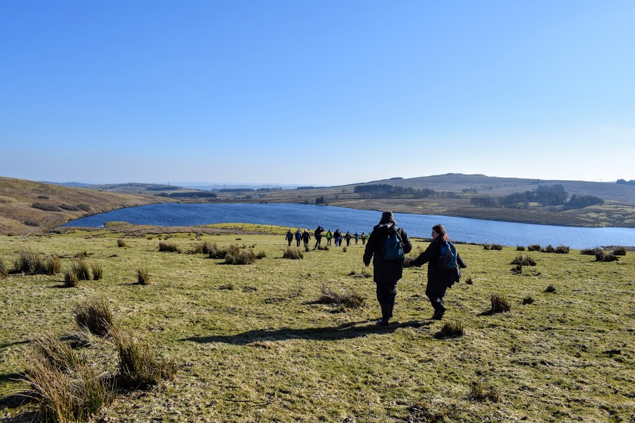
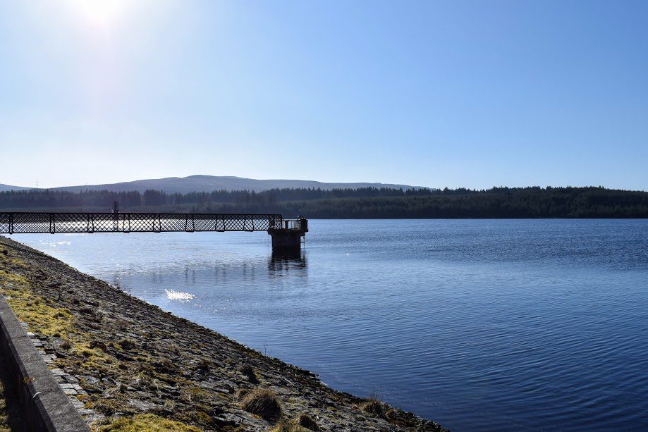
It was a tough trek over the heather and moss-clad moorland to the summit trig but everyone took things at their own pace and I have to say I really enjoyed it even though there was no path. There’s something to be said about going on a led walk with someone who knows the area like the back of their hand; being able to trust them going off-path in places you wouldn’t dare were you there alone. Paths are boring anyway, right? 😀 My view over lunch was of two reservoirs: Gryfe 1 and Gryfe 2. I day dreamed about how nice it would be to do a walk down by them one day. Little did I know that was next on the agenda for this very afternoon!
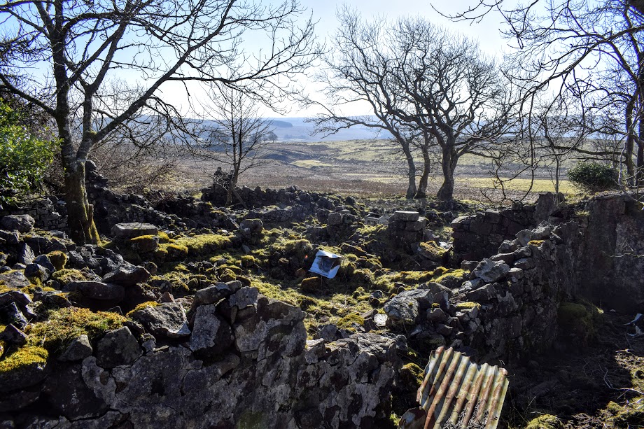
En route to the reservoirs we visited two farmhouse ruins, both of which were enveloped in a small cluster of trees. What made this so significant was that there was barely a tree in sight on the heather-clad landscape (as you will notice from my photos), so these really stood out. Yet you didn’t know there were ruins among them until you were right up close. I love discovering pieces of history whilst out walking. It really makes me ponder how life must have been for Inverclyde’s earliest inhabitants: so remote, so beautiful, so primitive. I think it’s amazing that remains of by-gone days still exist and it is my strong belief that the stories behind them should be known, shared and remembered. We can probably learn a lot from them!

Onwards we strode over grassy farmland, earth tracks and several gates to pass between the Gryfe reservoirs. Glancing behind me I could see the trig point on Corlic Hill in the distance, seeming so far away now yet I had stood there less than 30 minutes before. Our legs really are remarkable things!
A forestry track then took us back to the Old Largs Road. Having spent a blissful 4 hours hiking a route I doubt I’d ever have experienced without the guidance of the Rangers, I felt truly grateful for the beautiful country we live in. I highly recommend exploring this area. What a shame that it is so overlooked….. Being the largest Regional Park in Scotland and in a prime location (with easy access) from both Glasgow and Ayrshire, I can’t think why. Times are changing though and Clyde Muirshiel will be hosting it’s first ever Walking Festival in May 2018. Keep an eye on their Facebook events for details. You might even recognise one of the walk leaders 😉 Find out about other ranger-led walks on the Clyde Muirshiel website.