![]() Parking area off A82 – Buachaille Etive Mòr car park or Glencoe Viewpoint. There is a bus service operating along A82 however the closest stop is at the Kingshouse Hotel, 3 miles east of the start point.
Parking area off A82 – Buachaille Etive Mòr car park or Glencoe Viewpoint. There is a bus service operating along A82 however the closest stop is at the Kingshouse Hotel, 3 miles east of the start point.
![]() Purchase the OS map for this area
Purchase the OS map for this area
WALK REPORT: 11TH JULY 2021
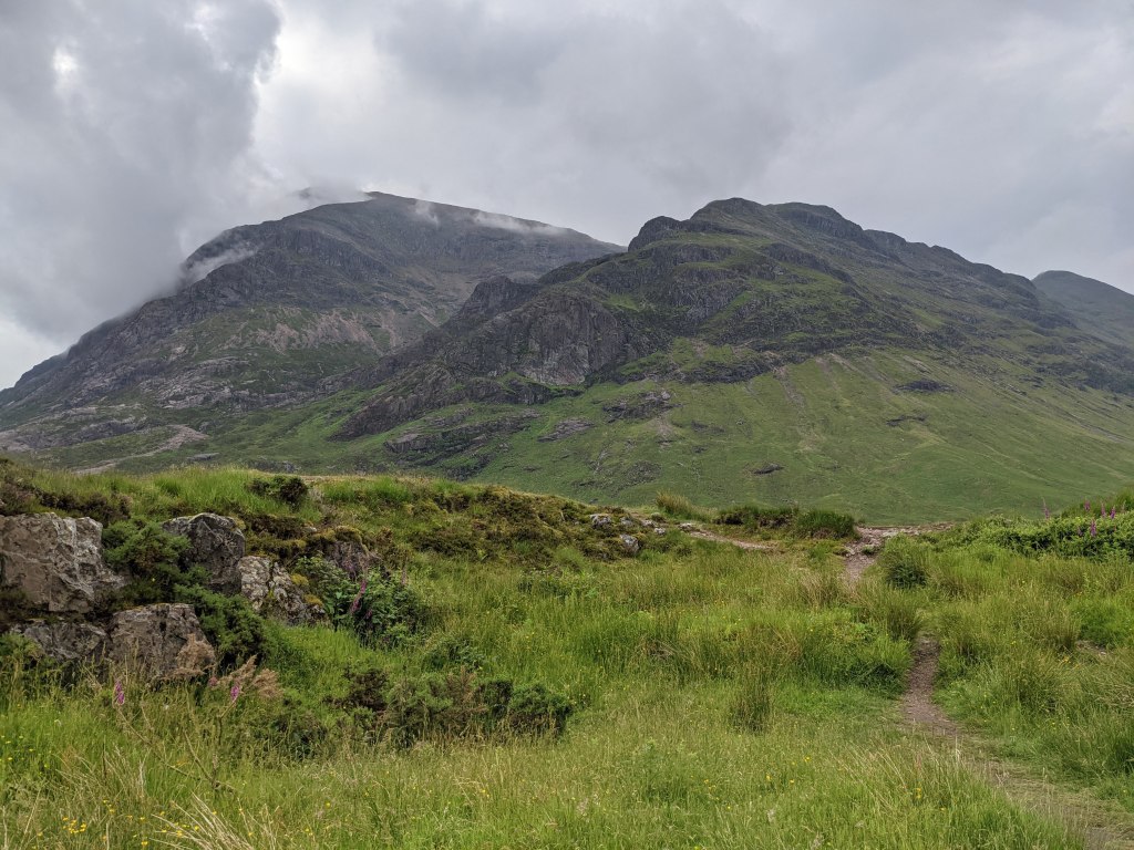
The good old Buachaille (pronounced boo-kill-a, although my family has always pronounced it “boo-kill”). The triangular-shaped mountain which sits majestically off to the side of the A82 and admired by many a passer-by en route to Glencoe. Including myself. I had often looked up at it and dreamed of the day I’d be climbing it. I’m not quite sure what took me so long, but on 4th July 2021 a message popped in to one of the group chats on my phone inviting me along the following weekend. A quick check of the diary and I was in!
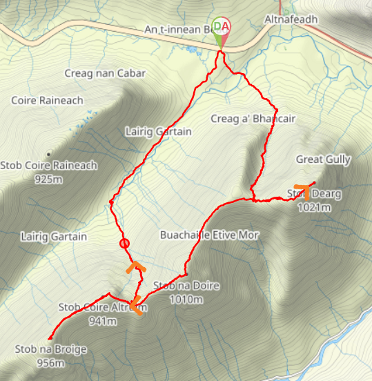
And so it was that on 11th July at 10am four of us arrived at Glencoe Viewpoint parking area. We had decided to meet there on the assumption that the “main” car park would be very busy on such a nice day (it was). There was also the added benefit of this meaning that the cars would be waiting for us at the end of the hike, avoiding a 1km walk along the A82 at the end of a long day.
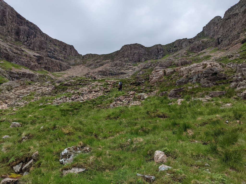
This would be the first time in ages that I’d be attempting such a strenuous mountain day. At one time in my life I was in the hills most weekends but I was more accustomed to low-level walks these days. My sister had done a few Munros in recent months and I knew that Jack, another member of the group, had done this very ridge walk only a few weeks earlier. I knew I’d be capable of doing it, but I was worried about my pace. As expected, I was at the back most of the way up the Coire, puffing and panting and taking frequent rest breaks, you know, “to take some photos”….. My lungs were definitely not handling this as well as they once might have.
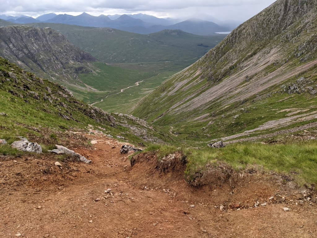
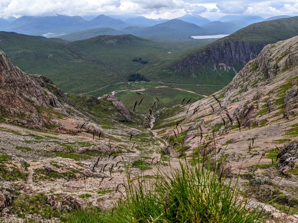
In my defence, the hike up the Coire na Tulaich was steep. The first section involved lots of scrambling and trying to figure out where exactly the “path” went. The issue was that the burn we were walking next to had completely dried out so it was difficult to distinguish burn from path. I have since read that this route is only really walkable in summer months, and I wonder if that is because with the burn in spate it is far too dangerous.
Somewhere mid-scramble Neil realised that his glasses were missing. We looked around the area we were at for a bit to no avail. We never did find them. We did remark on the irony of Neil working for a well-known optical retail chain… the plus side being that the very expensive pair of glasses he was leaving somewhere on the crags of the Coire na Tulaich would be replaced without too much stress. Still very annoying for him I’m sure!
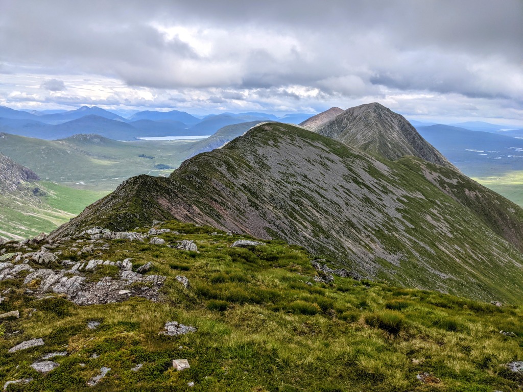
It was a hot day and the midges were biting. As we clambered up the loose scree towards the top of the coire, it was a relief to finally reach the ridge and find a bit of a breeze. The views were phenomenal in every direction.
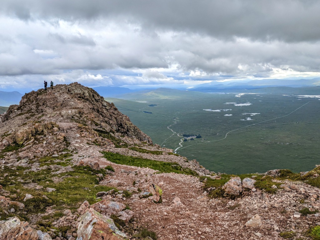
Our next move was to turn left/east and head along to our first summit Stob Dearg, nicknamed Mars by us due to it being completely covered in red rocks. Slightly disheartening was the realisation that although there are four summits on this ridge, all of them over 3000ft high, only two of them are classed as Munros. The other two are considered subsidiary tops since there is not enough elevation drop/gain between the Munro and these other tops to consider them Munros in their own right. On this ridge, the two Munros are the mountain tops at the furthest east and furtherst west points (Stob Dearg and Stob na Broige).
From the summit of Stob Dearg I was in awe of the view out across Rannoch Moor. I knew it was a huge expanse of wilderness, but from up here you got a true sense of just how vast and flat the area is compared to the mountainous terrain surrounding it. 50 square miles of boggy moorland stretching out as far as the eye could see. Did you know that Rannoch Moor was used as a filming location for the TV series Outlander??
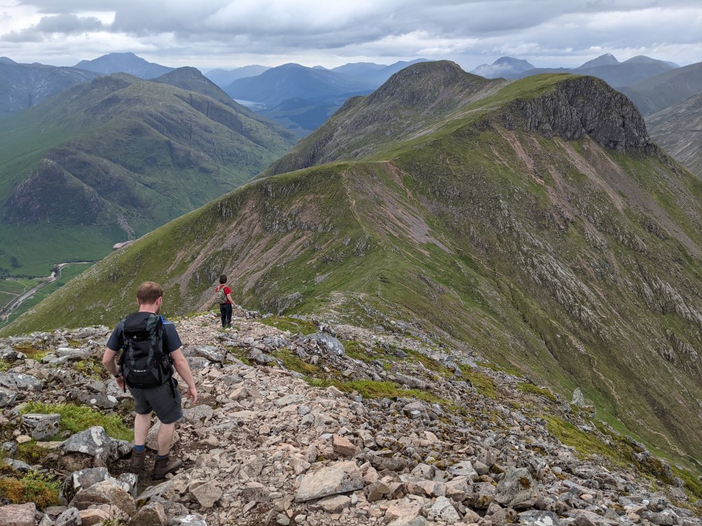
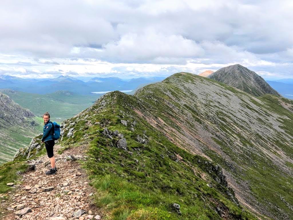
Once we were done admiring the views from Stob Dearg, we retraced our steps back to the top of Coire na Tulaich then continued along the ridge to Stob na Doire, Stob Coire Altruim and Stob na Broige. We were blessed with panormanic views across the highlands and a particular highlight for me was seeing the Aonach Eagach ridge in all its jagged glory from this height.
It was around this point that Jack’s brand-new-just-out-the-box boots started to hurt his feet and my sister and I insisted that the problem could be resolved if he borrowed a pair of our spare (thicker) socks. He was probably fed up listening to us going on about it and agreed. Unfortunately for Jack, my spare socks were pink….
From Stob na Broige we retraced our steps along the ridge to find the steep descent route down Coire Altruim.
The pay off was dipping our toes in to a burn when we reached the bottom. Admittedly the water was freeeeeezing! It almost certainly wasn’t actually freezing in July, but the temperature difference between my feet after a day in the hills and the water was enough to mean I couldn’t get further than a toe dip. Much admiration for Jack who managed to submerge both feet. Brrrr.
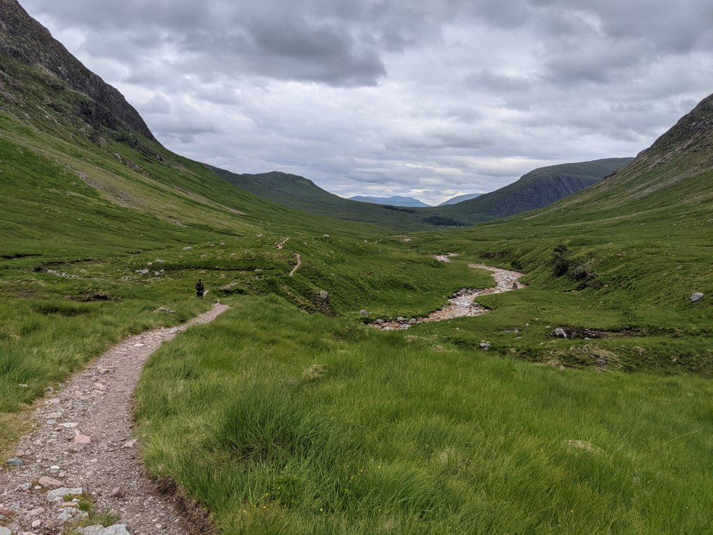
Feet refreshed, we began the walk out through Lairig Gartain. We were surrounded by beauty, but it did feel like a bit of a slog after 8 hours on the go. I was definitely ready to be back at the car.
And then the long drive home. A necessary evil.
93 photos later, I was home and waking up after a good nights rest. My body felt like I’d been hit by a bus and I had a million midge bites, but it was worth it.