TERRAIN: Grassy foreshore field, pebble and sandy beach, farm tracks, earth trails. Boggy underfoot at times. Gradual ascent to summit and more challenging descent due to less distinct and muddy path, which may become overgrown in summer months. Two gates to climb to reach summit trig point, 1 stile.
LIVESTOCK: Risk of cows on Goldenberry Hill and hill access track
![]() Public car park at Portencross (KA23 9QA). No public transport to start point. Closest train station is in West Kilbride which is 2.3 miles away. Local bus service to A78 which is 1.7 miles away.
Public car park at Portencross (KA23 9QA). No public transport to start point. Closest train station is in West Kilbride which is 2.3 miles away. Local bus service to A78 which is 1.7 miles away.
View Full Route Description
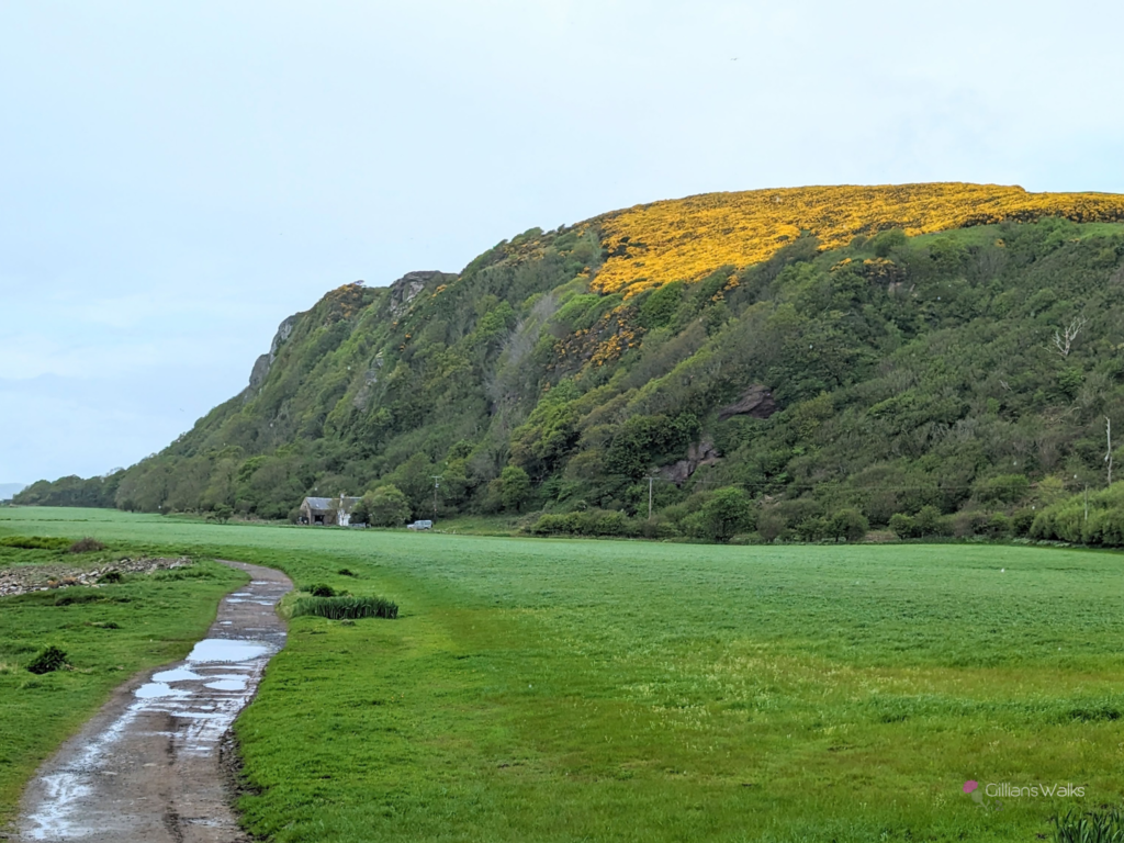
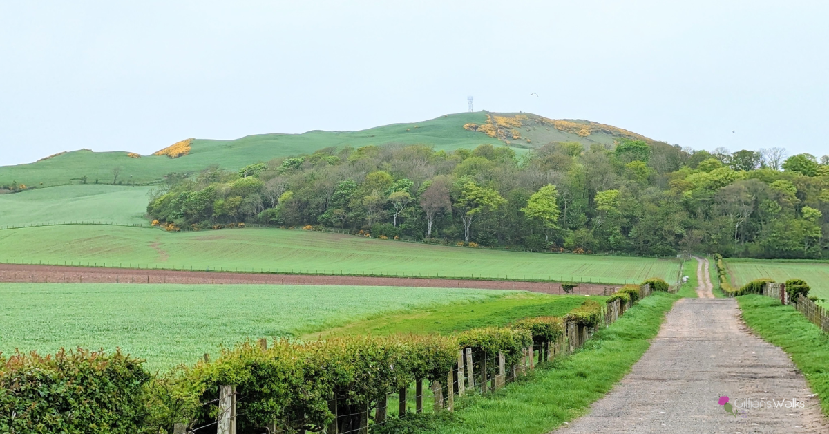
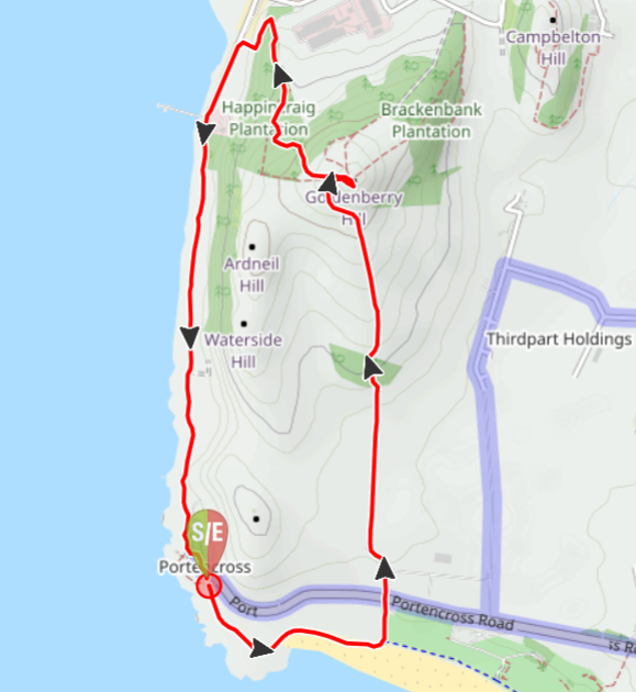
From the south end of Portencross car park go through the kissing gate onto a field and follow the path across the grass to another kissing gate. This leads down onto Ardneil Bay. Walk round the bay for approx 0.3 miles, looking out for a sign post on your left “Portencross Road”. Follow this track to pass Kirkfield House, cross over Portencross Road and continue ahead along the access road for Ardneil Farm. Pass through the farmyard and onto a gravel track with Goldenberry Hill now visible ahead. The track leads you through a small woodland then back out onto open hillside. There is a gate across the track which is often closed and padlocked and needs to be climbed. The track then veers left around the hillside and up towards a mast. From here, the summit trig point and cairn can be reached by climbing an old metal gate. You can either descend via the same route (3.5 miles) or take the more challenging route back down to form a circular walk (3.8 miles). For the circular walk, follow a faint path in a W direction from the trig point, following a stone wall downhill. When you meet up with a fenceline at the trees, pass through an old wooden gate into the woods. Follow an indistinct and muddy path as it zig zags downhill through the trees. Hunterston Power Station eventually comes into view ahead, and on reaching the boundary fence the trail takes a sharp left turn to follow the direction of the fence downhill towards a car park. At the bottom of the hill when you reach a gate, turn left to continue through the woods. The trail now runs along the base of the cliffs for approx 200m, leading to a stile which you should cross to reach Power Station Road. Turn left and walk along the road, which soon becomes a grassy path. You will reach Portencross Castle after 1.5 miles. Turn left to reach Portencross Road. The car park is a short walk along to the right.
WALK REPORT: 5th January 2019 & 10th May 2023
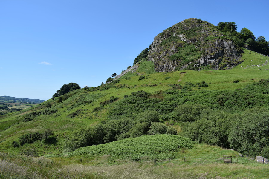
I was first at the top of Goldenberry Hill back in 2019 when I co-led a “New Year” group walk on 5th January. As I returned 4 years later my memory of the route was hazy but the images I did hold were of wide farm tracks all the way to the top and a farm gate which had to be climbed. It turned out that not a lot had changed in that time! That day we did a “there & back” route but on my second visit I was keen to check out a circular option, and that is the route I have chosen to feature in this report.
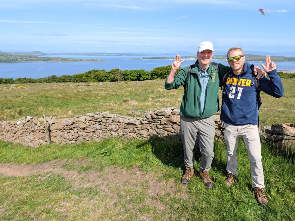
The reason for my return was that I had been booked by a father and son duo from the USA who were coming to the area to walk in the footsteps of their ancestors – the Boyds. We had agreed a guided walk route from Portencross to Goldenberry Hill, which was an important site during the Battle of Largs in which the Boyd’s played a pivotal role.
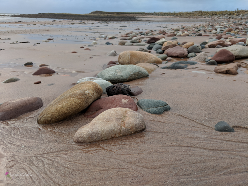
Walking along Adrneil Bay to kick things off is always such a pleasure. The pink sands and the expansive views across to the Isle of Arran – did you know that Portencross is the closest point on the mainland to Arran? Go on a clear day and you can see every detail on the island!
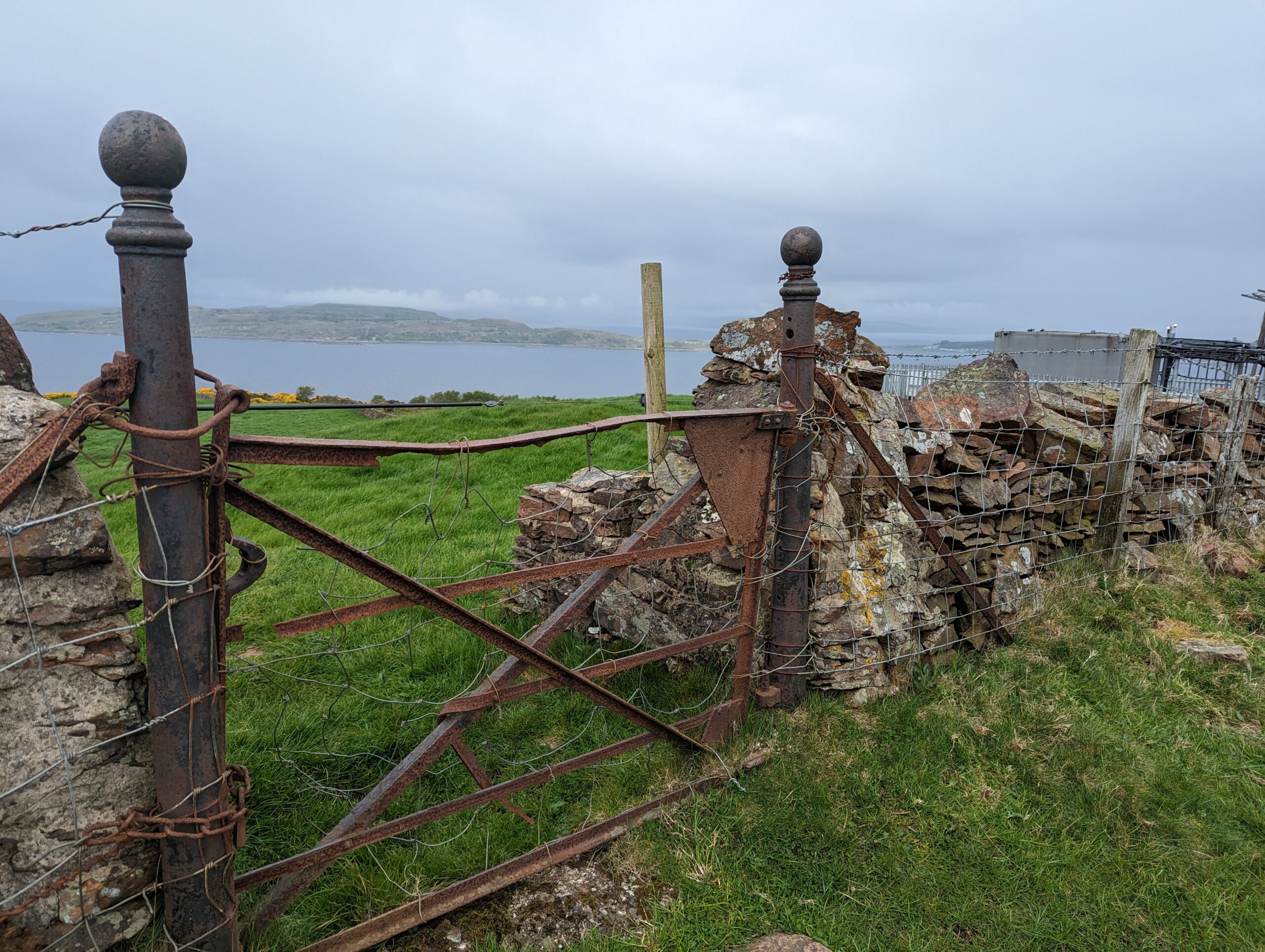
There are actually two gates to climb on this walk – the farm gate mentioned already and also a smaller, very old iron gate at the summit which leads to the trig point and cairn. There can often be cows close to the summit too: when I arrived with my American guests they were right beside the path, just beyond the farm gate… fortunately they weren’t interested in us and moved away as we approached. Phew!
There were several path options shown on my map for a possible descent, but they all seemed to stop in the middle of nowhere. Once onsite I could see that there were cows to the NE so I chose to go W instead, following a faint path towards the trees. I arrived at another old gate held closed by a piece of rope – the whole fence moved when I opened it! I carefully tied it back up once on the other side and started off down the hillside.
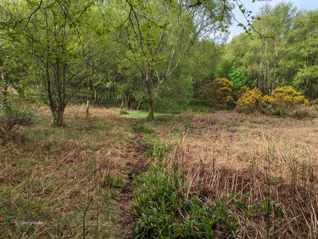
A path was visible most of the time, however I noticed that it was made from very soft peat-like mud which might be slippery when wet, particularly on the steeper sections. I remember thinking it would be good for the garden! The trail also looked like it might become overgrown during the summer months. I would recommend downloading the route to your mobile using the button above if you want to try the circular option, because the trail isn’t all that obvious at times.
To my delight after a steep descent beside Hunterston Power Station, the path led us along the base of some wooded cliffs to a stile. This gave us access to Power Station Rd for an easy walk back along to Portencross.
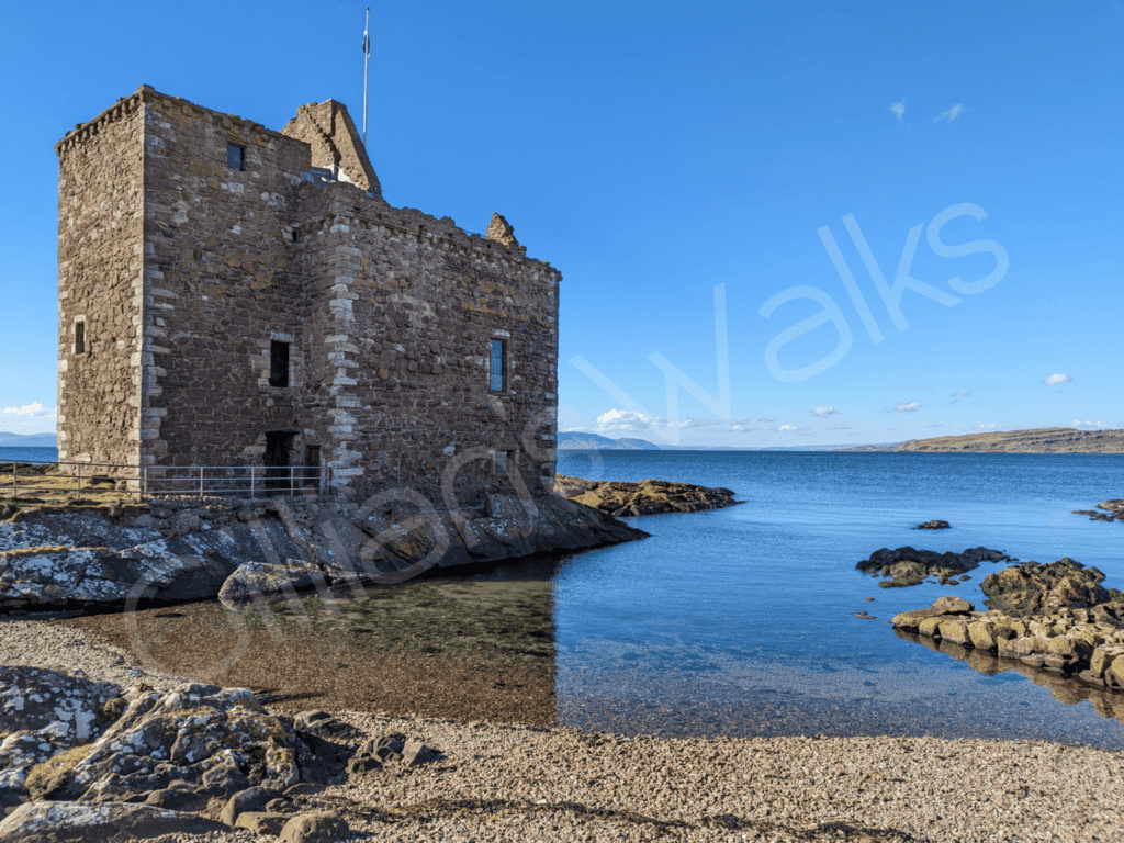
Walking this route in an anti-clockwise direction leaves Portencross Castle and it’s pretty harbour for the end. If you are fortunate enough to be there on a weekend, be sure to visit inside the castle: full of local history and the views from the rooftop are spectacular!
IMAGE GALLERY