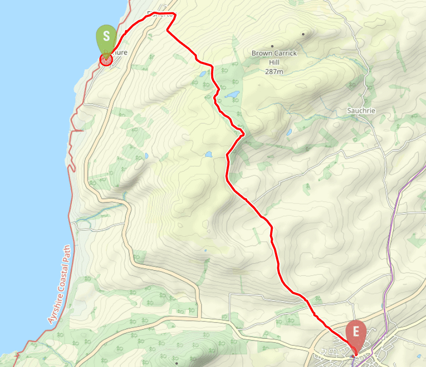
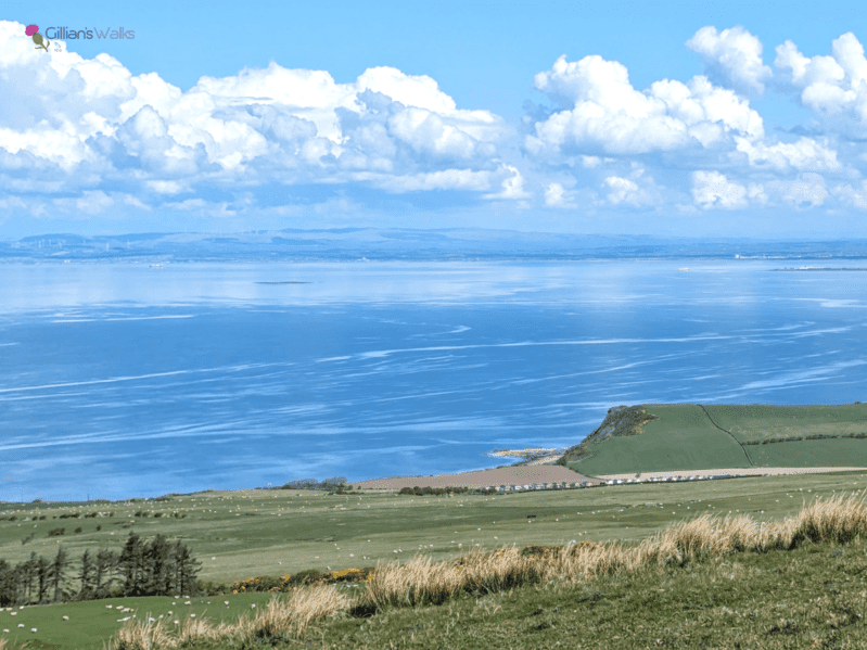
On a clear day I recommend adding in a short de-tour to the summit of Brown Carrick Hill (287m), for stunning views all along the Ayrshire coastline. There is also an optional short de-tour to an idyllic loch, signposted within the forest section. See route information below.
TERRAIN: Varied with a mixture of roadside pavements, surfaced roads, gravel tracks, boggy forestry trails and moorland where the path is indistinct. Several stiles and some relatively steep hills. Good way-marking in place.
Livestock is often present on this route.
![]() GETTING THERE: Frequent bus services to Dunure from Ayr. Car parking available at Kennedy Park or on-street within the village. The walk finishes at Maybole train station from which there are also frequent bus services. Small car park at Maybole train station or on-street around Greenside Park.
GETTING THERE: Frequent bus services to Dunure from Ayr. Car parking available at Kennedy Park or on-street within the village. The walk finishes at Maybole train station from which there are also frequent bus services. Small car park at Maybole train station or on-street around Greenside Park.
View full route description
Starting from the entrance to Kennedy Park, Dunure, head along Castle Road in the direction of the harbour. Castle Road takes you uphill and out of Dunure, through the village of Fisherton. Cross the Ayr Rd/A719 carefully and take the track to the right of Fisherton Primary, signposted ‘Hill Path to Maybole 7 miles’.
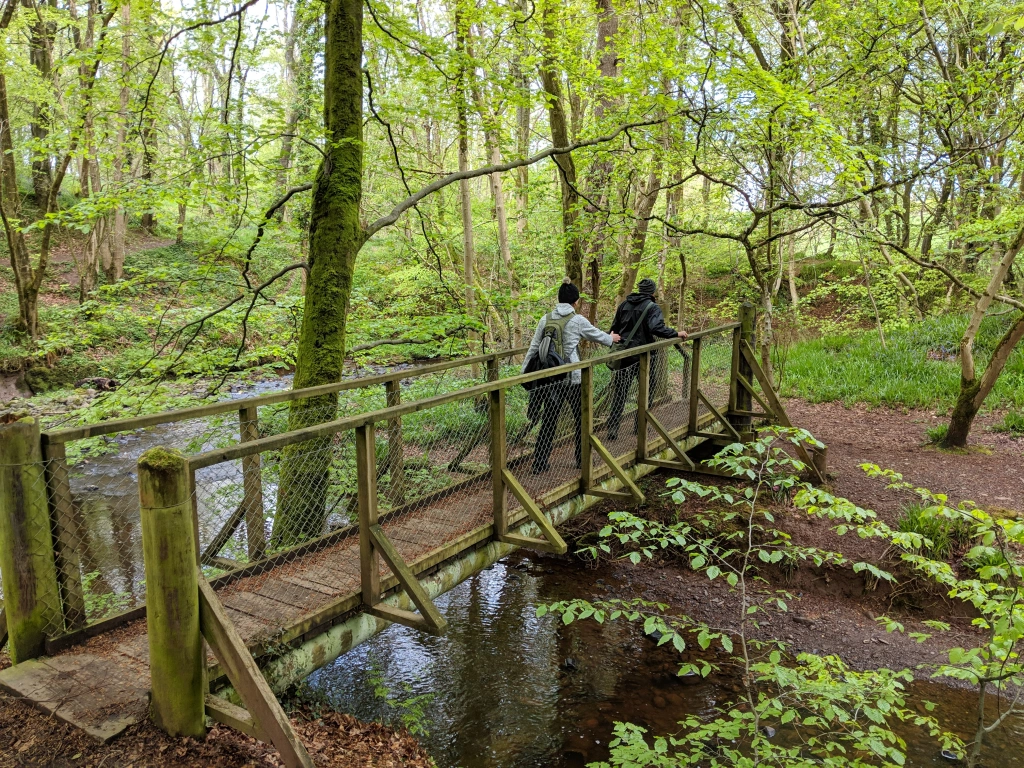
After 270m at a path junction turn right onto a gravel track. Before reaching Dunduff Farm turn left to start walking uphill again. There are a couple of stiles to cross as you ascend.
On reaching a small fishing loch 1km up the hill, the path forks. [Optional de-tour to Brown Carrick Hill – follow the directions here to the summit trig point, returning via the same route.] Turn right here, going over a stile and onto a forestry track signposted ‘Dunduff‘.
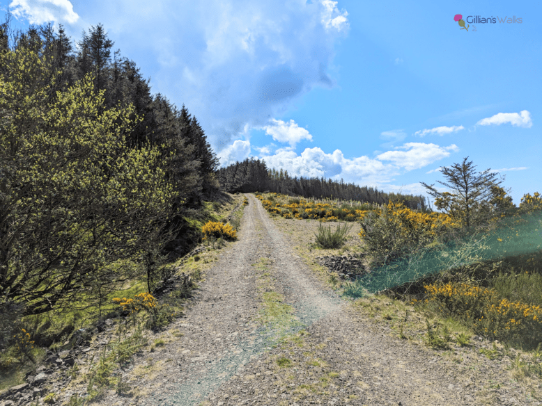
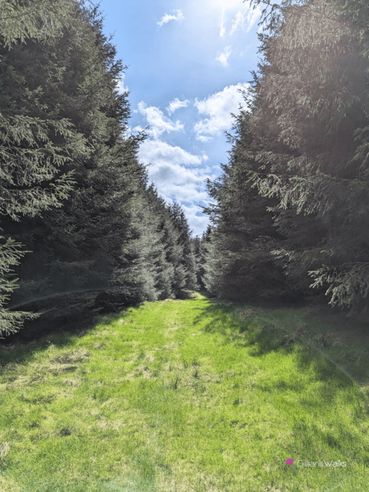
You will reach a large 3-way finger post approx 500m into the forest. Turn right, signposted ‘Maybole’ [the short de-tour to the loch is also very worthwhile!]. Continue along a pleasant forestry track for just over 1km to emerge out of the trees at a deer fence. Turn right here, signposted ‘Maybole’.
Follow the deer fence along to a gate. Beyond the gate you will be walking between two fence lines across the grassy moorland – there is a narrow trail but it can be quite wet underfoot.
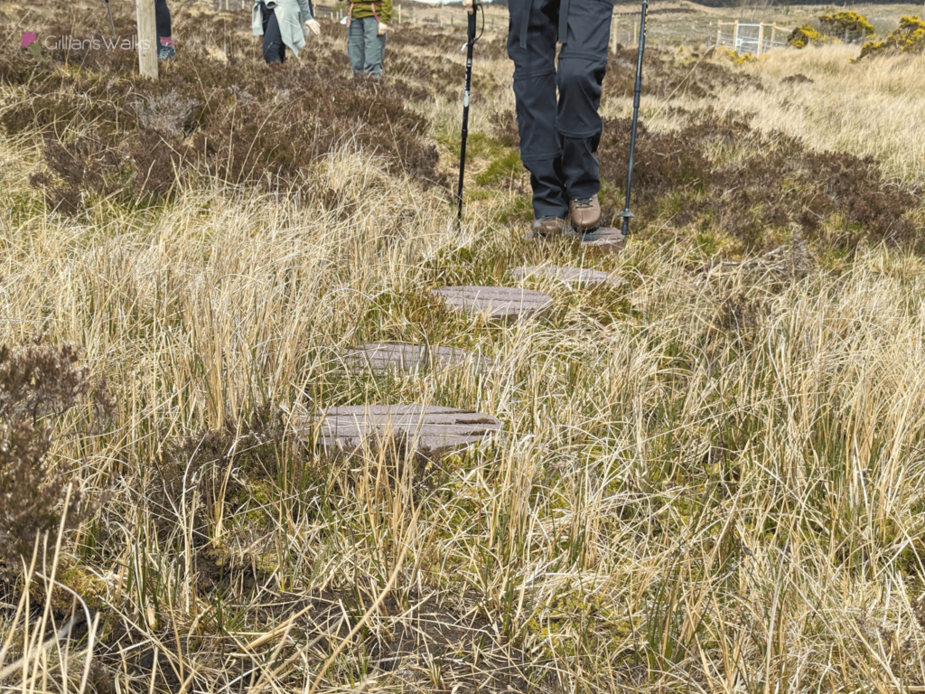
You will come to another gate and a stile. Beyond this there isn’t really a path however there are marker posts every now and then and ‘stepping stones’ to help you across the boggy terrain – follow these and you will find your way across the field. Keep fairly close to the fenceline on your left and you will emerge at a gate and stile at the edge of the forest (marked ‘waterfall’ on the OS map). The ground can be very muddy here.
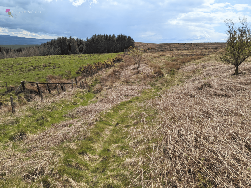
The route then passes through an area of gorse bushes – keep the fenceline on your left whilst crossing some tussocky grassland. After approx 400m you will emerge at a stile leading to a minor road.
Keep right to walk downhill on this pleasant single track road, part of the National Cycle Network. At a crossroads, continue straight ahead. The road eventually crosses the Maybole by-pass on a flyover before leading onto a residential street – Gardenrose Path.
The train station is located at the end of this street. To reach it, cross Cargill Rd and turn right. There is gap in the wall on your left which leads to a bridge across the railway and down onto Culzean Road, opposite Greenside park.
WALK REPORT – 27th April 2024
‘One day‘ I told myself, I need to see where that goes. Ever since spotting the ‘Maybole via hill path’ marker post in Dunure many years ago, this route had been on my ‘to walk’ list. And it moved closer to the top each time I walked my Brown Carrick Hill route. I’d heard that it wasn’t in the best condition so it needed to wait for a day I was feeling like an adventure, and had transport back from Maybole.
Fast forward to 18th March 2024 and this popped up on my Facebook feed….

Oooh, interesting! No better time to give it a bash then!
And so it was that one very fine day a month later I was heading out there with some ladies I’d met during my Ayrshire Coastal Path Discovery Series. We got on so well during those 12 months that we decided to form a walking club afterwards so that we could continue to go on some adventures together. For this, our inaugural walk, I had pre-warned them to expect bogs and lots of hills!
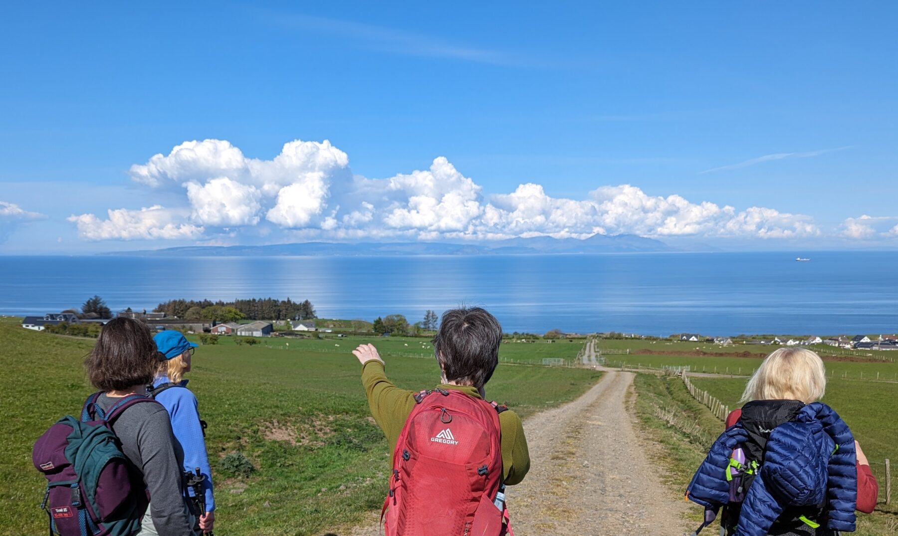
We couldn’t believe our luck with the mild, sunny weather and crystal clear visibility we had been blessed with. Every detail on the Isle of Arran was visible and we stopped many times to gaze over the glass-like Firth of Clyde. ‘How lucky are we, to live in a place like this?‘
Since conditions were so favourable, a de-tour to the Brown Carrick Hill trig point proved irresistible. I had been up there before on a day like this and had been in complete awe of my surroundings. I promised the others that the additional 2kms, dodgy stile crossing (twice) and small section of felled trees (twice) would be worth it…..
Feeling surprisingly chilly up here in the April breeze, we resisted the temptation to have an early lunch here in favour of getting back onto the planned route and hopefully finding somewhere equally as beautiful along the way.
And so it was onto unfamiliar territory for me now – how exciting! The walk up through the forest was lovely. Flowering gorse lined the track and filled the air with coconut. So far, no bogs….
We soon arrived at the first of the new 3-way marker-posts referred to in the Facebook post which had lured me here. Dunure in one direction, Maybole in the other, and…. what’s this….? ‘Loch‘ in the other direction… oooh that could be interesting. Checking my map I could see it was a mere hop, skip and jump from our location so definitely worth going to see. The group laughed, remarking on how my promised 7 mile walk was slowly extending to more like 10, and egged on by my mum, who wasn’t in the least bit surprised by my antics. She was well used to accompanying me on these types of research walks where curiosity usually gets the better of me!
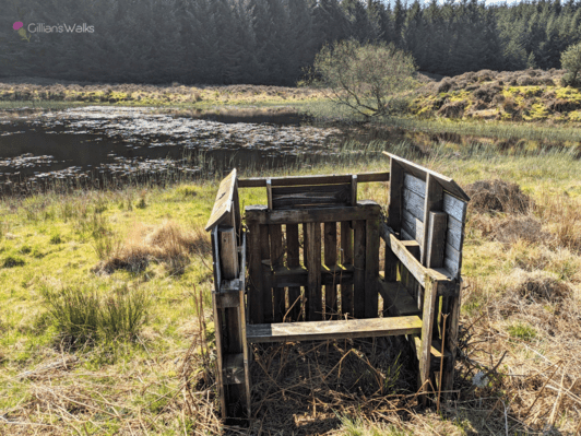
Well, what we found was nothing short of idyllic: a beautiful, peaceful spot. We decided to stop for lunch there beside the loch and enjoyed a blissful half hour or so soaking up the calm. Small dragonflies danced around us whilst pond-skaters made ripples on the water. How odd, we thought, that there is no bird life on the pond; it seemed like the perfect place for them. We did eventually spot a pair of Mallards through binoculars over at the other side of the loch in the reeds. Perhaps they are hiding from us, we wondered. Well it turns out that we were probably right, because all around us were small wooden hides built for duck shooting!
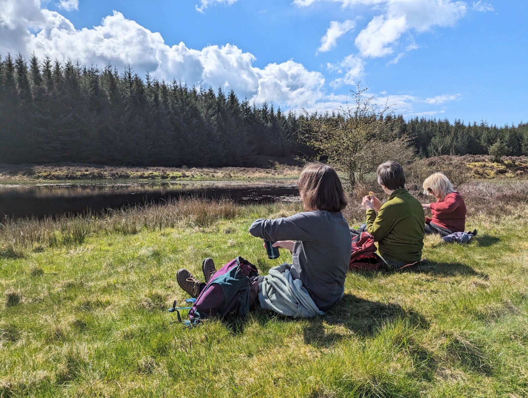
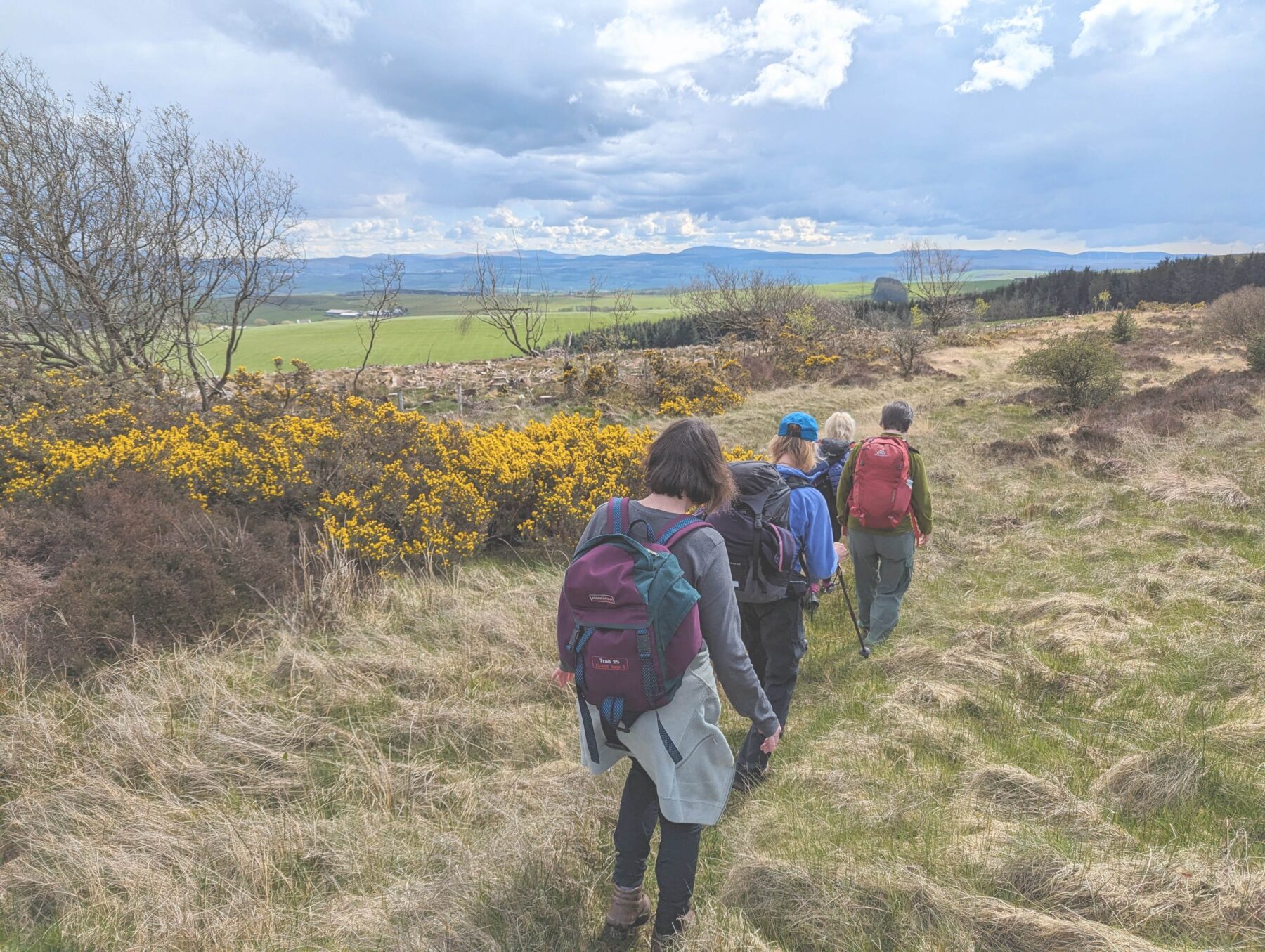
Much as we could have sat there all day, we peeled ourselves away to explore the rest of the trail. More very pleasant forestry tracks awaited – definitely boggier from this point onwards, but nothing we couldn’t handle with a bit of careful foot placement.
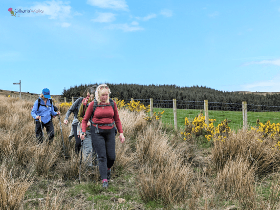
Before long we emerged out of the forest and onto the moorland section of the walk. Such variety! Plenty of signage reassured us that we were on the correct route which was important during this stage since the ‘path’ is much less obvious. Nothing plenty of boots on the ground won’t fix, so hopefully the route will become popular enough for a better trampled path to result.
Through a couple of gates in a new deer fence and over a stile, and we were out onto a moorland field with cows in it. I had been keeping an eye on them from quite a way back and they hadn’t moved, although they had been keeping an eye on us too! Cautiously we hurried past, hopping over the innovative ‘stepping stones’ which had been placed over the worst of the boggy ground.
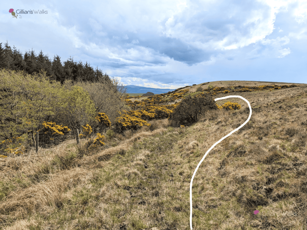
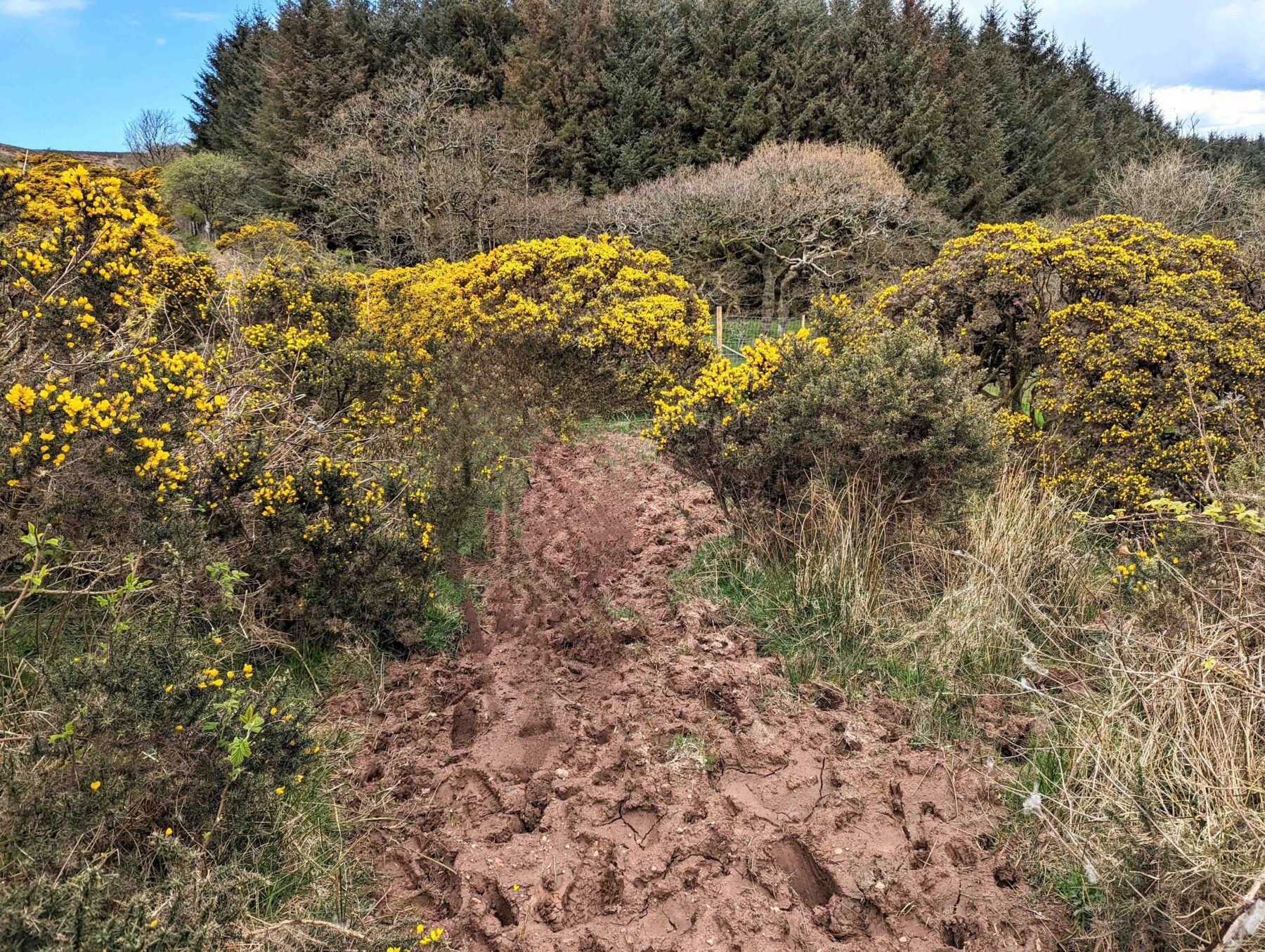
These, and some wooden marker posts with red discs on them, kept us right – without them it would have been a tricky section to navigate. What seemed like it might be a path ended up veering off into the middle of some Gorse bushes and some very deep looking mud…. Nope, not that way then… I went off up the hillside a little to see if there was a way around the Gorse, making sure to stay far enough away from the cows. ‘Gilllliaaaaaannnnn‘ – I heard someone shout my name from back down by the Gorse bushes. Uh oh…. please don’t tell me someone has fallen and hurt themselves, we are in the middle of nowhere. Maybe they are just wondering where I am…. I went back to investigate and indeed someone had slipped in the deep-looking mud but thankfully were none the worse for the incident aside from two muddy knees! Looking to my right I then saw two of the ladies emerging from a Gorse jungle with bits of it stuck in their hair. Can’t leave them alone for two minutes 😉
At the other side of the field was a gate which we were glad to reach because it took us away from the cows. The ground around the gate was covered in thick clay-like mud which had thankfully dried out enough to stand on without sinking in. I can imagine it being an unwelcome sight on a wet day!
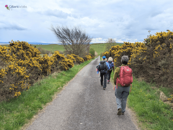
Emerging out of that short but tricky section we were again reassured by some marker posts. We picked our way through some tussocky grass to reach a final stile leading to a pleasant surfaced road. Part of the National Cycle Network, the road is quiet and very scenic. As we walked along we kept expecting to see Maybole appear at the brow of every hill, but it didn’t do so until we were almost there! Just shows how high up we had been and also how sheltered Maybole is by the surrounding hills.
We arrived into Maybole with precisely 5 minutes to spare for those who were taking the bus back to Ayr: perfect timing some might say (a fluke!). A great day out was had by all – quite the adventure and always nice to try a new route that is right on your doorstep!