TERRAIN: Graded moderate. Surfaced roads and pavements, grassy track, narrow woodland trails, boardwalk. There is one set of steps down to the riverside (with handrail). The riverside trail starts off easy enough but becomes more challenging as you progress, with a narrowing path (very close to the river), boardwalk in a poor state of repair and a very steep ascent back to the road (with rope!). Some parts of the riverside trail can become overgrown during the summer months. One gate. No stiles.
![]() Car parking available at Craigiemains Garden Centre, Ballantrae (free) – however please check opening times as the gates will be closed shortly after! Another option is Foreland car park at the southern end of the village (free). Local bus services stop on Main Street Ballantrae. Closest train station is Girvan, 13 miles north.
Car parking available at Craigiemains Garden Centre, Ballantrae (free) – however please check opening times as the gates will be closed shortly after! Another option is Foreland car park at the southern end of the village (free). Local bus services stop on Main Street Ballantrae. Closest train station is Girvan, 13 miles north.
![]() Public toilets are at Foreland car park (free) and customer toilets at Craigiemains Garden Centre or the Kings Arms, both on Main Street.
Public toilets are at Foreland car park (free) and customer toilets at Craigiemains Garden Centre or the Kings Arms, both on Main Street.
![]() Dog-friendly route. You might prefer to go out and back via the riverside route to avoid the road.
Dog-friendly route. You might prefer to go out and back via the riverside route to avoid the road.
View full route description
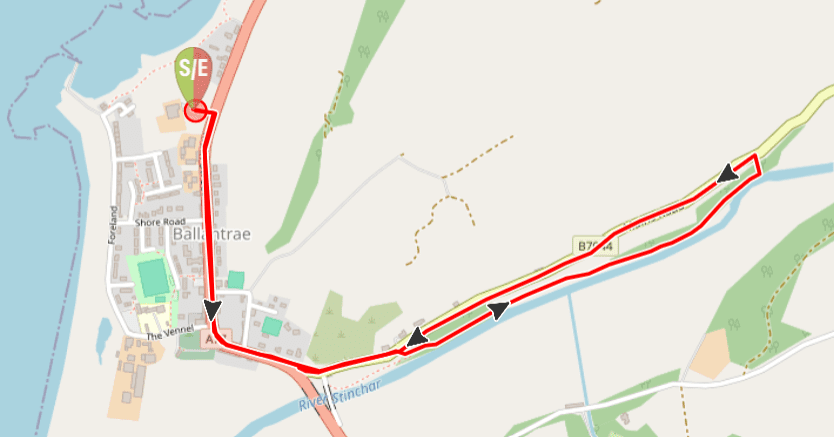
Leave Craigiemains Garden Centre via the main exit and turn right to walk along Ballantrae’s Main Street for approx half a mile. Before crossing the River Stinchar, at the war memorial, turn left onto B7044 / Mains Road.
Approximately 100m along the road, opposite the property called Windyknowe, look for the wooden access gate to the riverside walk on your right. There is a marker post here but at the time of writing it was obscured by vegetation. Go down the wooden steps to the riverside then turn left along the wide grassy embankment.
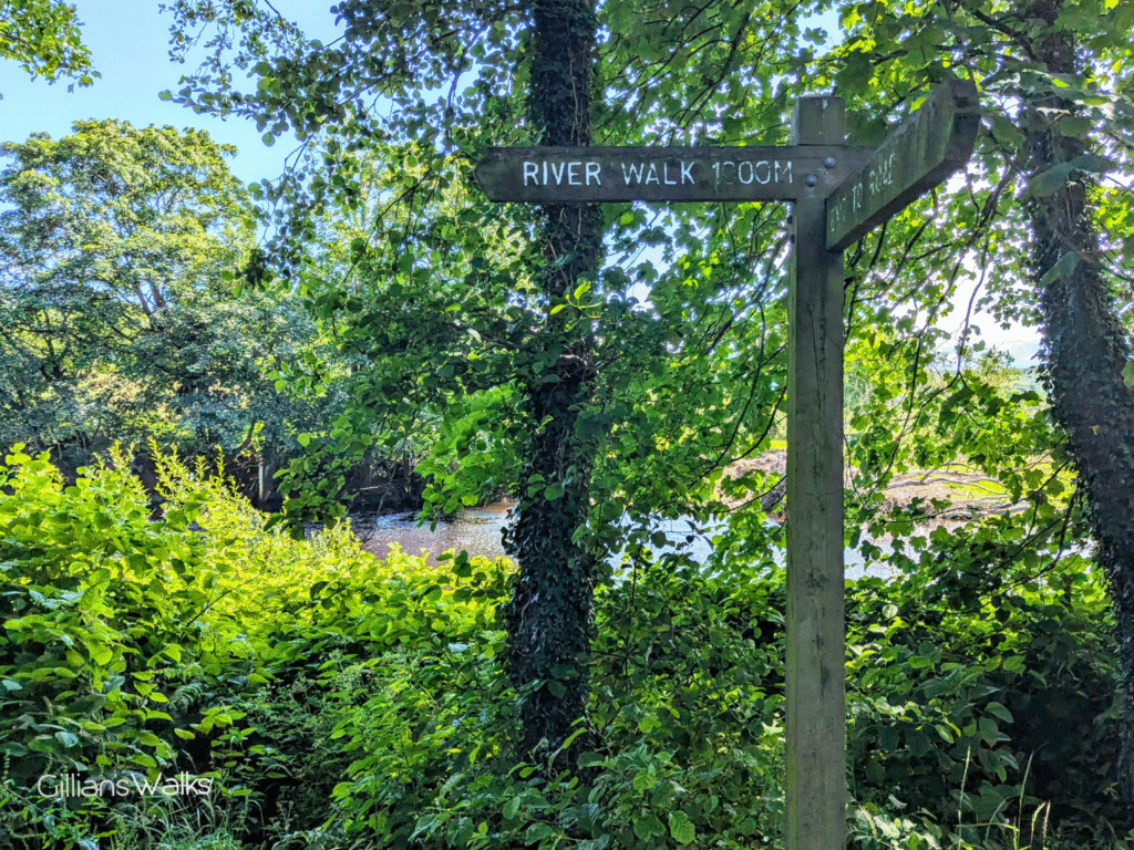
Approx half a mile along, just beyond a wooden bench and field access gate, the wide grassy track ends however continue along the river picking up a narrow trail through the trees. This trail becomes increasingly narrower and closer to the river, emerging at a tall wooden marker post. Turn left here (sign says ‘Exit to Road’) up a short but extremely steep hill leading to the B7044.
Turn left to walk along the B7044 back to the war memorial and then turn right to follow the A77 back to Craigiemains Garden Centre.
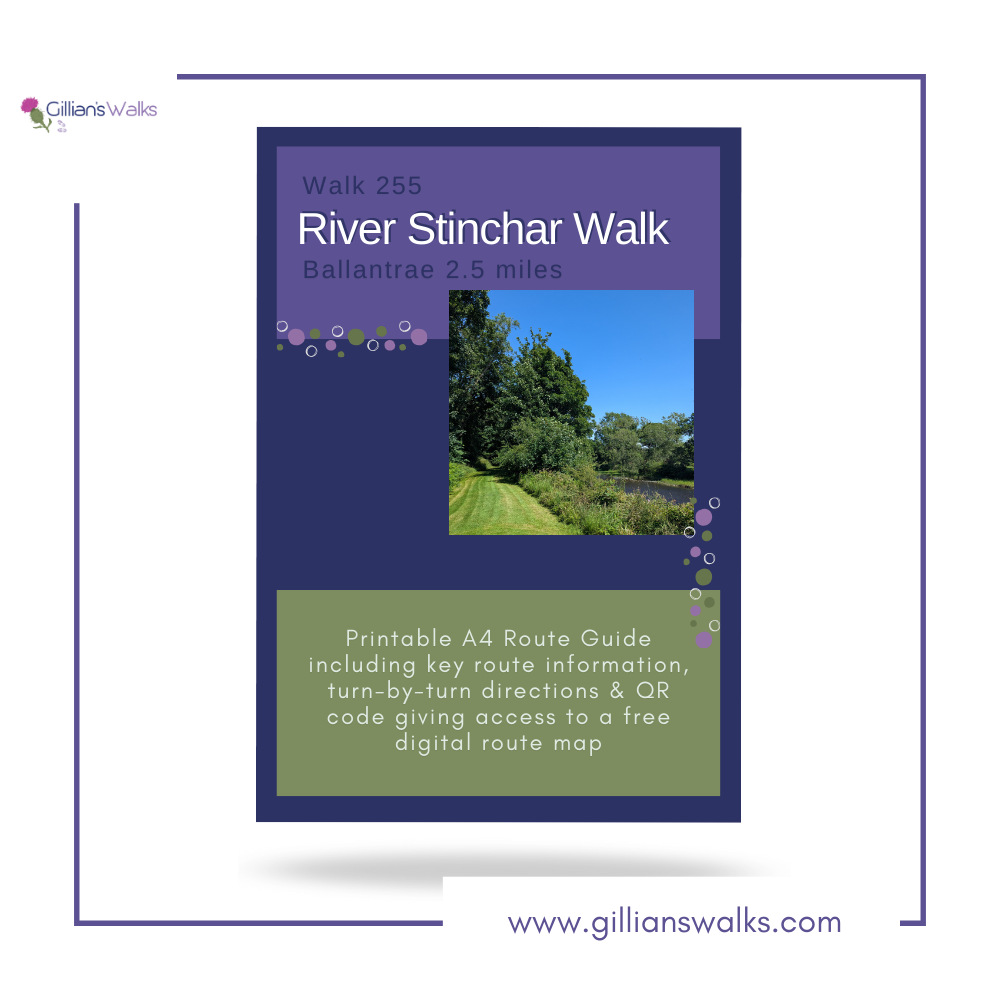
Printable Route Guide – River Stinchar Walk Ballantrae
Download, Print, Go! This PDF Route Guide has been carefully designed to allow you to easily print a copy of the key information for this route on an A4 page to take with you on the walk. Perfect for offline use!
Walk Report: 2nd July 2025
Well well well, what a surprise this little walk was! From the walk title ‘River Stinchar Walk’, I was expecting a gentle amble along the river; an easy peasy couple of miles. It turns out we were out for a bit more of an adventure than that! A good adventure, just an unexpected one, and likely not for everyone!
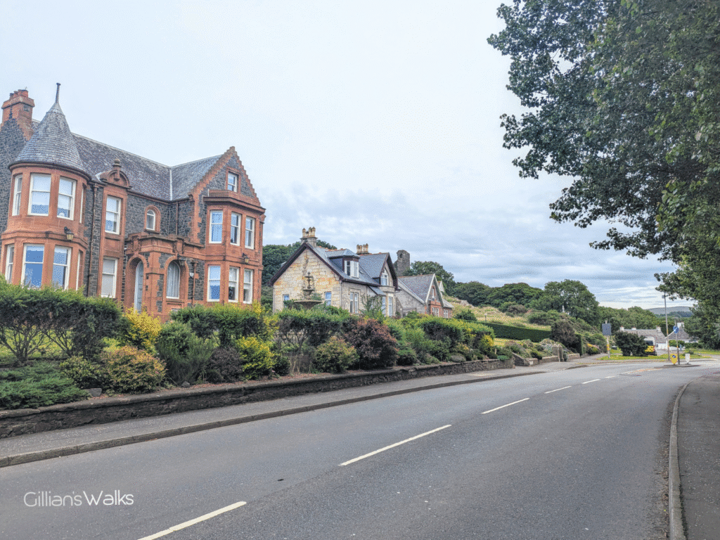
But let’s start from the beginning. Wandering along Ballantrae’s Main Street from the Garden Centre we admired the properties, noted a couple of shops to check out later, and gave our little Airbnb a wave on the way past. The road was either super quiet or mega busy, with traffic coming and going in waves, including lorries and coaches presumably heading to/from the ferry at Cairnryan.
We stopped in at the old cemetery to take a look at the Kennedy Mausoleum, containing the tombs of Gilbert Kennedy of Bargany and his wife Jean Stewart (Lady Bargany). Gilbert was only 25 when he was murdered in the early 1600s, the victim of an inter-clan rivalry. He was literally stabbed in the back by his own family…!
Across the road we admired what’s left of Ardstinchar Castle up on the hillside – former residence of Gilbert Kennedy and Jean Stewart. There is no access to it but you get a decent view of the ruins from the roadside. We also spent some time at the war memorial, which is accessed via some steps. On the base of it were dozens of pebbles with red poppies painted on them.
So much to see and we hadn’t even reached the river yet!
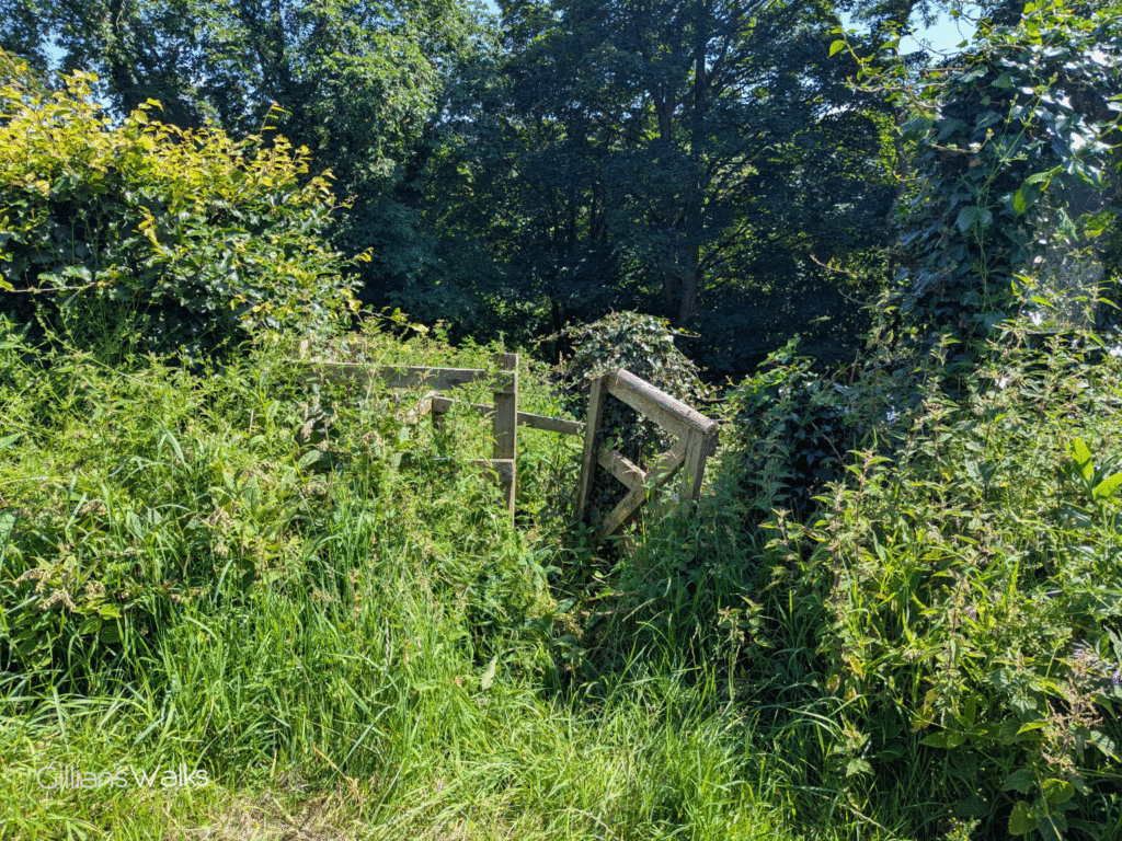
We had a bit of trouble finding the start of the river walk, which I had expected because I’d tried to find it in the past and failed! Our instructions said there should be a sign and steps leading to the riverside but we couldn’t see them. I put the boys on lookout duty and after some closer inspection there it was: the infamous wooden marker post had been there all along, almost completely obscured by ivy. Approaching the gate I was a little worried the route down to the river might be overgrown with nettles however we managed through and carefully made our way down the steps.

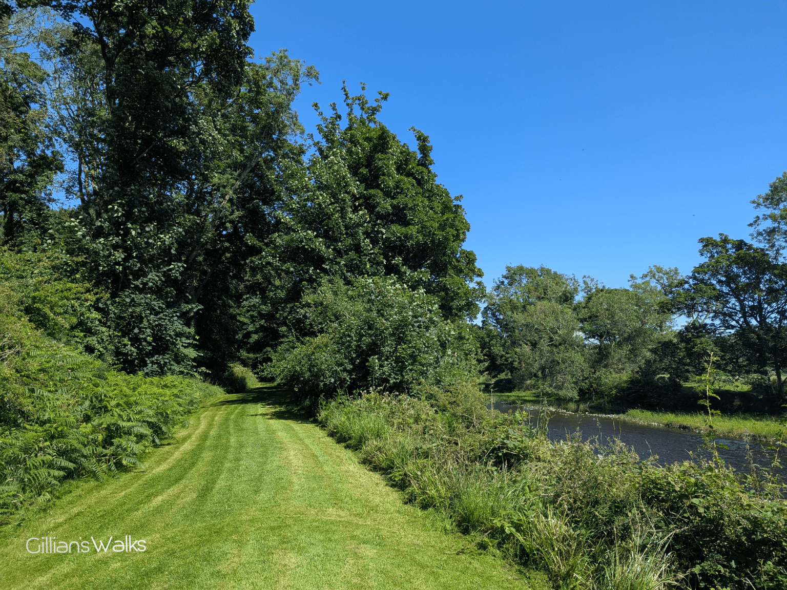
We were immediately impressed with the River Walk! In stark contrast to the overgrown steps, gate and sign at the roadside, we had all of a sudden arrived onto a perfectly mown, lawn-like grassy riverbank! It took us about three seconds to realise that there was a man actually going back and forth across it on a sit-on mower right now. Talk about good timing 😉 Wow, this was just beautiful and we couldn’t wait to explore more.
It was really pleasant down by the river. Peaceful. The warm sunshine surely played a part. ‘Gran would love this‘, I said to the boys.

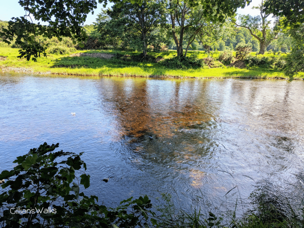
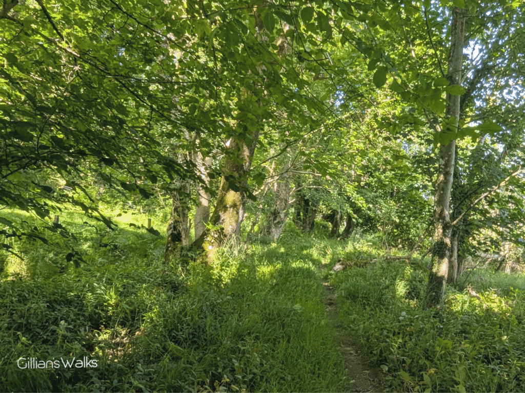
The grass started to get a little longer as we progressed, but nothing major, and we were sure that the man would be along with his mower shortly. We reached a bench, and beyond this the wide track seemed to stop abruptly. At first it wasn’t clear where we were supposed to go next. I knew from the walks leaflet that we were looking for a “fairly steep climb” back up to the road, but I wasn’t sure how far along the river that was. We found a narrow trail in the trees and decided to follow it to see where it led.
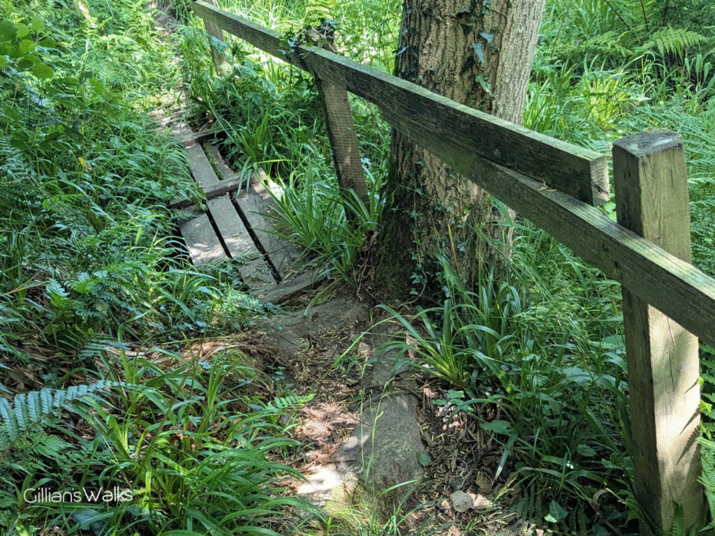
We soon came to a short section of narrow boardwalk with a handrail: a good sign that we were still on the intended route. Beyond this though, the trail became wilder with long vegetation hiding the path and we seemed to be tip-toeing at the very edge of the river. This can’t be right, we thought. It was just so different to the first part of the river walk it was difficult to see how it could be part of the same route.
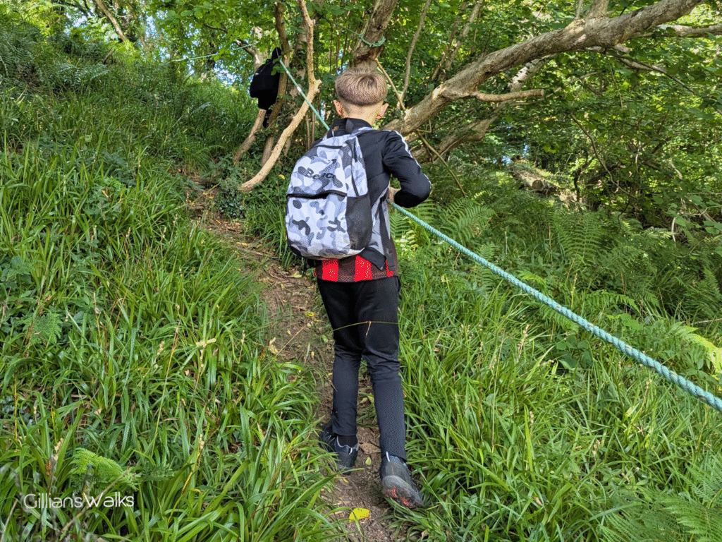
We persisted, more out of curiosity than anything else, and out of the blue there it was: a tall wooden marker post (in excellent condition I should add) pointing up a steep hill with ‘Exit to Road’ carved into it. Yay!
But wait… what’s this? A rope?! There was a rope tied around the marker post, and then attached to several trees, creating a makeshift ‘bannister’ all the way from the bottom to the top of the steep wooded hillside. Ooft, imagine if Gran was here! It certainly made it easier to climb the slope, and the kids of course thought it was the best thing ever. I thought back to the walk name, ‘River Stinchar Walk’ and my assumption that it would be a gentle amble, easy peasy. Ha, maybe not so much. Definitely an adventure!
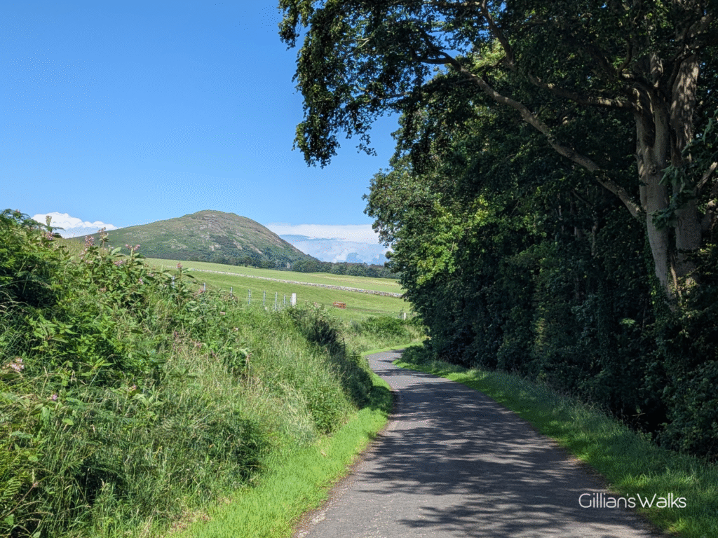
What was easy peasy though was the gentle amble back along the road to Ballantrae! Before you set off though, take a look to your right for a lovely view to Knockdolian Hill. Another walk, for a different day!
THIS ROUTE GUIDE WAS COMMISSIONED BY THE BALLANTRAE TRUST, WITH FUNDING FROM BALLANTRAE COMMUNITY COUNCIL. ALL OPINIONS AND PHOTOS ARE MY OWN.