![]() Buggy-friendly walk
Buggy-friendly walk
![]() Dog-friendly walk
Dog-friendly walk
![]() Parking available on Holmston Road – there are a few spaces on the road opposite Ayr cemetery. There are also bus stops on Holmston Road close to the start point. Ayr train station is half a mile away.
Parking available on Holmston Road – there are a few spaces on the road opposite Ayr cemetery. There are also bus stops on Holmston Road close to the start point. Ayr train station is half a mile away.
View full route description
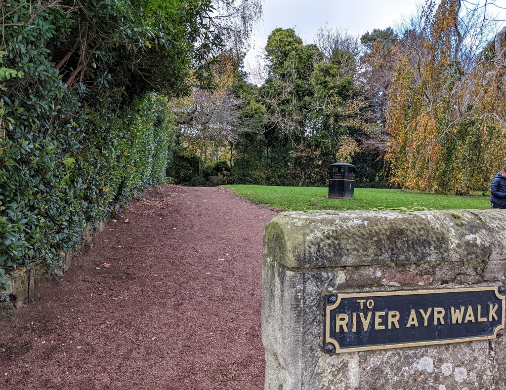
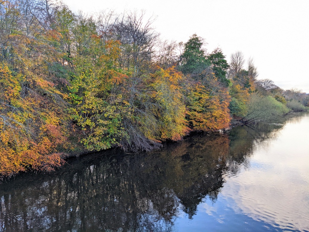
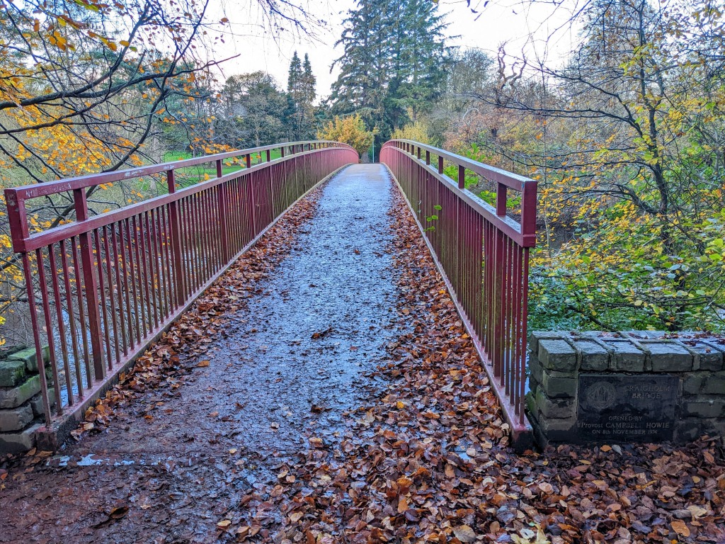
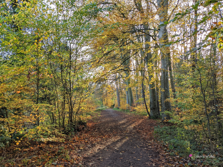
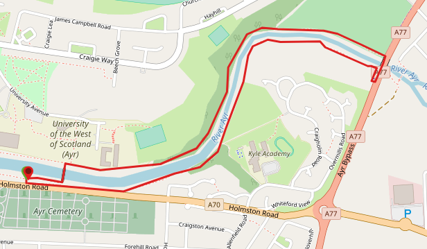
From Holmston Road move onto the red ash footpath behind the wall and turn right. On reaching a bridge cross it towards the college. Turn right at the other side and follow the woodland footpath for approx 1 mile. Go up onto the A77 and turn right to cross the bridge using the roadside pavement. At the other side of the bridge re-descend to the river. Turn left and follow the river along the opposite bank until you once again reach the red ash foothpath at Holmston Road.
WALK REPORT: 28th January 2016 (photos from November 2022)
A walk with hubby on rare midweek day off work! And no kiddies… This never happens 😉
I wanted to check out this route to see how child friendly it was with a view to returning with the kids another time.
We had actually intended on following a section of the River Ayr Way but immediately took a wrong turn so in the end did a completely different route! Our mistake was to cross the river towards Ayr College when we shouldn’t have and so we found ourselves walking along the opposite bank of the river. I will admit that we were completely ignorant to our mistake for most of the walk until we stopped for a picnic lunch and looked at a map! We followed the correct route on the way back to see what we had missed. Lesson: check the map before you set off!
Overall this was a short and enjoyable walk, so much so that I came back later in the week to do another walk from the same starting point.
This was actually the day I got the idea to track my routes: one thing which has always held me back form going out walks was fear of getting lost.’How do I know where this road leads?’ ‘What if it goes on for miles and I can’t get back in time for nursery pick up?’ I wished there was a way to create routes in advance using an online map and then follow them during the walk using GPS on my phone via an app. I didn’t know at that point whether such an app existed but I was going to create one if it didn’t. During my research I found ViewRanger (now Outdooractive) – amazing! I now track my routes as I walk them which allows me to follow the route again at a later point as well as share them with others online. I can never get lost again (as long as my phone battery holds up!) I highly recommend using such an app. My current preferred app and the one I recommend is Visorando, available for both Android and Apple. Every route on my website has a purple “download” button at the top which links to the route map on Visorando.