DIFFICULTY RATING: Easy. All on the flat and a mix of surfaced paths, grassy tracks and sandy beach. One difficulty can be the Gourock Burn which spills out onto the beach just south of the Waterside Hotel. If you are unable to ford, use the cycle path instead (requires a small backtrack). There is also a short section of beach at the north end of Ardneil Bay which can be trickier at certain states of tide due to large pebbles and a build up of seaweed. Two kissing gates – both at the north end. The field between the kissing gates can become very boggy at times and often has cows in it – option to bypass it by walking up past the ‘Green House’ seen from Ardneil Bay, and using the road to reach Portencross.
![]() There is on-street parking on Montgomerie Street, Ardrossan and a public car park at Portencross (KA23 9QA). No public transport to Portencross. There are train services between Ardrossan and West Kilbride which is 2.3 miles away from Portencross, making the walk closer to 9 miles. Local bus services also stop on A78 near Overton Drive, which is 1.7 miles from Portencross.
There is on-street parking on Montgomerie Street, Ardrossan and a public car park at Portencross (KA23 9QA). No public transport to Portencross. There are train services between Ardrossan and West Kilbride which is 2.3 miles away from Portencross, making the walk closer to 9 miles. Local bus services also stop on A78 near Overton Drive, which is 1.7 miles from Portencross.
![]() Closest toilets to start point are probably at Asda Ardrossan, a 5 min walk away. None in Portencross.
Closest toilets to start point are probably at Asda Ardrossan, a 5 min walk away. None in Portencross.
![]() Purchase the official Ayrshire Coastal Path Guide Book
Purchase the official Ayrshire Coastal Path Guide Book
View full route description
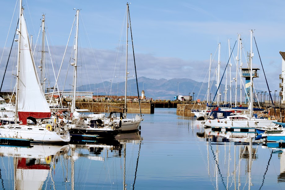
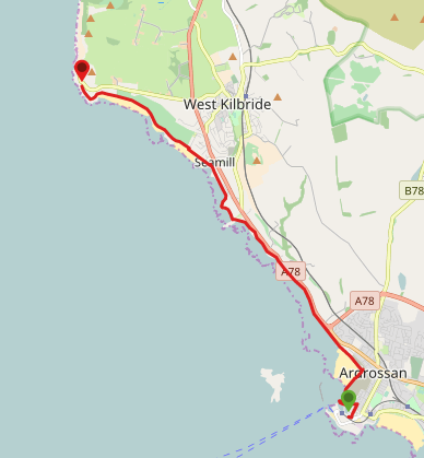
Facing Ardrossan Harbour, turn right to walk round the edge of the harbour. At the end of the terraced apartments, continue ahead around a grassy mound with some sculptures on it, circling back on yourself at the other side. Continue along the edge of the harbour onto Mariner’s View. Turn left off Mariner’s View onto the new Ardrossan Coastal Path route which leads to the cycle track parallel to North Crescent Road. Find a suitable place to drop down onto the beach at Ardrossan North Bay.
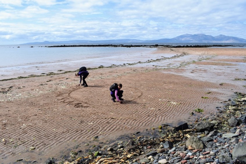
For this next section stay on the sandy beach all the way to The Waterside restaurant and Caravan Park – 4km. Just beyond The Waterside, Ayrshire Coastal Path marker posts lead you onto a sandy and grassy path to avoid a rocky area of coastline.
At Seamill, cross a footbridge over the Kilbride Burn and resume along the beach for 500m, passing behind the Seamill Hydro Hotel.
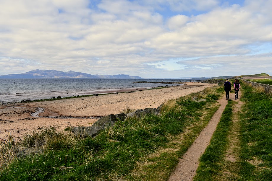
At the southern end of West Kilbride Golf Course, come off the beach onto a high-level footpath which goes around Ardneil Bay (or continue along the beach if you prefer) for 1.8km.
As you reach the north end of Ardneil Bay, there is a short walk across the pink sand and pebble beach to reach a kissing gate which leads onto a field. Follow a rough path across the seaward edge of the field to a second kissing gate. Go through the kissing gate – you are now in Portencross car park. Portencross Castle is just along the road!
WALK REVIEW: 23RD APRIL 2017 (updated March 2025)
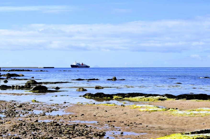
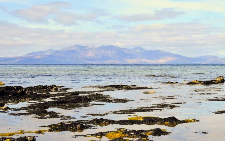
A coastal walk with plenty of beaches to walk on, hooray! What a glorious day we had for this one, couldn’t have asked for better. I had never before seen the Isle of Arran in such clarity from the mainland – it was crystal clear which meant irresistible photo opportunities. In fact, I’ve since been fortunate to witness Arran in all her detail on many a walk along this section of the Ayrshire Coastal Path. And it’s no wonder: Portencross is actually the closest point on the mainland to Arran.