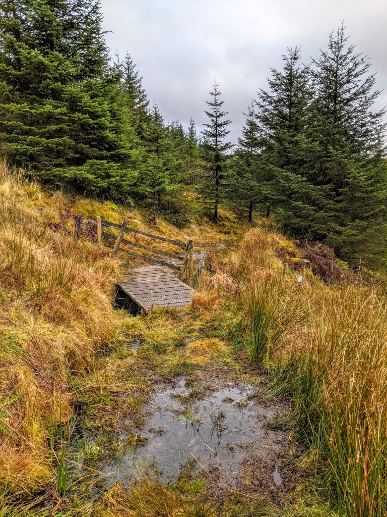
TERRAIN: A mix of surfaced roads and forestry tracks, with a less distinct, often boggy trail around the east side of the reservoir where there is also a small fence to cross. A fairly level walk with one short steep incline up to the reservoir.
![]() Dog-friendly route
Dog-friendly route
![]() Small car park at the end of Afton Road (parking here makes the walk 3.5 miles instead of 5 miles) and if that is busy or closed, there is a large lay-by approx 0.6 miles back, near Craigdarroch farm. The lay-by is where I like to begin the walk from and is the route described below. Please avoid parking on the roadside verges. No public transport to start point. Closest town, New Cumnock, has a train station and bus service and that is approx 5.3 miles along the scenic Afton Road.
Small car park at the end of Afton Road (parking here makes the walk 3.5 miles instead of 5 miles) and if that is busy or closed, there is a large lay-by approx 0.6 miles back, near Craigdarroch farm. The lay-by is where I like to begin the walk from and is the route described below. Please avoid parking on the roadside verges. No public transport to start point. Closest town, New Cumnock, has a train station and bus service and that is approx 5.3 miles along the scenic Afton Road.
View Full Route Description
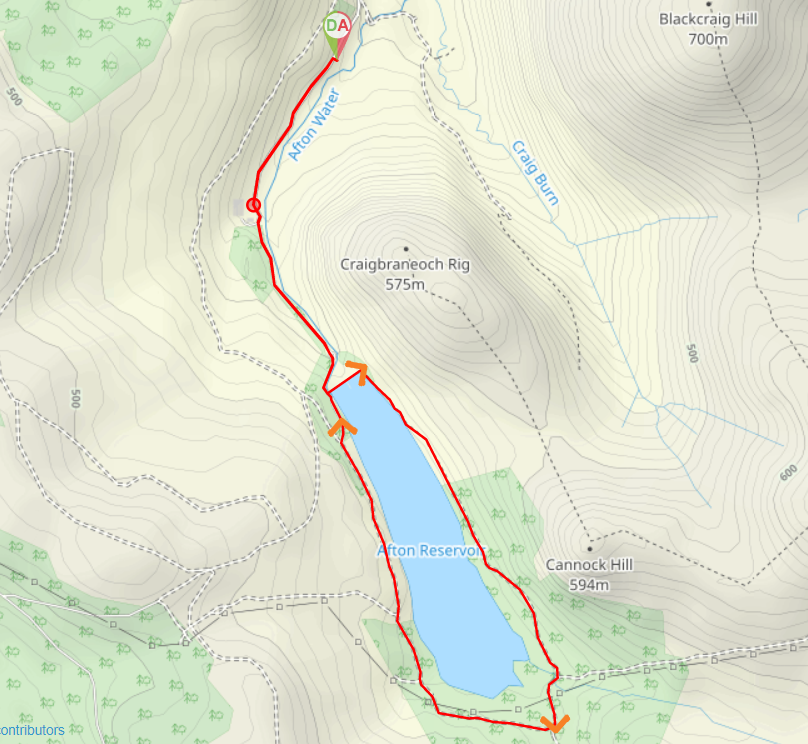
Start from the large lay-by off Afton Road, just south of Craigdarroch farm. Walk south west along Afton Road. The Afton Water should be on your left-hand side. After approx 1km you will reach a small area of forestry with a car park inside. Walk through the car park and continue South for a further 500m. The steep grassy slope leading up to Glenafton Reservoir will appear ahead. Follow the footpath uphill to the right. This takes you along the Afton Water and up to the edge of the reservoir. Turn left (North East) to cross the Afton Water and walk along the edge of the reservoir wall towards a forest at the other side. Go into the forest and turn right (South East) along a faint track which runs parallel to the reservoir. The reservoir should be on your right-hand side. Follow the grass/gravel (often boggy) track along the water’s edge, over a fence (no stile) and through another section of forestry. After 1.6km turn right (South West) at a path junction onto a wide forestry track. There is a footbridge over a burn and then the track heads away from the reservoir for a bit. Keep right (West) at a fork approx 200m along from the bridge. The track then begins to head back towards the reservoir. Heading north now, follow this track with the reservoir on your right-hand side, for 1.7km. There are some information boards dotted along the track which tell you a little of the history of the area. Keep right at any forks along the way to arrive back at the reservoir wall. Retrace your steps from here to the lay-by off Afton Road, just south of Craigdarroch farm.
WALK REPORT 26TH NOVEMBER 2020
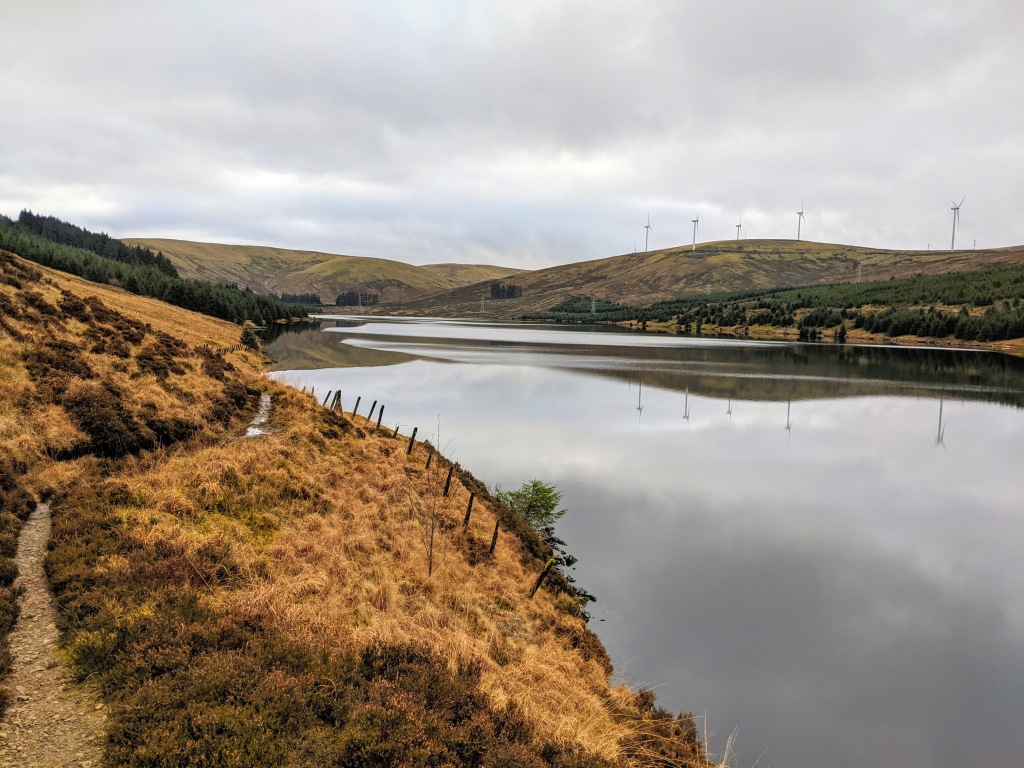
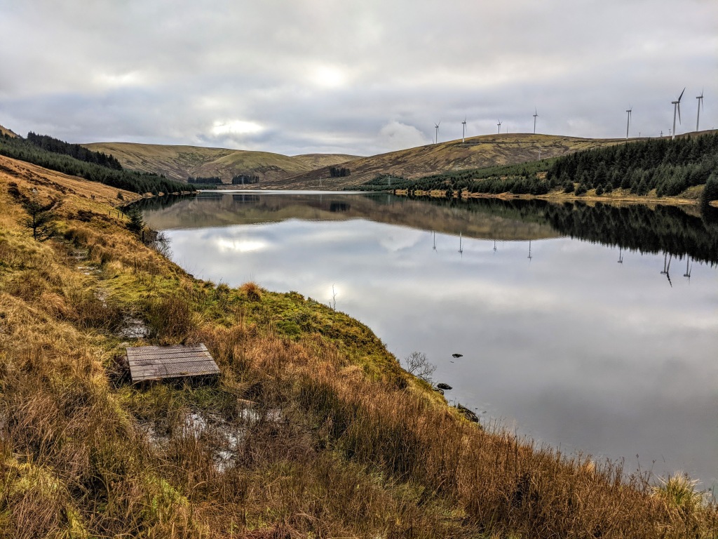
I’d last been down near the Afton Dam when I climbed Blackcraig Hill over the other side of the river, and that day I didn’t have time to go along to see the reservoir. There had since been many photos posted on social media to lure me there so I was delighted to be going back with mum to do the walk around it’s perimeter.
Even the drive down Glen Afton to reach the start point was stunning, and it was hard to believe we were still in Ayrshire. The song “Flow Gently, Sweet Afton” by Robert Burns was written about the Afton Water, and there is a Burns cairn just off the Afton Road to remember that. Worth a pitt-stop on the way down.
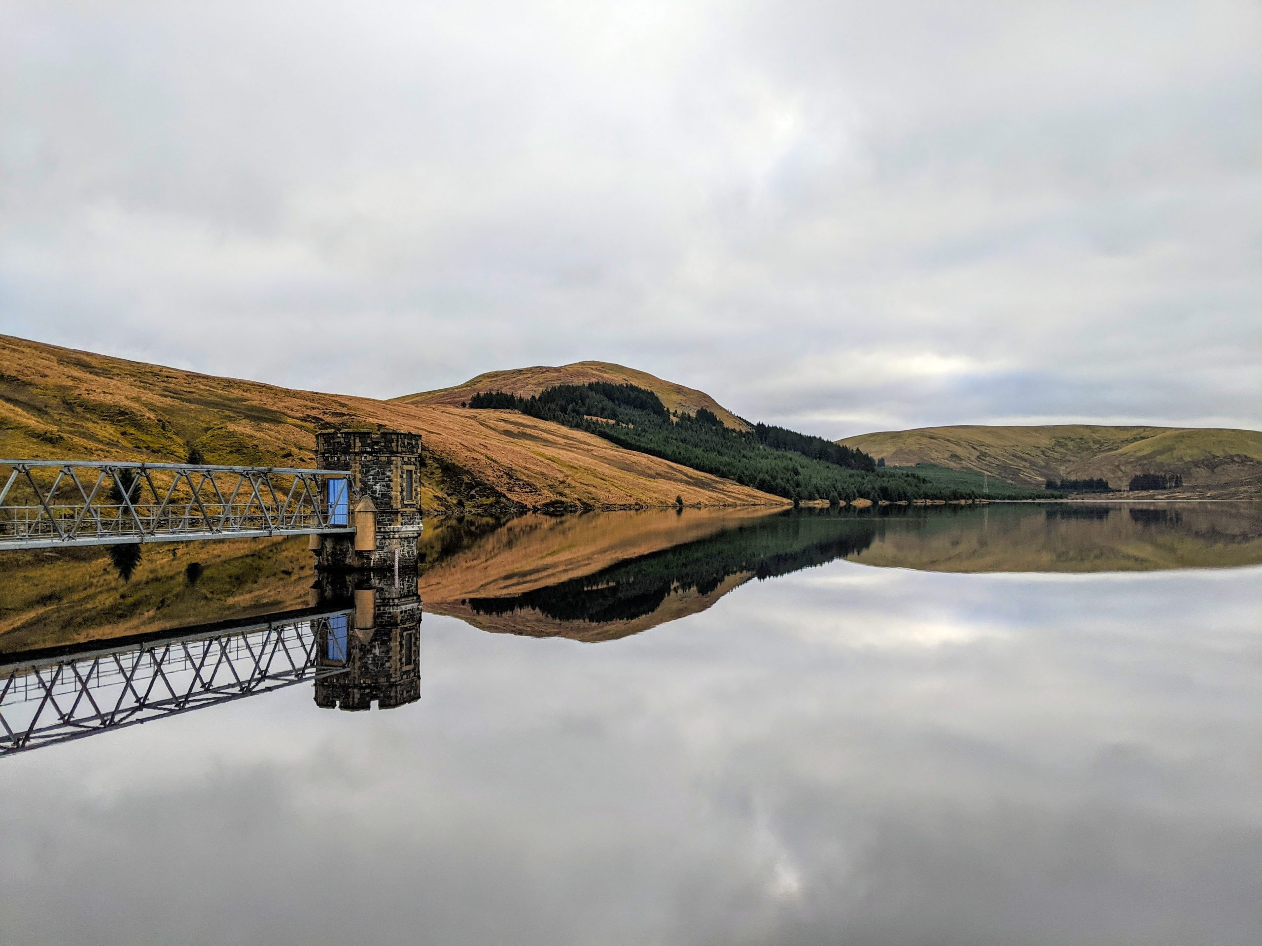
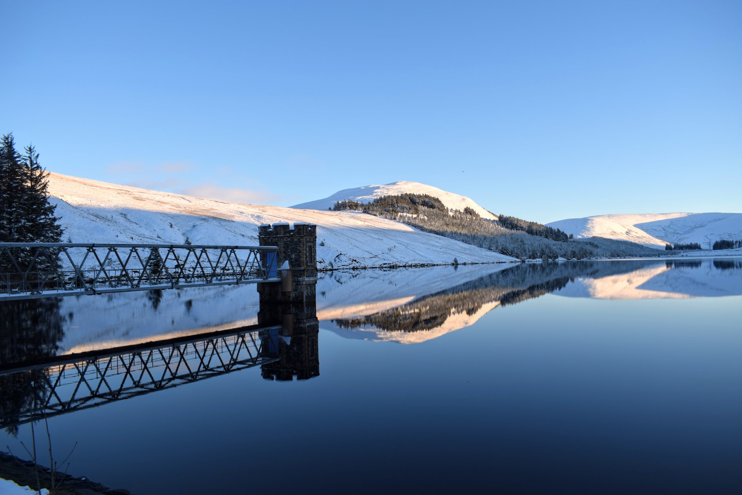
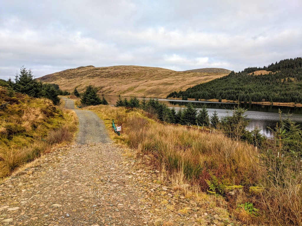
Glenafton Reservoir is the source of the Afton Water which flows into the River Nith in New Cumnock. The reservoir and associated treatment works supply drinking water to around 80,000 local people. The dam wall is huuuuuge (176 steps to the top!), and a popular spot for sledging in winter. The reflections cast in the glass-like reservoir on a calm snowy day are even more beautiful than at other times of the year, which is hard to believe.
We had decided to do the walk in a clockwise direction, because my research had found that the eastern side of the reservoir was a bit tougher going and we wanted to leave the easy bit for the end. It was definitely very boggy with a lot of surface water lying on the “path” thanks to the recent rainfall. There were sections of boardwalk which helped a bit, although we definitely could have done with more of it. It was quite slow going but definitely not a slog. I would call it exciting! A little way along we had a fence to cross and this took us in to some forestry where the path got gradually more defined.
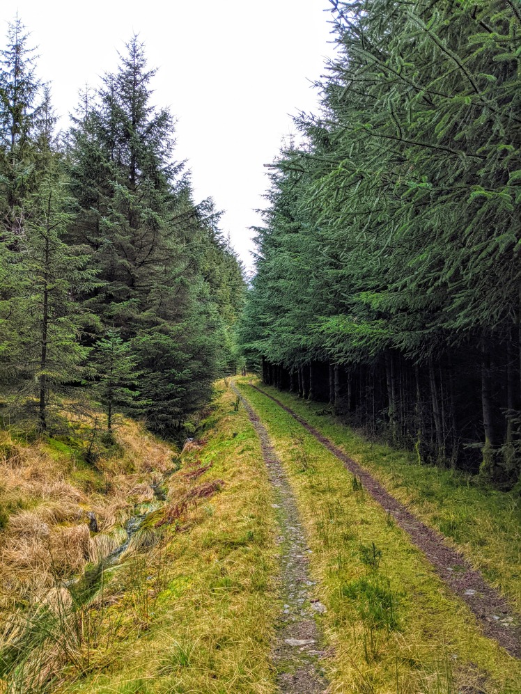
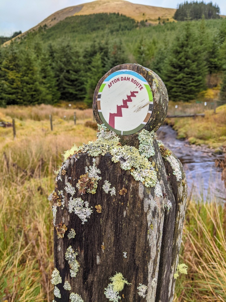
Once out of the forest we were on wide gravel forestry tracks for the remainder of the walk. Easier, much drier… I am actually glad that it isn’t like that all the way round though to be honest: the boggier east side gives the walk a nice bit of variety. Along the way we passed several wooden marker posts which had information panels hidden inside them. We spent a bit of time swinging them out and having a read. Many thanks to East Ayrshire Coalfield Environment Initiative for installing these. I am a big advocate for these sorts of things because they help to inform visitors about the history and heritage of the local area which might otherwise become lost in time.
For more information about this route check out this leaflet produced by Coalfield Environment Initiative


