TERRAIN: A moderately challenging route with 256ft of gentle ascent/descent and some uneven and boggy trails. Mixture of pavements, gravel tracks, woodland trails, and single track road. Two stock gates on the route – the first of which you can walk round the side of, and the second needs to be lifted to open/close it.
![]() Dog-friendly route
Dog-friendly route
![]() GETTING THERE: The walk starts and ends at Dalry Public Park where there is free car parking. Dalry Train Station is 0.5 miles away. Local bus services stop on New Street opposite the Public Park.
GETTING THERE: The walk starts and ends at Dalry Public Park where there is free car parking. Dalry Train Station is 0.5 miles away. Local bus services stop on New Street opposite the Public Park.

View full route description
From Dalry Public Park head out onto North Street/B780 and turn right. Walk along the pavement for approx 500m, crossing over when you get the chance. Once opposite Hamiltons Vehicle Sales turn left along an old single track road next to some wasteland.
When you reach a path junction keep right – there is a Doggartland Trail marker post here and Doggartland House will be to your right, visible through a closed gate. The track now follows the Rye Water for a short distance.
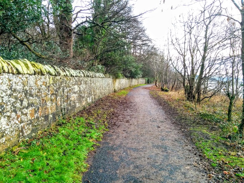
At the end of the track (entrance to a property ahead), turn left along a woodland trail. This part of the walk can be very muddy in places and the trail uneven. The trail ends at a metal gate leading to a single track road (note the limekiln on the right just before reaching the road).
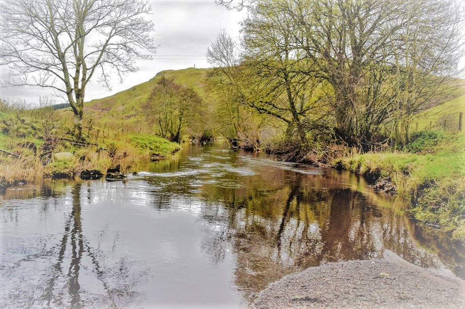
Turn left along the road for approx 200m to reach Flashwood Bridge over the Putyan Burn, a lovely spot.
From here turn right along the single track Fairlie Moor Road. Approx 700m along the road you’ll reach Baidland Mill. A little beyond this point, turn left down a farm track towards two sets of metal gates. Go through the gate on the left to access the start of the Velvet Path – a long wide track lined with trees on either side.
The Velvet Path descends gently. At the bottom follow the continuation of track as it bends to the left, leading down past a Scottish Water site and meeting back up with the Fairlie Moor Road again.
Turn right along Fairlie Moor Road. As you arrive into a residential area, keep an eye out for a grassy (sometimes muddy) lane on your left – it is located opposite a parking area at the first row of houses. There is a bench at the end of the lane you’re looking for.
Walk along the lane. At a triangular junction in the path, turn right, and then immediately keep left along a narrow earth path. You will soon pass through a row of wooden bollards. Just beyond this point, at a gap in the trees ahead, turn right. This leads you around to the start of Bleeze Road, however before you reach the residential street, look out for a lane on your right-hand-side, leading around the back of a sheltered housing unit and onto James Street.
Turn left on James Street. At the end of the street cross the B780/North Street (take care!) – the car park at the Public Park is ahead at the other side of the road.
WALK REPORT – 3rd February 2025
Quite unbelievably, an exact year passed between the first and second times I walked this route. It was 30th January…. completely unplanned and I didn’t actually even realise until I was there the second time telling someone about the first time and the date came up in conversation.
It hadn’t changed much in that time, apart from a couple of trees which had fallen in the recent bad storm Eowyn. We had intentionally taken gardening gear with us expecting to have to cut our way through in places – and that we did, although nothing that secateurs couldn’t handle. Are you allowed to walk around with a saw in your backpack? my husband had asked before I left home… I hadn’t given it much thought, but I decided that I had a ‘good enough’ reason for carrying one, should anyone ask, which I highly doubted they would.


I had remembered some parts of the trail being quite muddy. Mum had forgotten her pole that first day, and I remembered her holding on to tree branches in an attempt to make it along on two feet. In fact, I had a photo of her doing so! Meanie that I am….
Particularly muddy points included the woodland trail which I associate as being the Doggartland part of the walk, then the farm track at the end of the Doggartland, followed by the Velvet Path itself (not very velvety at this time of year – maybe more so in summer?).

We had trouble locating the start of the Velvet Path following the instructions on the Dalry Walks information board in the town centre. To be fair we were walking the route in reverse which never helps. “The path emerges between the hedgerows near Baidland Mains Farm“, it said. Indeed it does, however since you don’t ever pass Baidland Mains Farm on the walk and there are no way markers for the Velvet Path, we needed a bit more help.
Coming up the road from Flashwood Bridge, we got to Baidland Mill and we knew we had to take a left somewhere near there. A stile leading to some overgrown vegetation, and a gate leading to a field-edge track both put us off the scent. We weren’t sure if one of those maybe led to the Velvet Path, and perhaps it wasn’t used much so had become overgrown and inaccessible… We walked back and forth a couple of times trying to suss things out. In the end we decided to walk on a bit further and at a bend in the road we saw a farm track on our left leading to two gates, one of which opened out onto a long wide grassy lane between two rows of trees. That must be it! (It was). Hopefully I’ve done a decent enough job in my route description to save you from the same confusion!


The views on this walk were beautiful. Just my cuppa tea. Rolling green hillsides dotted with farms and fields of sheep, separated by hedgerows. In the other direction a birds-eye view down into Dalry gave a sense of the scale of the town. The turbines at Whitelee Windfarm glimmered on the horizon, apparently basking in the late afternoon winter sunshine.


Gorgeous little burns appeared unexpectedly along the way: first the Rye Water and later the Putyan Burn, which even boasted an impressive waterfall! I’ve since found out that this was once a weir, used in the production of electricity for Broadlie House which can be seen through the trees. In fact it was one of the first hydroelectric plants in Ayrshire!


Dalry is a town with an important industrial heritage, and that is apparent throughout this walk. Textile manufacturing was one of the industries it was known for, as well as mining and brickworks. In fact we passed an old limekiln at the end of the Doggartland trail, a former mill at Baidland, and the last part of the walk took us through the former brickworks. Indeed we saw bricks on the ground with ‘Dalry’ inscribed into them 🙂
And if you’re wondering about the name Doggartland, well near the start of the walk you pass a massive period property by the same name – apparently built back in the late 1800s by a wealthy Glasgow businessman as a holiday home (alright for some!). I have also read that there was an area of Dalry called Doggartland, where one of the mills was located. Although there was no obvious evidence of any remains that I saw. If you know more and would like to get in touch I’d love to hear from you!