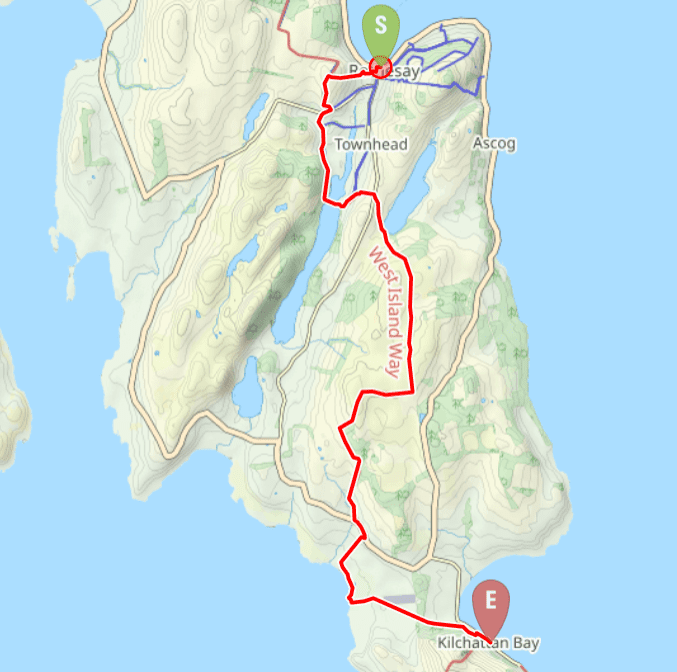
TERRAIN: Graded moderate. Some residential street pavements to start with on a fairly steep ascent to reach the WIW route, from which point expect a varied walk on a mixture of farm tracks, fields potentially with livestock in them, quiet roads, good moorland tracks, sandy beach, golf course and woodland trails. The ground can be wet and muddy in places and is fairly undulating. There are at least 16 kissing gates and one stile.
![]() This walk starts at the ferry terminal in Rothesay. To return to Rothesay from Kilchattan Bay use the local bus service. We caught the 1617 bus (Sunday) which got us into Rothesay with seconds to spare before boarding of the 1700 ferry sailing.
This walk starts at the ferry terminal in Rothesay. To return to Rothesay from Kilchattan Bay use the local bus service. We caught the 1617 bus (Sunday) which got us into Rothesay with seconds to spare before boarding of the 1700 ferry sailing.
![]() There are public toilets in the ferry terminal at Rothesay and in Kilchattan Bay.
There are public toilets in the ferry terminal at Rothesay and in Kilchattan Bay.
![]() Dog-friendly walk (Note: there is a possibility of livestock in several fields near the start of the walk and on the beach track at Stravanan Bay. The route also crosses a golf course and air strip. Please be a responsible dog owner.)
Dog-friendly walk (Note: there is a possibility of livestock in several fields near the start of the walk and on the beach track at Stravanan Bay. The route also crosses a golf course and air strip. Please be a responsible dog owner.)
View full route description
Begin your walk in Rothesay, close to the ferry terminal. Cross the main road into Guildford Square and cross the square to the far right corner where Montague Street meets High Street. You will be able to see the castle ruins ahead. Turn right onto Castlehill Street and at the end of the street turn right to walk down Queen Street. Turn right onto Ladeside Street then left on Bridgend Street. At the church the road splits – keep right onto Hillhouse Road. Continue uphill, looking out for a red post box in the wall where you turn left onto Ballochgoy Road. Continue to the very top of this fairly steep residential street to where the road ends at a wooden fence and WIW marker posts.
Turn left through the kissing gate and along the field edge. After a short distance you will arrive at a series of gates. We went through the gate straight ahead (which was heavy and awkward to open, but preferable to the gate on the left which was secured with barbed wire). Then head over to the hedgerow on your left and follow it to the right (S), down over the field, ideally with the hedge on your right-hand-side. At the bottom of this field we didn’t notice any marker posts and the ground around the only gate was quagmire so we ducked between the fence wires straight ahead, then turned left across the field heading towards a gate leading to Barone Road / B878.
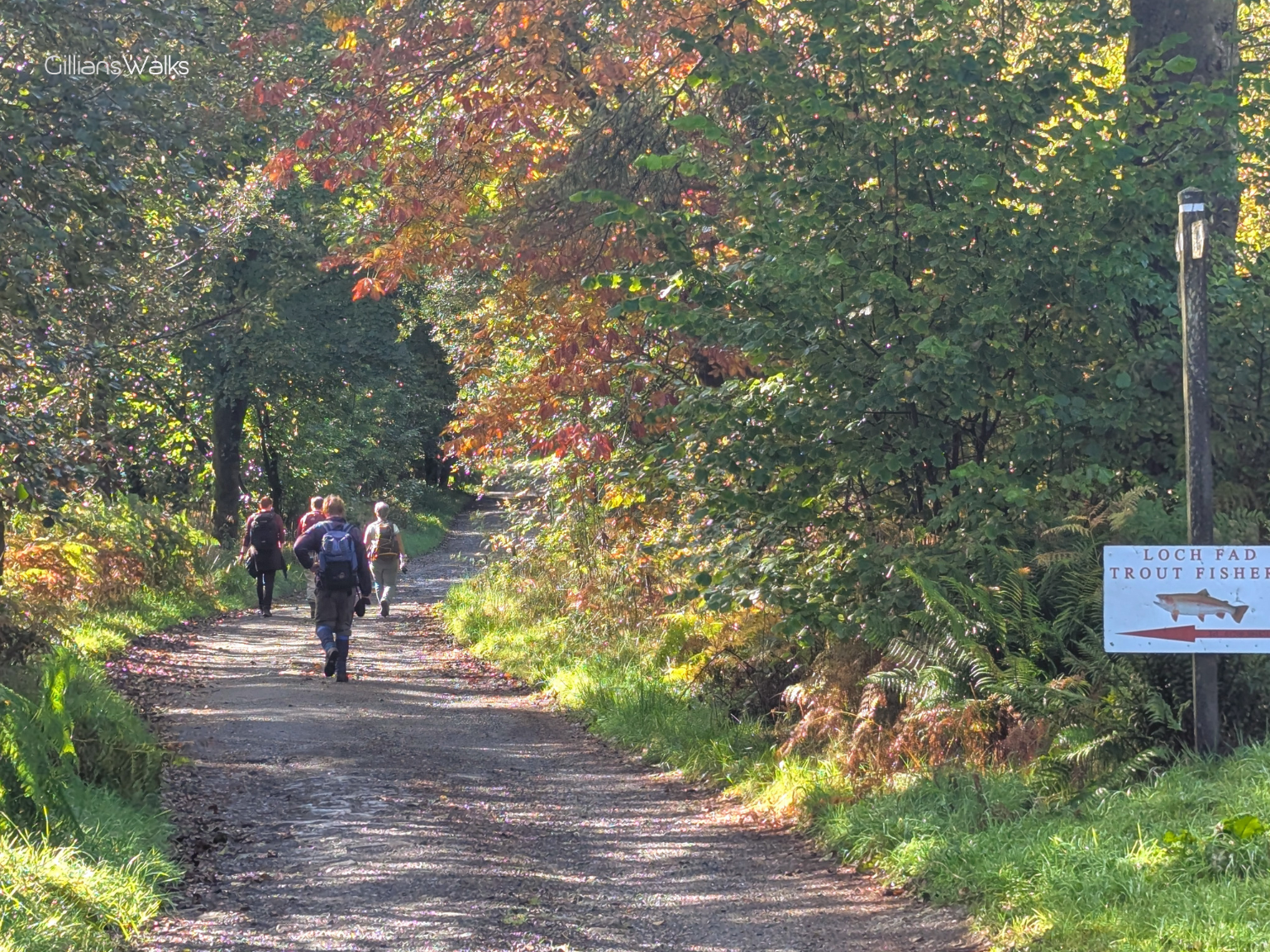
Turn right along the road and at the upcoming split keep left, signposted Loch Fad. After approx a mile there is a 3-way split – turn left, signposted Loch Fad Fishery.
Cross the Loch Fad causeway then follow the track alongside some buildings, looking out for a kissing gate on your right. Cross the field on a faint track uphill in a general NE direction to another kissing gate then veer left to follow the field-edge E on a boggy track. You will emerge at a kissing gate beside the B881.
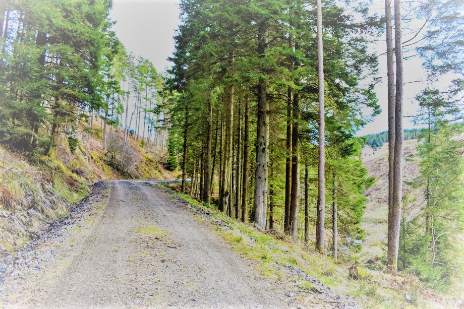
Cross the road, turn right, then take the first left onto a minor road. The road soon becomes a track and leads onto Lord James’ Ride – a gorse-lined track which takes you up over the Scoulag Moor.
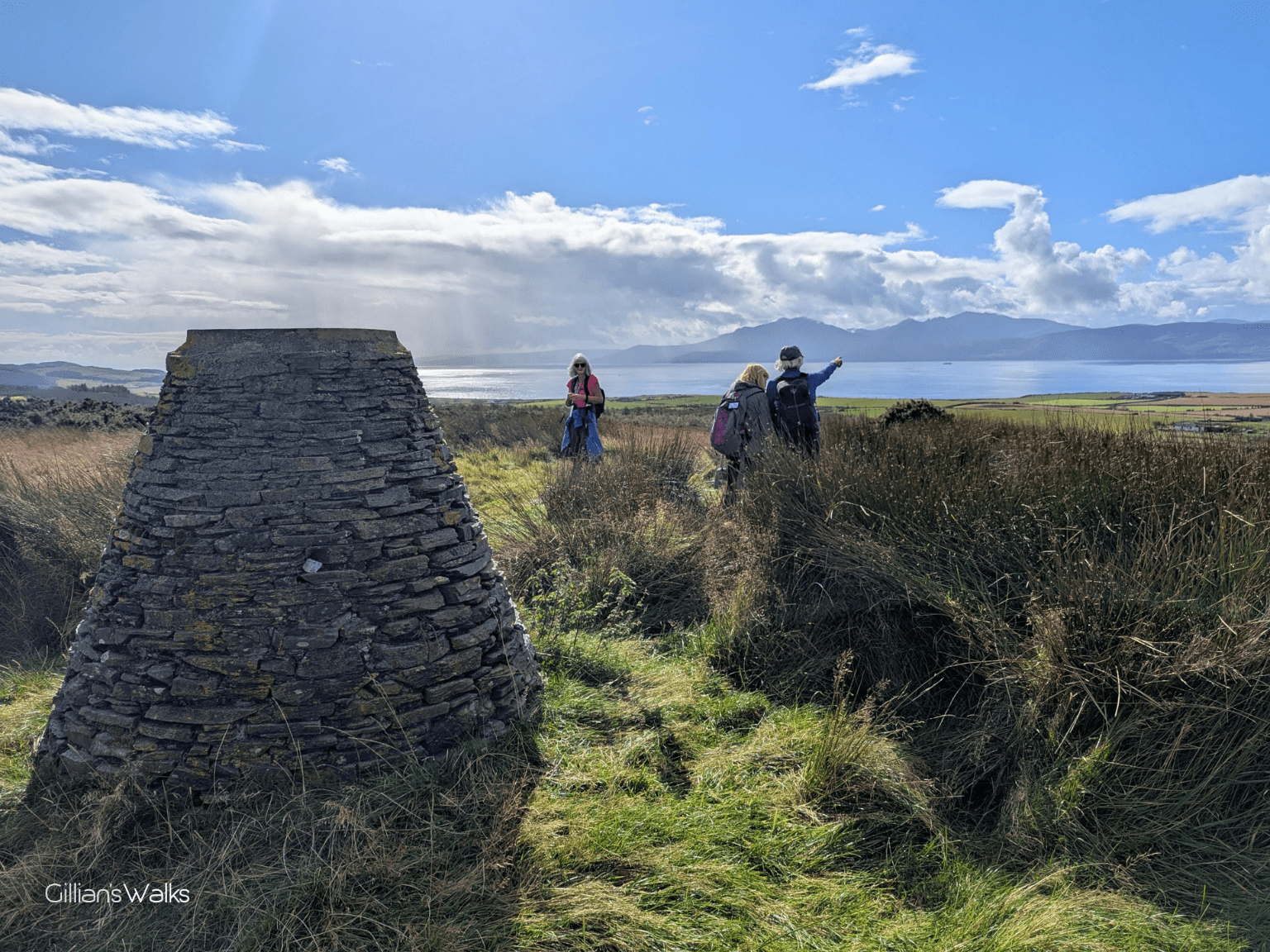
After approx 1.5 miles, you will arrive at a crossroads with an interpretation board on the left. Turn right here, following a good track across the Birgidale Moor. Look out for a cairn on your right at the top of the hill – a great lunch stop and fantastic viewpoint.
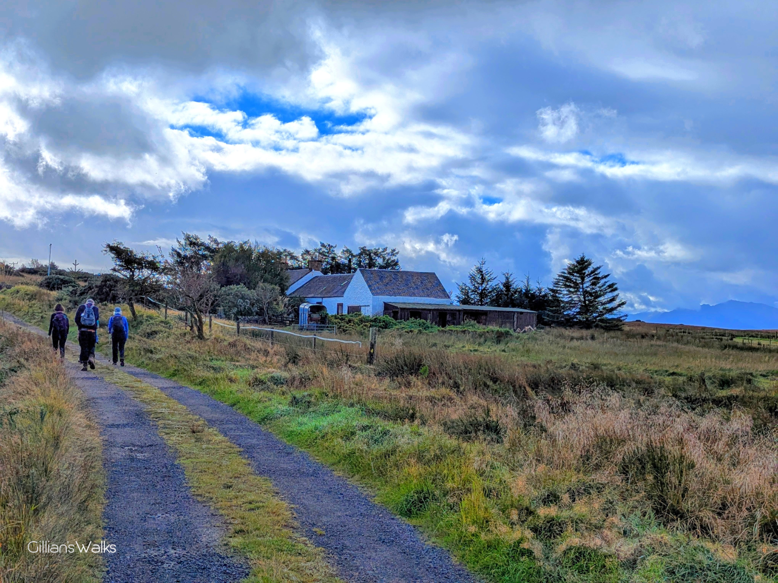
The track now starts to head SW downhill. Look out for a kissing gate on your left, before you reach a farmhouse. Go through the gate and follow this grassy track SE. A little less than half a mile along, turn right (S) down through a wooded section, emerging at A844.
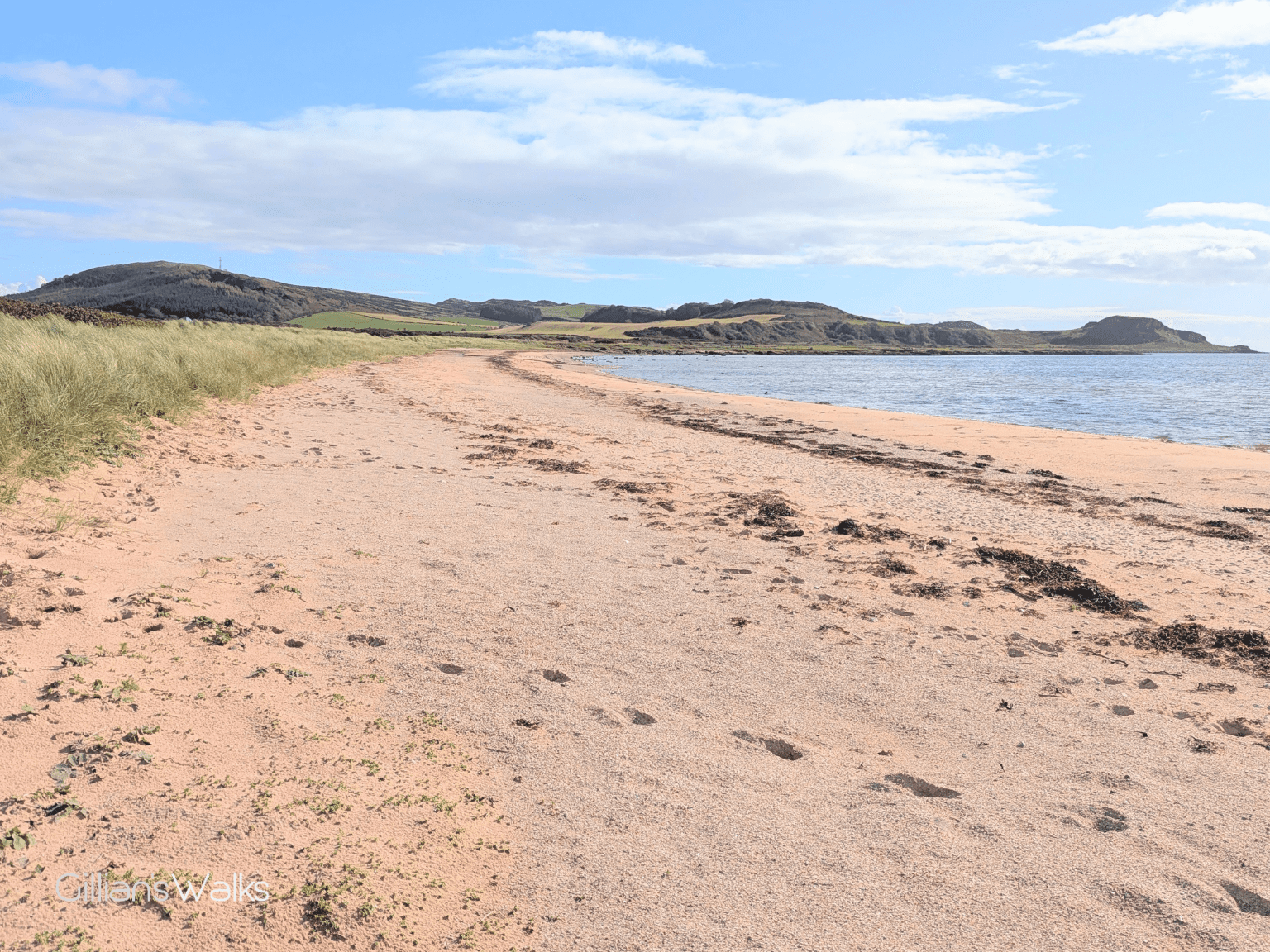
Turn left along the road – initially uphill then levelling off – to Langalbuinoch Farm. Turn right to go towards the farmyard, turning left down a track leading to the foreshore at Stravanan Bay. We chose to cut straight across the shortest part of the grass heading straight for the sandy beach. Turn left and walk SE along the beach as far as you can go, heading for a kissing gate at the edge of Bute Golf Club.
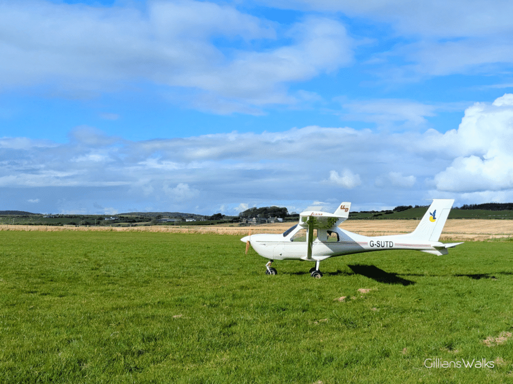
Go through the kissing gate then turn right to skirt the edge of the golf course then through a gap in the dry stone wall ahead. From here there is a track which takes you E along the edge of the golf course then SE through several kissing gates into the next field, along the edge of a small airfield, and another field, emerging at Plan Road.
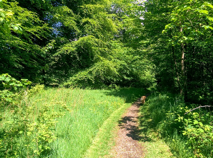
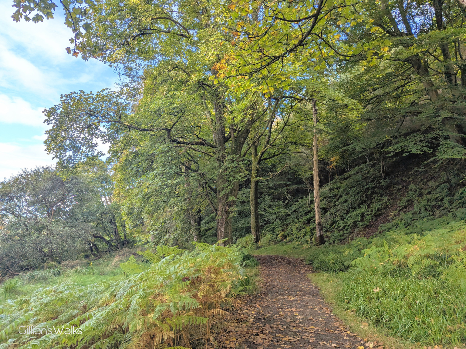
Cross the road and pick up the continuation of the route at the other side – a gravel track through ancient woodland. At the eastern end of the woodland you will go through a kissing gate. After this turn left down a lane leading to the main street in Kilchattan Bay, where this walk ends.
Walk Report: 28th September 2025
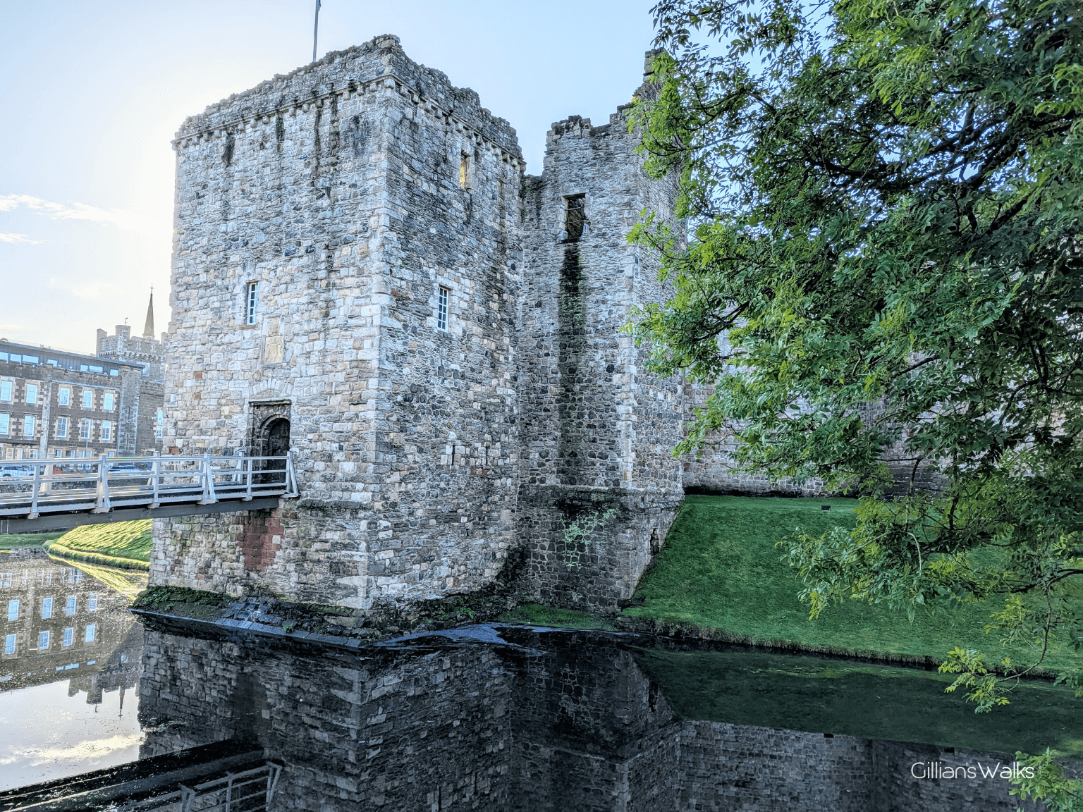
This time I decided to go a different way through Rothesay so that we’d pass the castle, which I hadn’t realised was so close to the ferry terminal last time! It was well worth it and definitely a more interesting route. Everyone on the walk with me had completed or was currently walking the Ayrshire Coastal Path, and on reaching Portencross I usually tell the story of how in the 1300s, the small harbour beside Portencross Castle was an important ferry port used by the Kings of Scotland as a stop-off point on their way between Dundonald Castle and the mighty Rothesay Castle, both held by Stewarts. So I was super excited to be standing here at the mighty Rothesay Castle for the very first time – at the other side of the story! I believe it may also have been my first time seeing a castle with a moat…. the stuff of legends!
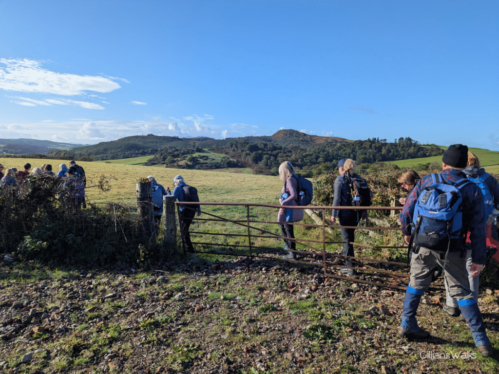
It wasn’t long before some layers started to come off: the residential street we took to meet up with the WIW was pretty steep and seemed to go on for ages! We stopped for a breather at the top and excitedly made our way in the direction indicated by the marker posts, happy to be crossing a field rather than passing more houses.
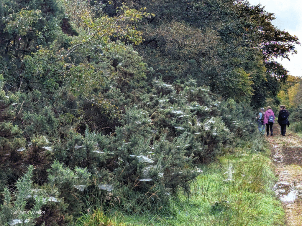
However the joy didn’t last too long before we experienced a brief moment of confusion at a set of gates. There were three of them, all leading to fields and none of them with a WIW logo on them. I could see from my map that we were supposed to head across the field directly in front of us, down a hedgerow, and the most sensible gate to go through was to our left. However it was secured using barbed wire….. The one to our right didn’t take us where we wanted to be, leaving the centre gate as the last possibility. No barbed wire was a good start, but it was one of those old rusty iron gates and was only attached by one hinge, making it very heavy and awkward to lift open. After a bit of heaving and careful replacement the job was done and we headed over to our hedgerow and down the field. Hopefully the photos below will help you out at this point – I was certainly glad to have downloaded the route to my Visorando app before setting off as we would have been lost otherwise (already)! We could see evidence that livestock grazes this field but thankfully there were no beasts anywhere in sight. The grass was however a big squelchy in places so there were a few wet feet by the time we got to the other side!
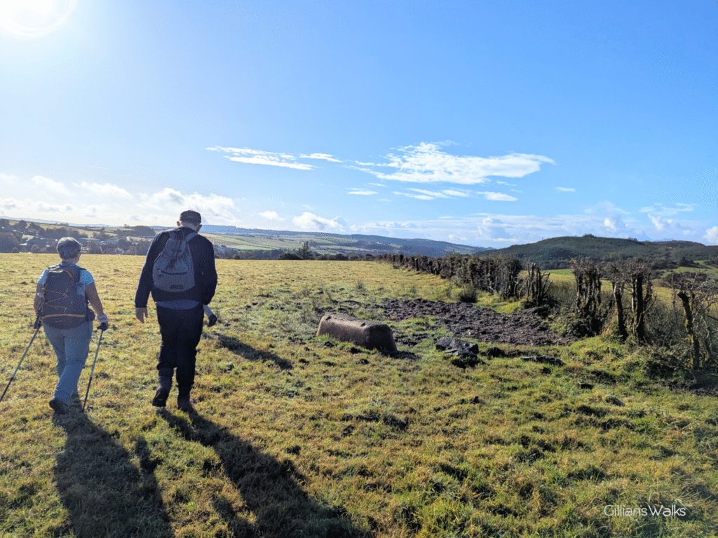
There was another moment of uncertainty when we reached the bottom of this field. Again we couldn’t see any marker posts, perhaps we missed them, but I could see from the map that we wanted to enter the next field and head left to a road. There was only one way out of the field that we could see and that was a gate to our right (a decent one this time!). The problem however was the deep, wet mud churned up around the base of the gate making it pretty impossible to even get close enough to open it, never mind to then go through. I had visions of someone potentially slipping and falling. So instead we opted to take our backpacks off and duck through the fence instead, between two wires. We positioned one person pushing the top wire up higher, another person pushing the bottom wire down lower, making a big enough gap for people to squeeze through. Once through, I spotted a large gate which led to the road we wanted to get to, so we headed diagonally down the field towards that. It would appear however that WIW walkers are supposed to stick to the field edge where we would have come across a stile leading onto the road. I only realised this once home and looked more closely at the map and re-read the official instructions. Having said this, the official instructions for all of the above section are simply to “cross the field”, so are a little vague.
Once on the road it was plain-sailing and very scenic with autumn colours beginning to show.
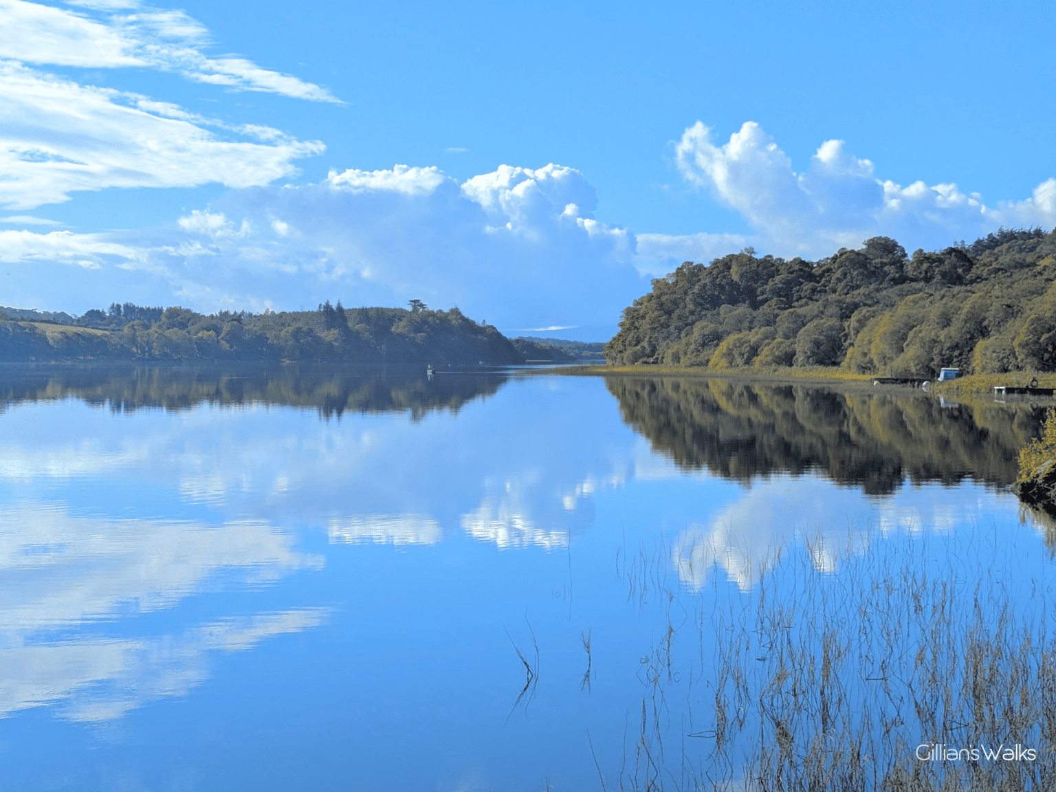
Loch Fad Fishery was well signposted, and it was also pretty spectacular! It is actually a Site of Special Scientific Interest (SSSI) due to the diversity of bird life and vegetation it supports, as well as its scenic value. The water was so still that the sky was reflecting in it. We could see a couple of people out on a small boat, presumably fishing. It was such a tranquil spot and we spent about 10 minutes here, soaking in the beauty and taking lots of photos.
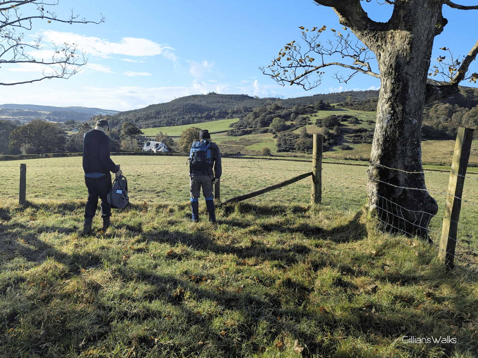
From here the track led up and across another field – there were cows this time, however thankfully they were at the other side and weren’t interested in us. Nonetheless we made our way hastily across to a gate at the other side.
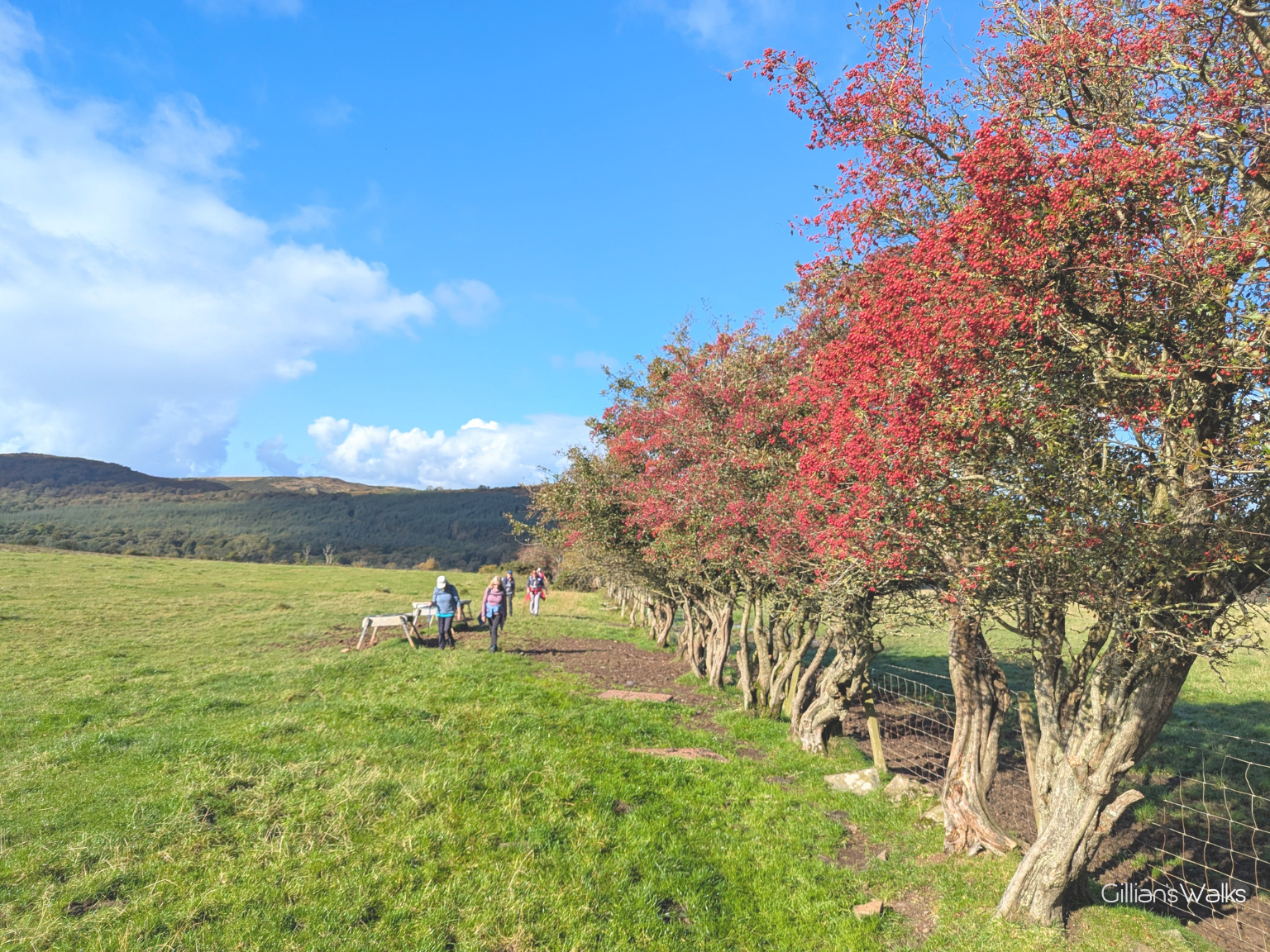
Beyond the gate a very wet and boggy track awaited our arrival! It took us along the field-edge beside a row of hawthorn trees, which were a striking red colour thanks to an abundance of berries.
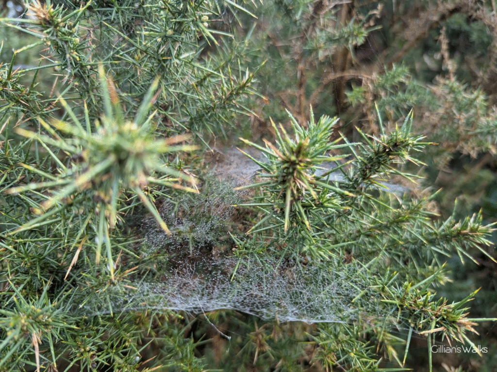
We then followed a series of lovely quiet roads and tracks which led us onto the Scoulag Moor via the so-called “Lord James’ Ride”. Having spent a fair bit of time on almost pathless boggy moorland last time we were on Bute walking from Rothesay to Rhubodach, we were very grateful today to Lord James for riding here, and leaving us this very good track to facilitate our journey across this stretch! One particular memory I have is of the abundance of Gorse lining the track – it must be spectacular in April when in full bloom! During our visit in September, they were full of spider webs!
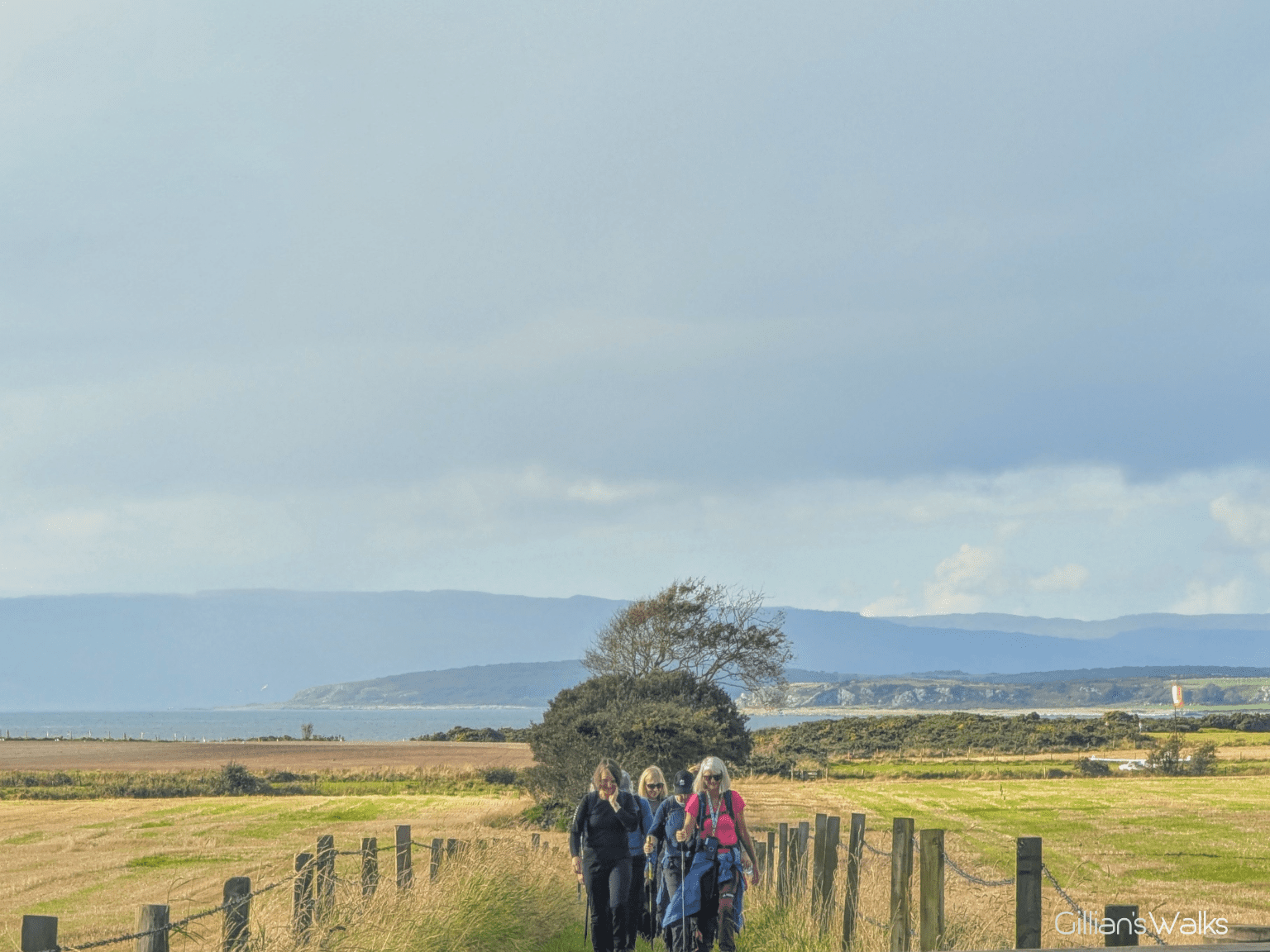
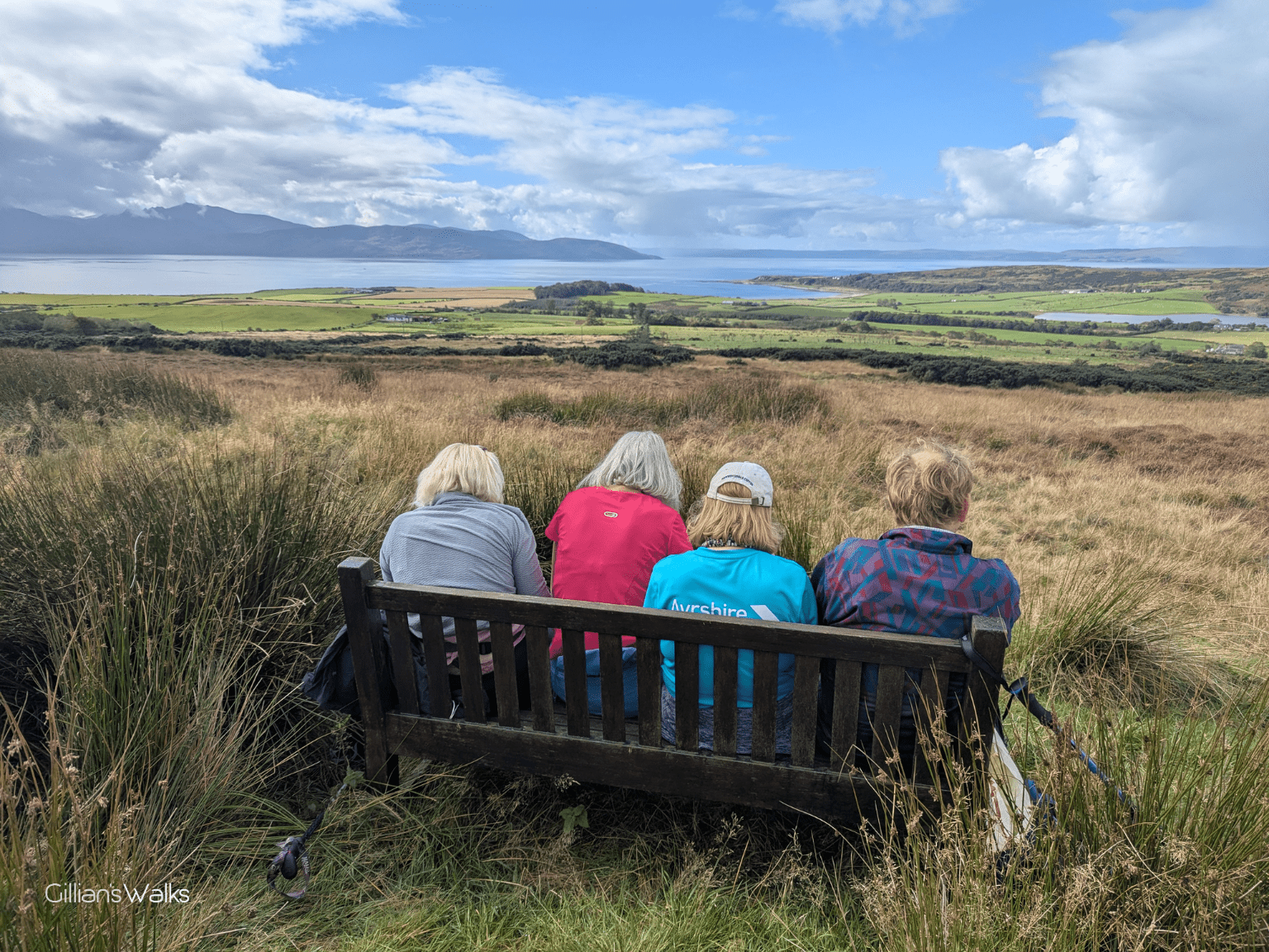
We weren’t sure where we might have lunch: there didn’t appear to be anywhere on the moorland track, and so we set our sights on Stravanan Bay unless we found anywhere good beforehand. Which we did, in the form of the cairn on the Birgidale Moor hilltops! With a bench! A spectacular panoramic view was the icing on the cake, our old friend Arran being the main focal point, but also Scalpsie Bay and north towards the Cowal hills.
It should all be downhill from here, right?? Almost! A good wooded track took us along high ground parallel to the Sound of Bute, with nice views of Arran and a little stream trickling beside us, the bracken beginning to take on its autumn colours.
After a short (uphill!) road section we were soon making a bee-line for the beach! On approach we began to notice that there were cows on the foreshore. Hmmm….probably for the best that we’d already stopped for lunch then! There was also a camper van and a tent pitched up inside what would be described as the perimeter of the field (which extended to include the sandy beach) – so, perhaps the cows were friendly? When we arrived at the gate we stood a while waiting on everyone to arrive and we could see that we were definitely going to have to walk through the herd, which was scattered across the entire area. They didn’t seem particularly interested in us though, one even moved away. I could see on the map that we were supposed to cross to the left, over the grassy foreshore, but I could also make out a desire line heading straight for the sandy beach. It was the shortest route past the cows and I liked the idea of being on the sand, so we made the decision to go that way. I’m pleased to report that the cows did not pay us one bit of attention!
A sign at the farm indicated that this was called Langalbuinoch Beach (Langalbuinoch being the name of the farm). The map says Stravanan Bay. Either way, what a beautiful place! Golden sands, with a pink tinge and the occasional small rocks scattered along the way. We felt very much at home with the Isle of Arran across the other side! We could easily have been somewhere on the Ayrshire Coast.
Next up – a golf course. Two ladies were mid-play so we waited until they waved us past. Our track then led onto a small airfield. What variety this walk has! To the untrained eye, or had it not been for the signage, it was just another field. Apart from the small plane parked in it! To our delight there were several picnic benches in the field, which we made good use of for a short breather.
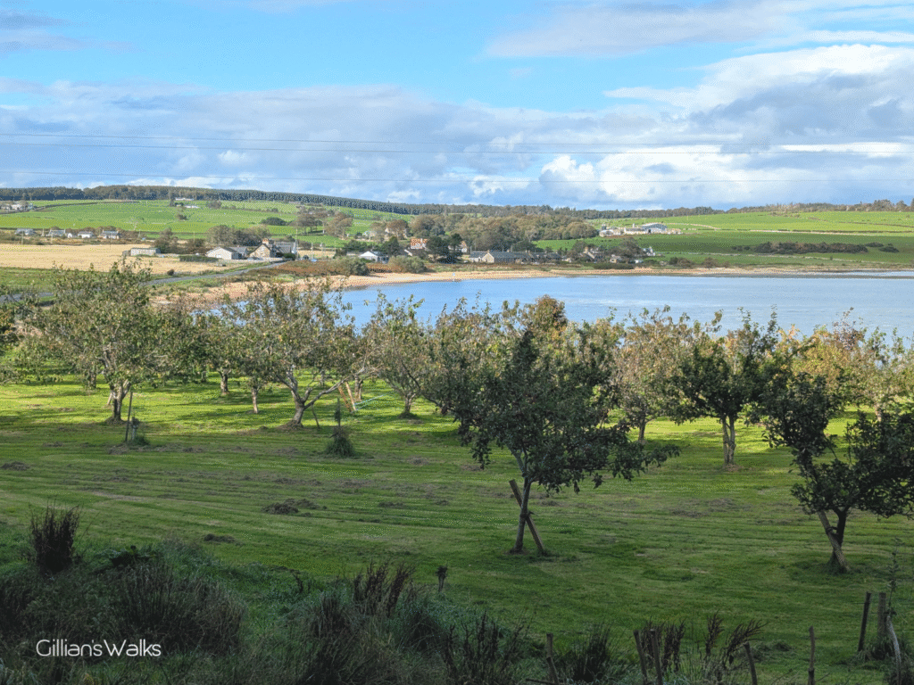
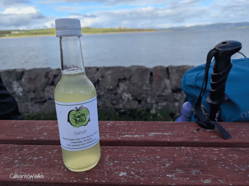
We were close to the end. The last section took us through a number of kissing gates and into a lovely woodland complete with fungi, and views down to Kilchattan Bay as well as the community orchard.
Before we knew it we had arrived in Kilchattan Bay, with around 40 minutes to spare before our bus. The tearoom was still open, although I think we caused a slight panic when 19 or us traipsed in! We sat outside waiting on the bus, many of us sipping on bottles of apple juice purchased from the tearoom, freshly squeezed from the village orchard. It was a lovely end to a brilliant day.
Other walks in the West Island Way series: