NOTE July 2025: There are a few small trees over the path inside the woodland walk to Smyrton – most people will be able to step over or duck under but they may present a barrier to others. In addition, part of the farmland route immediately beyond Smyrton is currently impassable for approx half a mile due to heavy Gorse growth. On my visit it was possible to divert around the field-edge and that is the route I have described below and on my digital map.
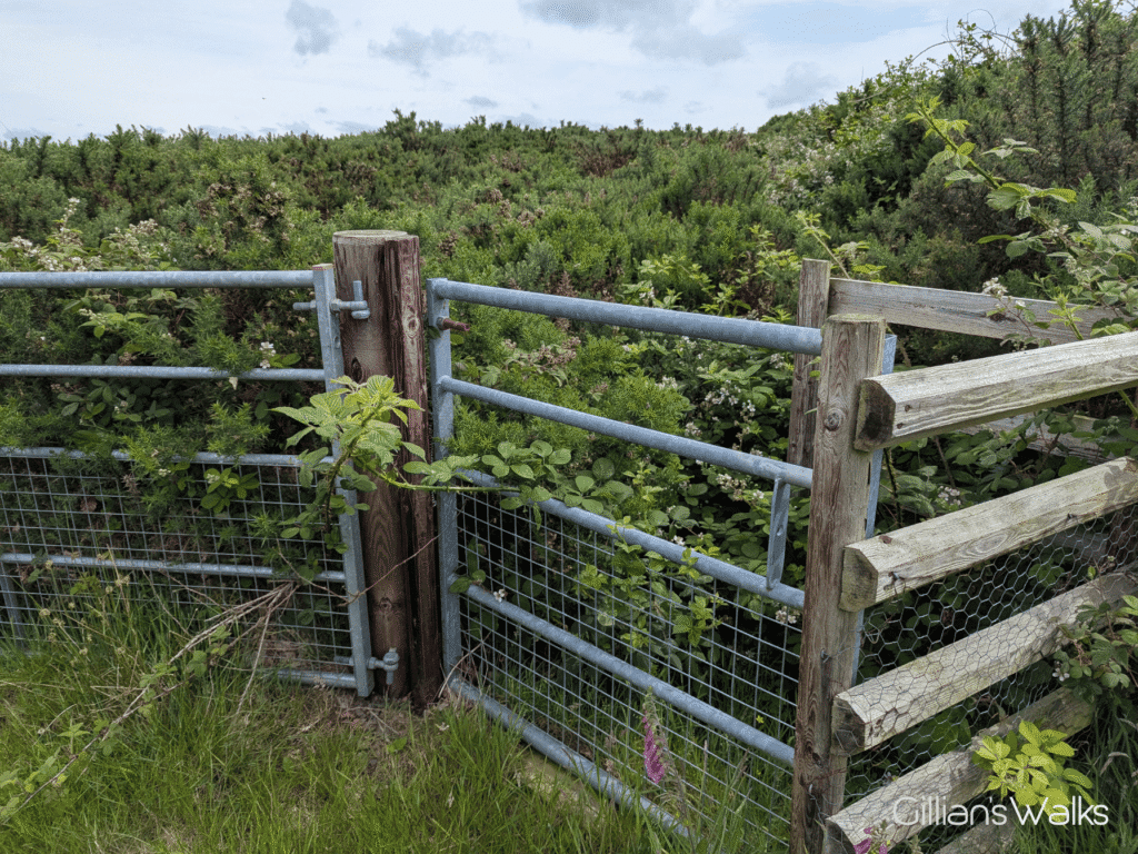
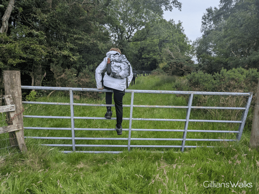
TERRAIN: Graded Moderate due to rough pathless terrain and a number of gates which need to be climbed. There is quite a mixture of terrain on this walk: paved surfaces, woodland trails, rough grassy fields and farm tracks. Several sets of steps within the woodland section at the start, some with handrail and some without. At least 10 farm gates, 3 of which need to be climbed. High chance of both sheep and cows on this route. Electric fences. No steep ascents or descents. No stiles.
![]() Car parking available at Craigiemains Garden Centre, Ballantrae (free) – however please check opening times as the gates will be closed shortly after! Another option is Foreland car park at the southern end of the village (free). Local bus services stop on Main Street Ballantrae. Closest train station is Girvan, 13 miles north.
Car parking available at Craigiemains Garden Centre, Ballantrae (free) – however please check opening times as the gates will be closed shortly after! Another option is Foreland car park at the southern end of the village (free). Local bus services stop on Main Street Ballantrae. Closest train station is Girvan, 13 miles north.
![]() Public toilets are at Foreland car park (free) and customer toilets at Craigiemains Garden Centre or the Kings Arms, both on Main Street.
Public toilets are at Foreland car park (free) and customer toilets at Craigiemains Garden Centre or the Kings Arms, both on Main Street.
View full route description
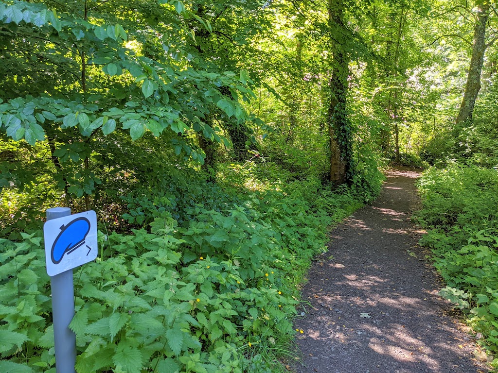
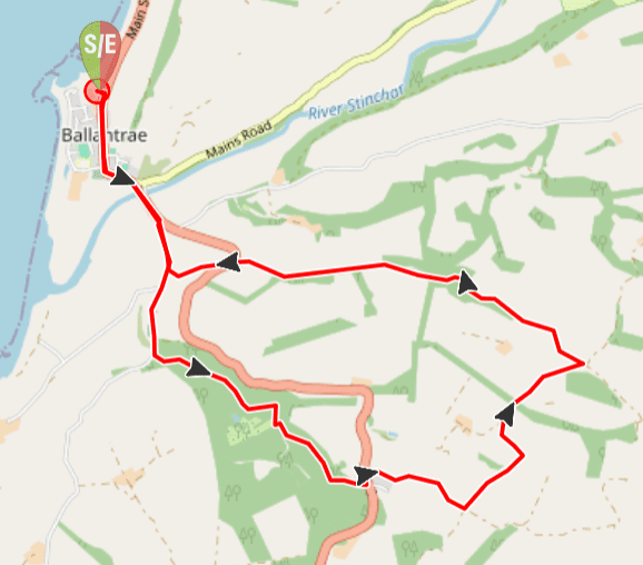
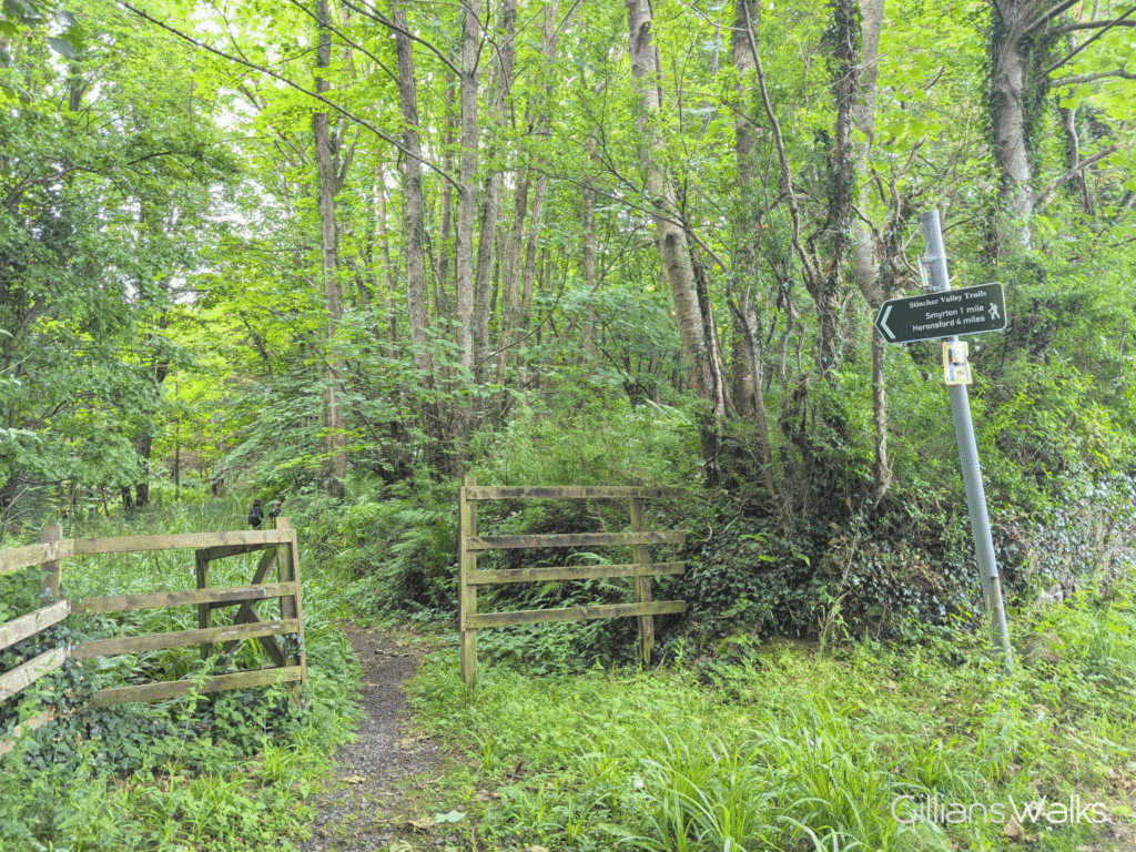
Leave Craigiemains Garden Centre via the main exit and turn right to walk along Ballantrae’s Main Street. After about 1km, and having crossed the River Stinchar, take the first road on your right to begin a gentle ascent. After passing the cemetery and just before you reach the entrance for Glenapp Castle Hotel, turn left onto a woodland trail, signed Smyrton/Herensford.
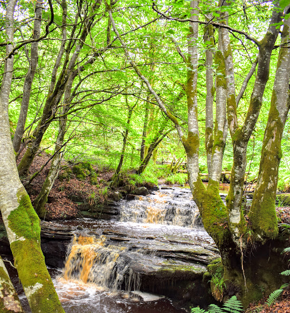
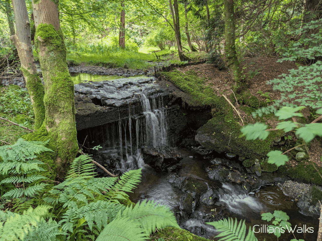
Enjoy a stroll through the woods beside the Kilphin Burn, crossing it several times via wooden footbridges.
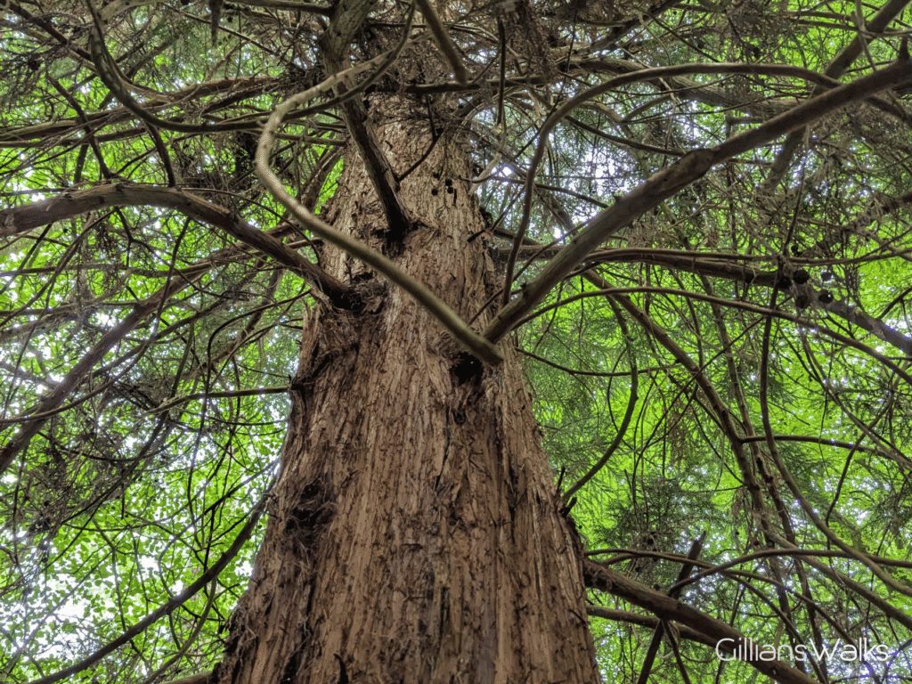
After the third bridge the path forks – keep left (closest to burn). The burn will now be on your left-hand-side for a while, contrary to what the path on the OpenStreetMap shows. You’ll pass several Redwood trees further in, as well as some bamboo. Around here there is a short steep uphill section then a mini suspension bridge and the burn splits in two here. After crossing the bridge, turn immediately right up some steps. The burn will now be on your right. However you will soon cross Midway Bridge, after which the burn will move back to your left-hand-side. At the next bridge the path forks – keep left to cross the bridge. The burn will now be back on your right.
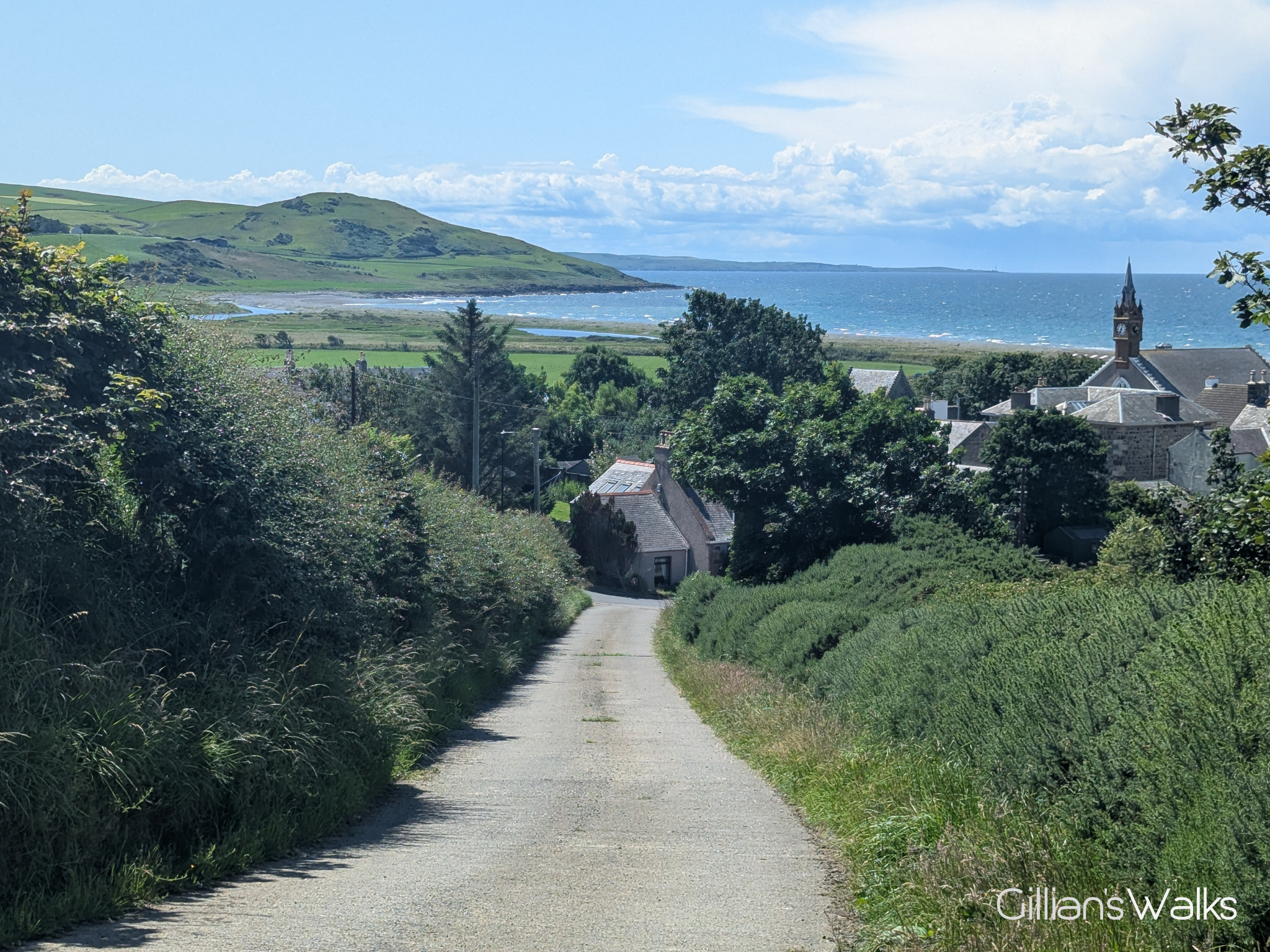
The woodland trail meets up with a wider footpath – turn left. You will pass through some metal gates and emerge at the busy A77 road. Take care crossing to the pavement at other side and turn left to walk along the roadside, taking the first right onto Smyrton Hill.
After passing some cottages the road becomes a farm track and opens out onto a field. The intended route is through a kissing gate immediately ahead. However at the time of writing the track at the other side of the gate was completely impassable for approx 700m / half a mile due to heavy Gorse growth so we diverted around the field edge instead. If you are following the map on Visorando, this is already reflected on the route. Once you’ve followed the field-edge (general SE direction) as far up the slope as you can go before meeting the boundary fence at the other side, turn left along a wide gap to reach a metal stock gate. At the time of writing I had to climb this gate as I was unable to release the chain.
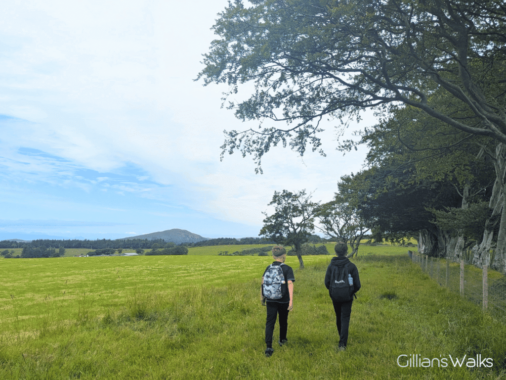
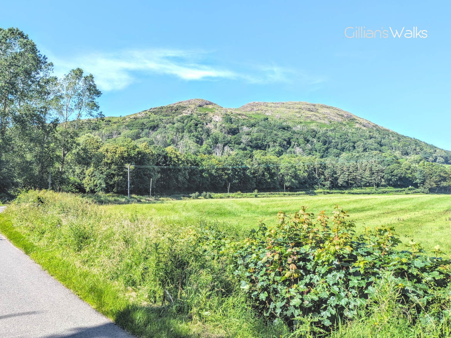
Turn immediately left (NE) to go through another gate and pick up a track running beneath a row of trees at the field edge. Follow the track for approx 1.6 km / 1 mile as it meanders across several fields and through 8 more gates (some open, some do not). At a crossroads turn left, signposted ‘Ballantrae Direct’. This good track becomes a surfaced road and leads to another crossroads beside Kilwhannel Farm: turn left to stay on the surfaced road (signposted ‘Ballantrae Direct’).
Enjoy an easy downhill stretch of single track road, emerging at the A77 Trunk road. Cross carefully then turn left to walk along the roadside verge for a few metres, turning first right onto a grassy track which leads to a minor road. Turn right to walk along the road to the A77. Turn left and retrace your steps from earlier to return to Craigiemains Garden Centre.
Printable Route Guide – Ballantrae Smugglers Trail: Glenapp Estate
Download, Print, Go! This PDF Route Guide has been carefully designed to allow you to easily print a copy of the key information for this route on an A4 page to take with you on the walk. Perfect for offline use!
Walk Report: 1st July 2025
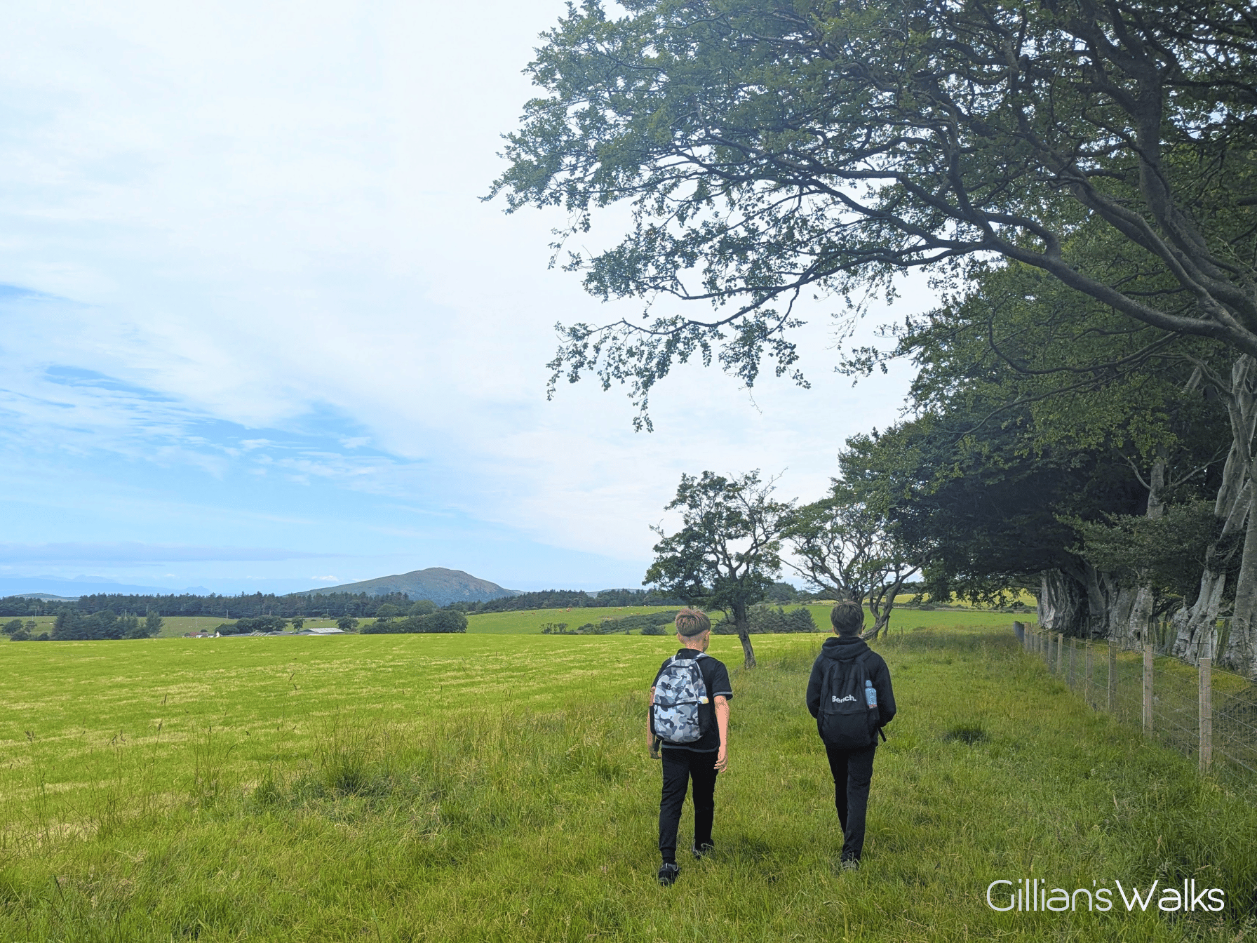
I parked up with the kids in tow and we set off on our wee adventure! It was to be a bit more of an adventure than I had promised, but hey ho, it all adds to the excitement, right?!
I knew the first part of the walk well, having spent a fair bit of time in Ballantrae on my Ayrshire Coastal Path escapades over the past 9 years. Right through the heart of the village, along Main Street, giving our wee Airbnb a wave on the way past. Check-in was from 3pm so we’d get to that much later!
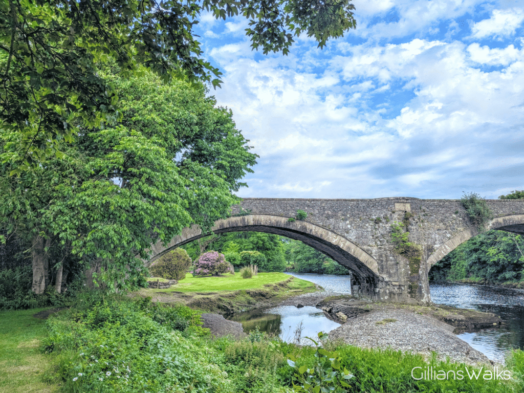
We made a point to cross the Stinchar via the old bridge. My youngest asked me why we weren’t just staying on the road – I guess it felt like an unnecessary de-tour to him. There were a few reasons: because we could (the bridge had fairly recently re-opened after a closure of some 10 years for structural repairs); because it is so much prettier, both as a bridge and the views from it (and it meant I could point out the riverside walk we’d be trying tomorrow!); because it is quieter, safer and more peaceful, taking us away from the lorries and buses and cars trundling past on the main road for a few minutes.
It was exciting to hear the sound of waterfalls on the Kilphin Burn soon after entering the woods. There’s just something about walking near water that changes the feel of a place, isn’t there? Add to that lots of footbridges which let you criss-cross at various points for a better look… ideal. We came across Californian Redwoods! And Bamboo! At times it didn’t feel like we were still in Ayrshire. What we didn’t see, and which I was desperately looking out for, were any red squirrels. Not surprising though really, considering the amount of noise the kids were making! I was just pleased to see them enjoy themselves and wondering how long it would last 😉
We encountered a few fallen trees on the path, likely a result from one of this year’s winter storms – none of them posed much of a problem, a couple of them could easily be stepped over and another we were able to duck under with a bit of care.
Out of the woods and through Smyrton where the real fun began! The leaflet I had told me to go through some gates, however the gate ahead of me was completely blocked by Gorse bushes, and we could see that the path beyond it was also impassable: oh no! The farm track we had been on until now seemed to bend to the right around the field-edge so I decided to follow that and try to walk parallel to our intended route, hoping to find a gate at the other side of the field. There were no sheep or cows in the field, nor crops, and we stayed as close to the edge as we could. The going was quite tough with long grass and some jaggy plants, so I really hoped we weren’t going to have to turn back. Fortunately when we got to the far end of the field there was access over to a gate which turned out to be exactly the gate we would have arrived at had we been able to go the correct way. Phew, back on track!
We encountered both sheep and cows on the next section, both with young. The sheep ran away from us as expected, and the cows were thankfully always quite far from us, so we kept moving “quickly and quietly” as I kept reminding the boys.
We also encountered many gates! Each of them seemed to be different in terms of how they were secured: some a simple pull-lever, some with a hook and chain, some with rope. Not all of them opened, despite our best efforts. Not that the kids minded – any excuse to climb over. I’m always minded of my mum in these situations – she can walk for miles and miles but a route which requires gate climbing can be very difficult for her due to an old knee injury.
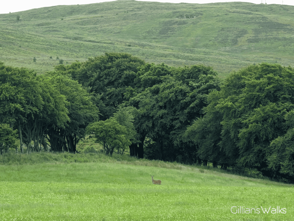
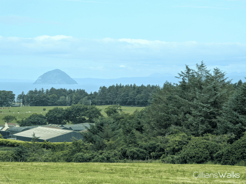
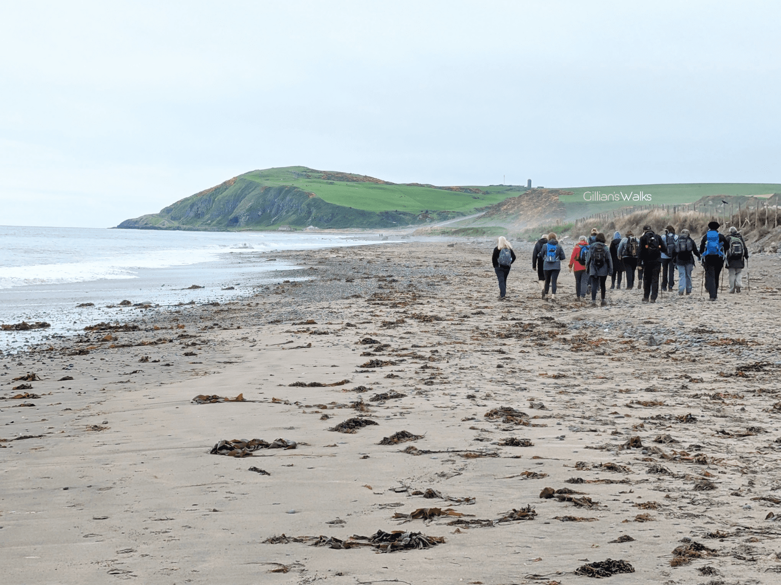
The views…. oh the views! It turns out that you get quite high up on this walk, though it doesn’t feel like there is much ascent at any point (great!). Ailsa Craig was looking insanely clear for one thing. We could also see Arran off in the distance, looking an unusual shape from this angle. It’s the combination of the lush green sheep-dotted fields, followed by the sea, followed by the Clyde Islands that does it for me…. beautiful.
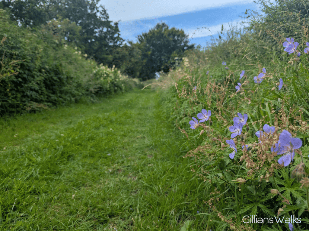
A little surprise towards the end of the loop was the grassy path between the A77 and the minor road which leads to Ballantrae. What a joy! Lined with wild flowers of every colour, it was a feast for the senses, and someone had obviously been mowing it recently, which was greatly appreciated by us.
Ballantrae’s Smugglers….
In the 18th and early 19th centuries, when duties in Scotland were high, there was a constant trade in smuggled goods being brought into Ballantrae from the Isle of Man or Ireland. These places acted as storehouses of contraband goods that had paid very low duties so that they were much cheaper than the same items available in Scotland. Tobacco, brandy, rum, gin, and salt were all landed on the beach at Ballantrae.
There are two smuggling stories involving locations in the vicinity of this walk. The first involves South Laggan which is located just to the north of this walk, close to the River Stinchar. The second story involves Craigbans, Big Park and Little Shallochwreck, just to the south of this walk.
With thanks to the Ballantrae Smugglers Festival for providing these fascinating stories! Find out more about the festival and upcoming events on the Ballantrae Smugglers Festival Facebook page.
There is more information about smuggling in the book, Ballantrae’s Smuggling Story, by Frances Wilkins, available from Craigiemains Home and Garden Centre, Ballantrae.
THIS ROUTE GUIDE WAS COMMISSIONED BY THE BALLANTRAE TRUST, WITH FUNDING FROM BALLANTRAE COMMUNITY COUNCIL. ALL OPINIONS AND PHOTOS ARE MY OWN.
This is one of 4 Ballantrae Smugglers Trails. If you enjoyed it you may like to try the others too:
Ballantrae Smugglers Trail – Panorama Walk
1.5 miles
Ballantrae Smugglers Trail – Knockdolian Hill
7 mile loop
Ballantrae Smugglers Trail – The Beach
4 miles
Ballantrae Smugglers Trail – Glenapp Estate
6.7 mile loop