NEED A SHORTER ROUTE OR A CIRCULAR WALK?
1) Shorten to approx 8 miles by starting at Wellington Square in Ayr, and finishing at Troon South Beach Kiosk – this also makes it more convenient if you are using public transport.
2) Shorten to approx 4.5 miles by splitting the route into two shorter walks: Ayr to Prestwick then Prestwick to Troon.
3) For a circular walk in this area, try my Prestwick to Troon Sea & Golf walk
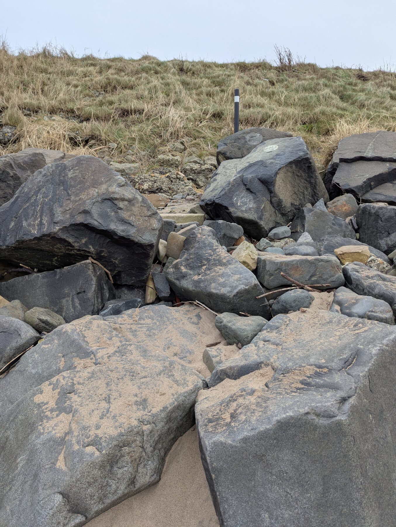
DIFFICULTY RATING: easy. All on the flat and follows a mixture of paved surfaces, cobbles, rough tracks and sandy beaches. Two kissing gates, no stiles, one set of steps. There is one short section some people might find more challenging at Bentfield Point (north end of Newton Promenade) where the route goes down through the rock armoury to access the beach. A small pathway has been created to facilitate access however the step down at the end might be tricky for some. *Can be avoided if necessary – see photos and route description below.
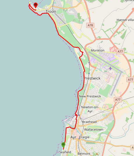
![]() In Ayr there are lots of town centre car parks (charges apply) or free parking at Seafield, or on Ayr Esplanade. In Troon there is free parking at South Beach Kiosk or at Troon Yacht Marina. Frequent bus and train services between Ayr and Troon.
In Ayr there are lots of town centre car parks (charges apply) or free parking at Seafield, or on Ayr Esplanade. In Troon there is free parking at South Beach Kiosk or at Troon Yacht Marina. Frequent bus and train services between Ayr and Troon.
![]() Public toilets at Ayr Pavilion, Prestwick Pavilion and Troon South Beach Kiosk. All payable via contactless only. Check opening times and charges on the SAC website.
Public toilets at Ayr Pavilion, Prestwick Pavilion and Troon South Beach Kiosk. All payable via contactless only. Check opening times and charges on the SAC website.
![]() Purchase the official Ayrshire Coastal Path Guide Book
Purchase the official Ayrshire Coastal Path Guide Book
View full route description
From the beachfront car park at Seafield, Ayr head north along the promenade (water on your left) to a roundabout. At the roundabout turn right (E) onto Blackburn Drive. At the bend in the road turn left (NE) onto a red blaze footpath crossing Low Green.
At the NE corner of Low Green you will emerge at a crossroads. Continue ahead (N) on Wellington Square, passing the Ayr Sheriff Court building.
At the next two crossroads continue ahead (N) on Cassillis Street until you reach St John’s Tower. Turn right (NE) here onto Bruce Crescent, which becomes Montgomerie Terrace, passing some tennis courts on your left-hand-side.
At the end of Montgomerie Terrace continue onto a ramp, taking you down onto a paved area. Turn right (N) and right again (NE), keeping the high walls of the former Citadel Fort on your right-hand-side.
On reaching South Harbour Street, turn right (SE). The River Ayr will be on your left as you walk along this street to a mini roundabout.
Pick up a small pedestrian lane to the right of ‘The Rusty Nail’ – taking you past Loudoun Hall and out onto New Bridge Street.
Turn right (SW) on New Bridge Street, which becomes the Sandgate. Just past Cathcart Street cross Sandgate at a pedestrian crossing then continue straight ahead onto Newmarket Street.
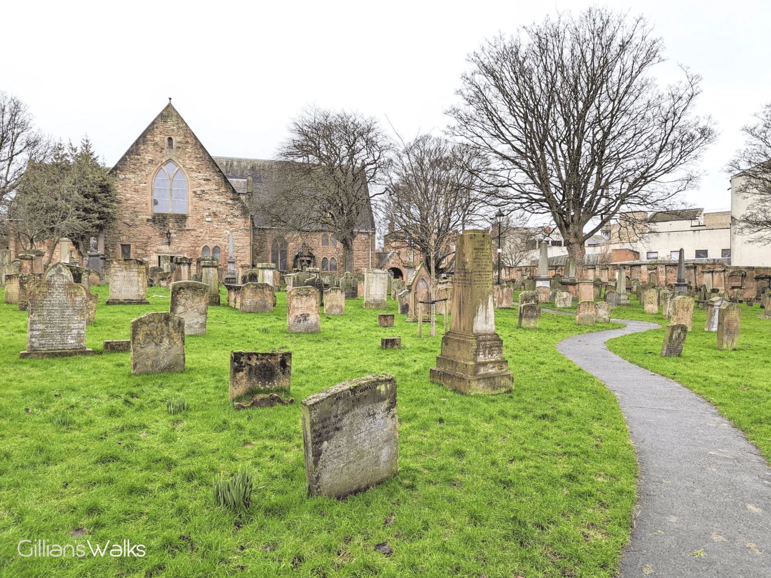
You will emerge onto Ayr High Street. Cross High Street then turn right (S). Take the second lane on your left – Kirk Port which leads to Ayr’s Auld Kirk.
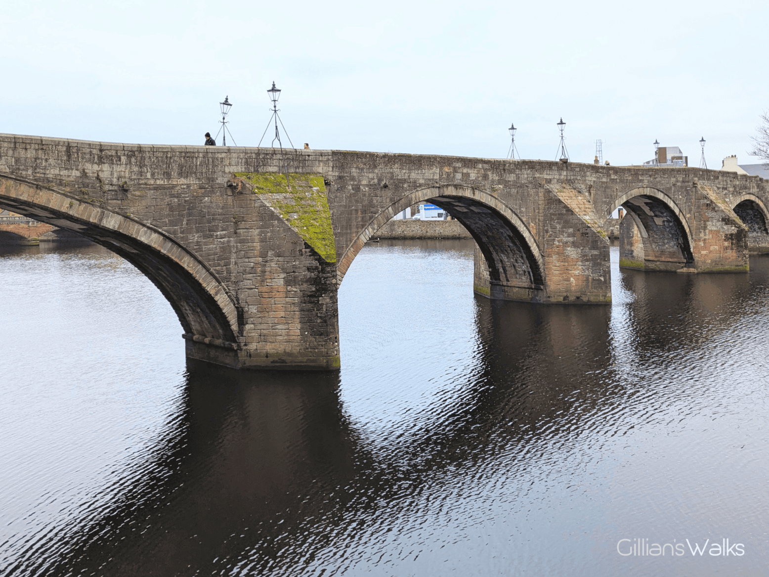
From the church head towards the river then turn left (NW) to walk along the riverside path (river on your right-hand-side) to a set of steps leading onto Ayr’s Auld Brig.
Turn right (NE) to cross Auld Brig then turn left (NW) along River Street to Main Street/A719.
Cross Main Street/A719 and turn right (N).
After 300m, at a fork on Main Street next to National Tyres and Autocare, keep left to join Peebles Street. At the end of Peebles Street turn left (W) onto Waggon Road and take the first right (N) onto Glebe Road.
Turn left (W) at the end of Glebe Road to follow the street to the railway bridge. Cross the bridge and and wind down Saltpans Road to Newton-on-Ayr promenade.
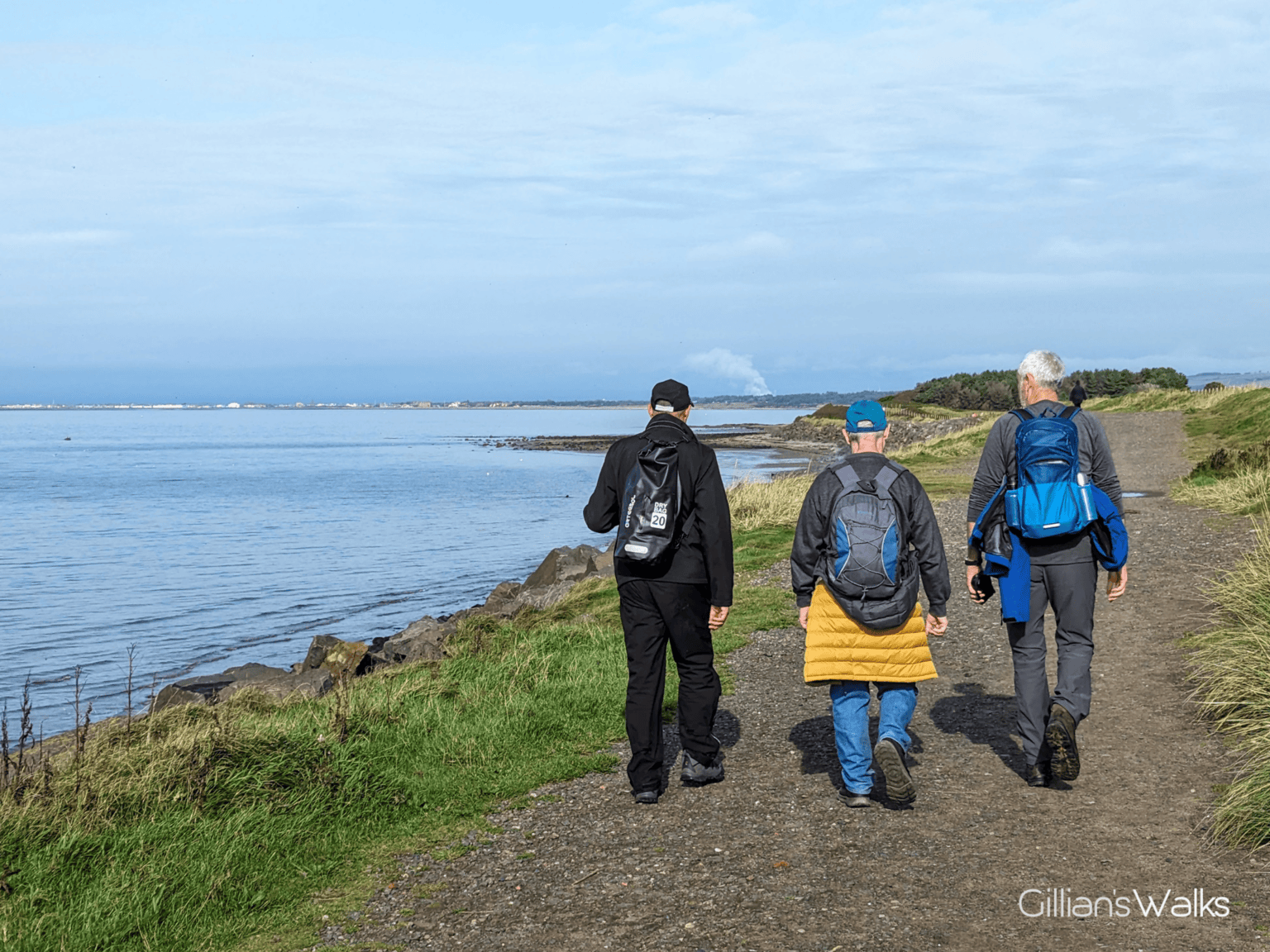
Turn right (N) and walk along Newton-on-Ayr promenade. At the north end of the Promenade, continue ahead through some metal gates (usually always open) and up onto a rough track which runs between Prestwick St Nicholas Golf Course and the sea.
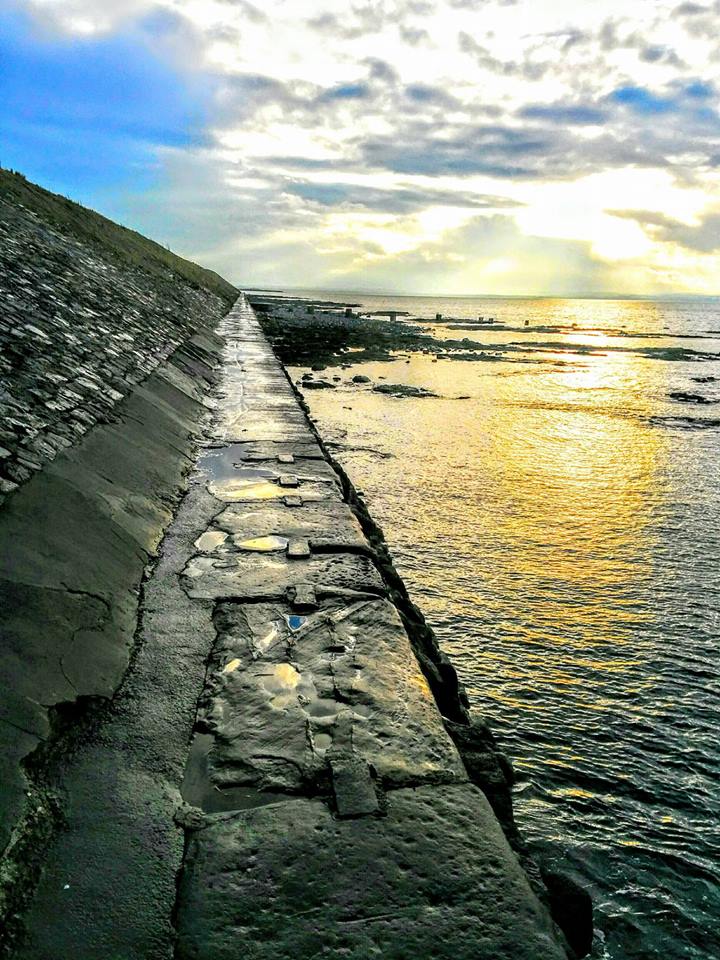
Approx 500m along, at an Ayrshire Coastal Path marker post, bear left onto a narrower footpath leading down through the rock armour and onto the beach. *On days when there is a very high tide this might be impassable – in which case bear right to follow the track along the edge of the golf course instead.
Continue on the beach until you reach a ramp up onto Prestwick promenade, approx 1km round.
Continue along Prestwick promenade until you pass the Kidzplay building, keeping it on your right-hand side. Make your way down onto the sandy beach.
Approx 1km along the beach, look out for an Ayrshire Coastal Path marker post in the sand dunes to your right. Turn right (E) here to go over the sand dunes and onto a sandy footpath along the edge of the golf course. There should be a fenceline on your right-hand side.
After crossing the Pow Burn via a footbridge, keep left. You will reach a gate with a kissing gate at each side of it. Go through the kissing gate on the left then turn left (W) to walk along a surfaced track just outside Prestwick Holiday Park. The path soon narrows and becomes sandy, bending to the left (NW) to emerge next to the Pow Burn.
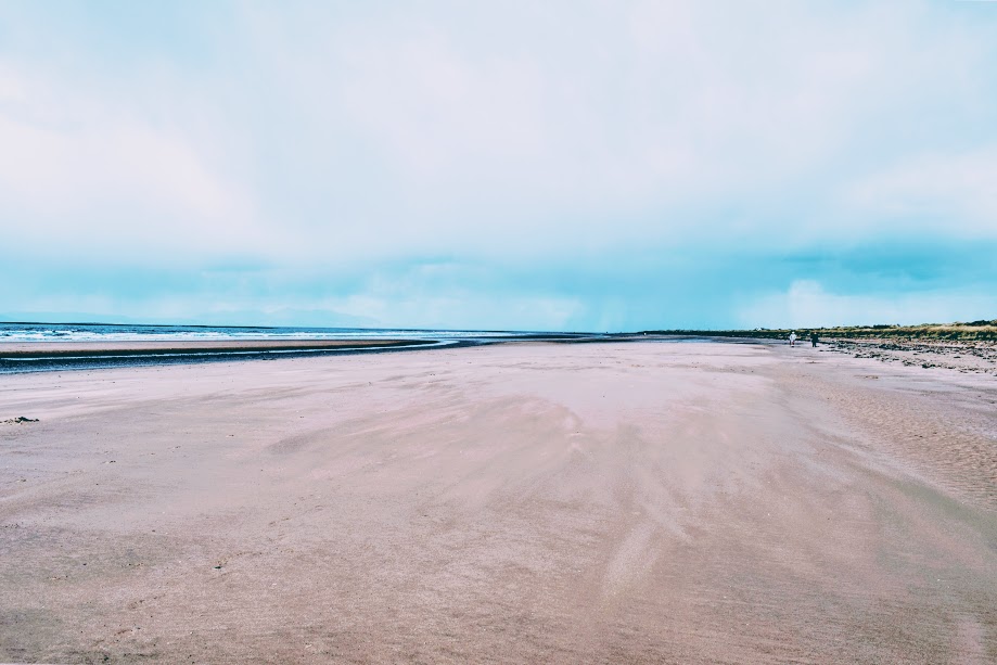
Continue onto the sandy beach of Troon South Sands with the Pow Burn on your left. Walk North along the beach for approx 3km, heading up onto the promenade at any of the ramps to arrive in front of Troon South Beach Kiosk (public toilets here).
Turn left (W) along the promenade for 400m and at a small car park continue ahead (W) to reach Titchfield Road.
Walk along the pavement next to Titchfield Road to the base of a high grassy mound (the Ballast Bank). Here you can choose to either walk along the cliff path to the left (not recommended at high tide) or take the steps up onto the Ballast Bank. Both end at a car park 700m along.
Walk through the car park then turn right (NE) to stay on the road. At the end of the road turn right again (S) onto the B749/Harbour Road. You will arrive at the entrance to Troon Yacht Marina approx 600m along on your left.
WALK REVIEW: April 2017 & December 2024
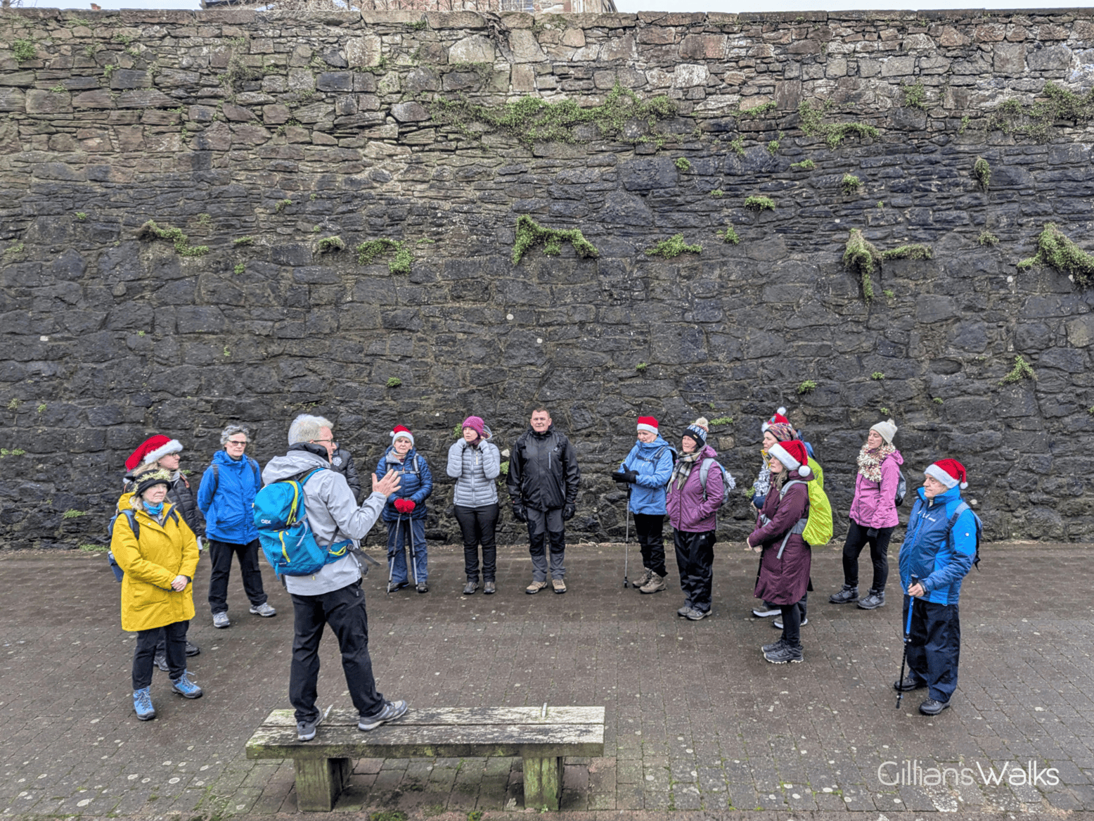
This is the section of the Ayrshire Coast that I am most familiar with; it is the one closest to where I live so I had been coming here my whole life. For that reason it was the stretch I was least looking forward to when I set off on my 100 mile charity walk of the Ayrshire Coastal Path in April 2017. Today was day three for me and would see me walk 25 miles between Ayr and Ardrossan, this 9 mile stretch being part one of that. Having walked the first half of the ACP alone (50 miles), I was delighted to have company today in the form of my mum and friend Helen. It was a particularly blustery day with some heavy rain at times and a fair bit of mileage along sandy beaches, so having people to share the experience with really made a huge difference to my morale.
The route I took that day was the most direct one north, missing out Ayr Town Centre, which I understood to be an optional de-tour. I had a lot of miles to cover and felt that I had been through Ayr plenty of times before so there would be nothing new to see….. (How wrong I was! More on that below). So I continued along the promenade instead of coming off at Low Green, and then followed the River Ayr inland to New Bridge Street then off I headed to Newton-on-Ayr, eager to reach Prestwick.
I have since returned to walk this section many times with groups as part of my Ayrshire Coastal Path Discovery Series and have grown particularly fond of the part which goes through ‘historic auld Ayr’. In fact this is now the official route and is fully signposted as such. Many people tell me that this part of the walk is a highlight of the whole series for them!
Before you know it, you’ve spent up to an hour discovering parts of Ayr you didn’t know existed!
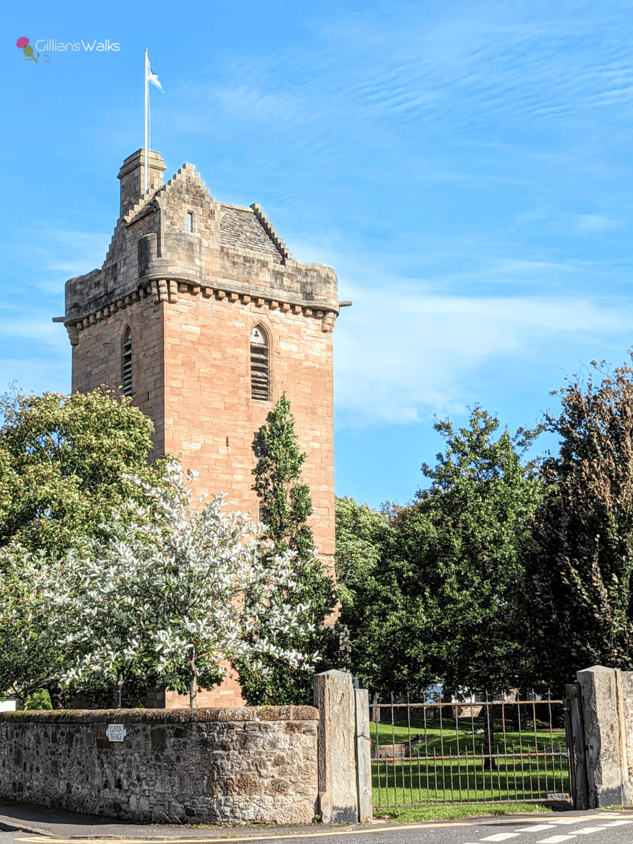
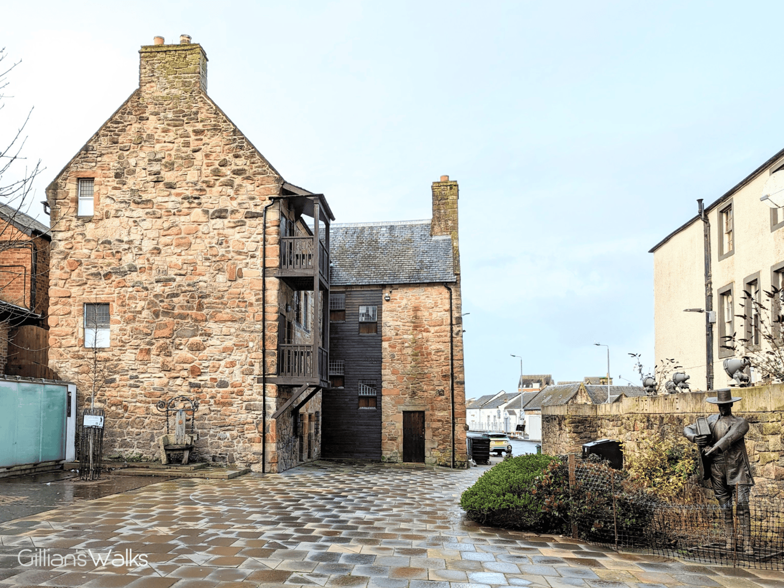
Crossing the river takes you to Newton-on-Ayr, which was actually a separate settlement until the 19th century. Here the Carnegie Library and Newton Tower are significant landmarks to look out for, before you continue on your journey north.
Full disclosure – I don’t particularly enjoy the section between the Auld Brig and Newton Promenade. It is very industrial with lots of traffic and noise. Not where I would normally choose to go for a walk. Having said that it is a relatively short section with few alternatives, otherwise I assume the ACP would not pass this way!
It is a relief to arrive at the start of Newton-on-Ayr Promenade. Take a moment to pause and enjoy being back by the sea! At high tide and if there are strong winds, the water will often splash up over the sea wall here – very dramatic! In calm conditions at high tide I have been amazed at how clear the water is – colourful pebbles visible below the surface. At low tide the sandy beach looks very pleasant. I can imagine coming here with the kids, who would love throwing the pebbles into the water. Quieter than the main beaches in Ayr or Prestwick, I noted. One thing that stood out though was the unnecessary number of bins along the promenade!! For such a quiet place it seemed a tad overkill! Perhaps it gets busy here on a hot day?!
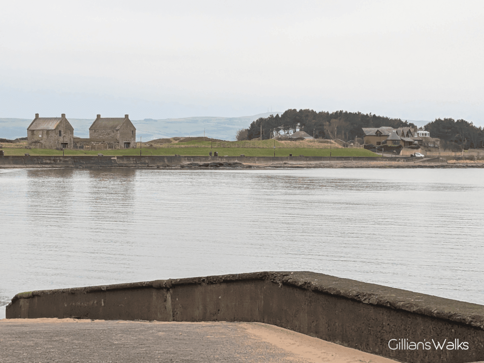
From the southern end of Newton Promenade you can see the impressive Blackthorn Salt tower and also, if the tide is low enough, the Kaffir shipwreck – a steam-powered cargo vessel which ran aground in 1899.
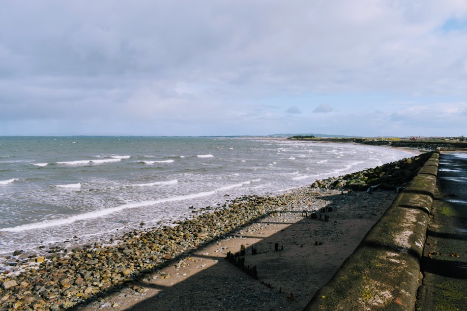
The track between here to Bentfield Point is one of the highlights of the walk for me – its elevated position gives you lovely views across to Arran and back towards the Carrick Hills and the Heads of Ayr, as well as ahead to Troon. Heading past Prestwick St. Nicholas Golf Course I always keep a look out for my Uncle Rab who might be out there somewhere enjoying a round!
The Ayrshire Coastal Path volunteers have worked hard to create easier access down off this track, through the rock armour to the beach at Bentfield Point. It is also very well way-marked. Some people might still find it a bit tricky – see photo below. At all but the highest of tides you can access the beach here and walk around the Point to Prestwick Promenade. On the off-chance it is impassable, or if you are keen to avoid going down over the rocks, there is an alternative route inland on a good track along the edge of the golf course.
The next stage is an easy walk along Prestwick Promenade. Look out for the historic salt pan houses, and be sure to stop at Mancini’s for an award-winning ice cream! This family business has been in the area for over 100 years, and the Pavilion it is housed in dates back to 1910! You might also be grateful for the public toilets at this point…
A little further along close to Kidzplay, you will pass a sunken concrete area. It looks quite unremarkable today, but go back to the 1930s right through to the early 1970s and it was a bustling ‘bathing lake‘. People used to travel from all over to come here, usually by train or bus. It was one of the largest outdoor pools in Scotland at the time, able to accommodate over 1000 bathers (who braved the unheated sea water) and 3000 spectators. Swim galas would be held here too. Its demise, like so many other seaside towns, was the lure of cheap package holidays abroad.
I love the walk along the sand dunes between Prestwick and Troon. The view from up there is beautiful. Although I tend to walk on the sandy beach now, since reading about how important sand dunes are and learning that by walking on them I am contributing to their erosion. There hasn’t been much beach walking on this route so far, so it is a welcome change in any case.
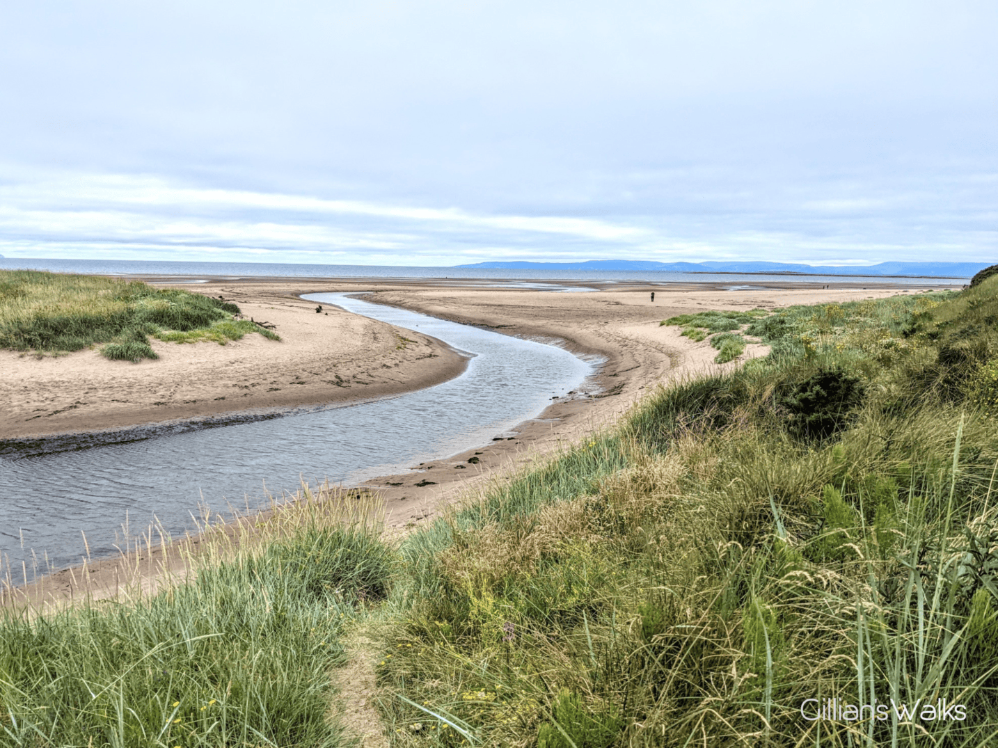
Important to look out for the Ayrshire Coastal Path marker post in the dunes a little more than halfway along the beach. If you miss it, you’ll likely end up at the mouth of the Pow Burn, on the ‘wrong’ side and unable to get across. The marker post directs walkers up over the dunes and along the edge of Prestwick golf course, followed by Prestwick Holiday Park, and finally Royal Troon golf course, to emerge at the other side of the burn with dry feet! It is a particularly enjoyable section in the summertime when the paths are lined with a variety of coastal flowers visited by butterflies.
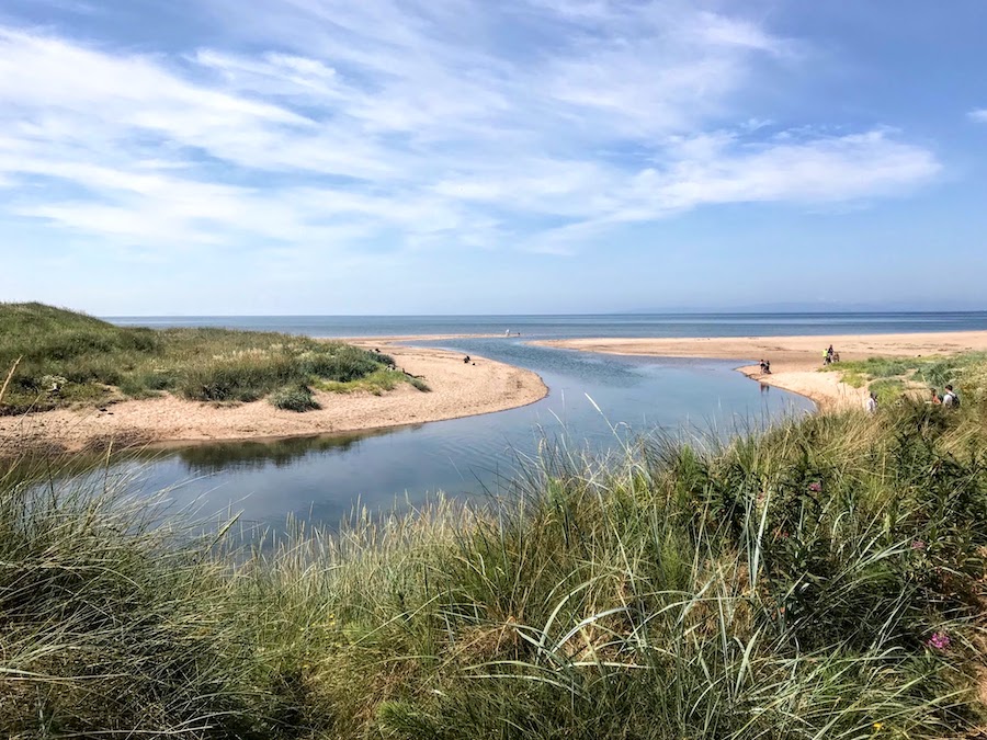
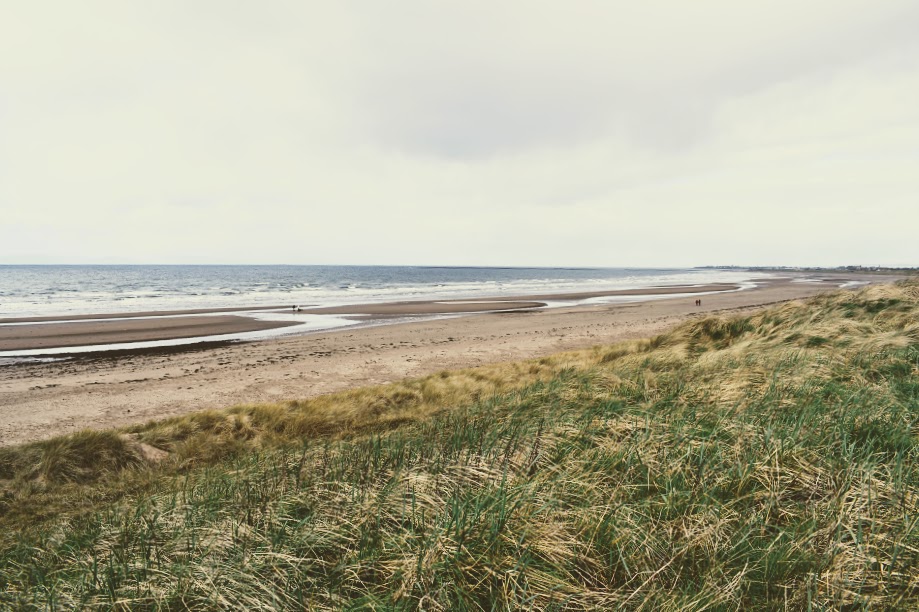
The Pow Burn is another highlight of the walk! So beautiful and unexpected the first time you visit. The area at the mouth of the Pow Burn is a designated Site of Special Scientific Interest and you can often see a variety of bird life here, including swans.
Troon South Sands is all that stands between you and Troon now. A fantastic long stretch of golden sandy beach which makes for easy walking. Just around the corner, look out for kite surfers who frequent the bay here on a breezy day!
I equally love the cliff walk in Troon! It is a difficult choice between the ‘cliffs’ (the lower path) or the grassy mound known as Ballast Bank; both offer equally exciting experiences: I love the cliffs because they feel dangerous (adventurous?) The path is very well made but a little uneven and sometimes the sea water can crash up onto it! On the other hand the views from the top of the Ballast Bank are simply spectacular on a clear day and towards the end of it you get a birds-eye view into the sawmill, always popular with my kids!