NOTE JAN 2025: Due to storm damage caused by Storm Eowyn there is a short 200m stretch of this route between Knock Hill and Routenburn Rd which is currently closed as fallen trees are completely blocking the path. I have described a diversion below which adds approx 1km. The closed section is the wooded Glen at the Blackhouse Burn (between the bottom of the field and the Routenburn Road). To de-tour around it, turn left at the kissing gate at the bottom of the field and walk along the edge of the bushes in a SE direction for approx 150m, where you can turn right (SW) to pick up a track. At some gates, turn right (W) to continue along the farm track, passing through a metal gate and then down onto the Routenburn Road. Turn right on Routenburn Rd to continue along the Ayrshire Coastal Path route.
DIFFICULTY RATING: Moderate. This is a hilly walk! Starting at sea level you gradually work your way up to Knock Hill summit via paved surfaces, farm tracks and hillside trails – nothing steep. The remainder of the walk is also hilly with plenty of sustained inclines and declines on single track roads, some of them steep. The hill trails are usually pretty wet and boggy (think of a giant peaty sponge). There are often sheep on and around Knock Hill. Three kissing gates and two large metal deer fence gates.
LOW ROAD OPTION: From Largs the Ayrshire Coastal Path splits into two: the high road (via Knock Hill as described here) or the low road via Routenburn Road. I would still rate the low road as moderate due to the amount of ascent and descent – don’t be fooled – you still go up quite high. The big difference is you stay on well-surfaced quiet roads, skipping out the (often wet and boggy) ascent of Knock Hill. Note however that the two routes merge and even the low road requires a lot of ascent and descent prior to reaching Skelmorlie.
WANT A CIRCULAR ROUTE? Try my Knock Hill Circular from Largs
![]() Car parks at Largs Marina (KA30 8EZ) and Wemyss Bay Train Station (PA18 6AR) where there is a charge. There’s a regular local bus service between Wemyss Bay and Largs with a handy bus stop across the road from Wemyss Bay train station. The provider is McGill’s – be aware that on my last trip the 11 minute journey cost a whopping £6.30 single! On the plus side, you can often see seals basking on the rocks as you journey along the A78 – not sure if that makes the price seem any better?!
Car parks at Largs Marina (KA30 8EZ) and Wemyss Bay Train Station (PA18 6AR) where there is a charge. There’s a regular local bus service between Wemyss Bay and Largs with a handy bus stop across the road from Wemyss Bay train station. The provider is McGill’s – be aware that on my last trip the 11 minute journey cost a whopping £6.30 single! On the plus side, you can often see seals basking on the rocks as you journey along the A78 – not sure if that makes the price seem any better?!
TOILETS: There are public toilets on Largs Promenade (chargeable – contactless payment only) and at Wemyss Bay Train Station (free). Skelmorlie Secret Bunker is located approx two thirds of the way along the walk and welcomes Ayrshire Coastal Path walkers to use their portaloo during their opening times, which at time of writing are 1pm-5pm on weekends between April and September. Check their website for updates.
![]() Purchase the official Ayrshire Coastal Path Guide Book
Purchase the official Ayrshire Coastal Path Guide Book
View full route description
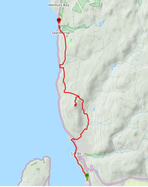
Head North from Largs Yacht Haven to pass Largs’ famous Pencil monument. Follow the coast along for 1.6km to cross the Gogo Water then follow Bath Street 300m to reach Largs ferry terminal.
Head North along the Esplanade for 1km to reach Aubery Park and it’s pond. Cut across the park and turn right to follow the Noddsdale Water to the A78. Turn right onto the A78 then first left onto Barr Crescent.
This residential street becomes Noddleburn Road. Take a left off Noddleburn Rd to follow a lane close to the burn as far along as you can. There are some steps at the end of it then another short lane leading to Glen Avenue. Turn left and follow Glen Avenue to emerge onto Brisbane Glen Road. Turn left and walk along Brisbane Glen Road for 640m to a fork. Keep left to follow the way-marked farm track to Brisbane Mains Farm. The route passes through the farmyard via a kissing gate.
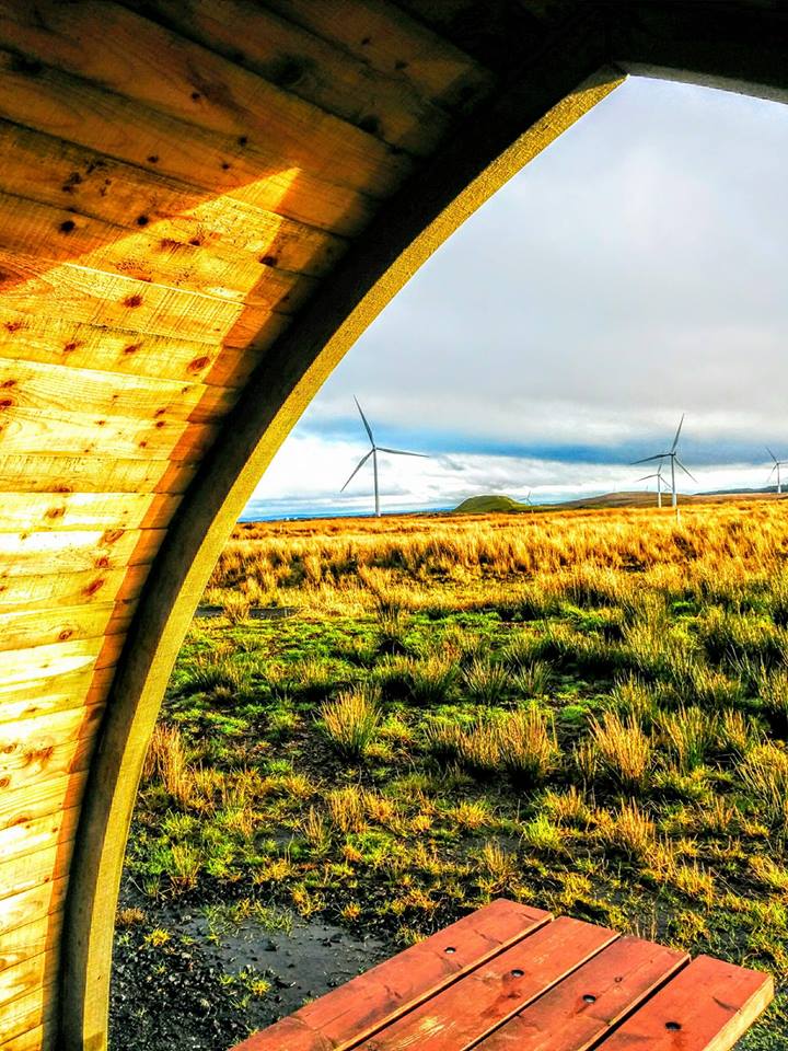
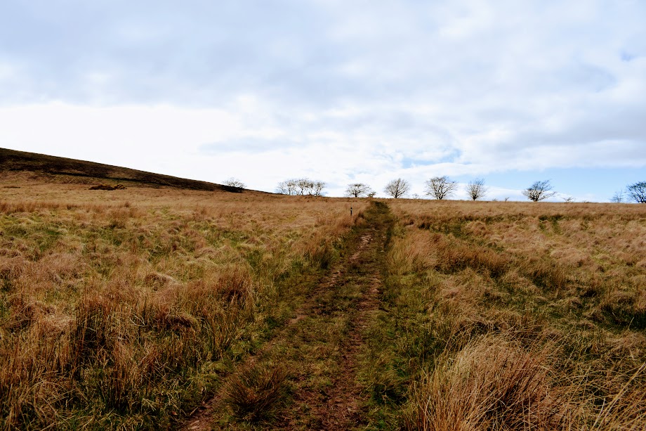
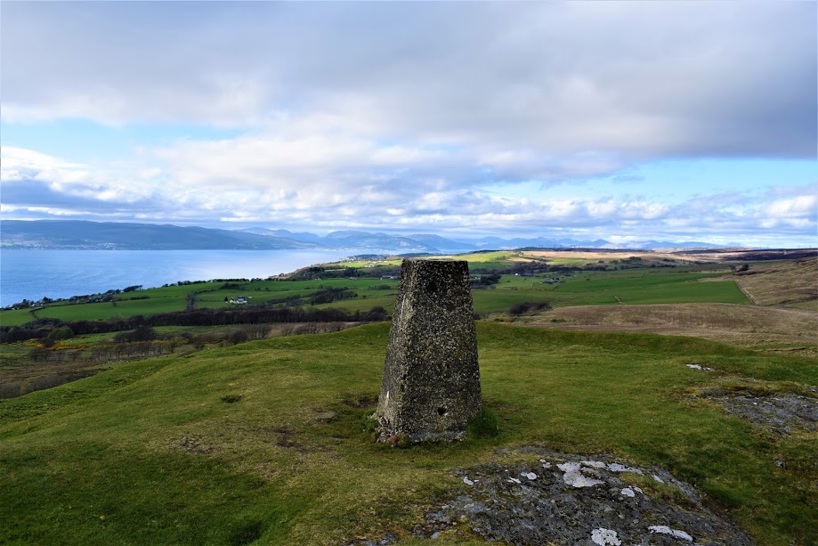
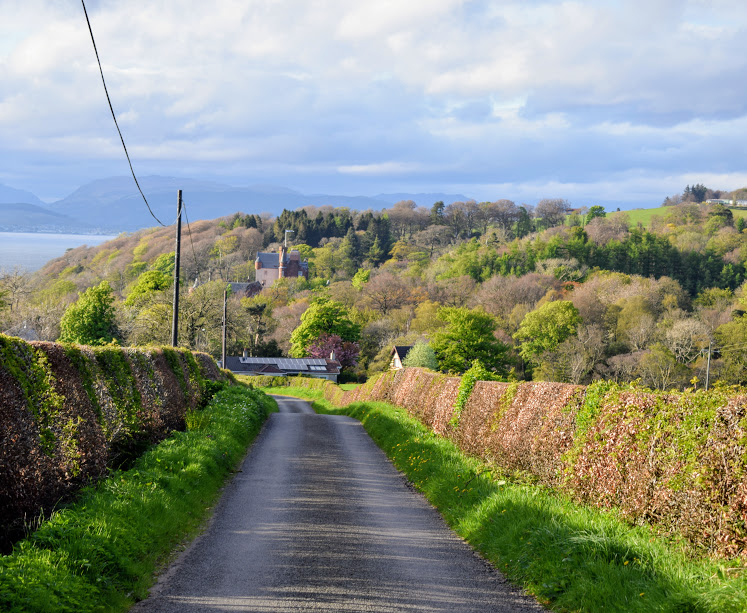
After 1km on gradual ascent, the farm track bends to the left (NW) onto a less defined trail across boggy peatland. Keep left at two forks to stay on the Knock Hill path. The trail bends South towards the hill, and once at the base you can either take the steep path going straight up the slope or for a gentler ascent there is also a trail which circles around Knock Hill several times up to the summit trig point.
From the summit return via the same route to an Ayrshire Coastal Path marker post where you turn left to follow a narrower track down to a deer fence. Turn right to follow this along to a tall metal gate immediately followed by a wooden kissing gate.
Once through both gates keep to the left of the trees, heading downhill (NW) over a field. After a short distance a deep wooded glen will appear on your right-hand-side, with the Blackhouse Burn running through it. Follow the fenceline down the hill to a kissing gate. *Note the next 200m of path between here and Routenburn Rd is currently closed due to storm damage – please follow diversion at the top of this article*. Go down through a small woodland with some steep, uneven ground, to emerge onto Routenburn Road.
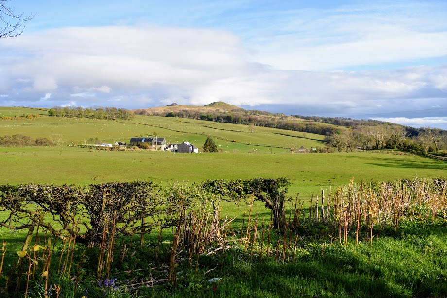
Turn right (N) and continue along this pleasant minor road for 2km, passing Skelmorlie Secret Bunker, then through the hamlet of Meigle and ending at the busy A78 Trunk Road.
Cross over then turn right (N) to walk along the roadside pavement for a short 20m, crossing again to take the first road on the right onto another minor road leading steeply uphill to Skelmorlie Castle. Continuing uphill, the road passes Skelmorlie Mains Caravan Park before beginning to head back downhill and into Skelmorlie itself.
Walk North along Skelmorlie Castle Road for approx 1km. Go straight on at the crossroads beside Eglinton Bar onto Skelmorlie Cross. At the next crossroads, turn right onto Station Road. Station Road is a steep brae which winds its way downhill to the A78. Turn right on the A78/Shore Road to cross the Kelly Burn. Wemyss Bay Train Station will be in view and marks the end of this walk.
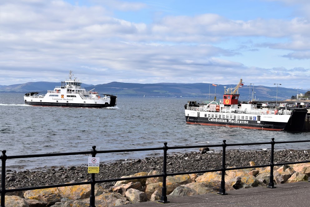
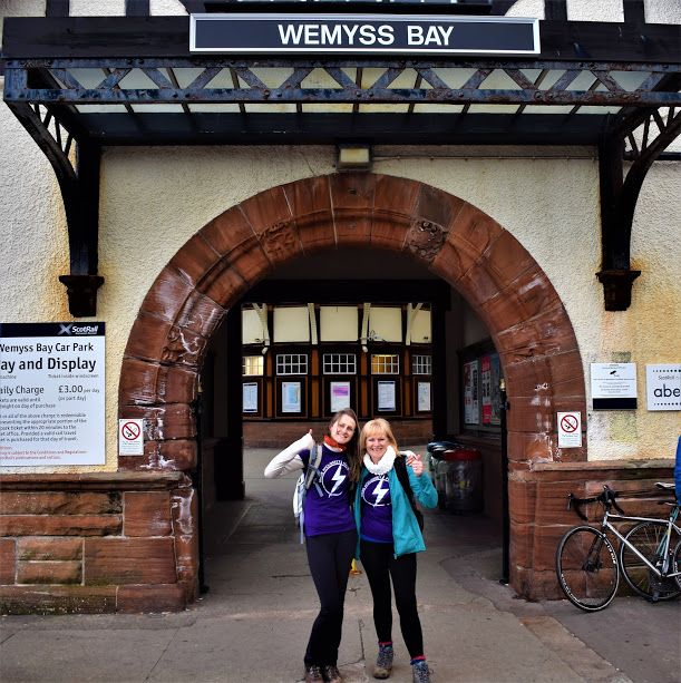
Note: the official end point of the Ayrshire Coastal Path is at the site of a grit bin on the left bend near the bottom of Station Road, however there is currently nothing to mark the location due to storm damage caused by Storm Eowyn in January 2025. Suggest celebrating at Wemyss Bay Train Station, which has been described as “Britain’s loveliest railway station” by writer Sir Simon Jenkins. I haven’t seen them all to be able to cast a vote, however I do agree that Wemyss Bay is particularly lovely!
WALK REVIEW: 23RD APRIL 2017
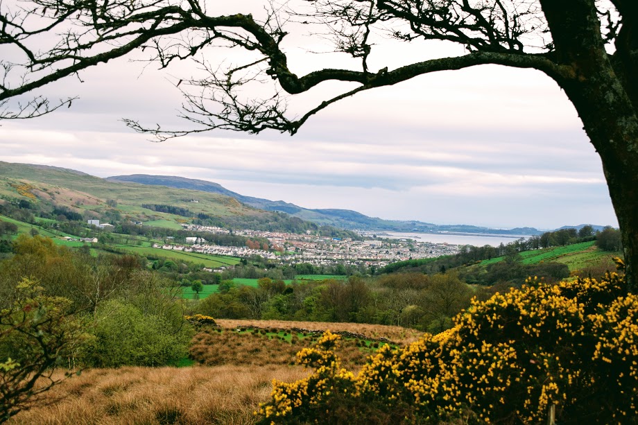
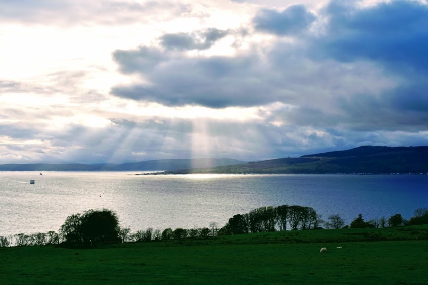
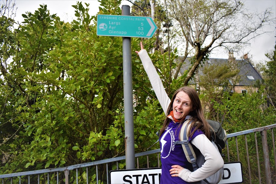
There are two options for this final section of the Ayrshire Coastal Path: the low road and the high road. Despite the fact it is several miles longer and I had already walked 13 miles by the time I arrived in Largs, naturally I chose the high road! From what I had read it sounded more interesting and over the course of my 4 days on the Ayrshire Coastal Path I had experienced some amazing scenery along the higher paths. Plus I had never been up Knock Hill before 😉
My mum came along too, she wanted to do the last leg of my charity walk with me so had joined me in Portencross earlier in the afternoon. I don’t know why, but it wasn’t until I reached the final way marker that it really hit home I had just walked 100 miles! It wasn’t something I had given any thought to before embarking on the walk for the Mark McCloskey Foundation, but to have rocked up at Wemyss Bay with only myself to celebrate with would have been a real shame so I am truly grateful to my mum for walking all that way with me. She was there for parts of the final two days and it gave me a great morale boost. As it was, my dad and family friend Archie came to collect us in Wemyss Bay and even walked the last mile with us. It was then off to Ardrossan for a well earned chippie!!
I have mixed feelings about this Largs to Wemyss Bay walk. I want to say it’s a great walk and I think it is, but I’m finding it hard to muster up the enthusiasm it deserves. I am confident that is only because I was so exhausted by the point of starting it that I couldn’t properly appreciate it. Largs just seemed enormous, a never ending promenade….(although it is worth mentioning that there are more benches in Largs than on the entire rest of the Ayrshire Coastal Path put together!!) and when we reached the A78 towards the end of the walk we both could have quit there and then when we realised that the uphill bits weren’t over yet! Now that I have been to the top of Knock Hill, I would consider trying the low road next time for a gentler, less boggy experience.
On a more positive note, the views along this walk were stunning and apart from the long walk through Largs, I found that things stayed interesting thanks to constant changes in terrain. I liked that it involved a bit of hillwalking too and I am wondering whether Knock Hill might be an option with the kids one day if I can find somewhere closeby to leave the car….


Go to: previous section Portencross to Largs
Go to: full Ayrshire Coastal Path review