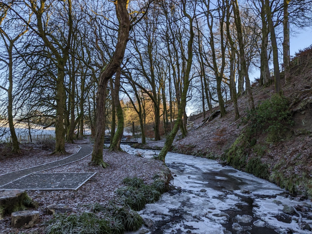
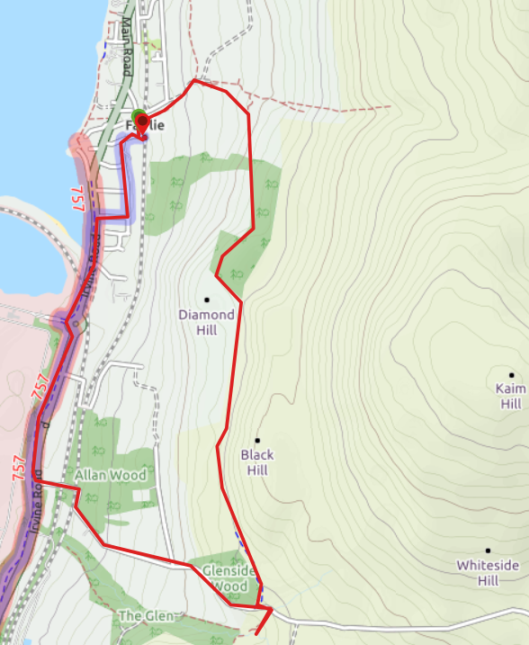
JANUARY 2025: the track along the base of Black Hill is heavily rutted due to a combination of recent (early 2024) forestry works and cows. It is very hard-going particularly after any rain. Much of this muddy track can be avoided by de-touring up onto Black Hill and along the ridge. See route description and photos below for more info.
Terrain: This route is graded Moderate. A variety of woodland paths, rough farm tracks, grassy fields and surfaced road/pavement. Parts of the route can be very boggy at times. It is a hilly walk, starting almost at sea level, with 600 ft of vertical height gain (more if you go up Black Hill). There are several kissing gates and metal stock gates. There is one ford to cross, with plenty of stepping stones. See also notes above and photos following forestry works in 2024 which have impacted on part of the route.
![]() Dog-friendly walk (note: sheep and/or cows can be present along most of this route at different times of the year – please be a responsible walker)
Dog-friendly walk (note: sheep and/or cows can be present along most of this route at different times of the year – please be a responsible walker)
![]() Walk starts from Fairlie Train Station (KA29 0DX) where there is a small car park and on-street parking. Regular trains between Fairlie and Glasgow / the Three Towns. Bus stop on Main Road/A78, a couple of minutes walk from the start.
Walk starts from Fairlie Train Station (KA29 0DX) where there is a small car park and on-street parking. Regular trains between Fairlie and Glasgow / the Three Towns. Bus stop on Main Road/A78, a couple of minutes walk from the start.
View Full Route Description
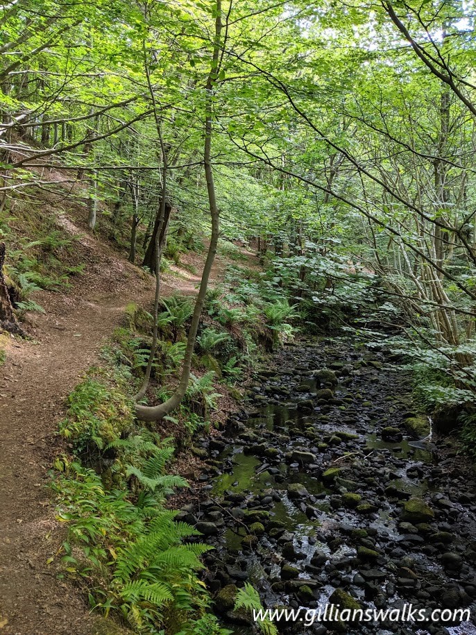
From Fairlie Rail Station follow a lane heading North between the last house on Station Road and some trees. After only 80m it emerges onto Burnfoot Road where you turn right (E) to follow a path signposted “Fairlie Castle, Glen & Waterall, Kaim Hill”. From here a woodland path follows Fairlie Burn up through the glen to the remains of Fairlie Castle.
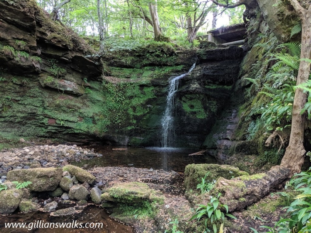
There are several small waterfalls as you climb through the glen. The first ‘major’ waterfall is located just off the path beside the castle. You can pick up a faint trail in the trees heading towards the burn and if you follow it upstream a little across rougher ground, you will reap your reward.
Return to the main path at the castle and continue uphill.
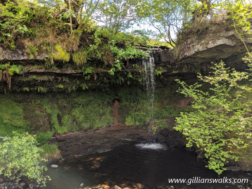
You’ll see a wooden footbridge on your right. You can either cross now, or follow the route to another stunning waterfall a little further up the glen (some scrambling is required to reach it). If you want to pay it a visit, continue along the main path for approx 200m. Look out for a wooden sign that says ‘Waterfall’ on your right at one of the bends in the path. Follow the trail into the trees and up a muddy banking. You will hear the noise of the waterfall before you see it! Enjoy, then retrace your steps back to the footbridge.
Cross the footbridge, go through the kissing gate and you will emerge onto a meadow. Cross the meadow diagonally uphill (SE) to a gate in the wall. Go through the gate.
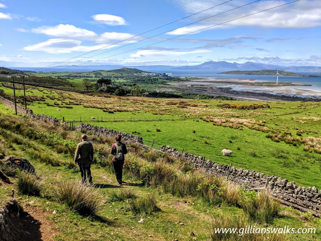
There are 3 paths from here (only one shown on the map) – take the middle path which initially heads uphill then bends to the right to run parallel to the wall heading south. On a clear day the views from here are spectacular! Traverse the hillside for approx 220m, gradually gaining height to emerge at a gated entrance to the woods.
Immediately on entering the woods there is a small ford to cross and another gate, then the path continues through the trees.
Note there have been some forestry works at the S end of the woods, with a large volume of tree felling so the ground becomes extremely churned up and boggy where the track widens. You will eventually reach a gate leading onto a field approx 650m along from the ford.
Go through the gate. Follow a faint path left (SE), almost parallel to the dry stone wall. At the end of the wall go through a gate and then through a second gate, to reach the base of Black Hill.
Here you have options:
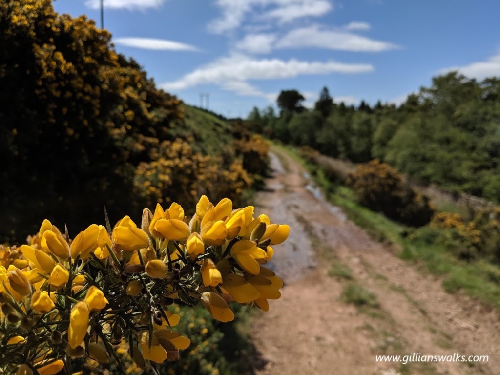
1) follow the route plotted on this map which means turn right (S) and follow a wide track along the base of Black Hill (can be very boggy and has been churned up by the recent forestry works and cows). Or…
2) turn left instead, following the fenceline and looking out for a faint trail heading SE up the hillside on your right. This takes you up steep ground onto the wide heathery ridge of Black Hill. Keep right at a fork to descend to a wide track at the base of the hill. Turn left (S) along the track.
To avoid a boggy and waterlogged descent to the Fairlie Moor Road, when you arrive towards the end of the track, keep right to go through a metal gate, staying on this wide track all the way down onto the road. The last gate may be padlocked which would require climbing it, although there is a narrow gap to the left which it may be possible to squeeze through.
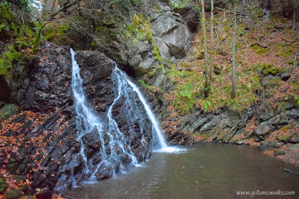
Once on Fairlie Moor Road, the continuation of the route is to the right, but for a short and very worthwhile detour to another waterfall turn left (E) along the road for 90m.
Just beyond the bend in the road, look for a faint footpath on the right (not signposted). There is a viewpoint over the waterfall which isn’t difficult to reach, however the descent to Glen Burn beyond this point is steeper and sometimes slippery. You can actually walk in behind the waterfall if there isn’t too much water at the time of your visit!
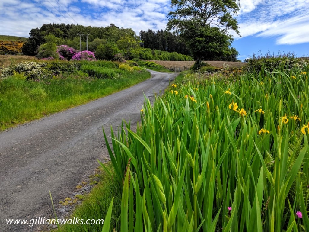
Retrace your steps to the Fairlie Moor Road, turn left (W) and follow it downhill for 1.5km to meet with A78/Irvine Road. Take care crossing over then turn right (N) onto the NCN 757 / Ayrshire Coastal Path route.
Continue along the cycle path for 1.3km to reach Fairlie. Take the second road on your right (E) onto Montgomerie Avenue and at the end of the street turn left (N) onto Montgomerie Drive. Station Road is at the end of this street. Turn right (E) on Station Road to reach Fairlie Rail Station.
WALK REPORT: May 2019 / January 2025
This is a route which I planned with EnRich Outdoors for the Clyde Muirshiel Walking Festival. I had opted to lead one closer to home than the previous year’s Four Waters to Corlic Hill route, mainly to cut back on travel time. Fairlie wasn’t an area I knew that well, so I had some exploring to do before we could promote the walk on the festival programme!
We recce’d the route on a glorious sunny day in May and were rewarded with the most magnificent views across to the Cumbraes and the Isle of Arran. I couldn’t believe the turquoise of the water or the pink sands of Fairlie and Hunterston beaches – it felt like we were on one of the western isles or abroad. Unfortunately when we led the walk for the walking festival the weather wasn’t quite so kind!

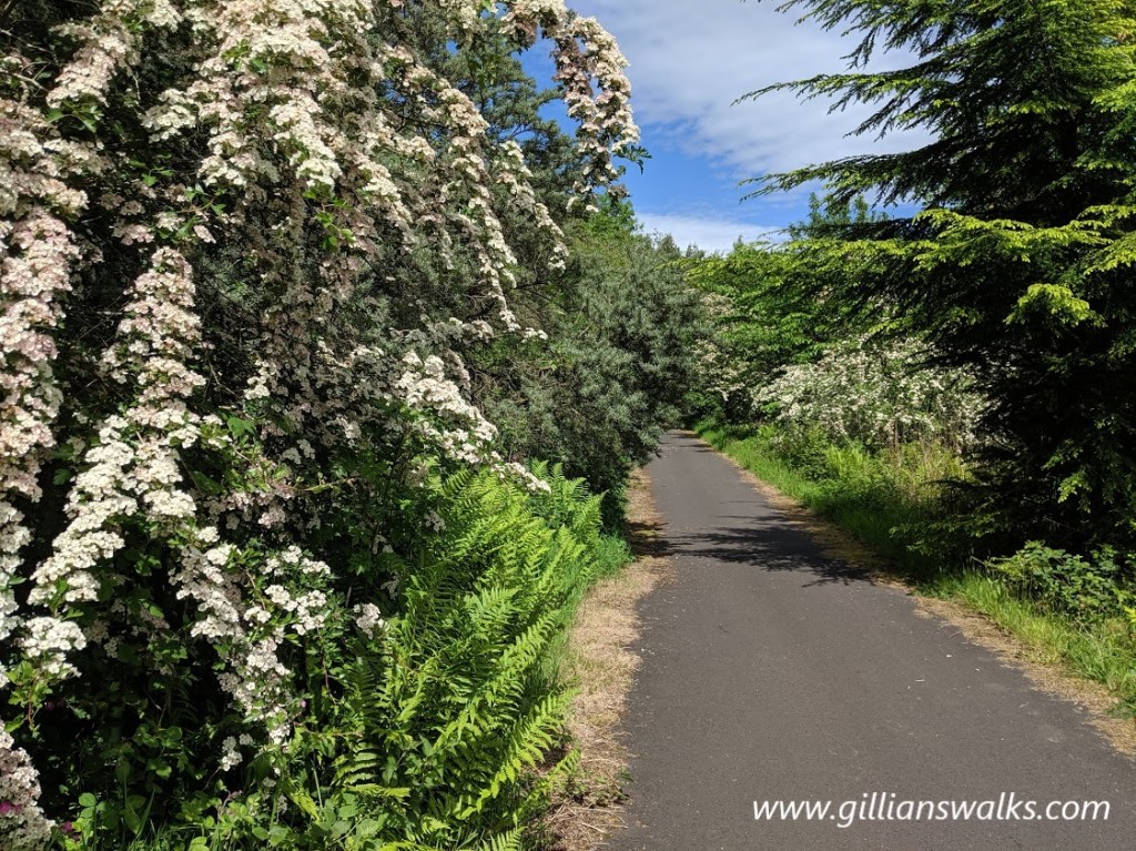
Another highlight of this walk is the two woodland sections – first Fairlie Glen where there are lots of mini waterfalls in the Fairlie Burn, and then coming along the Southannan Burn a bit further along, which is just idyllic. Sadly the southern end of the second woodland has been subject to timber felling in early 2024 and on my last visit looked like a disaster-zone. Probably not helped by the fact it was winter and everything was frozen. Hopefully it will regenerate soon, though I can’t help but reminisce about what once was….


If you fancy gaining a bit more height on this walk you can go up Black Hill and along its ridge, instead of using the track along the base. The climb up is quite steep but not far, and it’s well worth it for the additional views. The path along the top can sometimes be in better condition than the one along the base, as the lower path has been used for access during the recent forestry operations. On my last visit it was pretty boggy and uneven. There are directions for both options if you expand the ‘View Full Route Description’ section above.


The waterfalls were actually a surprise to me on my first visit! Although appearing hidden, it turned out that the first one was not really, as we later crossed over the top of it on a footbridge. Still, it is much nicer to see from below than from above!
The second waterfall we only ‘found’ thanks to an old wooden way marker just off the path which simply said “waterfall”. Of course we were intrigued so followed the path. There were some fallen trees to negotiate and a little bit of scrambling – and all of a sudden out of nowhere there it was! There wasn’t a lot of water in it during our visit, granted, but enough to make an impression. Imagine it when the burn is in spate!
The third and final waterfall was one the EnRich Outdoors team had visited before but was a first for me. Again, it wasn’t far off the main path (not signposted this time though!) and it was another “wow” moment as I approached. This one reminded me of the Yad Waterfall in Maspie Den, Fife because you could actually walk in behind it. I guess you probably can’t always do that, however the water levels were low enough when we were there that it was easily done.
We chose a really colourful time of year to do the walk: the hawthorn trees were in full bloom and bluebells carpeted the woodland floors. There was also coconut-scented gorse along the base of Black Hill, and Fairle Moor Road was lined with irises. We saw lots of hairy caterpillars, found the empty shell of a bird’s egg and an abandoned wasps nest! I can definitely recommend doing this walk in May, though I am sure it is a pleasure most times of the year and especially after heavy rainfall when the waterfalls will be all the more spectacular (and the path all the more boggy!).
Be sure to download the route map to your mobile phone so that you can follow it precisely once you arrive at the start point. You can access the digital map via the purple button further up, underneath the map image.
Enjoy!