Managed by South Ayrshire Council between Ayr and Failford, then East Ayrshire Leisure Trust between Failford and Glenbuck, the River Ayr Way invites walkers of all levels to experience the ever-changing landscapes of Ayrshire’s rural heartland.
This is your guide to exploring the River Ayr Way west to east, from sea to source. I have divided the route into 7 manageable sections of between 4.5 miles to 8 miles, also pointing out when you can further split the section or do a circular walk.
The map below gives an overview of the different stages, with waypoints indicating the end point for each stage. You can access an interactive version of the map by clicking on the image which will open it in the Visorando app or website. Interactive maps for each individual section are also available via the route guides below.

Click the links below to discover River Ayr Way route maps, photos and turn-by-turn directions to help you plan your adventure!
Beneath the route cards, you’ll also find a Q&A about the route.
Ayr to Auchincruive
5.6 miles
Auchincruive to Annbank
4.5 miles / 7 mile loop

Annbank to Failford
7 miles / or split in two

Failford to Catrine
6 miles / or split in two

Catrine to Limmerhaugh
8 miles / or split in two

Limmerhaugh to Muirkirk
6.5 miles / or split in two

Muirkirk to Glenbuck Loch
4.4 miles

See also this longer route Wellwood to Glenbuck, via Cairn Table (13.7 miles)
Q&A
How long does it take to walk the River Ayr Way?
There are loads of options with the River Ayr Way and you can complete it in anything from 1-9 days depending on what distance you want to cover each day. The route guides above describe the route completed in 8 stages, however neighbouring sections can be combined to create longer and therefore fewer stages. Some people complete the whole trail in a day, for example those taking part in a charity walk, or the annual River Ayr Way Challenge (ultra/relay). The Annbank to Failford section can be split in two by stopping at Stair.
What are the highlights of the River Ayr Way?
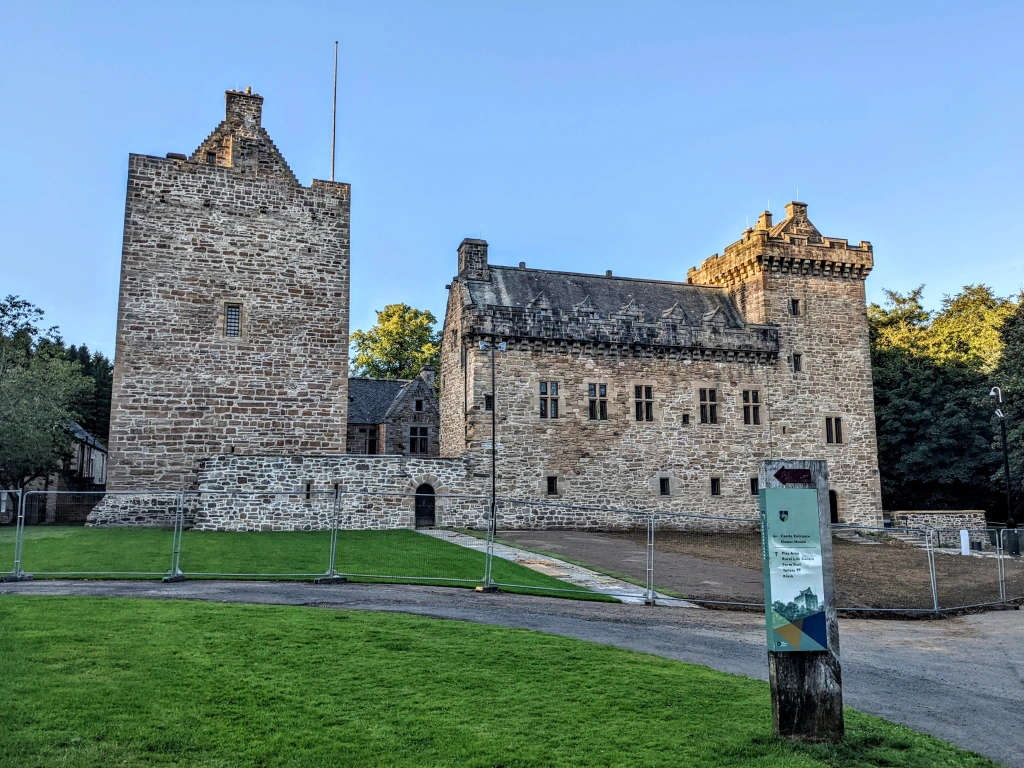
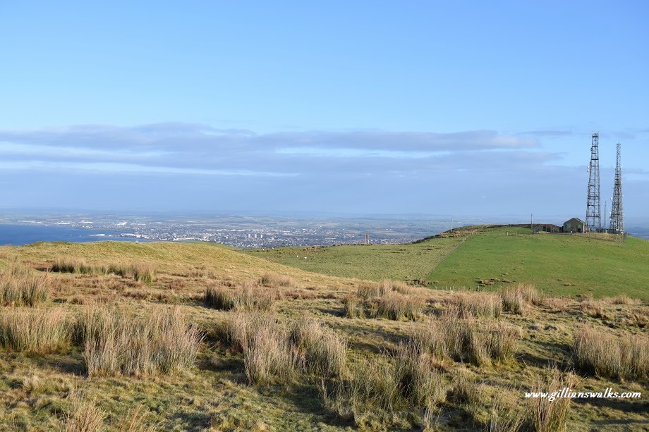
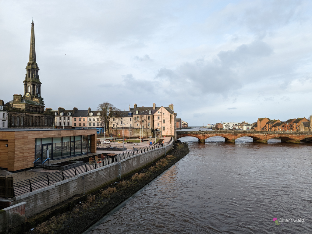
Some of the highlights include historic ‘auld’ Ayr, Ballochmyle and Enterkine viaducts, Ayr Gorge Woodland Reserve, Catrine Voes, and Glenbuck Loch. Once through Ayr Town Centre, the whole route has a lovely rural feel to it with many of the western sections through beautiful native woodland.
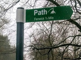
Is the River Ayr Way well signposted?
The way-marking along the River Ayr Way is variable. I don’t recommend relying solely on the marker posts to navigate the trail. Use a mobile mapping app such as Visorando as a back up – I have plotted each section out for you already, so all you need to do is click the ‘download/follow’ button within the route guides. If you aren’t sure how to use this sort of technology to follow a digital route map, have a look at my Introduction to Digital Navigation courses.
Is the River Ayr Way suitable for beginners?
Yes I’d say that on the whole the River Ayr Way is suitable for beginners, so long as you have the appropriate footwear and are prepared to be outdoors for 2+ hours. If you are fairly new to walking, doing the route in 8 or 9 sections makes each stage between 3 miles and 7 miles in distance.
The terrain varies from one section to another but none of them present anything particularly challenging. See individual route guides for more detailed information about path surfaces, elevation gain, gates, stiles, etc.
Can you do the River Ayr Way using public transport?
The town of Ayr has a train station, if you are travelling to the area from further afield. For some sections of the River Ayr Way it is possible to use public transport (bus) to get between the start and finish points. For other sections it is necessary to use a nearby town/village as a base from which to travel to the start of the walk and then back again. There are also sections where public transport is not an option at all. Each of my route guides above contain more detailed information about this, specific to that part of the trail.
Do you have gpx files for the River Ayr Way?
Yes, I have made these available via Visorando which is the mapping company I use for all of my routes. Inside each of my route guides (above) you’ll find a button inviting you to ‘Download/follow this route on your mobile‘. If you tap that, it will re-direct you to Visorando, from where you can download the gpx file to your device.
Also available: a single gpx file for the entire route.
Did you know that I teach Digital Navigation skills? Handy if you aren’t familiar which this technology!
Have other questions? Feel free to get in touch with me and I’ll do my best to help! [email protected]