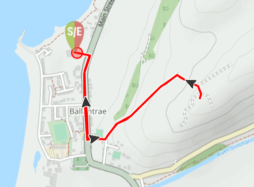
TERRAIN: Graded Easy. Surfaced paths, loose stone track and grassy hillside. The ascent to the mast is moderately steep but not very far, with two benches available to take a rest. Three gates to open. Livestock (sheep) highly likely on this route. No stiles or steps.
![]() Car parking available at Craigiemains Garden Centre, Ballantrae (free) – however please check opening times as the gates will be closed shortly after! Another option is Foreland car park at the southern end of the village (free). Local bus services stop on Main Street Ballantrae. Closest train station is Girvan, 13 miles north.
Car parking available at Craigiemains Garden Centre, Ballantrae (free) – however please check opening times as the gates will be closed shortly after! Another option is Foreland car park at the southern end of the village (free). Local bus services stop on Main Street Ballantrae. Closest train station is Girvan, 13 miles north.
![]() Public toilets are at Foreland car park (free) and customer toilets at Craigiemains Garden Centre or the Kings Arms, both on Main Street.
Public toilets are at Foreland car park (free) and customer toilets at Craigiemains Garden Centre or the Kings Arms, both on Main Street.
View full route description
Leave Craigiemains Garden Centre via the main exit and turn right to walk along Ballantrae’s Main Street.
Opposite the Kings Arms Hotel, turn left onto Arrol Avenue. At the bend in the road, where there is a bench should you need it, turn left onto a concrete track heading gently uphill.
Walk straight through the sheep pens and onto a loose stone track, turning right up a moderately steep hill towards the mast.
Return to Craigiemains Garden Centre via the same route.
Printable Route Guide – Ballantrae Smugglers Trail: Panorama Walk
Download, Print, Go! This PDF Route Guide has been carefully designed to allow you to easily print a copy of the key information for this route on an A4 page to take with you on the walk. Perfect for offline use!
Walk Report: 1st July 2025
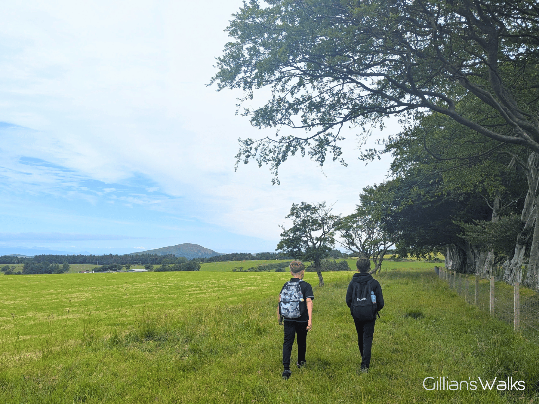
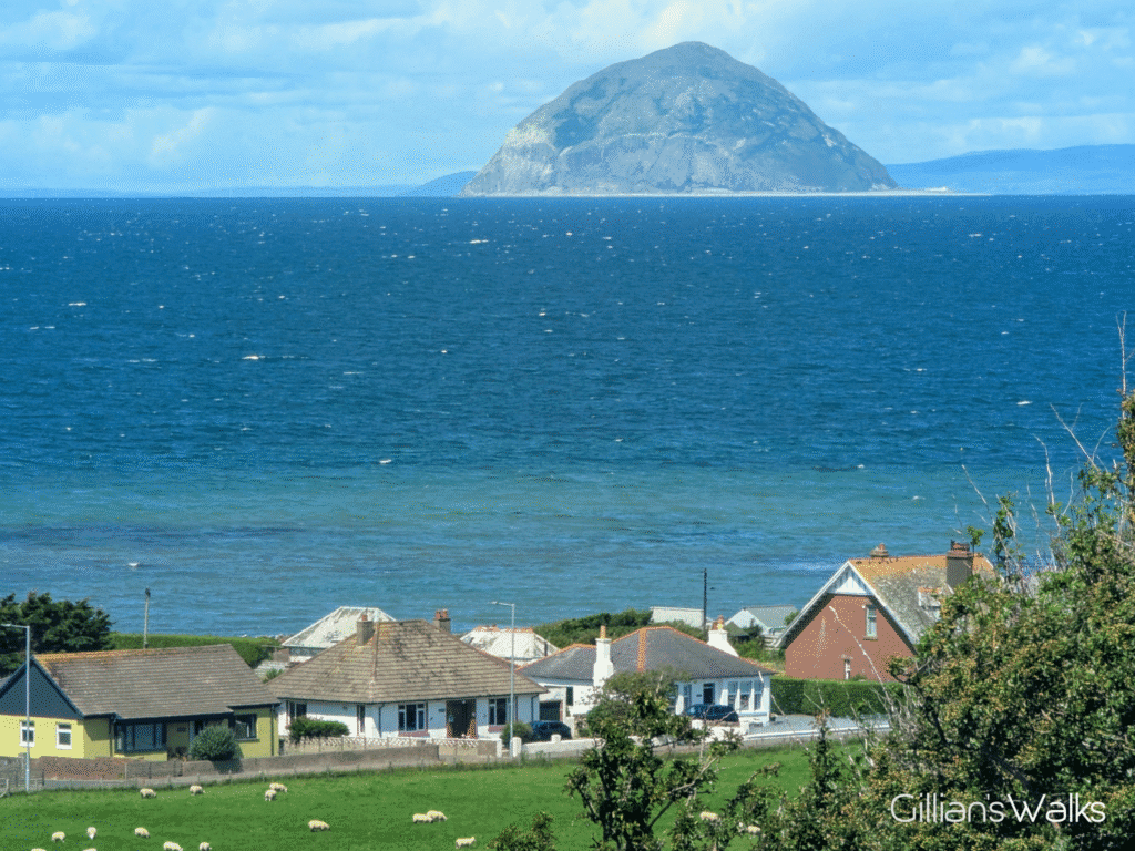
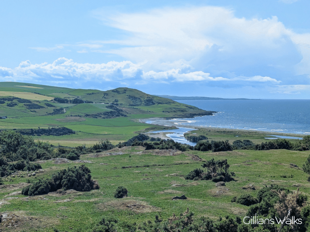
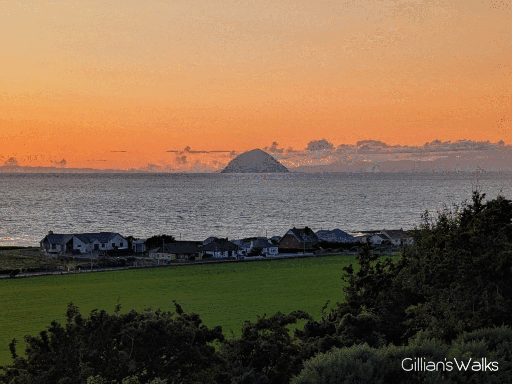
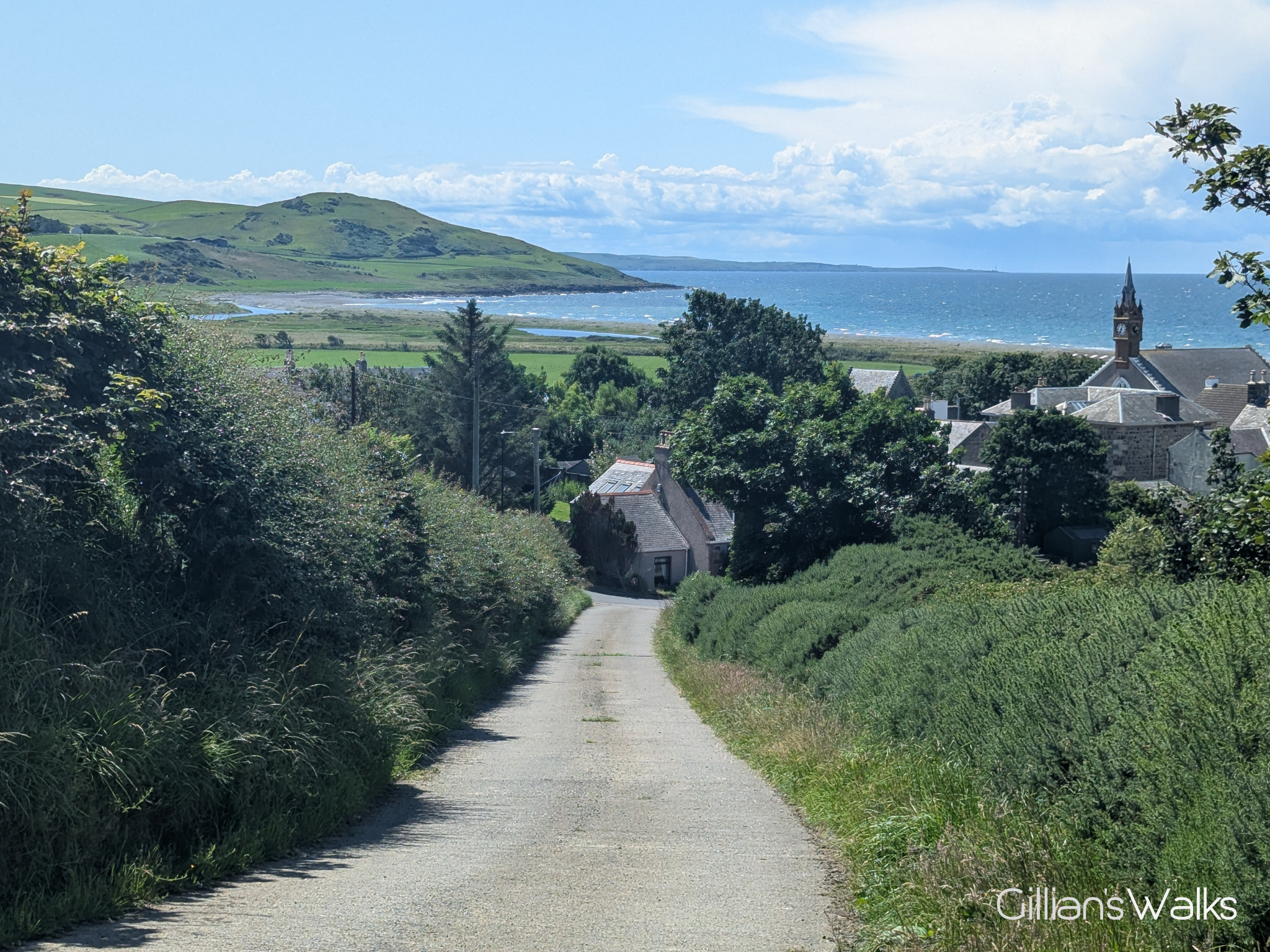
What really struck me about this route was the panorama of views almost immediately on gaining the smallest amount of height. Talk about a bench with a view…. The cameras were already coming out when we reached the bench on the hill, capturing the stunning view south across the rooftops to Downan Hill and the mouth of the River Stinchar (see cover photo). My mind went back to the many times I’d walked that coastline!
Turning around to continue uphill, it wasn’t long before Ailsa Craig and the Isle of Arran appeared over the top of the hedgerows. Every detail of Ailsa Craig was visible; the clearest I’d ever seen it and the closest it had ever felt. And Arran was behind Ailsa Craig….. its mountain range seemed to have been stretched lengthways from this angle, and Holy Isle moved away over to the right of the island! Neither were true of course, I just wasn’t as familiar seeing it from this far south, as I am from the Prestwick/Troon/Irvine area.
‘The water is turquoise!‘ my son exclaimed. And that it was, like an advert for a holiday resort somewhere exotic. Were we really still in Ayrshire??
Continuing up the path, we could see the old windmill standing isolated ahead of us on Mill Hill. A bit of a local landmark, I’d seen it many times from the coast and people on my guided walks had in the past asked me what it was. I’d always just replied with “an old windmill”, which is all I could glean from the map! From a distance it had looked to me more like a rectangular stone block than a windmill, but in fact it is circular. The information I’d been given ahead of doing today’s walk told me that it is one of 12 surviving vaulted tower windmills, a type rarely found outside of Scotland. Thought to have been built in 1696, it stands 24ft high, 15ft in diameter, with walls over 3ft thick. It would have been used for grinding grain! I didn’t get a good picture of it because we were too far away, but you can see a close-up on the Ayrshire & Arran website.
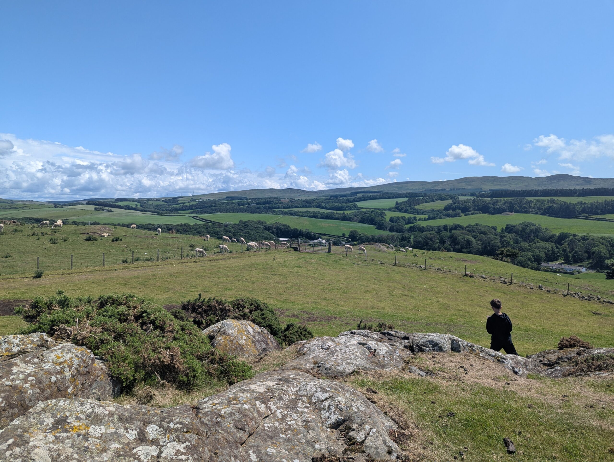
Arriving at the sheep pens I was glad I had some instructions with me as I might have questioned whether I should be walking through them otherwise. The first gate was open, and ahead behind the next gate we could see several dozen sheep crowded along the track we were supposed to be using. Rather than disturb them we chose to cut diagonally across the empty field to our right instead.

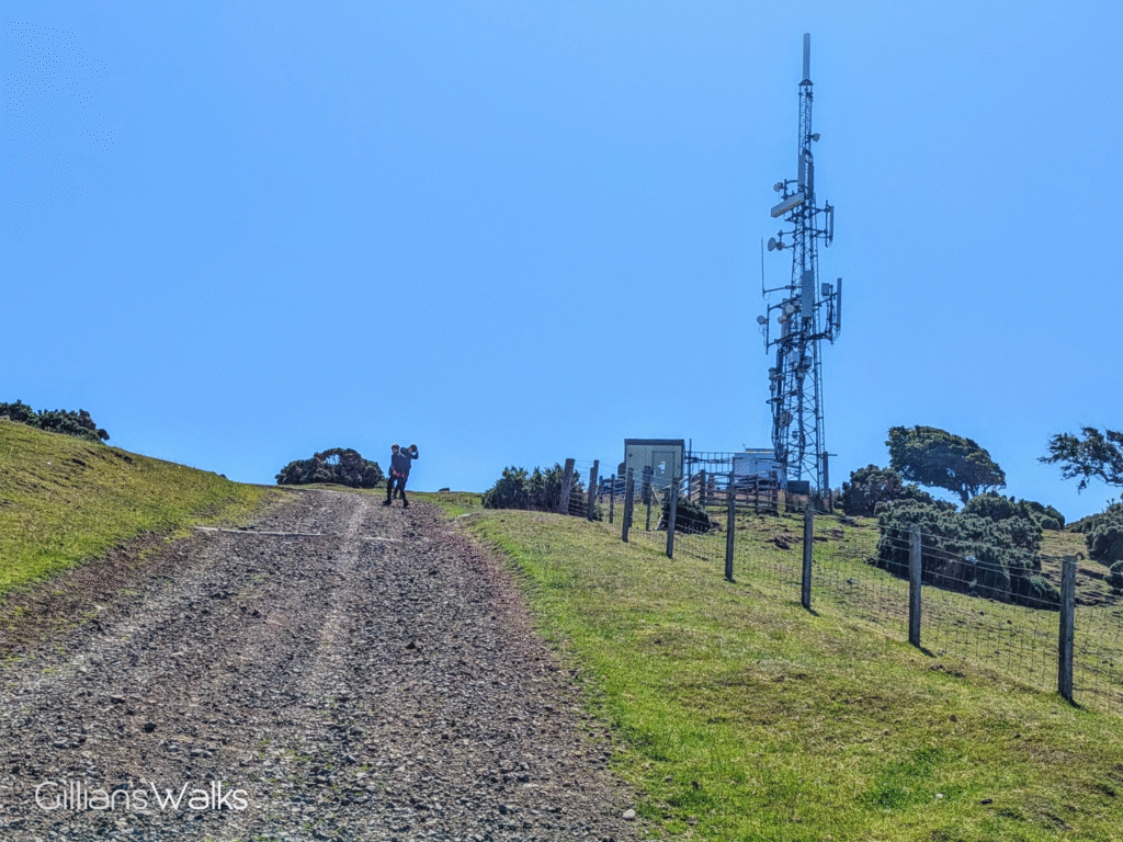
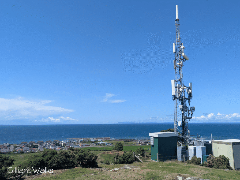
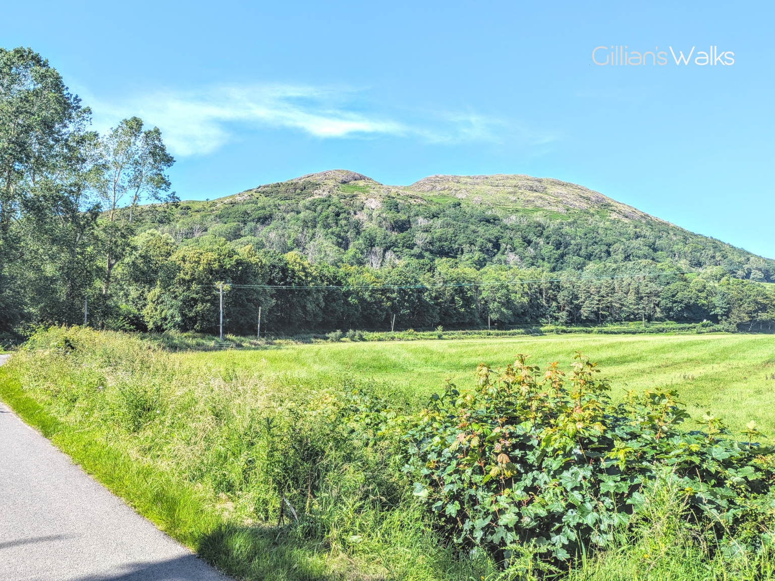
And just like that we were at the mast! To the north and east: miles and miles of farmland and rolling green hills, including Knockdolian Hill where we were heading tomorrow. To the south: the headland at Downan Hill on the Ayrshire coast, and the mouth of the Stinchar. To the west: Since we were now higher up, the views across the coast extended as far as Kintyre and Northern Ireland.
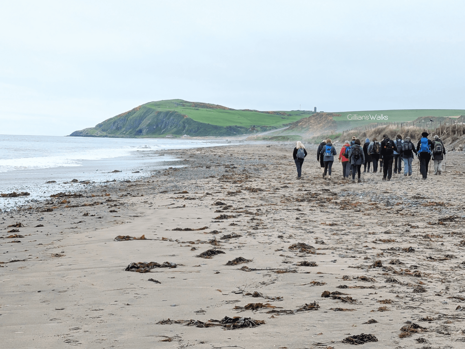
Whilst admiring the view from the mast, let your thoughts wander back to days gone by. Imagine a time when wherries, small boats sailing from the Isle of Man, were landing smuggled goods on the beach at Ballantrae down below you.
In the 18th and early 19th centuries, when duties in Scotland were high, there was a constant trade in smuggled goods being brought into Ballantrae from the Isle of Man or Ireland. These places acted as storehouses of contraband goods that had paid very low duties so that they were much cheaper than the same items available in Scotland. Tobacco, brandy, rum, gin, claret and salt were all landed on the beach at Ballantrae.
The following are all true stories….!
With thanks to the Ballantrae Smugglers Festival for providing these fascinating stories! Find out more about the festival and upcoming events on the Ballantrae Smugglers Festival Facebook page.
You’ll also find more information about smuggling in the book, Ballantrae’s Smuggling Story, by Frances Wilkins, available from Craigiemains Home and Garden Centre, Ballantrae.
In fact we enjoyed the views on this short walk so much that we returned in the evening to watch the sun setting behind Ailsa Craig. Simply stunning.
THIS ROUTE GUIDE WAS COMMISSIONED BY THE BALLANTRAE TRUST, WITH FUNDING FROM BALLANTRAE COMMUNITY COUNCIL. ALL OPINIONS AND PHOTOS ARE MY OWN.
This is one of 4 Ballantrae Smugglers Trails. If you enjoyed it you may like to try the others too:
Ballantrae Smugglers Trail – Panorama Walk
1.5 miles
Ballantrae Smugglers Trail – Knockdolian Hill
7 mile loop
Ballantrae Smugglers Trail – The Beach
4 miles
Ballantrae Smugglers Trail – Glenapp Estate
6.7 mile loop