Want something shorter? Try this 1.2 mile Knockdolian Hill walk instead.
Up for a bit more adventure? Replace some of the road walking with the River Stinchar Walk instead
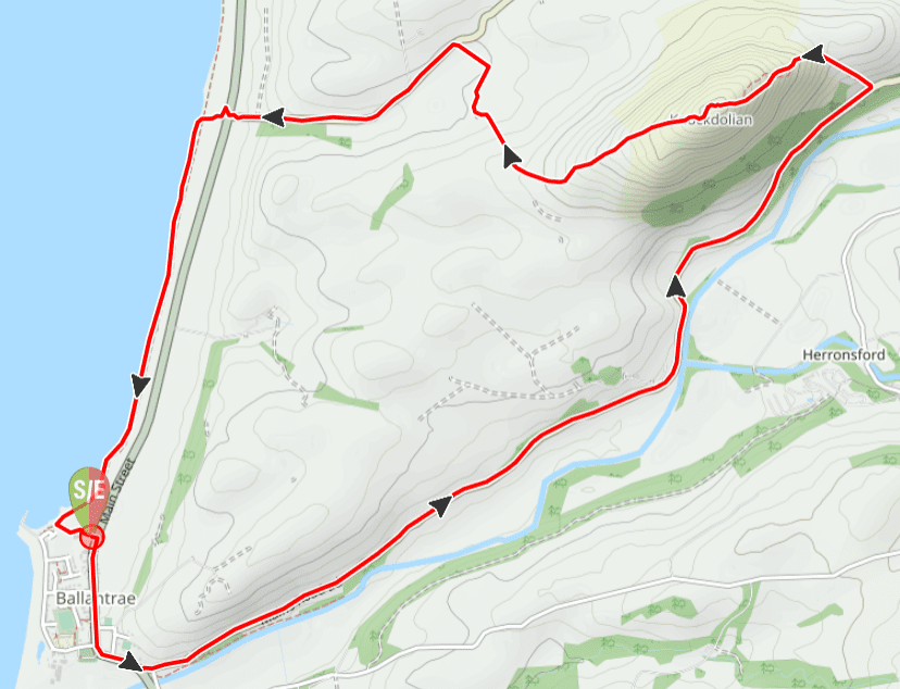
TERRAIN: Graded moderately challenging due to steep ascent and pathless descent (navigation skills required). Total ascent/descent is 827 ft / 252 m. Roadside pavement, surfaced single track roads, grassy hill path, pathless fields, sand and shingle beach. Livestock highly likely (both sheep and cows). Seven gates.
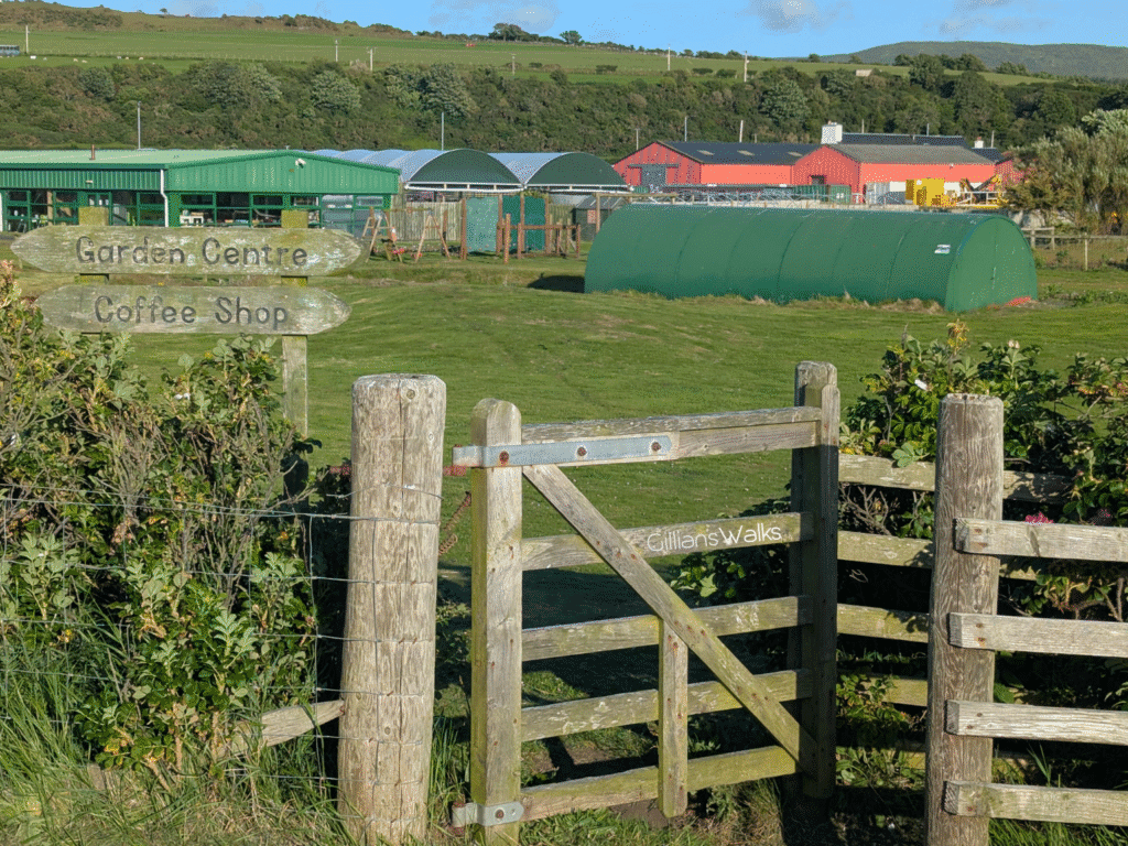
![]() Walk starts and ends at Trae Bakes, Craigiemains Garden Centre in Ballantrae. There is a cafe inside and walkers are welcome. Takeaway also available – option to phone in advance to place orders to collect before/after your walk. Dog-friendly seating outside. Opening times Tuesday to Sunday 10am-4pm (kitchen closes 3pm)
Walk starts and ends at Trae Bakes, Craigiemains Garden Centre in Ballantrae. There is a cafe inside and walkers are welcome. Takeaway also available – option to phone in advance to place orders to collect before/after your walk. Dog-friendly seating outside. Opening times Tuesday to Sunday 10am-4pm (kitchen closes 3pm)
![]() Closest train station is Girvan, 13 miles north. Local bus services stop on Main Street Ballantrae – get off at Trae Bakes, Craigiemains Garden Centre. Trae Bakes, Craigiemains Garden Centre kindly welcomes walkers to use their car park however please note that car park gates are locked outwith opening hours (see above). Please park respectfully giving priority to cafe and garden centre customers. There is also a large free public car park a short distance away at Foreland Car Park, accessed from Main Street via The Vennel.
Closest train station is Girvan, 13 miles north. Local bus services stop on Main Street Ballantrae – get off at Trae Bakes, Craigiemains Garden Centre. Trae Bakes, Craigiemains Garden Centre kindly welcomes walkers to use their car park however please note that car park gates are locked outwith opening hours (see above). Please park respectfully giving priority to cafe and garden centre customers. There is also a large free public car park a short distance away at Foreland Car Park, accessed from Main Street via The Vennel.
![]() Ballantrae’s public toilets are free and are located at Foreland car park, accessed from Main Street via The Vennel, just a short de-tour from the main walking route. The toilets at Trae Bakes, Craigiemains Garden Centre are for customer use only.
Ballantrae’s public toilets are free and are located at Foreland car park, accessed from Main Street via The Vennel, just a short de-tour from the main walking route. The toilets at Trae Bakes, Craigiemains Garden Centre are for customer use only.
View full route description
Leave Craigiemains Garden Centre via the main exit and turn right to walk along Ballantrae’s Main Street for approx half a mile. Before crossing the River Stinchar, at the war memorial, turn left onto B7044 / Mains Road.
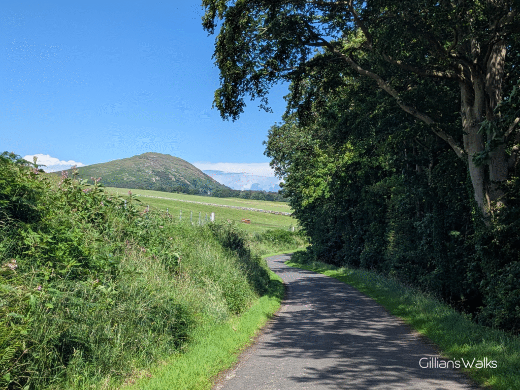
Enjoy easy walking along this pleasant single track road for 2.8 miles until just beyond Finnart Cottage. There is a marker post on the right-hand-side of the road here which directs you up a steep grassy slope to a field gate. Go through the gate and out onto the open hillside.
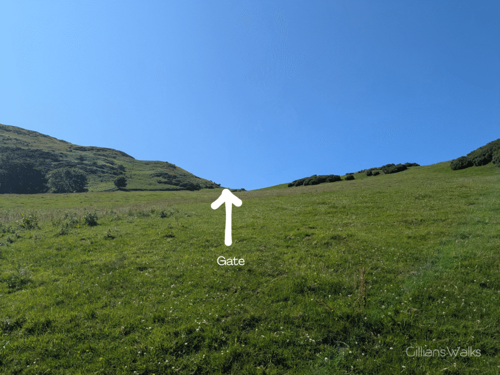
Cross the hillside in a general NW direction, heading towards a low point on the horizon where there is another gate.
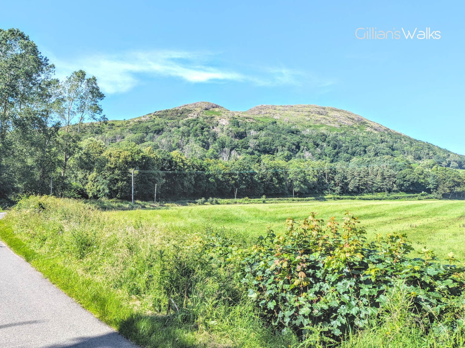
Go through the gate and follow a faint grassy track directly up the steep slope (W). The views begin to open up as the track makes its way up Knockdolian’s eastern shoulder to the summit trig point.
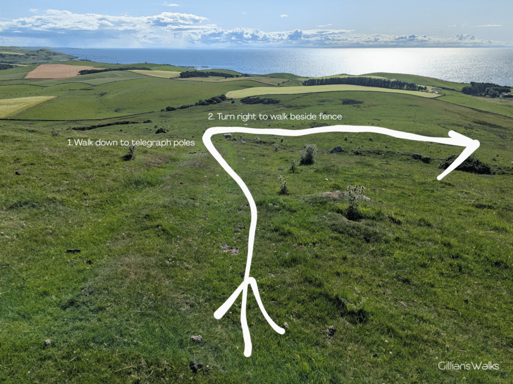
Descend from the trig point via Knockdolian’s western shoulder. Approx 200ft down the slope go through a gate in the dry stone wall.
Beyond the gate, look for a line of telegraph poles farther down the hill: walk towards these in a general SW direction. As you get closer you will see that there is also a fence beneath the cables. Turn right (NW) to walk along the edge of the field with the fence on your left-hand-side.
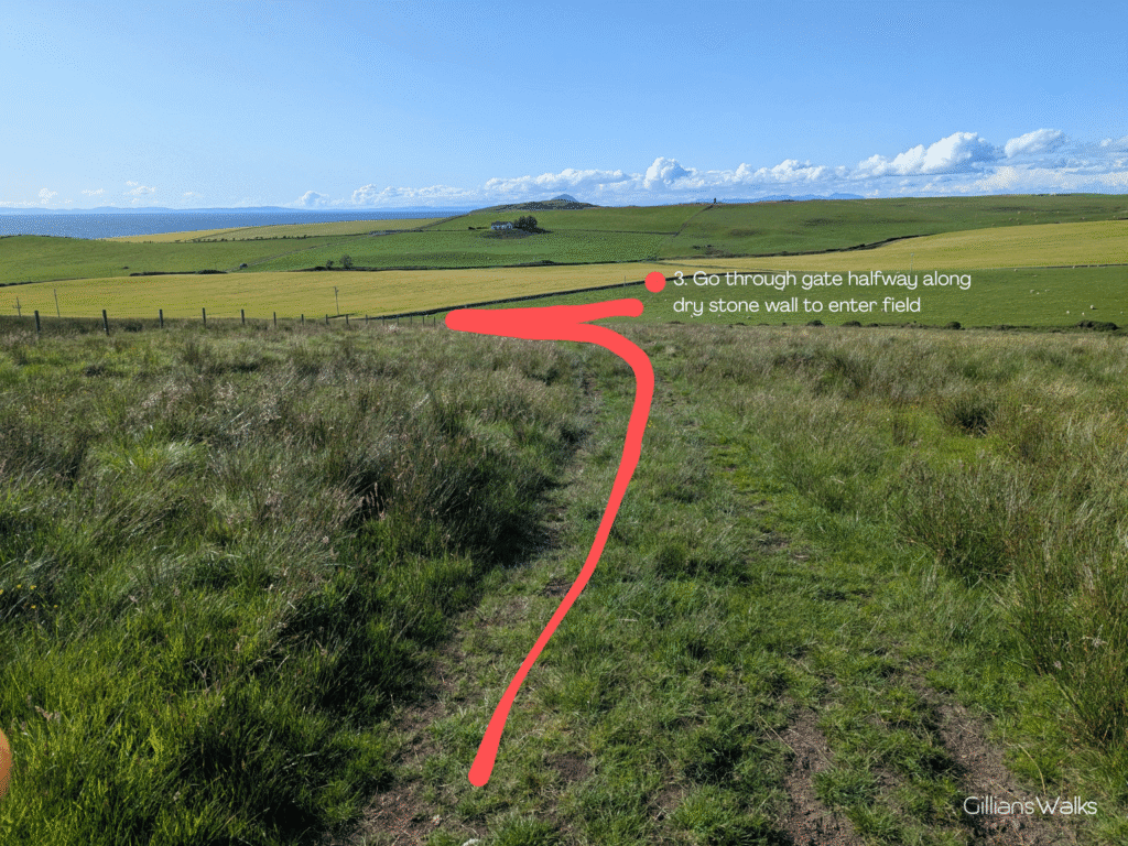
There is a dry stone wall ahead with a gate about halfway along it, giving access to the field. Go through this gate and turn right (NE) to walk along the field-edge for around 200m (with the wall on your right-hand-side), entering the neighbouring field via another gate and turning left (NW) along the field-edge (fence on your left-hand-side) to reach the B734 / Colmonell Road just east of Hilltop Cottage.
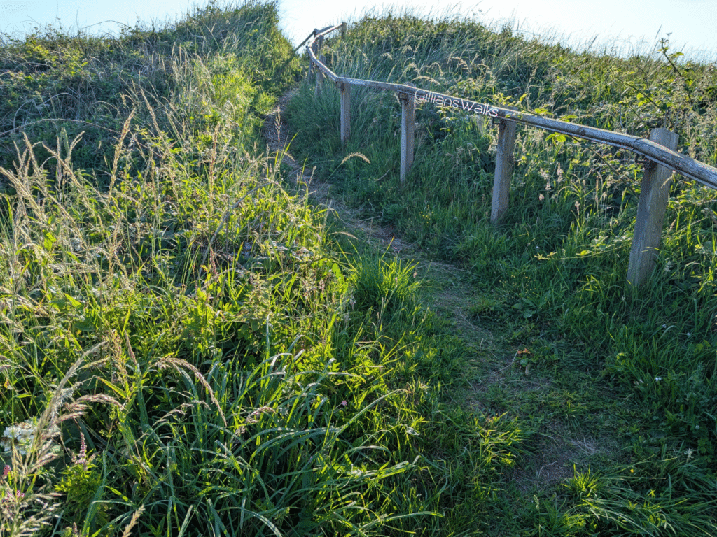
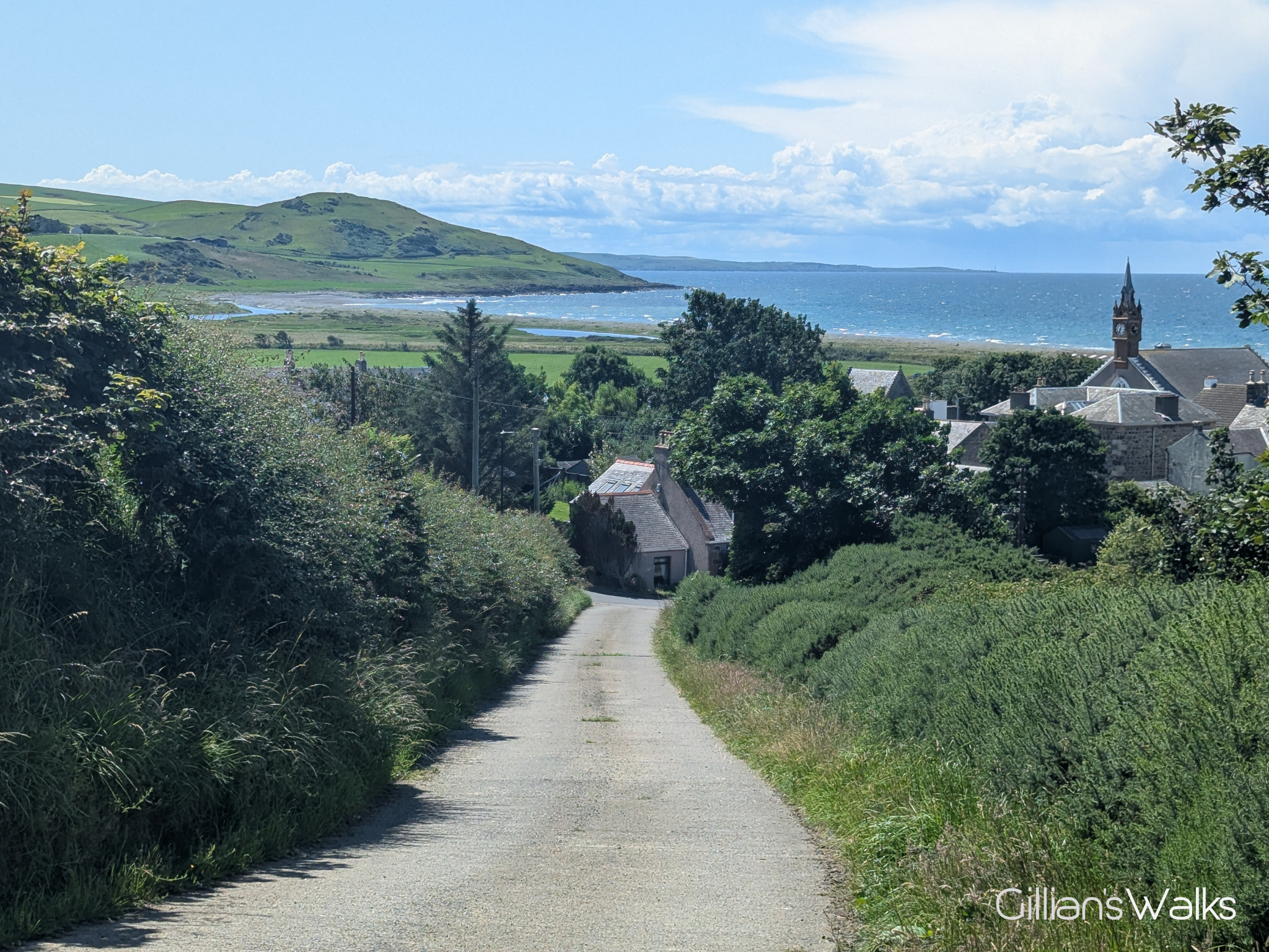
Turn left (SW) to follow the road for three-quarters of a mile, emerging at the A77 Trunk Road. Cross carefully to a road on the other side (slightly to your right). Follow this road as it bends left towards a cottage, and through a wooden gate right beside the cottage (it will feel like you are walking into their garden). The track beyond the gate takes you around the back to a kissing gate and walkway over the sand dunes to Ballantrae Beach.
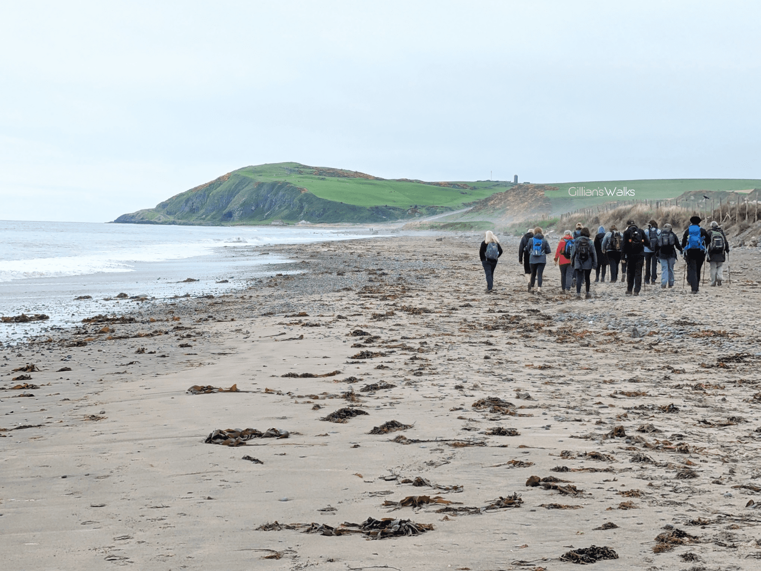
Turn left to walk south along Ballantrae Beach. After approx 1 mile look out for an access ramp on your left and follow it off the beach, turning right to walk along a grassy track between the cottages and the beach. Before reaching the harbour, you will arrive at a kissing gate on your left which leads into the grounds of Craigiemains Garden Centre, where this walk finishes.
Printable Route Guide – Ballantrae Smugglers Trail: Knockdolian Hill Circular
Download, Print, Go! This PDF Route Guide has been carefully designed to allow you to easily print a copy of the key information for this route on an A4 page to take with you on the walk. Perfect for offline use!
Walk Report: 1st July 2025
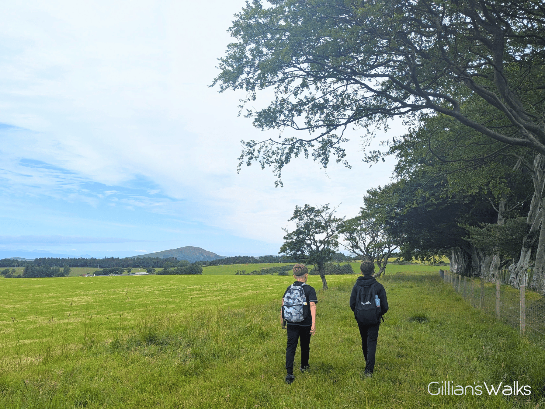
The kids and I tackled Knockdolian towards the end of our Ballantrae staycation. As a result, by the time we came to walk it, we’d seen it from pretty much every angle apart from the top! We were blessed with blue skies and crystal clear visibility – just the trick. Although it’s small at 265m / 869 ft, it is often shrouded in low cloud. Something to be aware of if you are considering giving it a bash.
A little apprehensive about the long (almost 3 mile) stint along the road to kick things off, I was actually pleasantly surprised at how lovely it was. Roads can be a hit or a miss, especially when walking with two tweens. The surrounding scenery and volume of traffic can make or break the experience. I can confirm that the B7044 is one of the good ones! We experienced only the very occasional car, and we were kept entertained by lots of cottages and farms dotted along the way, plus a variety of scenery. One minute we were walking beneath a canopy of trees and the next we had extensive views over the countryside. As we progressed, Knockdolian Hill loomed ever larger! Highlights included seeing the natural floodplains for the River Stinchar, and the massive bulls at Balnowlart cottages.
We reached our turn-off for the hill path just as a change was needed and made our way up the very steep track to the field gate. I was surprised when the gate opened outwards towards me, onto the steep slope. It was a lot heavier than I had anticipated and gravity was making it quite challenging to keep a hold of whilst everyone went through and then again when trying to secure it.
Once through, it wasn’t immediately obvious where we should go, however I of course had pre-planned the route using Visorando so all I had to do was have a quick look at my map to check what direction we should be going in. Looking up towards the base of Knockdolian I could see a gate visible on the horizon. We decided to head for that. Since there was no livestock in the field at the time we were able to make a direct line for it.
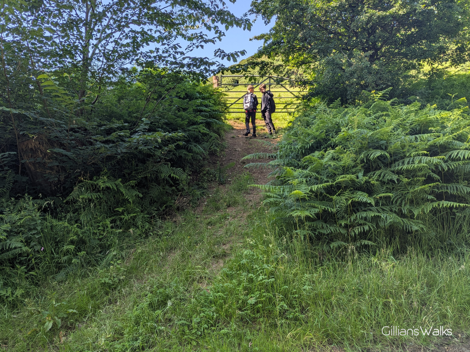
It was steep! You realise you’re not as fit as you thought you were when you try and go up a steep slope with a 12 and a 13 year old waiting for you! On arrival at the gate we found that the fence it was attached to wasn’t in the best of conditions. In fact the only reason the fence was standing at all was because the gate was holding it up. The strainer post and several of the fence posts were rotten and just resting on top of the ground. This made the gate tricky to open and securely close, as we had the weight of the fence to try and hold up at the same time.
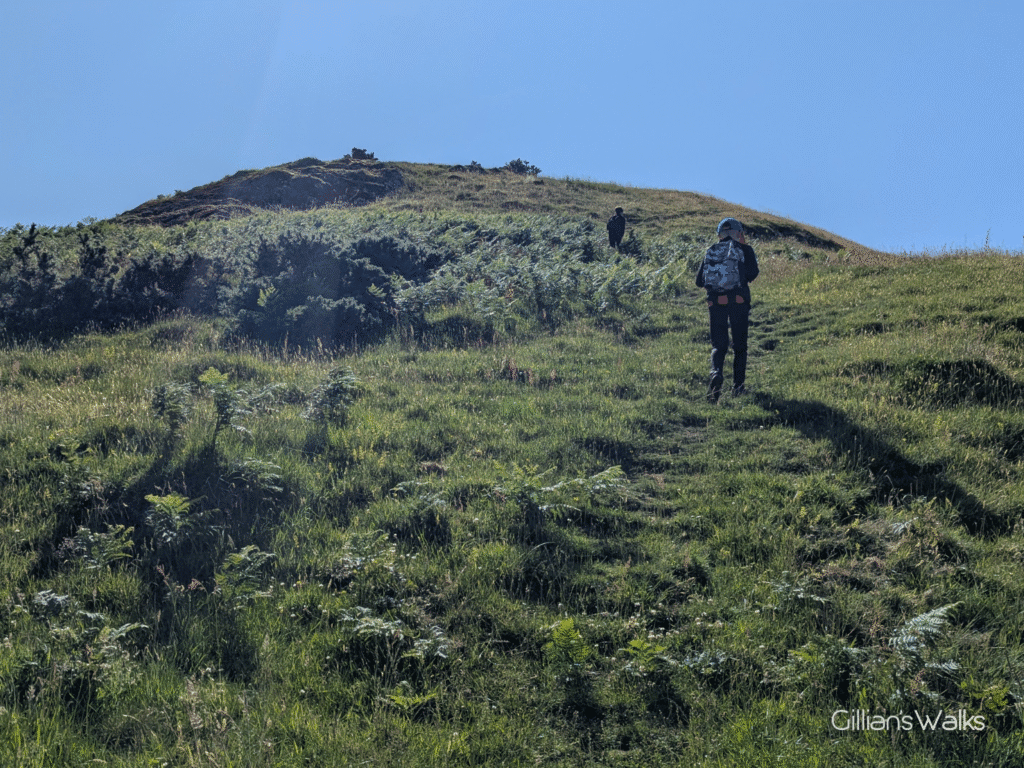
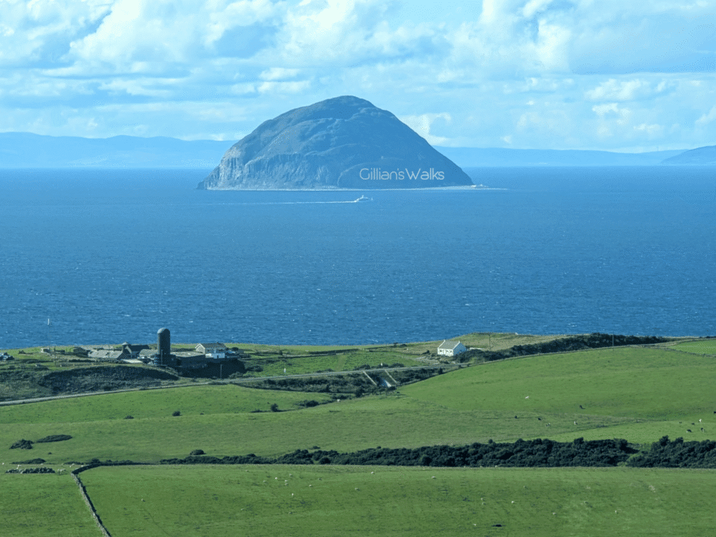
That challenge overcome, we set off up the zig zags to the summit. The views were already impressive even from the lower slopes of Knockdolian’s eastern shoulder: out across the glimmering water, Ailsa Craig and the Isle of Arran looked as clear as I’d ever seen them; inland I could see right up the Stinchar valley towards the village of Colmonell and the Arecleoch Windfarm.
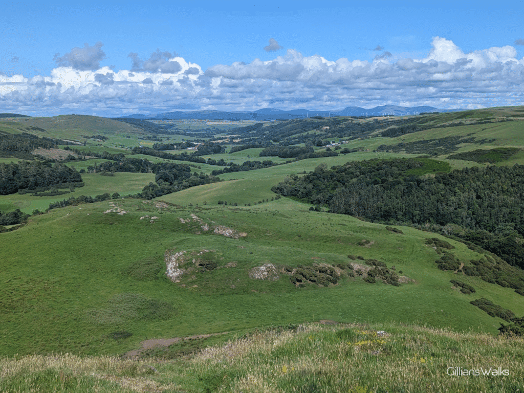
Much closer, I could see a small loch – Loch Melemon according to my map – with the impressive-looking Knockdolian House nestled amongst the trees beside it. This was built by the Cathcart family in 1842.
Now would be a good time to tell you some stories about Ballantrae’s Smuggling trade, with which the Cathcarts had a strong association! In the 18th and early 19th centuries, when duties in Scotland were high, there was a constant trade in smuggled goods being brought into Ballantrae from the Isle of Man or Ireland. These places acted as storehouses of contraband goods that had paid very low duties so that they were much cheaper than the same items available in Scotland. Tobacco, brandy, rum, gin, claret and salt were all landed on the beach at Ballantrae.
The following true stories are included in this Route Guide with grateful thanks to the Ballantrae Smugglers Festival. Find out more about the festival and upcoming events on the Ballantrae Smugglers Festival Facebook page.

You’ll also find more information about smuggling in the book, Ballantrae’s Smuggling Story, by Frances Wilkins, available from Craigiemains Home and Garden Centre, Ballantrae.
Back to the walk, and the views…. Whilst I stopped many times to take it all in, the same cannot be said for my two boys, who seemed to transform into excited mountain goats. I let them have their freedom whilst I caught my breath. Alone, I made my way slowly up the steep slope, watching butterflies dance and listening to birds chirping around me: Meadow Pipets, according to my Merlin bird ID app. Every now and then I looked up to see one of the kids waving down to me from much further up the hill. I could hear them shrieking every time they thought they’d reached the top and realised it was a false summit. And any time they couldn’t see me for a few minutes, a Snapchat message would arrive asking for my whereabouts, with photographic evidence that they had made it to the top 🙂
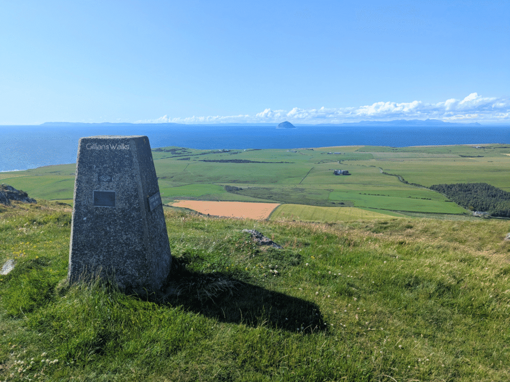
As I did eventually too! By then the boys had gotten over the views and had found a comfortable spot out of the strong breeze to catch up on social media. After a brief eye-roll, I turned my attention to the 360 degrees panorama before me. Wow. How lucky are we to live close to a place like this?! Visibility was excellent and from this higher position I could see over to the Northern Irish coastline as well as the Kintyre Peninsula. Closer, lush green fertile land surrounded us in every direction. And since we’d been walking in the area for a few days now, we could see many of the places we’d already been: Look boys, that’s the caravan park we walked to yesterday (Lagganhouse). Look boys, that’s the wee road we walked along on the first day... And look boys, there’s the mast we walked up to last night!
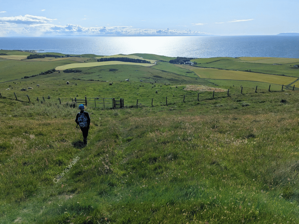
We started our descent down the western shoulder of the hill as advised by our route notes. There wasn’t really a path that we could find, so we picked a way down in roughly the correct direction and found a gap in a dry stone wall leading to a field gate which we presumed put us right on track. There were sheep and lambs in the field which made the boys a bit nervous but we chose our route carefully to give them space.
The notes we had been given spoke of some overhead power lines we should head for, in particular the one with the transformer on it. We could see the power lines, but I had no idea what a transformer looked like. One of the posts had a rectangular box shape attached to it – maybe that? We were then to look for a wooden structure in a wall. There were numerous walls separating the fields below, and none of them had what we would describe as a wooden structure in it.
From this high ground I could see the road we were aiming to get to, but I wasn’t sure if we were supposed to go high (towards the farm) or low (through the fields). The fields all had either cows or crops in them….. What to do?? The cow fields were out of the question. So we spent a lot of time walking back and forth along the edge of the fields considering various options. One of which involved standing atop a wooden fence post and jumping off it, over some barbed wire fencing to get into the field below! Needless to say I vetoed that one fairly quickly: even if the kids were game, I was not and I certainly couldn’t write up a Route Guide with those instructions!
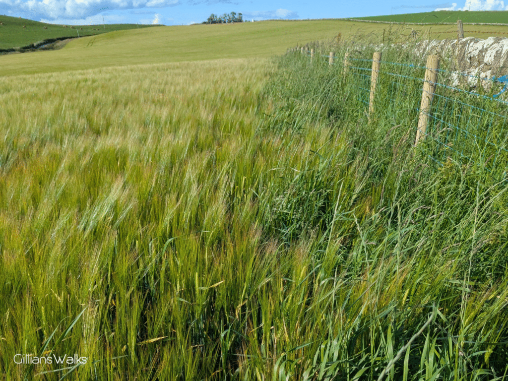
The problem was that access to any of the fields was very limited, because they were bordered by a dry stone wall which had a barbed wire fence at both sides of it, making it too wide and dangerous to hop over. In the end we went with the best of the options at the time which was to climb over a gate into a field thick with waist high barley and do our very best to stay as close to the edge as possible so as not to damage it. It was tough going but we were relieved to eventually find the road.
Having since liaised with some walkers who live locally, it seems that the way we went in the end was correct – we were just unlucky that the field was in crop at the time.
I have to again give kudos to the Visorando app for helping us out in this situation: the OS Map layer showed me where all the field boundaries were, and I could pair that info up with the location of visible gates to come up with a plan. The good news is that you don’t have to wonder what way to go, as we have done the hard work figuring it out for you! Just download the digital map via this link, or read my turn-by-turn directions and follow in our footsteps. And if you’re not sure how to use that technology, why not come to one of my ‘Intro to Digital Navigation’ sessions? I’ve even annotated some photos for you to hopefully make the way clear (see below).
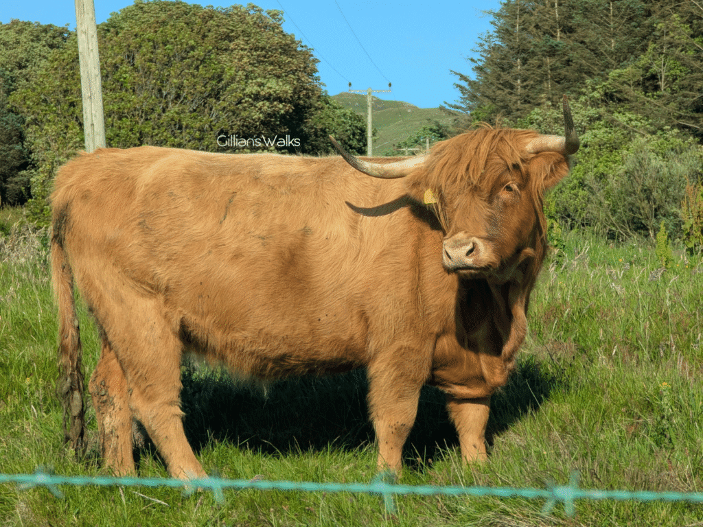
And so off we went tired but relieved along the Colmonell Road to the A77. A couple of highland coos greeted us from their roadside field, so after a few photos we crossed over and found our way around the cottages to the beach.
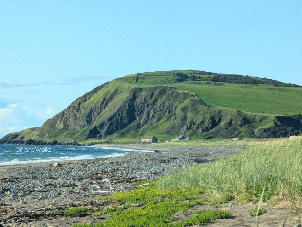
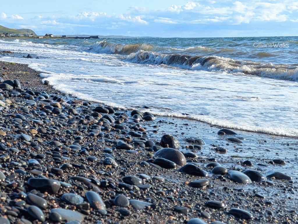
Ballantrae Beach is familiar to me from my many Ayrshire Coastal Path walks, however it was new for me to be heading south! A glimpse towards the familiar north showed the early evening light hitting Bennane Head in all the right places. Beautiful. In spite of the calm evening, there was a bit of a chop in the water which gave it some movement and we enjoyed the relaxing sound of the waves breaking over the sand and colourful pebbles as we made our way slowly along the beach. We made sure to stop briefly at the wreckage of Richard III so that I could tell the boys her story. You can read all about it in my Ballantrae Beach Route Guide!
THIS ROUTE GUIDE WAS COMMISSIONED BY THE BALLANTRAE TRUST, WITH FUNDING FROM BALLANTRAE COMMUNITY COUNCIL. ALL OPINIONS AND PHOTOS ARE MY OWN.
This is one of 4 Ballantrae Smugglers Trails. If you enjoyed it you may like to try the others too:
Ballantrae Smugglers Trail – Panorama Walk
1.5 miles
Ballantrae Smugglers Trail – Knockdolian Hill
7 mile loop
Ballantrae Smugglers Trail – The Beach
4 miles
Ballantrae Smugglers Trail – Glenapp Estate
6.7 mile loop