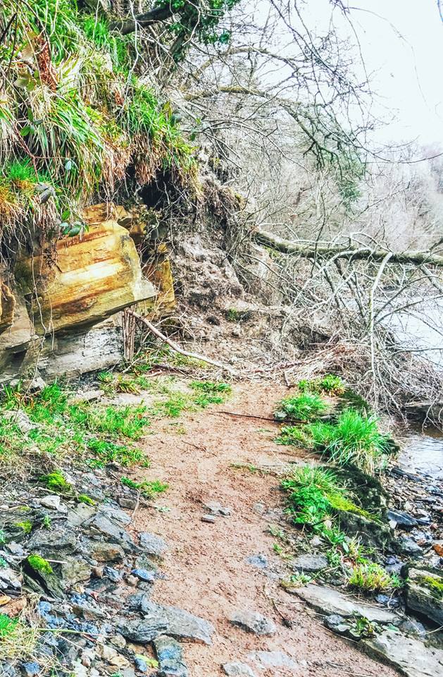
NOTICE – There is currently a short diversion in place due to a landslide on the narrow riverside trail between Tarholm Bridge and Annbank. The diversion is signposted from the trail – it simply cuts out the dangerous section by taking you up and around the back of it. Steep hill up and then steps down the other side.
Want to make it a circular walk? Try this 6.5 mile figure-eight loop which takes you back to Auchincruive via a mixture of quiet country roads, woodland paths and farm tracks. Learn how to use digital maps to follow pre-plotted routes at one of my Introduction to Digital Navigation courses.
TERRAIN: Mostly woodland trails and grassy fields. Very boggy in places. A couple of fairly steep hills and lots of steps, some with handrails and some without. Several kissing gates, one stile. Chance of livestock on field sections.
![]() There is a bus service from Annbank to Ayr which stops just outside Auchincruive on B743 at East Lodge, which is approx half a mile walk down through the scenic Auchincruive Estate to Oswald’s Bridge. For parking, there are a few spaces beside Oswald’s Bridge at Auchincruive, no formal car park just small lay-bys. There is also a small car park a little off-route at this office building (always quiet at weekends). In Annbank there are plenty of on-street parking options on the residential streets surrounding the top of Mill Road.
There is a bus service from Annbank to Ayr which stops just outside Auchincruive on B743 at East Lodge, which is approx half a mile walk down through the scenic Auchincruive Estate to Oswald’s Bridge. For parking, there are a few spaces beside Oswald’s Bridge at Auchincruive, no formal car park just small lay-bys. There is also a small car park a little off-route at this office building (always quiet at weekends). In Annbank there are plenty of on-street parking options on the residential streets surrounding the top of Mill Road.
![]() There are no public toilets on this route. The closest conveniences to the start point are at the Bothy Cafe in the Auchincruive Estate which has customer toilets. This is approx half a mile off the route, at the “wrong” side of the river.
There are no public toilets on this route. The closest conveniences to the start point are at the Bothy Cafe in the Auchincruive Estate which has customer toilets. This is approx half a mile off the route, at the “wrong” side of the river.

View full route description
Just along from the eastern end of Oswald’s Bridge, opposite the Wallace Burns Cairn, the continuation of the River Ayr Way is clearly way-marked through a gate on the left.
After crossing a field (NE) to another gate, you soon find yourself on a well defined track through dense woodland. The River Ayr will begin to appear to your left and the path follows it upstream.
Approx 1.5km along a steep hill awaits. At the top you will come to a fork in the path where you continue straight on over a stile, however take some time to visit the viewpoint to your left first!
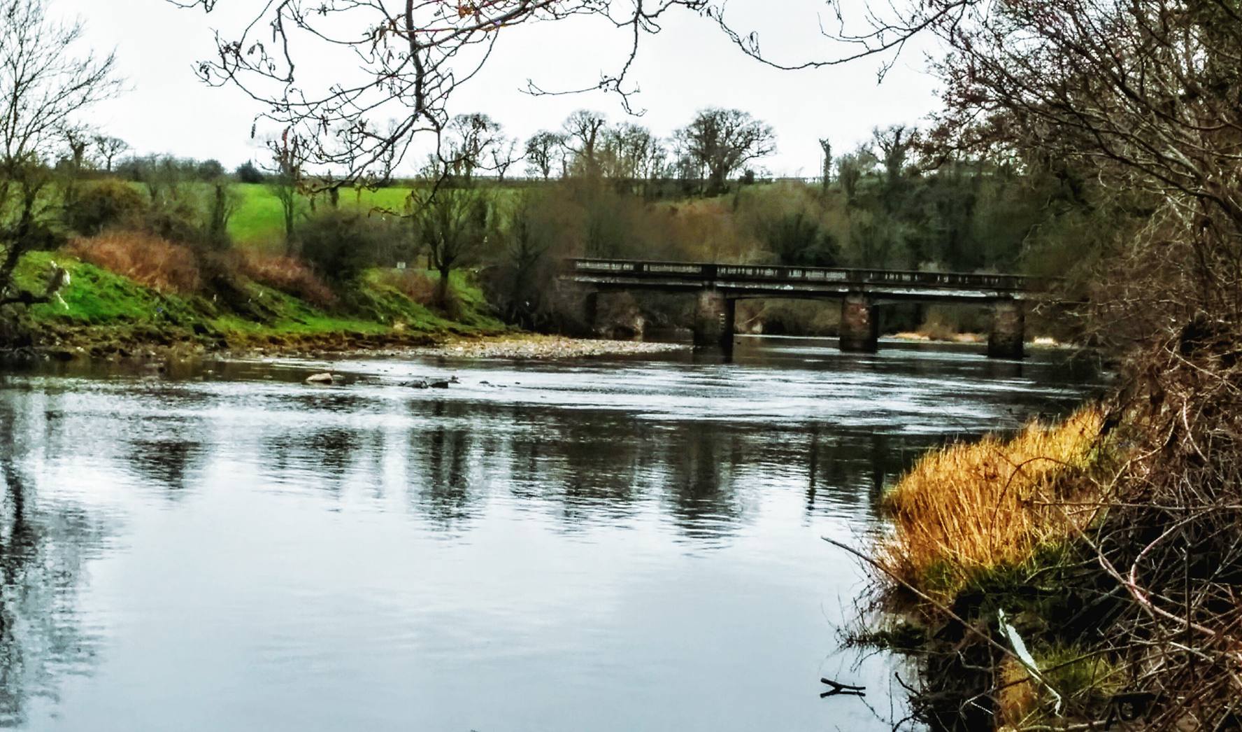
The track heads back downhill via some steps, and continues to follow the curves of the river taking you through more woodland and beside some farmland, to emerge onto B744 at Tarholm Bridge.
Turn left to cross the bridge and look out for way markers leading you through a gate on the right. This takes you onto a narrower trail very close to the river.
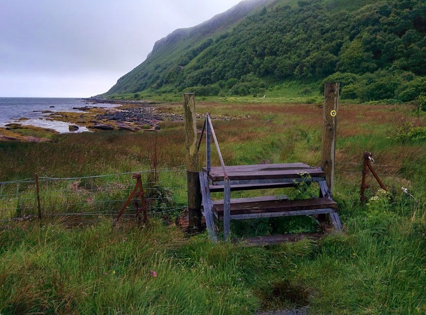
Just over 1km along, turn left to go uphill on a path leading up the embankment. You’ll see River Ayr Way signage discs at the bottom of this path. This is a short de-tour to avoid a landslip which blocks the path below. Steps take you back down the other side to re-join the riverside trail. Turn left to continue.
A short distance along you’ll come out of the trees onto a field – stick to the edge of the field (river close to your right-hand-side). Go through a gate at the far end of the field, then turn left, passing a former mill and out onto Mill Road, which leads into Annbank.
WALK REPORT: 26th March 2016 and 30th November 2024
I thoroughly enjoyed every minute of this walk and will be back for sure as there are people I’d love to show it to! I may be wise to avoid the closed section of the path next time though!
On my first visit back in March 2016, I chose this route because I had a child-free day and therefore wanted to tackle a longer route (in case you’re thinking 4 miles isn’t very long, I did the 6.5 mile figure-eight walk mentioned above!) and one that I knew wouldn’t be suitable for a buggy. I had been at Auchincruive only a week prior when I completed a short walk with my mum & youngest son, and when we were ready to leave I spotted the start of the next section of River Ayr Way leading off through a gate. I really liked the area and plan to walk the entire trail so it made sense to come right back.
A friend had called off due to a poor weather forecast so it was me, myself and I. The weather must have put others off too because I didn’t meet a soul until the final 20 mins of my walk. Quite different to my return trip in November 2024, when I had a group of 12 people with me!
It’s amazing how much time and the weather can change a route…. The photos below were taken at roughly the same places on the walk, over 8 years apart and in different seasons. The ones on the left were taken in March 2016 and those on the right were taken in Nov 2024:


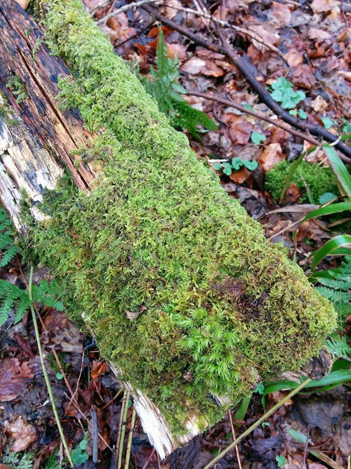
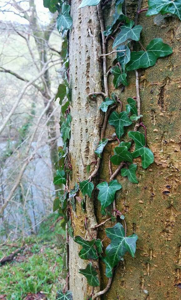
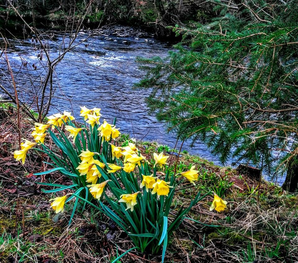
Something that I particularly enjoyed about this part of the walk was the variety of plant life on display – I am a sucker for ivy and moss and you have it in abundance here… I also saw a variety of wildlife including lambs, ducks, roe deer and a pair grey herons which have beautiful long necks and black tips on their wings. Couldn’t get a decent photo of them!
Another highlight was the viewpoint – you have to work hard to get up to it, and then go back down to come back up…. but it’s very worthwhile indeed.


When I first did this walk there was a notice on the gate at Tarholm Bridge advising that this section of the Way was closed due to a landslide at the Black Rocks. I was immediately curious! What’s the worst that could happen if I came to a part that was impassable…? I could always come back and walk along the road…. Deep down I hoped that I wouldn’t need to turn back and that maybe South Ayrshire Council had fixed the issue and had just forgotten to take the sign down 🙂 I am glad I went because this section was to hold some of the nicest scenery I had come across all day and was so tranquil.

I was nervous though – what would I find?! Well… a whole section of the path had been covered by rocks and trees which had slid down the steep embankment towards the river! It is such a short section though and I could see footprints making their way up the debris and down the other side so I decided to follow them and see if I could get across. I paused a few times to take some photos but my heart was racing and I did realise that I was putting myself in danger by coming this way. Looking up at it I could see that it was probably unstable and I was aware of having no power over what would happen if I were to dislodge another part of it whilst standing on it. The rocks I was walking on were pretty slippery too so it was slow going.
Nothing happened though, I got across safely and despite feeling silly for having ignored the notice on the gate I felt a little smug too that I had done something ‘naughty’ and gotten away with it!
Sadly the landslide was still there when I returned in November 2024. However, a de-tour had been put in place up around and down the other side. Great that this part of the trail is open again without the need to walk along the main road!
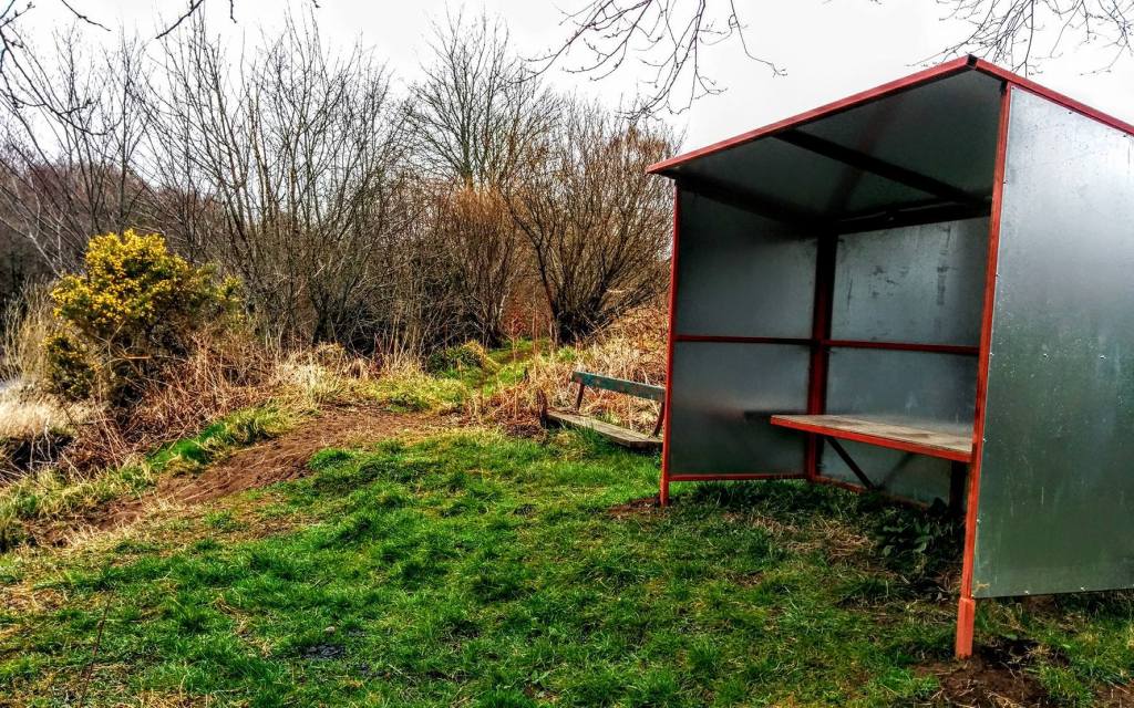
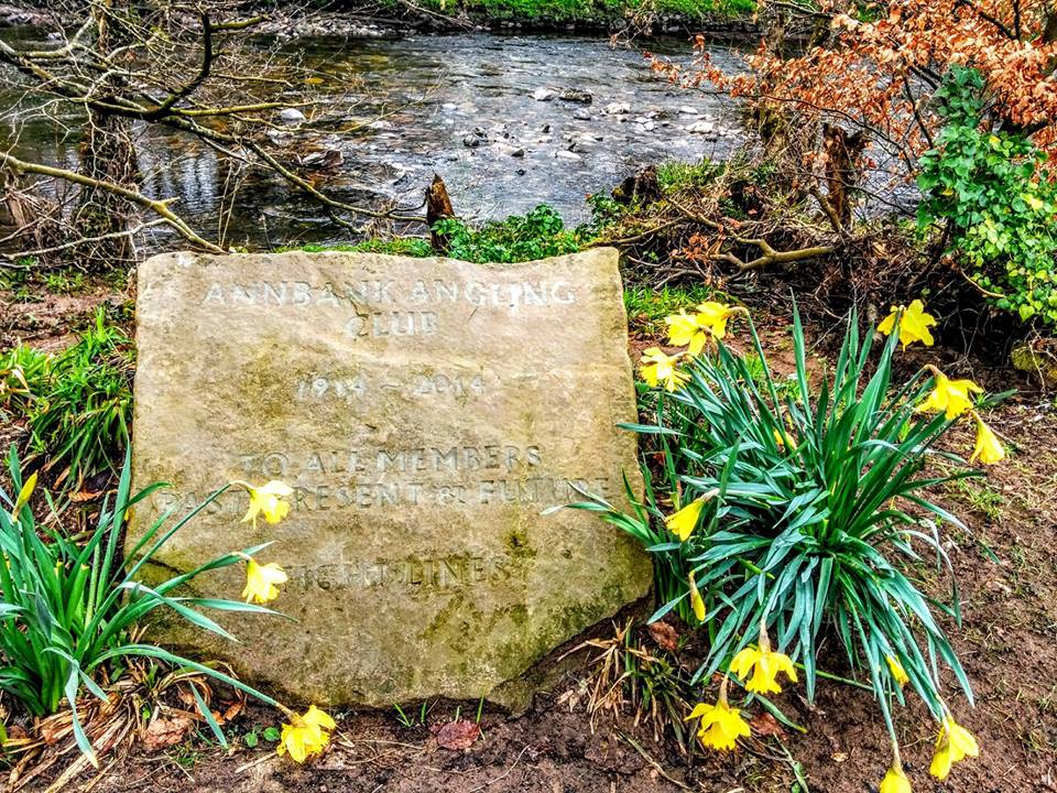
A large part of this walk is shared by Annbank Angling Club as you will see from the numerous little shelters dotted along the river. There is also a plaque just before you come into Annbank marking 100 years of the Club’s existence.
I have to give credit to my mapping app for this walk: Before leaving home I used it to plot out the exact route. Once onsite all I had to do was open the app on my phone and ‘follow’ my planned route. Walking alone, one fear I have is getting lost but these apps eliminate that possibility. I also use it to notify a few people of my planned route so that someone is aware of where I am should anything happen. I can highly recommend using one either to map out your own walks in advance, or to download my routes and then have the ability to ‘follow’ them turn by turn. It uses GPS to track your whereabouts so the only thing you need to activate is your location services. The site I currently use and recommend is Visorando, available on both Apple and Android.