TERRAIN: Graded Moderate. There are some prolonged steep ascents on this route as well as pathless sections over rough, boggy moorland. Expect also a mix of surfaced pavements and roads, farm tracks and woodland trails. There are at least 7 kissing gates and 5 stiles.
![]() This walk starts at the ferry terminal in Rothesay. To return to Rothesay from Rhubodach use the local bus service. Note that bus times are very limited, with only 5 runs per day and none on a Sunday. My experience was that the 1640 service from Rhubodach does not arrive into Rothesay on time to catch the 1700 ferry sailing to Wemyss Bay. Other services may be the same.
This walk starts at the ferry terminal in Rothesay. To return to Rothesay from Rhubodach use the local bus service. Note that bus times are very limited, with only 5 runs per day and none on a Sunday. My experience was that the 1640 service from Rhubodach does not arrive into Rothesay on time to catch the 1700 ferry sailing to Wemyss Bay. Other services may be the same.
![]() There are public toilets in the ferry terminal at Rothesay
There are public toilets in the ferry terminal at Rothesay
![]() Dog-friendly walk
Dog-friendly walk
View full route description
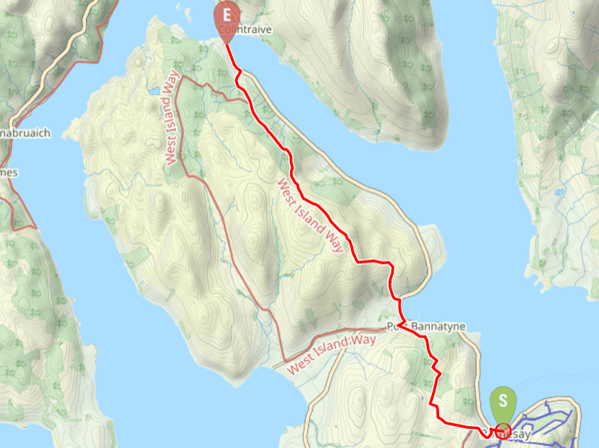
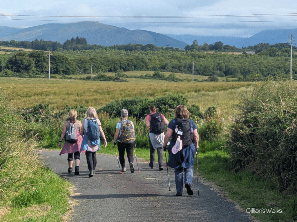
Begin your walk in Rothesay, close to the ferry terminal. With the sea on your right, set off north along the A844 Guildford Square, which soon becomes Victoria Square. At a small roundabout opposite the Winter Gardens, turn left onto Gallowgate. You’ll soon reach a crossroads – continue straight ahead onto Bridgend Street, which you should continue to follow uphill until reaching St Andrews Church. Turn right here onto Hillhouse Road. This residential street soon bends to the right and becomes Westland Road, which you stay on for a sustained uphill walk of approx 1 mile leading you out into the open countryside.
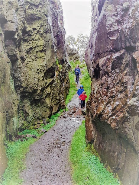
Approx 200m before you arrive at Westland Farm, turn right through a kissing gate onto a wide grassy track. After half a mile there is a tall metal deer fence across the track – turn left here onto a narrower track and follow the signposted route as it zigzags along field edges and through pleasant woodland to reach a tall kissing gate at Bannatyne Mains Rd.
Turn left along the road, soon enjoying the views across Kames Bay and the hills on the Cowal Peninsula. After approx 150m, at the bottom of the hill which leads to Port Bannatyne Golf Club, come off the road onto a track on your right. This pleasant woodland path emerges onto A844 at Port Bannatyne. Turn right to walk down the roadside pavement towards the bay. At the end of the road turn left along A886, with the bay on your right-hand-side, for just under half a mile.
Turn left onto a track beside Sawmill Cottage. At the first fork, keep right (signposted ‘Hilton‘). Follow the fairly steep track uphill. Where it takes a sharp bend to the left (approx 500m up), look out for a narrow track and wooden boardwalk on your right – this is the start of the moorland section of the walk.
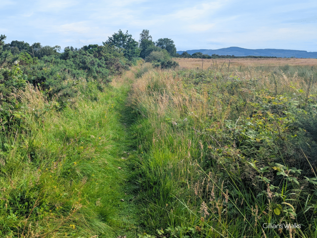
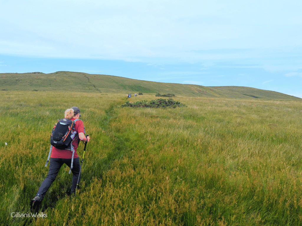
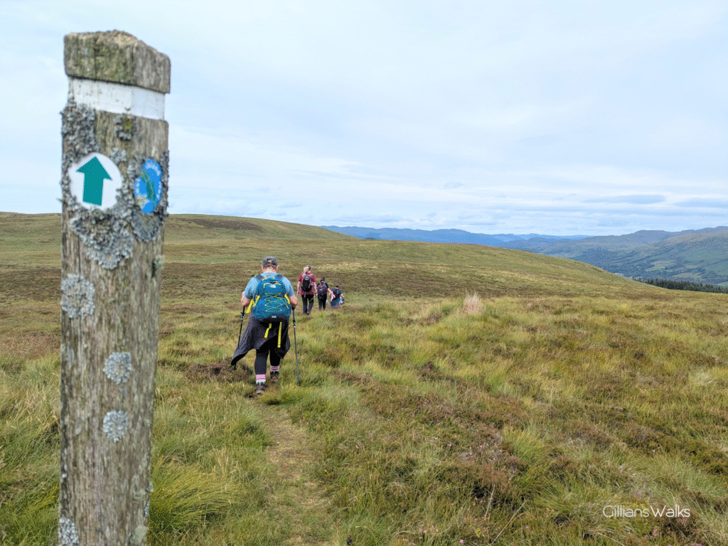
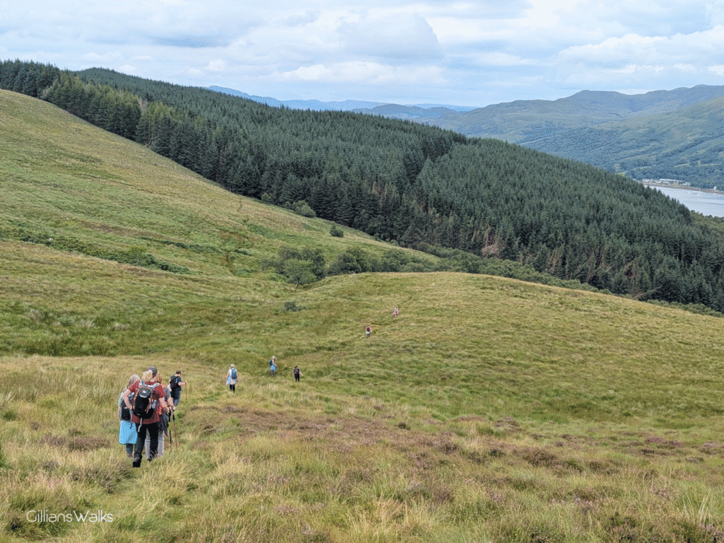
Although way-marked, navigation skills would be useful on this open and exposed moorland section of the route, where it would otherwise be easy to lose your way. An indistinct trail carries you N then W up onto the rolling moorland slopes of Edinbeg Hill then N towards Kames Hill. Look out for tall wooden marker posts. After crossing a stile at NX 054694, the trail begins to head in a general NW direction for approx 1.5 miles over a wide plateau and gently downhill towards a forest. Enjoy views down to the Kyles of Bute.
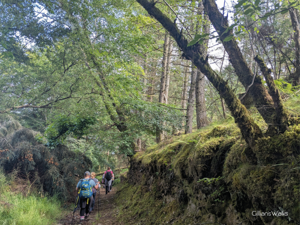
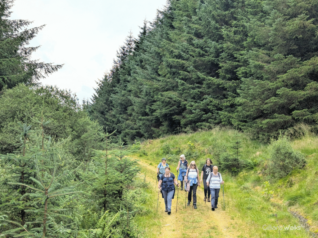
Cross a stile to access the forest, initially following a trail along a narrow clearing in the trees then onto a wide forestry track. Keep right at an obvious fork approx 1.5 miles down, where at the time of my visit there was evidence of recent tree felling operations. This track drops back towards the coast, ending at the A866.
Turn left along A866 for around half a mile to reach the ferry terminal and bus stop at Rhubodach, where this walk ends.
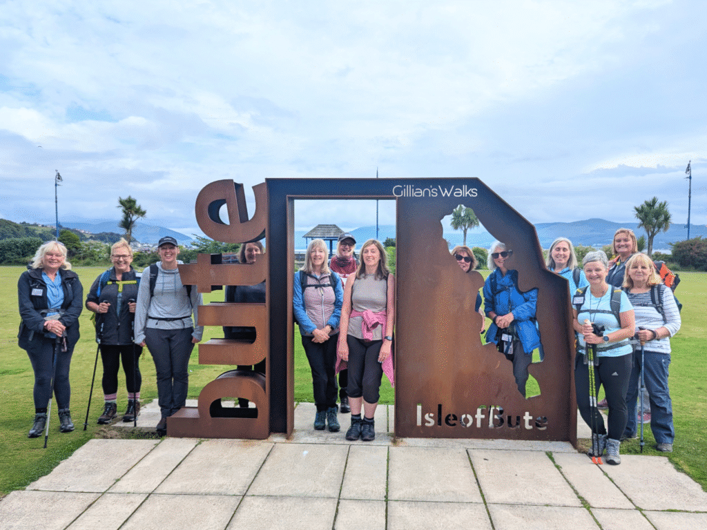
Walk Report: 19th July 2025
Our second walk on the Isle of Bute! Having ticked off the excellent Kilchattan Bay Circular last month, this time we headed in the opposite direction to the far north of the island: Rhubodach. Normally I’m one to walk Long Distance Trails in order, but with no buses to/from Rhubodach on a Sunday, we had to make the most of this Saturday meet-up to get this stage done.
The official guide starts this stage from Port Bannatyne, but I’d figured that if we did Rothesay to Port Bannatyne today, we wouldn’t need to do it next time, and today’s walk was the shortest one to add it to. I picked a route out of Rothesay and onto the West Island Way using the Visorando app. A great addition to the trail would be some way marking from Rothesay ferry terminal to direct walkers to the closest WIW joining point, which seems to be to the north-west of the town. I may have missed it, but I don’t recall seeing any, and being only my second ever visit to the island, I’m not sure whether the route we chose was the best/most scenic option. We didn’t know better, so it didn’t matter!
After an initial residential section which was mostly uphill, we joined up with the WIW route on Westland Road. This was a lovely stage on quiet country roads and then across a zig zag of farm tracks, grassy trails and woodland paths, with several boardwalks and kissing gates, and a couple of muddy bits to keep us on our toes.
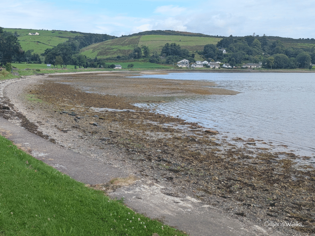
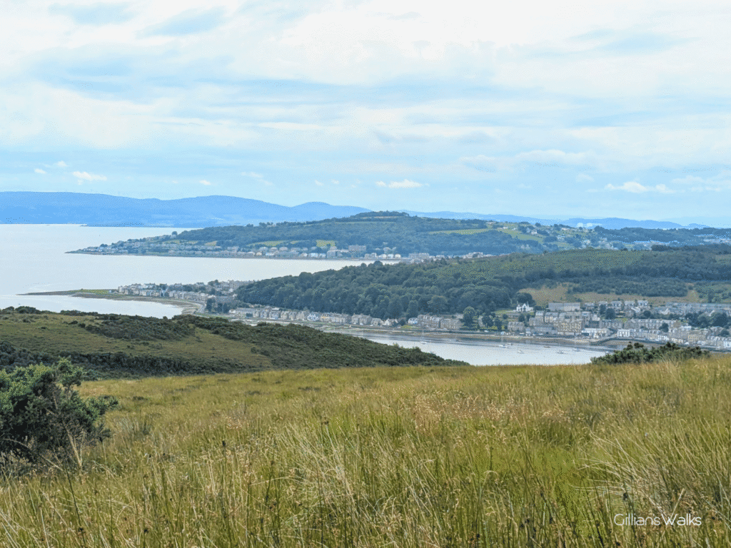
Before we knew it we had dropped back down to sea level at Kames Bay, Port Bannatyne. What a lovely place! The small marina looked busy with boats – it is said to be the gateway to the Kyles of Bute – and the tide was out, revealing a pebble shore. With a long walk ahead and a bus to catch at the far end, we didn’t have time to explore the village itself. We will have to return and do so another day!
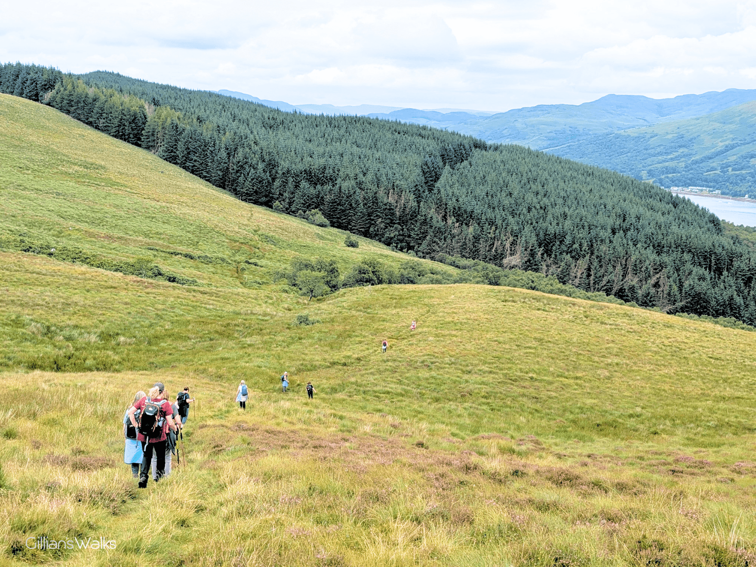
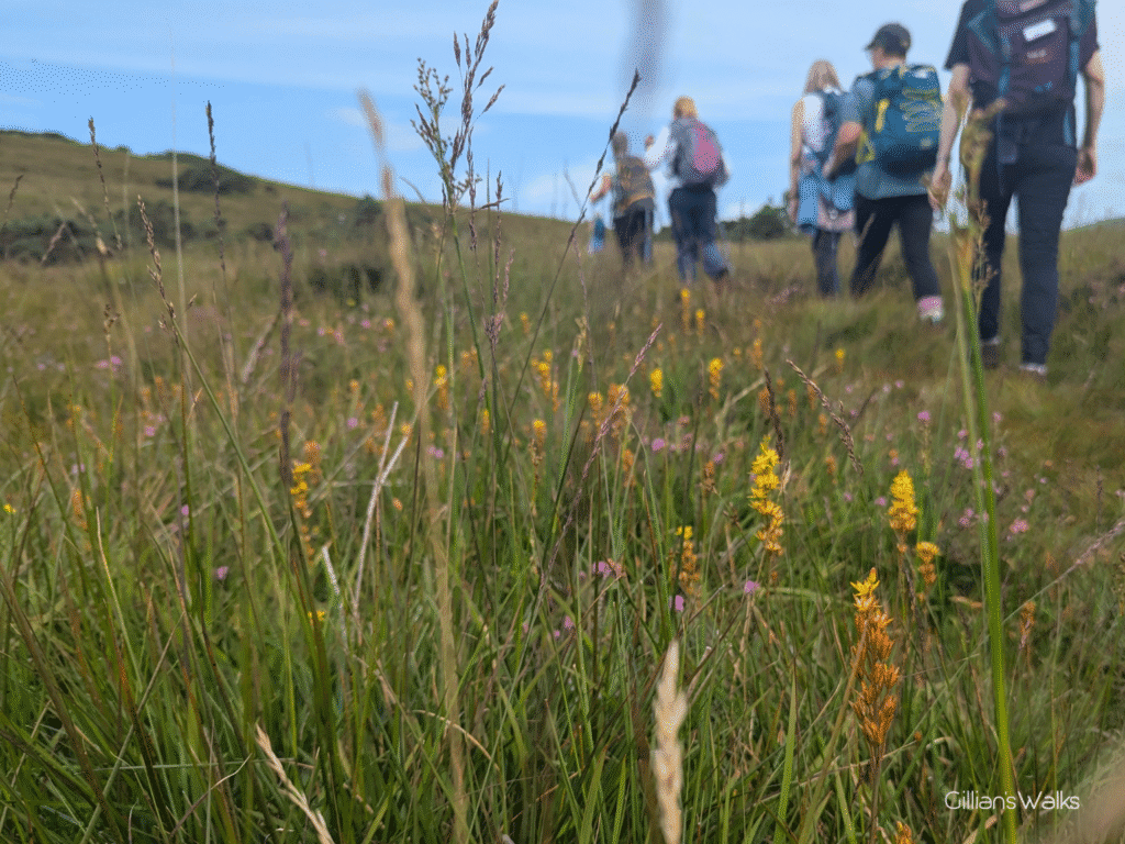
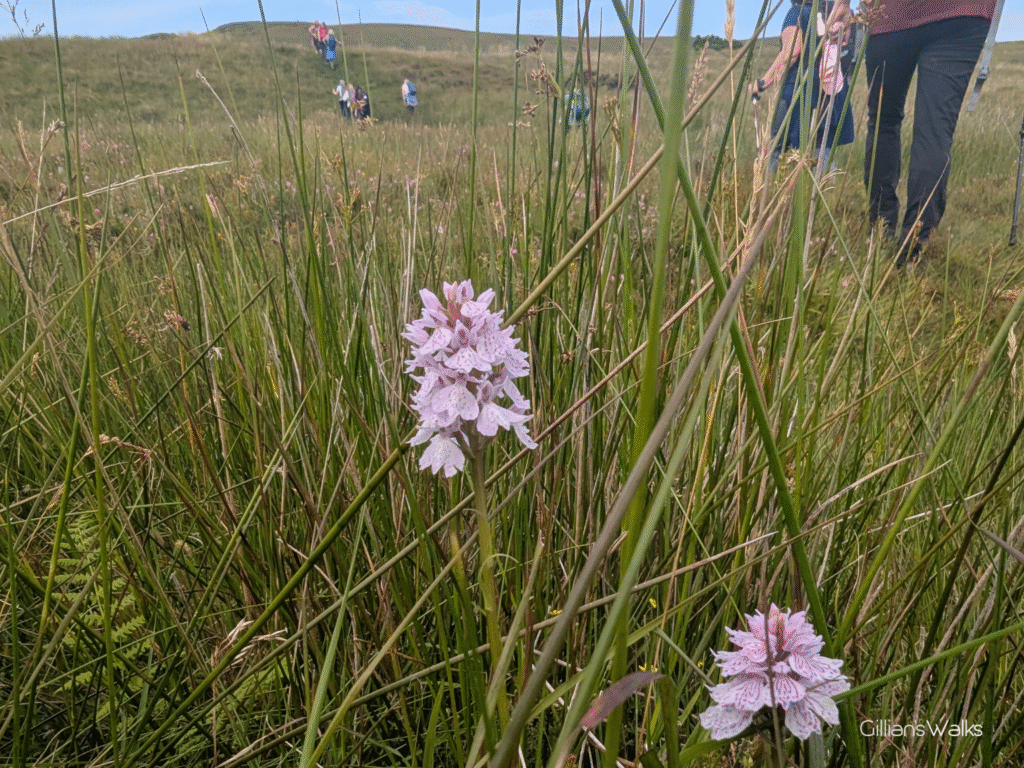
From here a steep track took us uphill to the moorland section of the route. I’d heard from several sources that this part can be particularly boggy so I was pleased that we were doing it after a prolonged dry spell when the bogs had mostly dried up. I was amazed at the variety of wildflowers on display here: the star-shaped Bog Asphodel being one, as well as beautiful pink Heath Spotted Orchids. Not forgetting all the heather with the little pink clusters of bell-shaped flowers (Cross-leaved Heath I am led to believe). They fairly brightened up what might otherwise be quite a bleak place at certain times of the year.
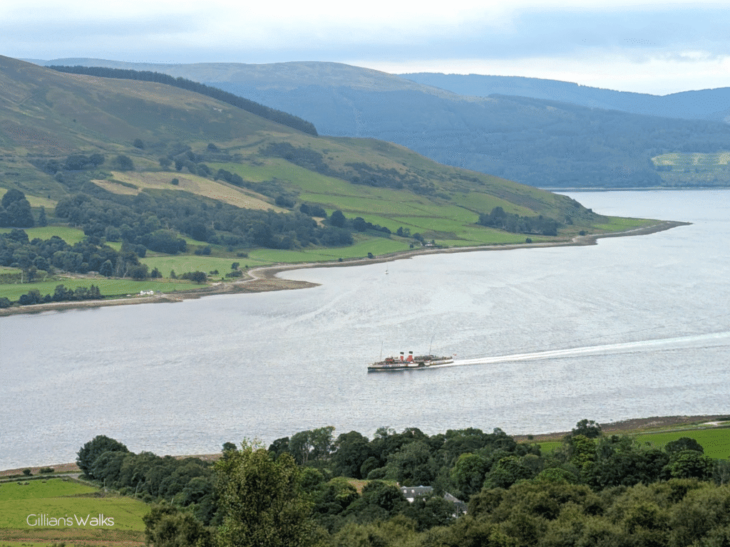
As we climbed ever higher, the views were our reward: to the south-west the mountains of Arran; to the south-east the double delight of Port Bannatyne and Rothesay; to the north-east the Loch Striven/Kyles of Bute meeting point and hills on the Cowal Peninsula. We were even treated to the joy of watching the Waverley sailing slowly past!
The moorland section was dotted with tall wooden marker posts, visible in the distance since we had a clear day. The trail is very indistinct in places – so much so that I am pretty sure we didn’t exactly stick to the “correct” route between markers at times, but with the help of Visorando were able to stay roughly on track. I definitely recommend having a map with you if you attempt this section.
We stopped for lunch at the top of Edinbeg Hill, around 4.5 miles into the walk (halfway!). Being one of the highest spots on the walk we had beautiful views from here and we spent some time debating what we might be looking at. All unfamiliar territory to me! This hill summit also happened to be at the end of a particularly steep ascent, so we were all ready for a well-earned rest…
Then off we set, pretty sure it would “all be downhill from here”, which it generally was from Kames Hill onwards. Reaching the forest felt like a milestone moment after so long spent out on the hills and moors, and we welcomed the return of a prominent track to follow. Until this point we had only passed four other walkers all day. We were therefore surprised to come across a large group of some 20+ members of Ayr and District Rambling Club in the forest, who were walking the full northern loop from Ettrick Bay if I’m not mistaken. It was lovely to spend a few minutes chatting with them about their day so far. Having just come down off the moors, we didn’t envy them still having that all ahead of them!
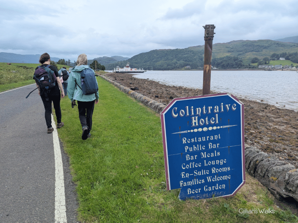
On the short walk along the road to Rhubodach, we could see the ferry arriving from Colintraive. A small boat which looked similar in size to the Cumbrae ferry, possibly even smaller! We passed a traditional-style old metal sign which had fallen down off its rusty pole, advertising the Colintraive Hotel. The words ‘Beer Garden’ at the bottom caught my eye! With about 1.5hrs to wait for the bus back to Rothesay, we could either wait it out in Rhubodach, or…… might we have time to hop on the approaching ferry across the water to Colintraive, have a drink in the beer garden at the Colintraive Hotel, then catch a return ferry before our bus would leave?? Some speedy timetable checks and calculations revealed that we could just make it….
We didn’t have much time to spare pondering whether or not it was a good idea – the ferry was about to leave! We went for it – why not live dangerously! The sailing only takes 5 minutes each way (one of the shortest ferry routes in Scotland) – just enough time to use the boat’s facilities and rest the weary legs for a minute. The plan couldn’t have gone more smoothly and before we knew it we were sat at the picnic benches sipping away (Irn Bru for me), as the Waverley sailed past for the second time in a day! We made it back for our bus, and off we went back to Rothesay.
The fun didn’t end there though. We ran from the bus stop to try and catch the 5pm ferry, the bus having arrived into Rothesay around 5 to the hour. Alas, we were turned away – you must be there 15 minutes before departure time. That made sense of course, but why did the buses not run in time with the ferry departures? That, we could not get our heads around.
So we had an hour to wait in Rothesay before the next sailing. What to do….. Some of us went for a chippy dinner, others found a little brasserie for a drink, the rest went to sit in the park. Ah ha, so the majority of us spent money – THAT’s probably why the buses don’t run in time with the ferries!
All in all a true adventure of a day out with a little bit of everything. I highly recommend this walk on the Isle of Bute.
Other walks in the West Island Way series: