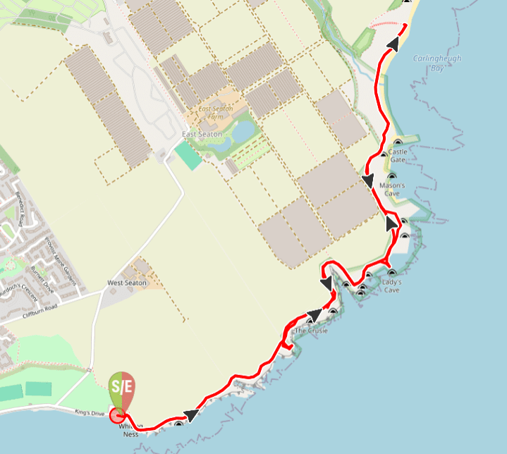
TERRAIN: Graded easy: the main footpath along the clifftops is surfaced and flat, although can feel close to the edge at times. One set of steps down to/up from Carlingheugh Bay (optional). No gates or stiles. There are a number of benches dotted along the path. If you choose to explore any of the rock features more closely the walk becomes much more adventurous with informal desire lines and loose gravel trails, sometimes steep with sheer drops towards the sea. Take care! Total distance there & back is 3.5 miles (1.75 miles each way).
![]() Plenty of free parking at the walk start point: Arbroath Cliffs car park, Victoria Park, where there are also public toilets. It is approx 30 mins walk (1.5 miles) from Arbroath bus or train station to the start of the walk.
Plenty of free parking at the walk start point: Arbroath Cliffs car park, Victoria Park, where there are also public toilets. It is approx 30 mins walk (1.5 miles) from Arbroath bus or train station to the start of the walk.
![]() Dog-friendly walk however note that the path is close to the cliff edges at times so care should be taken
Dog-friendly walk however note that the path is close to the cliff edges at times so care should be taken
View full route description
From the eastern end of Arbroath Cliffs car park, head up the ramp onto the clifftops. Follow this surfaced path along with the sea to your right-hand-side for just over 1 mile, to a split in the path above Carlingheugh Bay. There is a wooden sign post here for the Angus Coastal Path. You can either turn back at this point, or turn right to go down onto Carlingheugh Bay for a while first.
Return via the same route.
Walk Report: 23rd August 2025
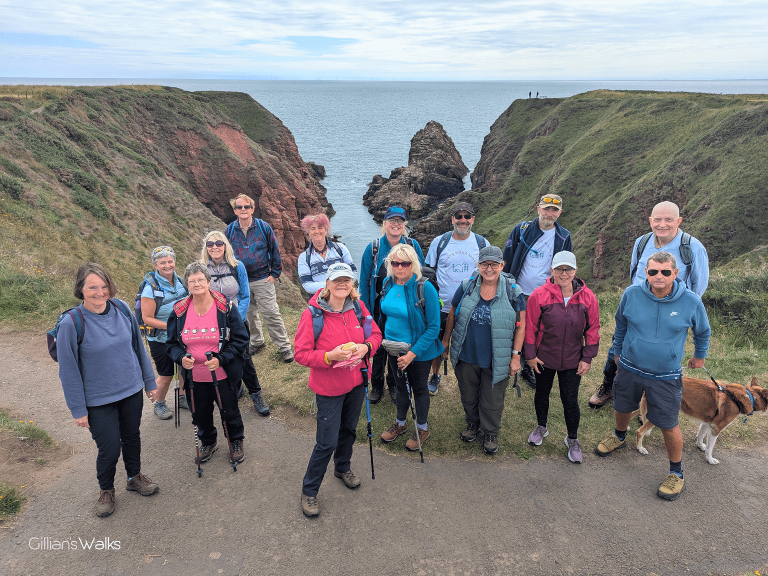
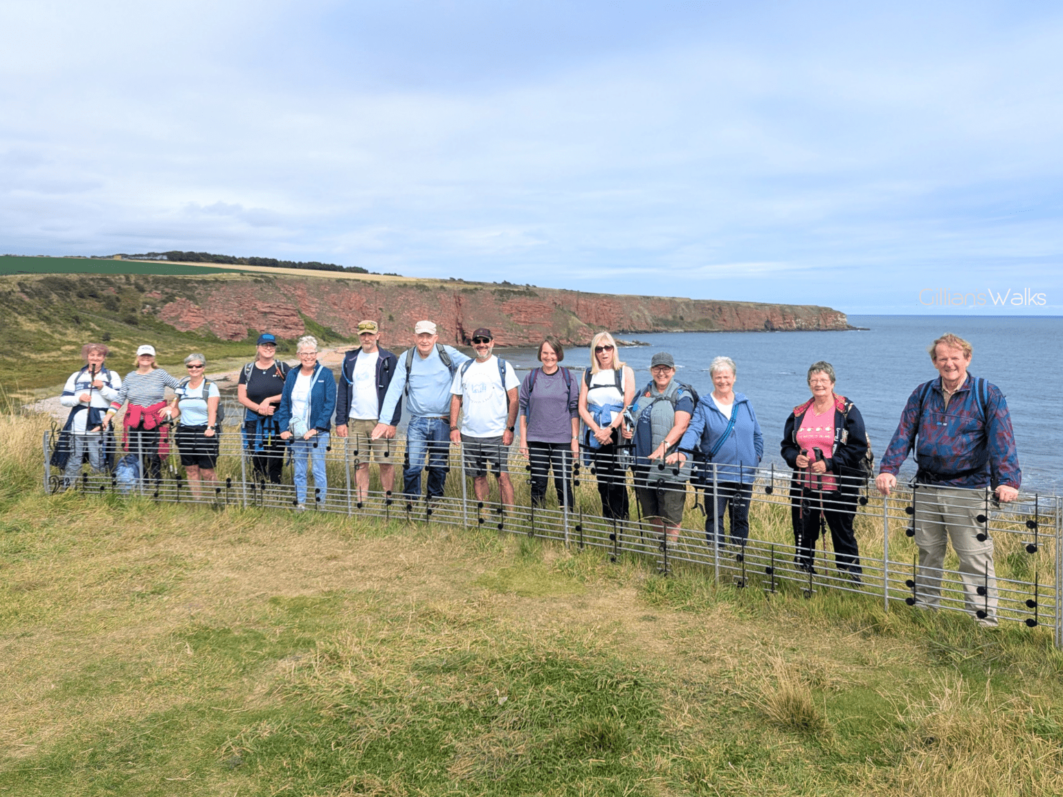
Local guide, Pete, of Walking with a Reason, had invited me to take a group up to Arbroath with me to walk the Cliff Trail. Along with his invitation he had sent a few photos and say no more, we were in!
I met Pete when he came to Ayrshire to walk the Ayrshire Coastal Path and got in touch. We walked a section together and seeing as it was his final day I presented him with a completion certificate, right next to Portencross Castle – which he was both surprised and delighted with! Pete had been walking the route to raise funds for Girvan Youth Trust. Considering that he lives on the east coast, it might seem like a strange choice of charity, until you realise that Pete’s passion is promoting walking as a therapeutic activity for people struggling with mental health challenges, enabled by fundraising opportunities. He has completed various challenge walks all over Scotland and raised money for many different charities along the way.
Back to Arbroath…. When we arrived we were met by Pete and several members of his friendly walking group who were only too happy to be showing us one of their favourite trails. We promised to return the favour sometime, although where we might take them in Ayrshire which could compare to this place remains to be seen!
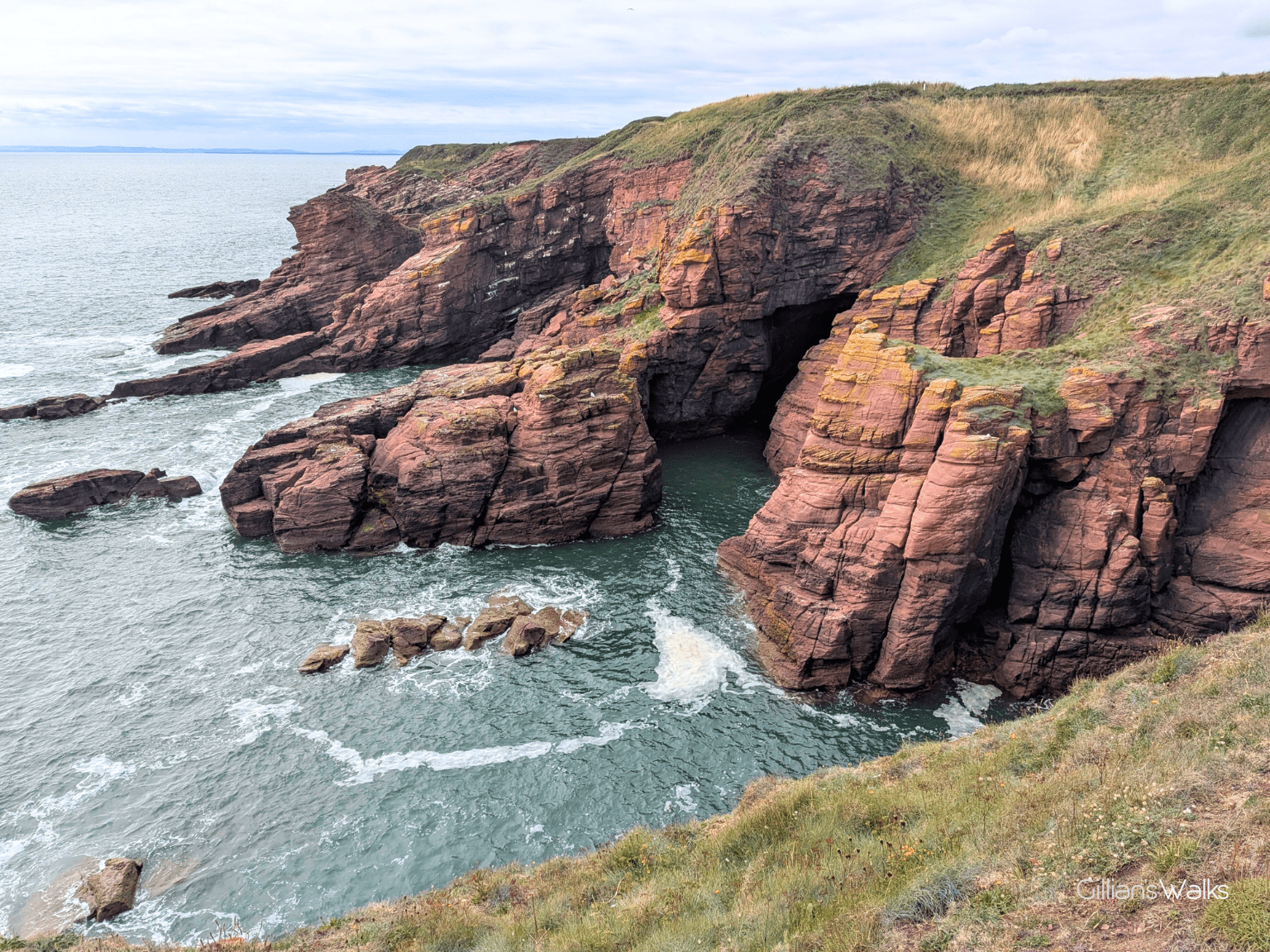
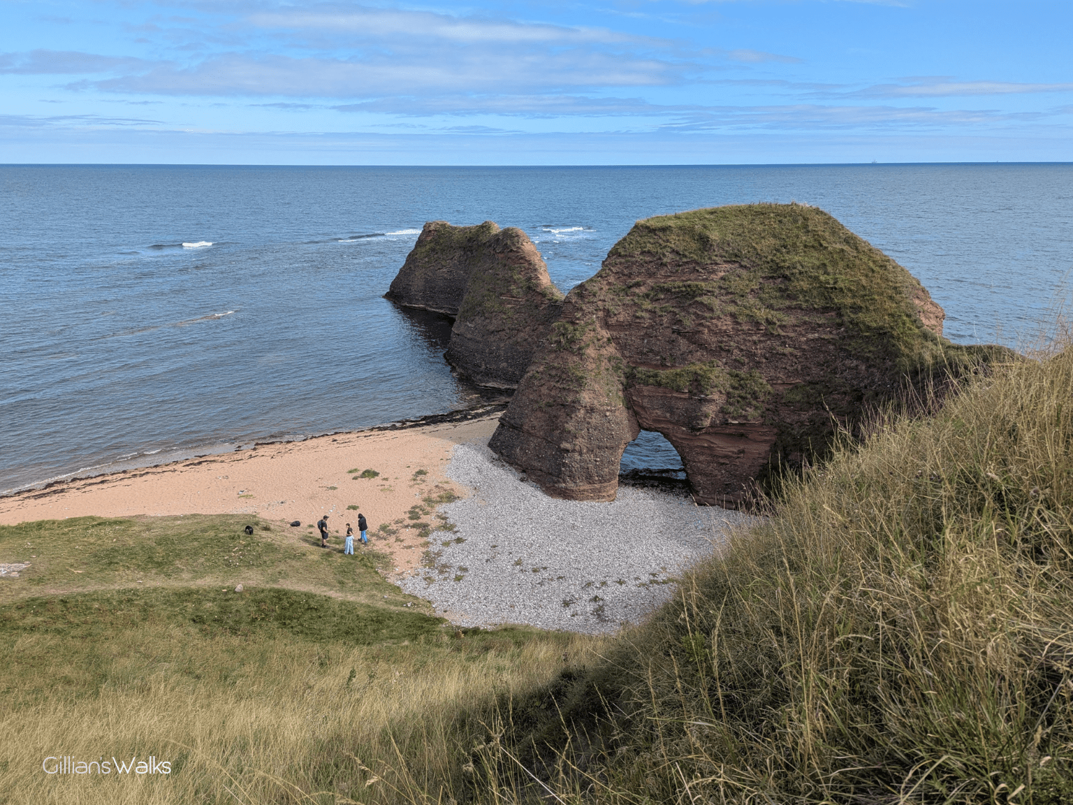
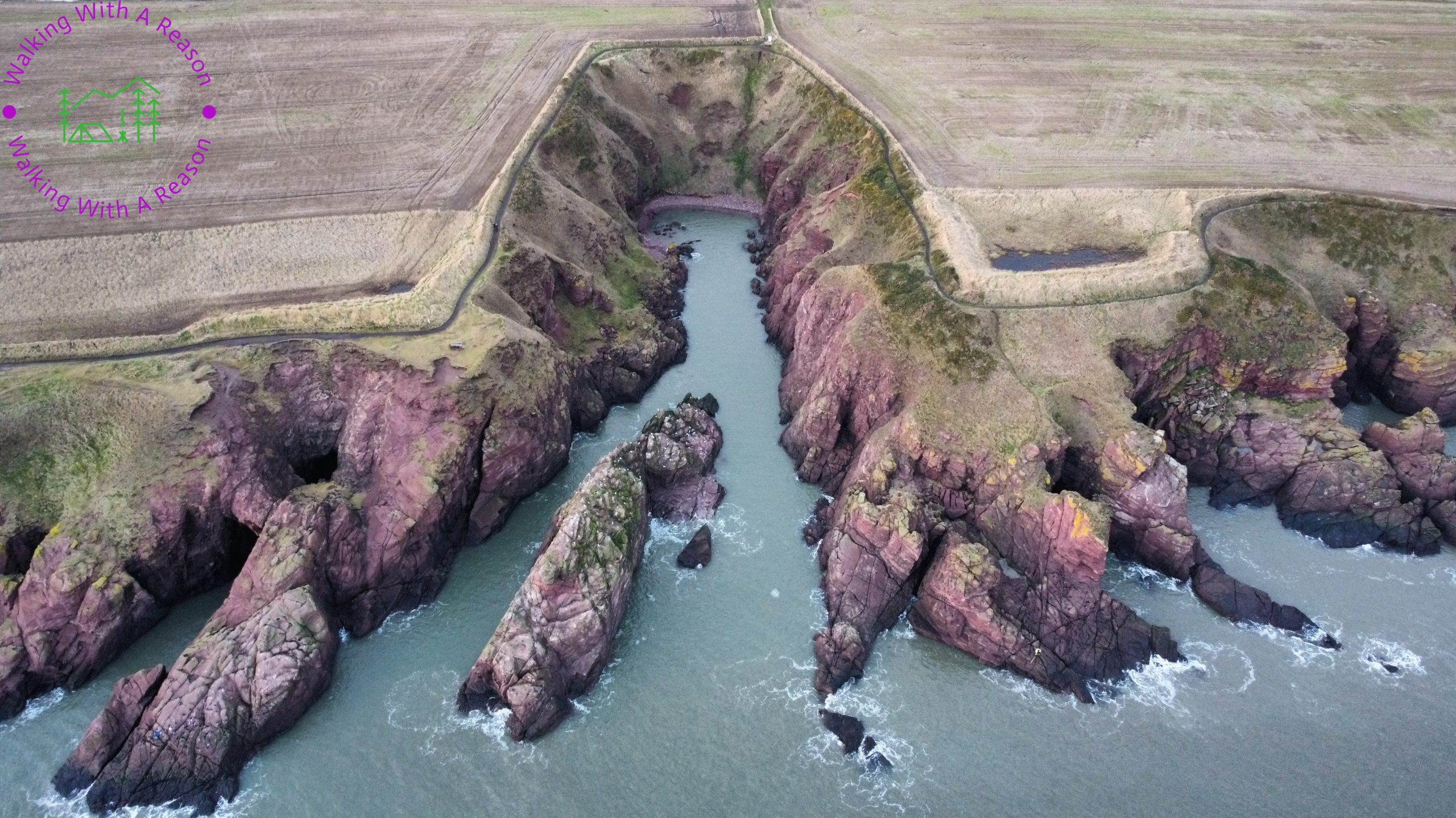
We had scheduled in four hours for the walk, and the plan was to head along as far as we could in two hours, and then start to head back. At the most if we made it along to the next village – Auchmithie – and back again it would be an 8 mile walk. In reality we walked 3.5 miles in total. Why only that distance?? Well, in spite of the unexpectedly well-surfaced footpath, we made very slow progress due to stopping at every corner to take photos! The coastline here was like nothing we had back home, and we were in awe of the never-ending stream of red sandstone rock features and sea caves. They came with curious names like Deil’s Heid, Mermaid’s Kirk, and the Needles E’e…. We had been blessed with fair weather and calm seas but we pondered how dramatic this place must be on a stormy day!


Another thing…. we are used to the Firth of Clyde with the Isle of Arran as a backdrop. Here, the eye was cast way out over the North Sea to a vast nothingness. If you could see all the way to the next landmass due east, it would be northern Denmark! That kind of blew my mind.
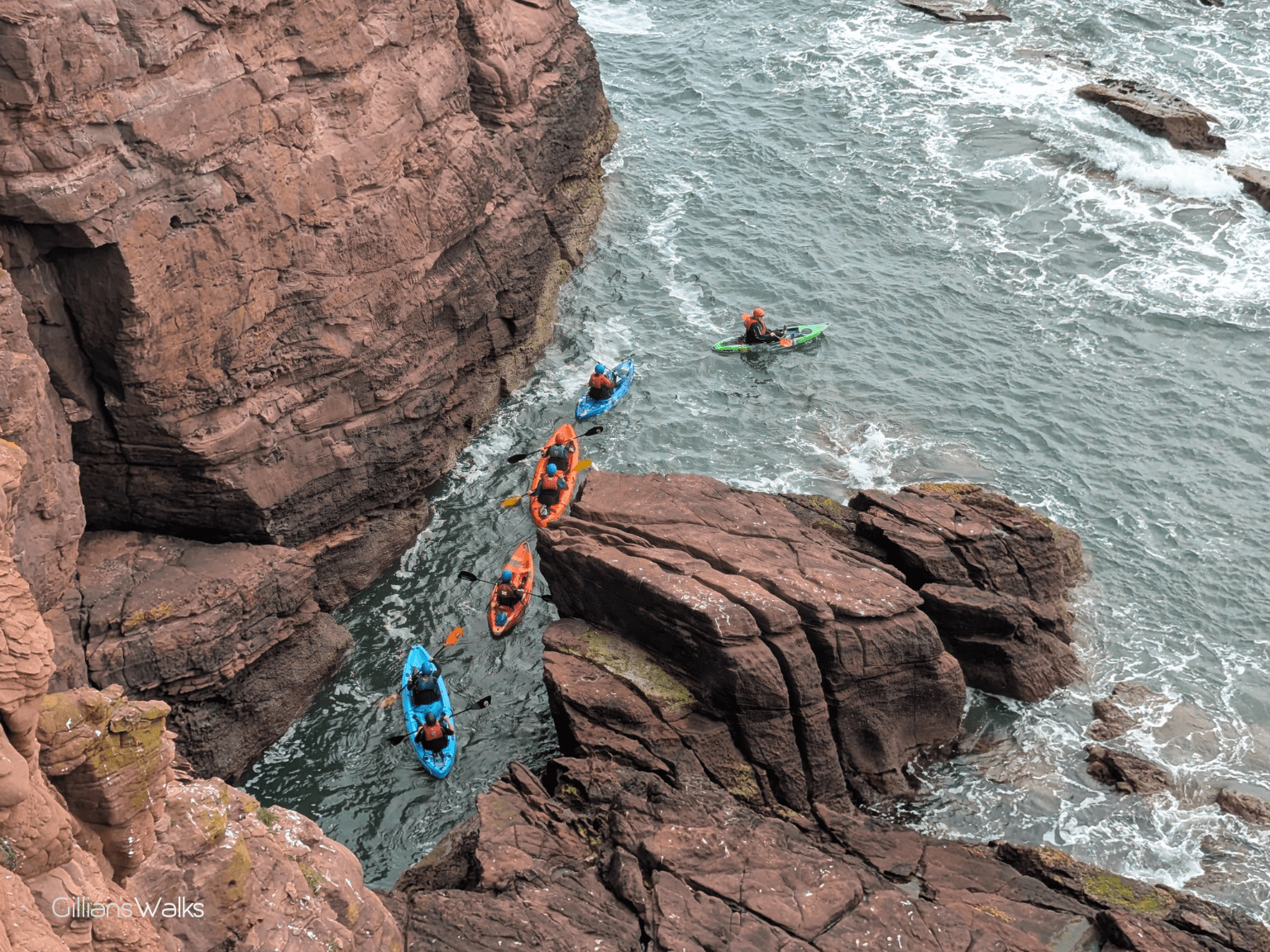
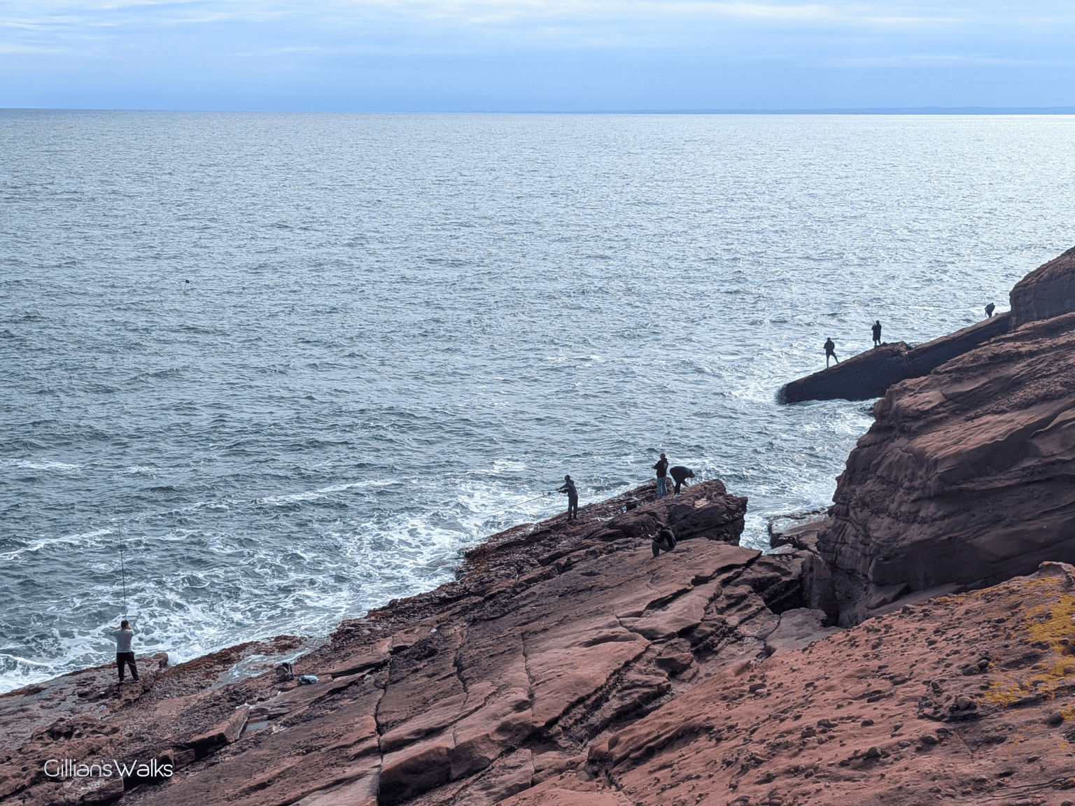
The trail was busy with other walkers, people with dogs, even someone braving the narrow path on his bike. It is clearly a well-used local path. Indeed, Pete tells us that he comes here most days, and that it never gets boring because no two days are the same. There were people fishing from the rocks, and the sea was busy too, with people out on kayak excursions weaving in and out of the myriad of sea caves and some adventurous sorts jumping off the rocks into deep pools! It looked fun, but I was happy watching from above…. 😉
Part of the route is also within the boundary of the Seaton Cliffs Wildlife Reserve, managed by the Scottish Wildlife Trust. I didn’t realise this until we passed one of their signs. According to their website, dolphins can often be seen offshore, and the whole area provides an important habitat for seabird colonies, butterflies and wildflowers. We did indeed see seabirds, butterflies and wildflowers on our visit, but alas no dolphins.
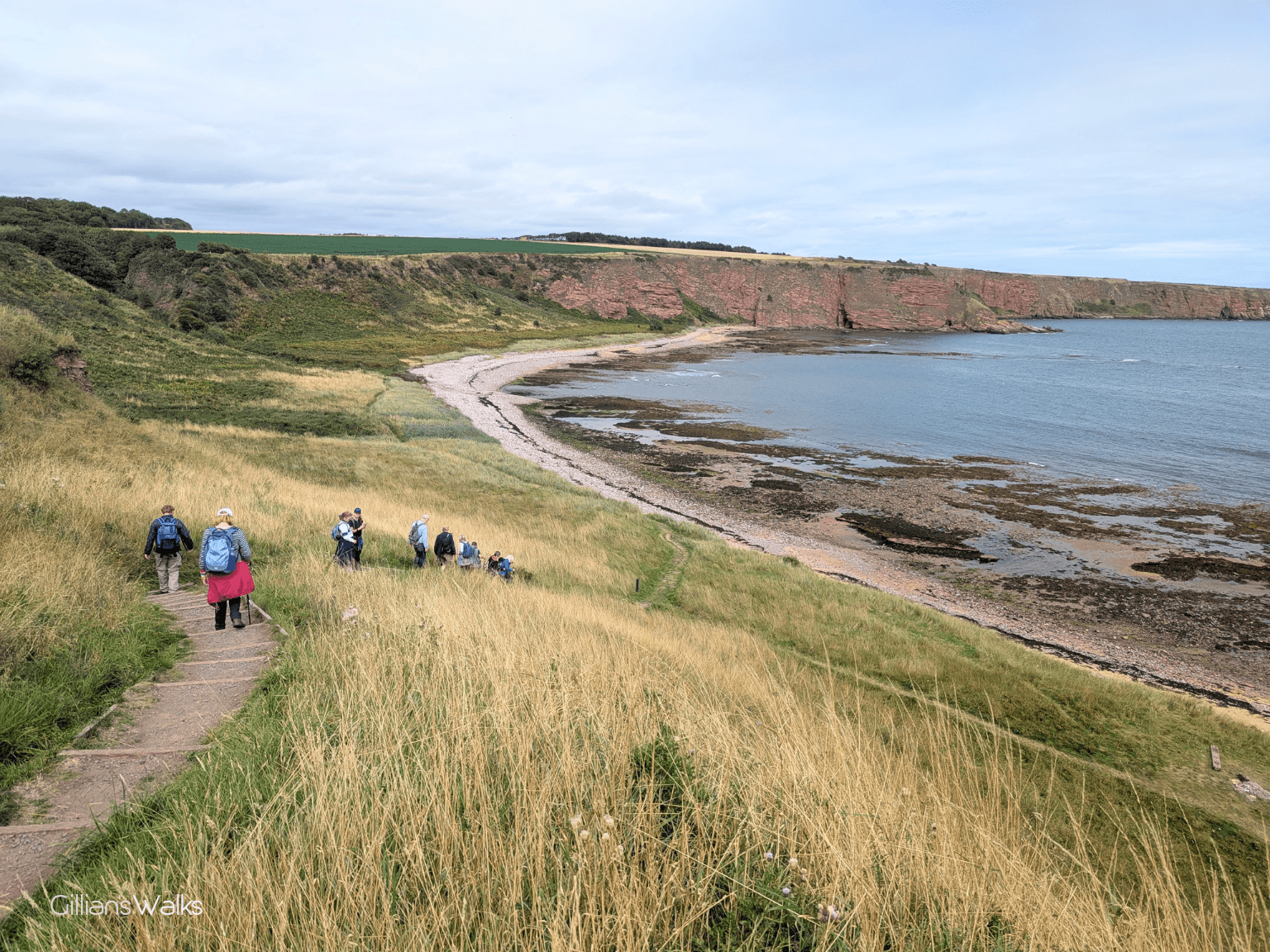
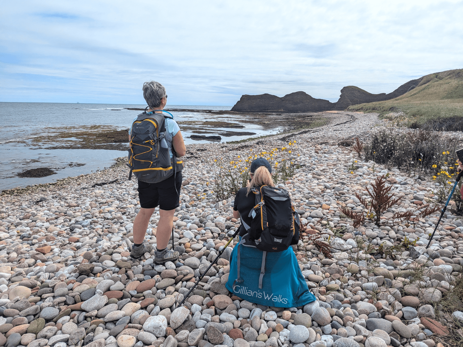
Carlingheugh Bay is a long stretch of sand and pebble beach with a red sandstone sea arch and rock stacks at its southern end and dramatic tall cliffs at the northern end. It was such a peaceful spot, somewhere you could easily sit for hours on a mild day with a book. Some of our group did stay a while, wandering along the bay chatting and soaking up the tranquillity. They were waiting for the rest of us who had been tempted on a bit further to see what else lay ahead on the clifftops. It required going up a steep set of steps which wasn’t everyone’s idea of fun. But there was no obligation: the bay offered the perfect place to kick back and wait. Pete told us that he often comes out here to wild camp. We could see the attraction!
Another notable feature at this point on the walk is the music note sculpture above Carlingheugh Bay, created by an anonymous artist. Do you read music? Apparently it relates to the hymn Lord of the Dance and the sculpture appeared mysteriously one day in 2019!
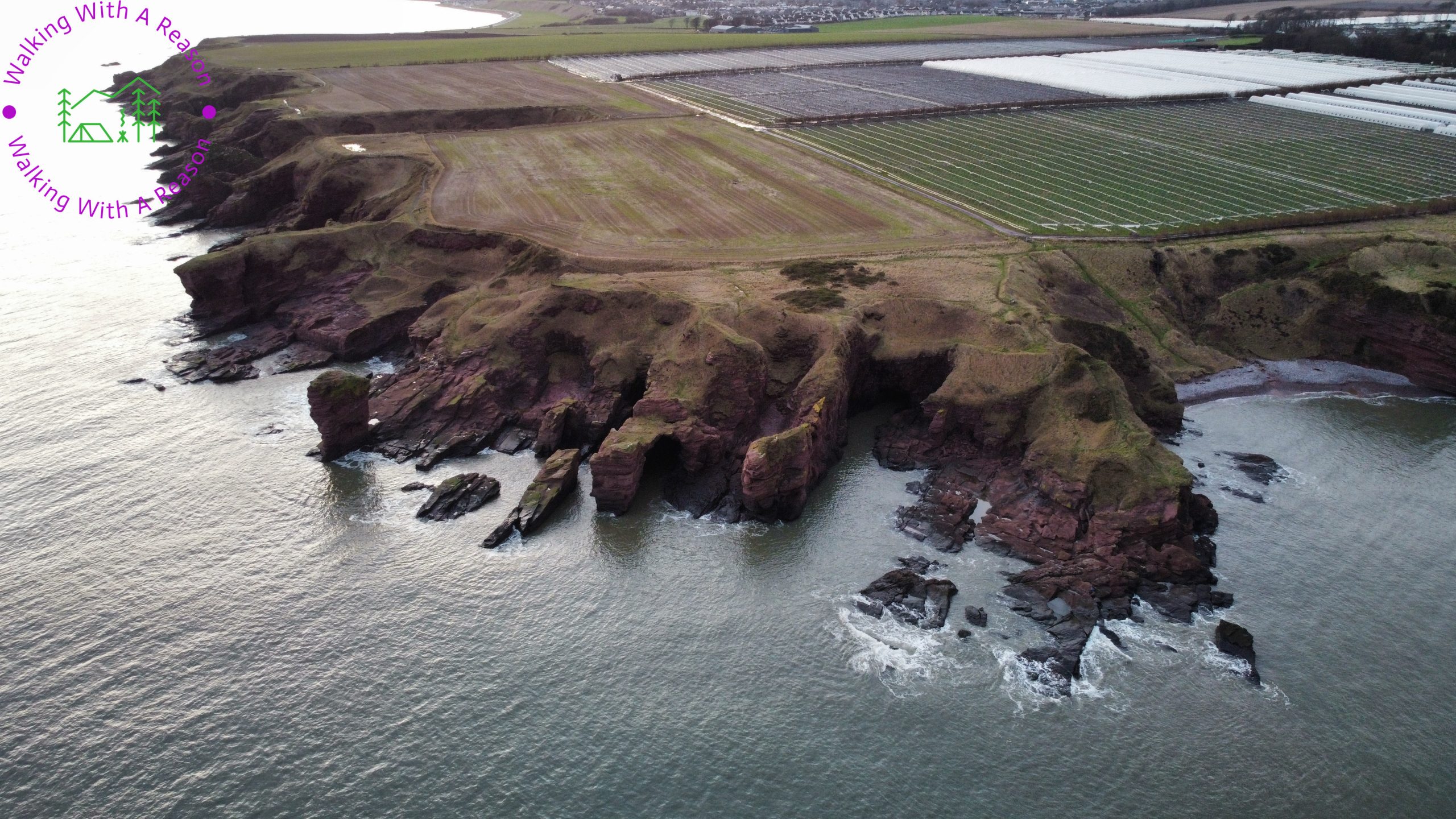
Whilst up on the clifftops, if we could prise our eyes away from the sea view for a second, we could see that the inland fields were choc-a-bloc with rows and rows of unfamiliar-looking poly-tunnel structures with plants inside. Asking one of our guides, we were reliably informed that they were strawberry farms! Something else you don’t see very often down in Ayrshire! I made a mental note next time I was at the supermarket to look and see if any of the strawberry punnets came from Arbroath 🙂
I was unaware of this at the time, however on seeing some of Pete’s drone shots after the walk I noticed how completely flat the clifftop fields are compared to the rock edges. And how far inland they stretch: huge, smooth, horizontal swathes of fertile lands. It was a pleasure to flick through Pete’s huge collection of photos over dinner at the fantastic Townhouse restaurant in Arbroath, who looked after our large group impeccably. Pete has kindly given me permission to share some of his drone shots on this Route Guide. I hope they will inspire you to go there and see this place of beauty with your own eyes!
If you are interested in learning more about how these rock formations came to be as they are today, I can recommend downloading the ‘Arbroath to Auchmithie Geodiversity Trail’ leaflet by Angus Council.
In hindsight, we could probably have arranged to walk all the way to Auchmithie and take a bus back to Arbroath. Something for you to consider, although bear in mind you wouldn’t get a bus all the way to the trail car park, so you’d need to factor in the extra 30 minute walk if that’s where you are parked. I have also read that the bus service is fairly infrequent, so it may be best to plan the bus journey before the walk so that you are walking back to cars.
A fantastic day out was enjoyed by all, enhanced by the local knowledge of Pete – Walking with a Reason.