Looking for a longer walk? You might enjoy the Ballantrae Smugglers Trail – Knockdolian Hill Circular walk which starts in Ballantrae and is a 7 mile loop.
TERRAIN: Graded moderately challenging due to steep ascent and descent. Total ascent/descent is 669ft / 204 m. Navigation skills required in poor weather. Grassy hill path and some pathless sections. Sheep possible on this walk. Two gates (each way). No stiles.
![]() Space for 2 cars opposite Finnart Cottage on the B7044. No public transport to start point. Local buses serve Ballantrae village approx 3.5 miles away.
Space for 2 cars opposite Finnart Cottage on the B7044. No public transport to start point. Local buses serve Ballantrae village approx 3.5 miles away.
![]() No public toilets on this route. Closest are at Foreland Car Park in Ballantrae, approx 3.5 miles along the B7044.
No public toilets on this route. Closest are at Foreland Car Park in Ballantrae, approx 3.5 miles along the B7044.
View full route description
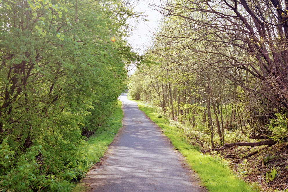
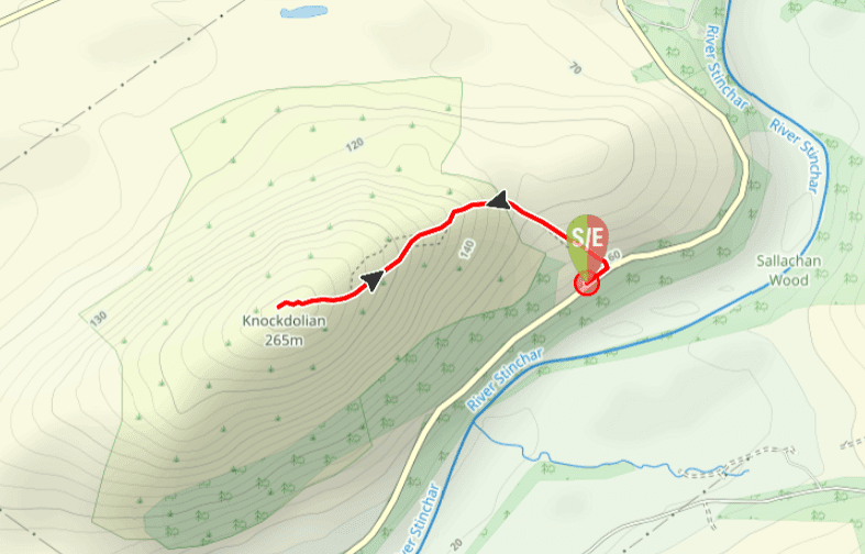
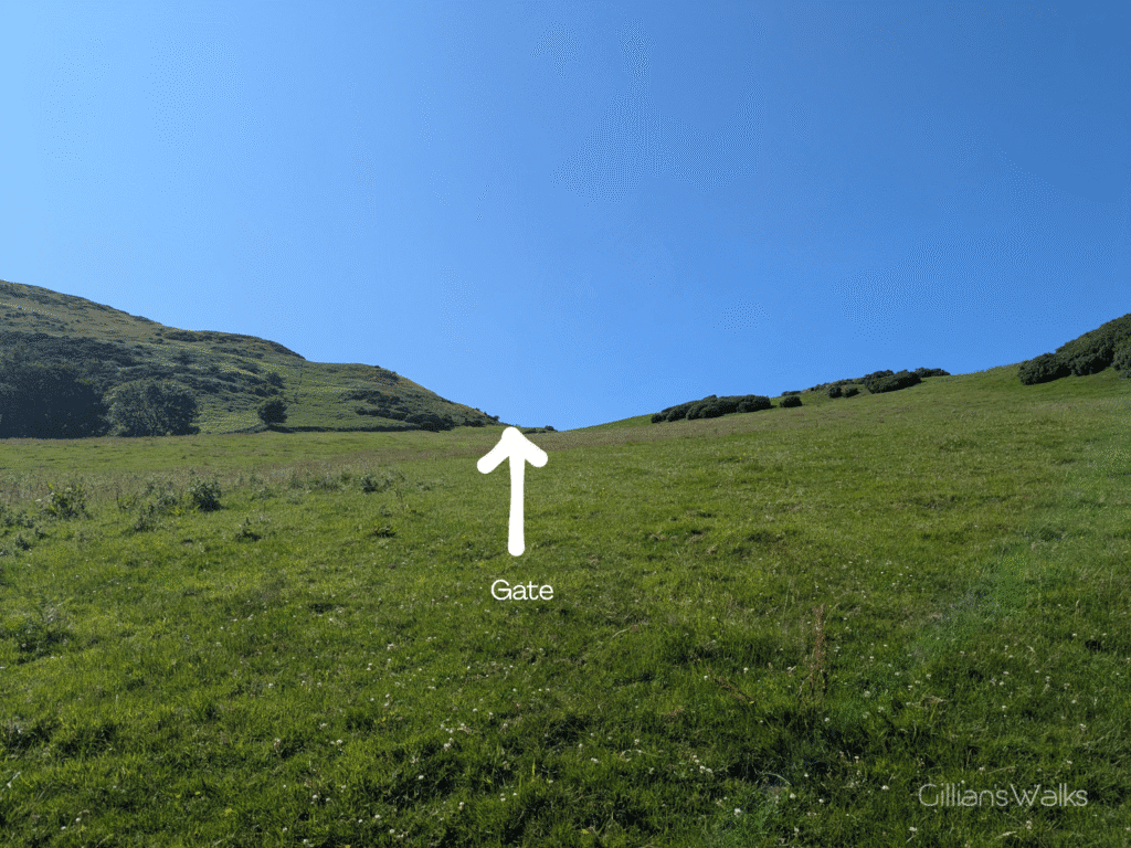
Just beyond Finnart Cottage there is a tall ‘Knockdolian’ marker post at the roadside which directs walkers up a steep grassy slope to a field gate. Go through the gate and out onto the open hillside.
Cross the hillside in a general NW direction, heading towards a low point on the horizon where there is another gate.
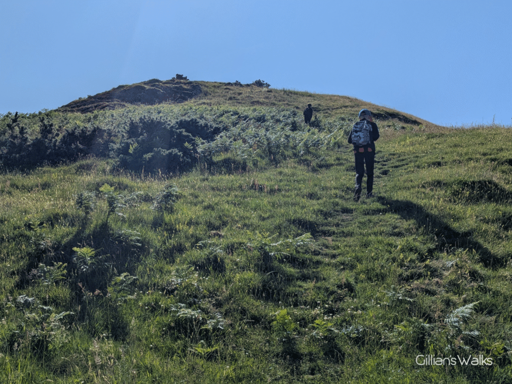
Go through the gate and follow a faint grassy track directly up the steep slope (W). The views begin to open up as the track makes its way up Knockdolian’s eastern shoulder to the summit trig point.
Descend via the same route.
Printable Route Guide – Knockdolian Hill
Download, Print, Go! This PDF Route Guide has been carefully designed to allow you to easily print a copy of the key information for this route on an A4 page to take with you on the walk. Perfect for offline use!
Walk Report: 2nd July 2025
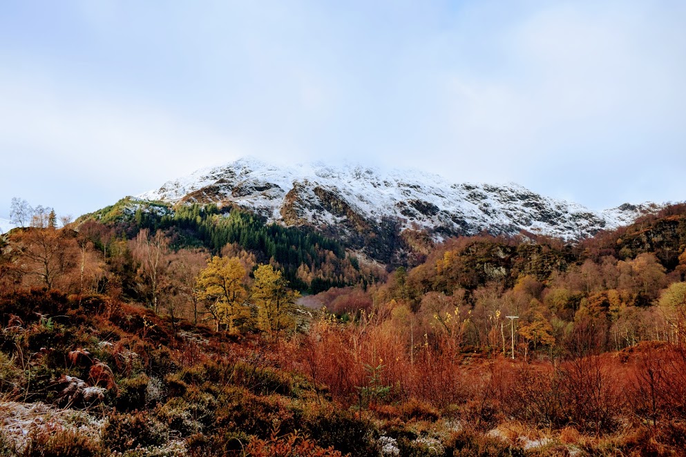
The kids and I tackled Knockdolian towards the end of our Ballantrae staycation. As a result, by the time we came to walk it, we’d seen it from pretty much every angle apart from the top! We were blessed with blue skies and crystal clear visibility – just the trick. Although it’s small at 265m / 869 ft, it is often shrouded in low cloud. Something to be aware of if you are considering giving it a bash.
I was looking forward to this one, it had been on my bucket list for some time! A prominent landmark from Ballantrae and the whole coastline around that area, it is known by some people as “Ailsa Craig’s Twin” because of its steep-sided conical shape, which makes it look like Ailsa Craig when seen from the sea. I’ve read that it is cone-shaped because it was formed from a volcano – possibly the oldest in Ayrshire!
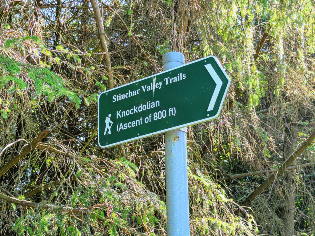
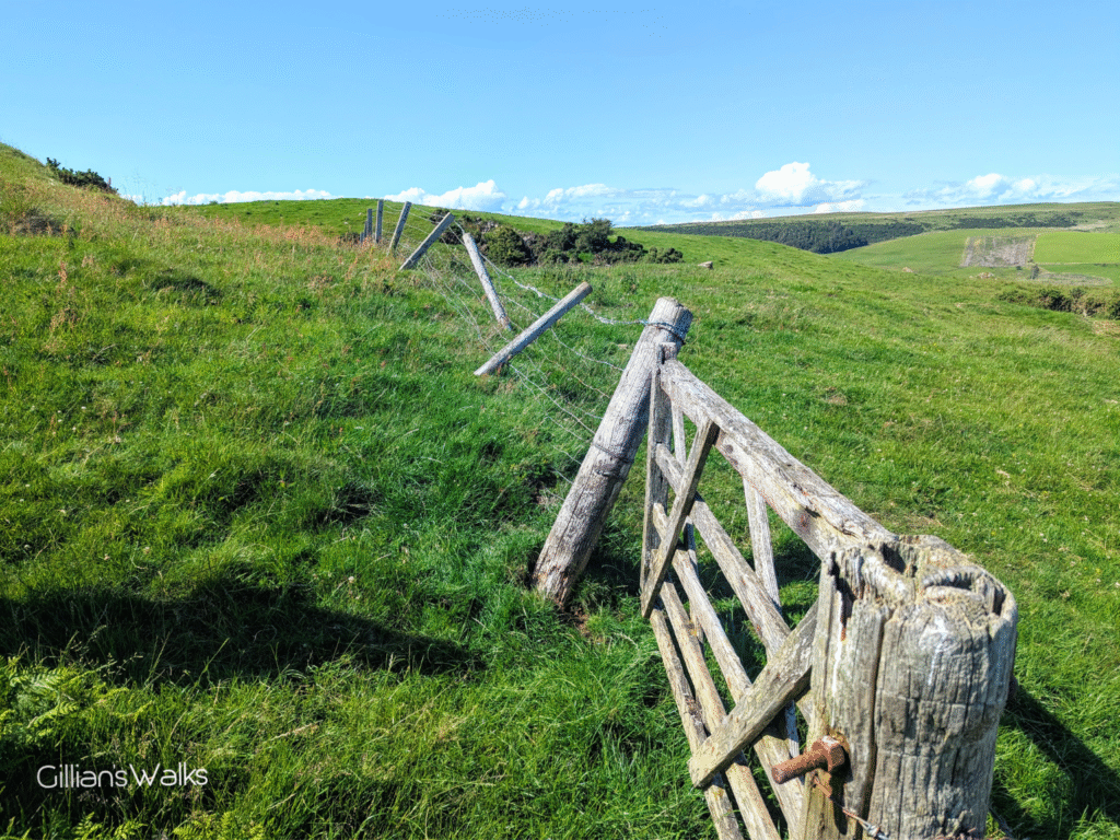
We made our way up the very steep track from the Stinchar Valley Trails sign to the field gate. I was surprised when the gate opened outwards towards me, onto the steep slope. It was a lot heavier than I had anticipated and gravity was making it quite challenging to keep a hold of whilst everyone went through and then again when trying to secure it.
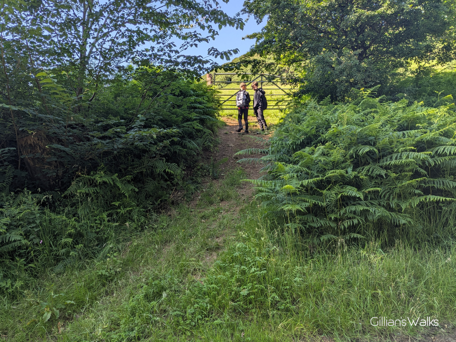
Once through, it wasn’t immediately obvious where we should go, however I of course had pre-planned the route using Visorando so all I had to do was have a quick look at my map to check what direction we should be going in. Looking up towards the base of Knockdolian I could see a gate visible on the horizon. We decided to head for that. Since there was no livestock in the field at the time we were able to make a direct line for it.
It was steep! You realise you’re not as fit as you thought you were when you try and go up a steep slope with a 12 and a 13 year old waiting for you! On arrival at the gate we found that the fence it was attached to wasn’t in the best of conditions. In fact the only reason the fence was standing at all was because the gate was holding it up. The strainer post and several of the fence posts were rotten and just resting on top of the ground. This made the gate tricky to open and securely close, as we had the weight of the fence to try and hold up at the same time.
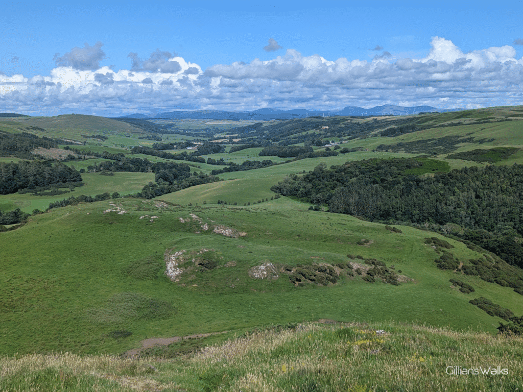
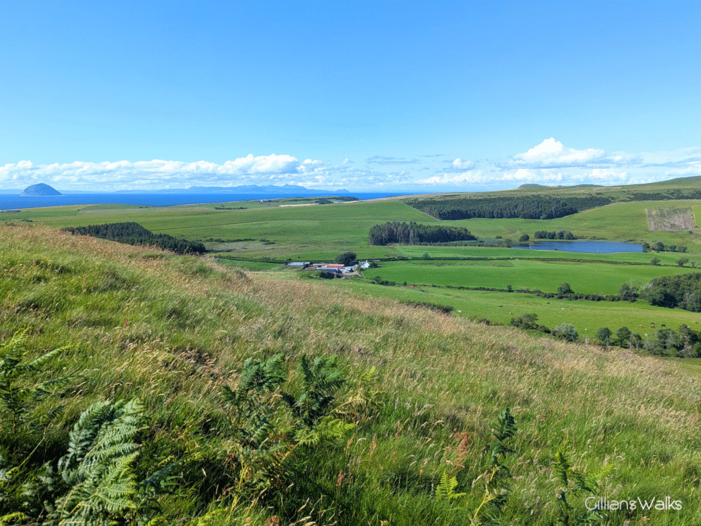
That challenge overcome, we set off up the zig zags to the summit. The views were already impressive even from the lower slopes of Knockdolian’s eastern shoulder: out across the glimmering water, Ailsa Craig and the Isle of Arran looked as clear as I’d ever seen them; inland I could see right up the Stinchar valley towards the village of Colmonell and the Arecleoch Windfarm.
Much closer, I could see a small loch – Loch Melemon according to my map – with the impressive-looking Knockdolian House nestled amongst the trees beside it. This was built by the Cathcart family in 1842.
Whilst I stopped many times to take it all in, the same cannot be said for my two boys, who seemed to transform into excited mountain goats. I let them have their freedom whilst I caught my breath. Alone, I made my way slowly up the steep slope, watching butterflies dance and listening to birds chirping around me: Meadow Pipets, according to my Merlin bird ID app. I didn’t realise it at the time, but Knockdolian Hill is actually protected as a SSSI (Site of Special Scientific Interest) due to subalpine ‘chalky’ grassland which is normally only found at high altitudes. Grasses like wild thyme and common bent thrive here. This is probably why there were so many small butterflies when I was there! I’d like to go back and pay more attention to the grasses, and the butterflies, now that I know.
Every now and then I looked up to see one of the kids waving down to me from much further up the hill. I could hear them shrieking every time they thought they’d reached the top and realised it was a false summit. And any time they couldn’t see me for a few minutes, a Snapchat message would arrive asking for my whereabouts, with photographic evidence that they had made it to the to the top 🙂
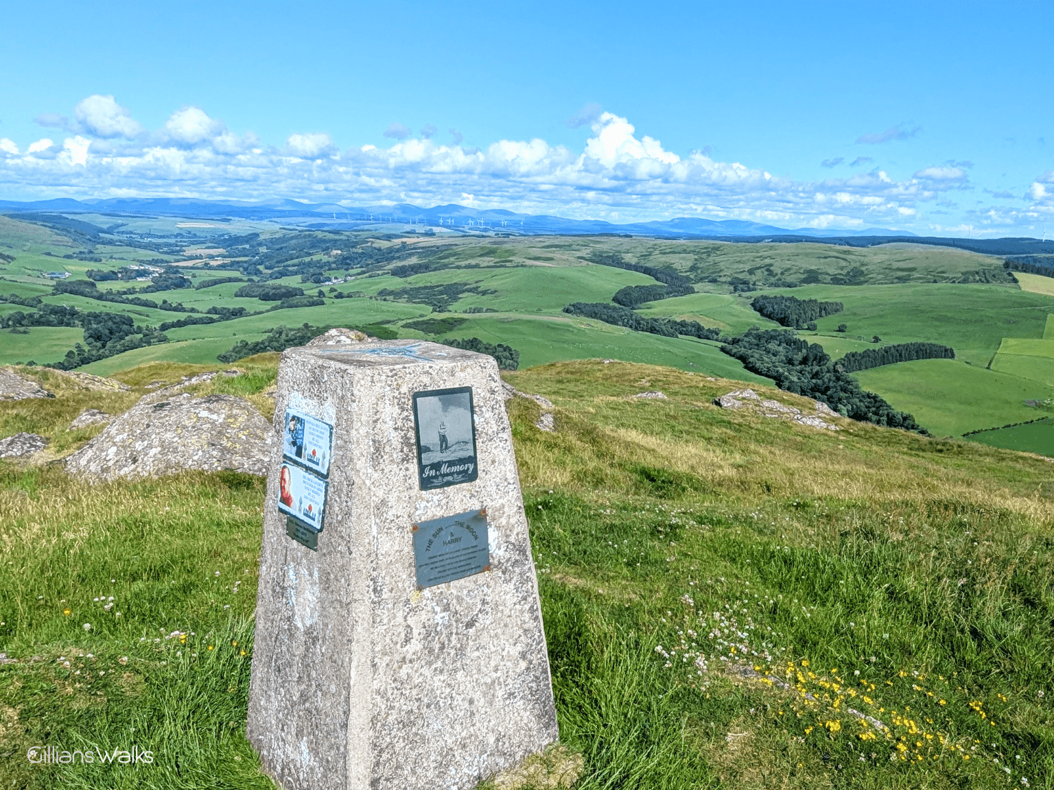
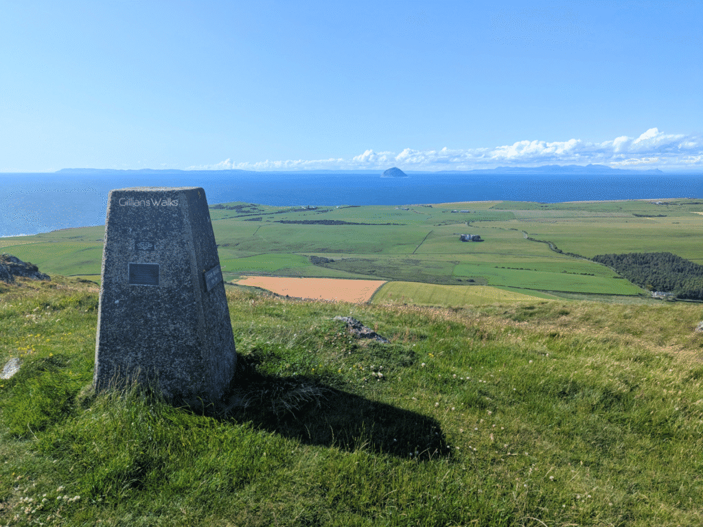
….As did I eventually! By then the boys had gotten over the views and had found a comfortable spot out of the strong breeze to catch up on social media. After a brief eye-roll, I turned my attention to the 360 degrees panorama before me. Wow. How lucky are we to live close to a place like this?! Visibility was excellent and from this higher position I could see over to the Northern Irish coastline as well as the Kintyre Peninsula. Closer, lush green fertile land surrounded us in every direction. And since we’d been walking in the area for a few days now, we could see many of the places we’d already been: Look boys, that’s the caravan park we walked to yesterday (Lagganhouse). Look boys, that’s the wee road we walked along on the first day... And look boys, there’s the mast we walked up to last night!
And so that was that: Knockdolian Hill, tick! We actually walked this route as part of a longer circular starting and finishing in Ballantrae. You can find more info on that here: Ballantrae Smugglers Trail – Knockdolian Hill Circular
THIS ROUTE GUIDE WAS COMMISSIONED BY THE BALLANTRAE TRUST, WITH FUNDING FROM BALLANTRAE COMMUNITY COUNCIL. ALL OPINIONS AND PHOTOS ARE MY OWN.