NOTE: The Millennium Bridge at Doonfoot, Ayr is closed from Monday 16 March to Sunday 28 June for essential maintenance works. The public should not attempt to use the bridge during the works, but instead should follow the signed diversion, via Scaur ODoon Road, Dunure Road and the footpath along the north bank of the River Doon. This adds approx 1 mile onto the route. More info on the ARA website.
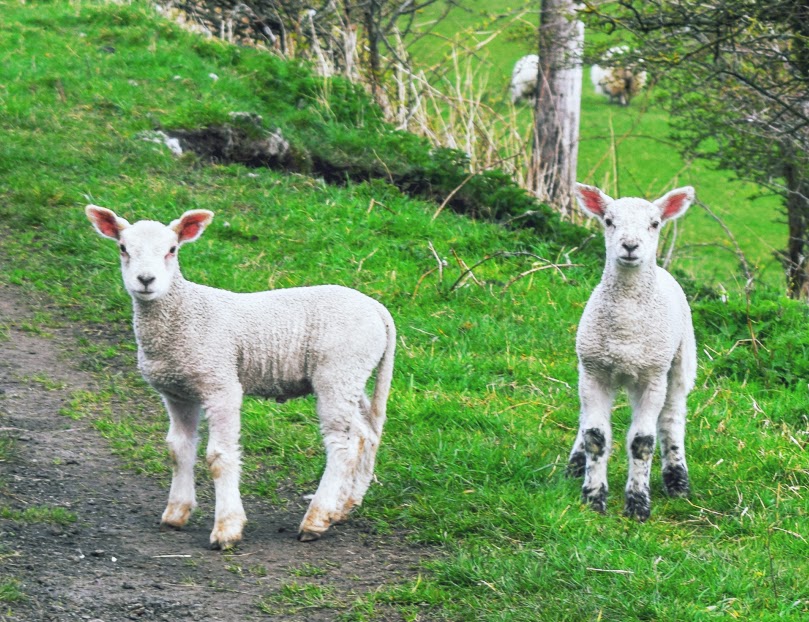
DIFFICULTY RATING: moderate–difficult. Tracks and trails, shingle, pebble, rocky and sandy beaches, rough pathless farmland. Several stiles and kissing gates, one steep ascent via gully steps. Cows often on foreshore at Fisherton and sheep/lambs on the disused railway line near Heads of Ayr Caravan Park. Drumbain Waterfall can be tricky to cross when in spate.
**It is important to check tide times before setting off on this walk: for 2 hours either side of a high tide Heads of Ayr and Fisherton Bay are usually impassable.**
![]() Parking available next to Dunure Castle in Kennedy Park, Dunure (£3 per day charge between Easter and Sept, free at other times of the year). In Ayr there are lots of town centre car parks (charges apply) or free parking at Seafield, or further along the Esplanade. There is a regular bus service between Ayr and Dunure and there is also a train station in Ayr.
Parking available next to Dunure Castle in Kennedy Park, Dunure (£3 per day charge between Easter and Sept, free at other times of the year). In Ayr there are lots of town centre car parks (charges apply) or free parking at Seafield, or further along the Esplanade. There is a regular bus service between Ayr and Dunure and there is also a train station in Ayr.
![]() Public toilets in Kennedy Park, Dunure (closed October to March) and at Ayr Pavilion. Both payable via contactless only. Check opening times and charges on the SAC website.
Public toilets in Kennedy Park, Dunure (closed October to March) and at Ayr Pavilion. Both payable via contactless only. Check opening times and charges on the SAC website.
![]() Purchase the official Ayrshire Coastal Path Guide Book
Purchase the official Ayrshire Coastal Path Guide Book
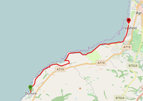
View full route description
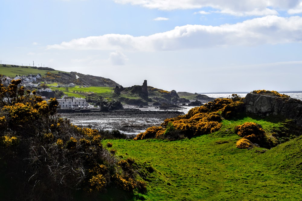
Start by walking around the edge of Dunure harbour and across the village’s sand and shingle beach.
At the north end of the beach you will see a gap in the rocks – go through this to a gate.
For the next section look out for large white painted circles on the rocks showing you the way. Follow a faint desire line up onto a grassy foreshore, weaving in and out of the hillside to eventually arrive at a kissing gate.
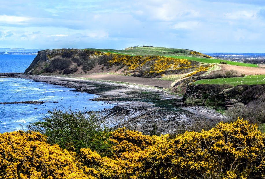
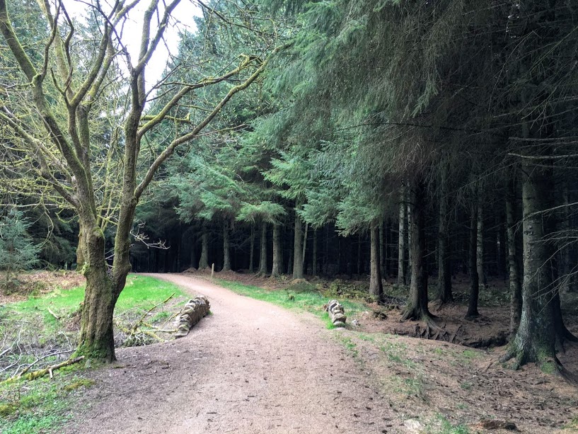
Beyond the kissing gate the trail takes you through some gorse and across the clifftops.
You’ll arrive at a dry stone wall with a stile followed by a small footbridge over Ladywell Burn.
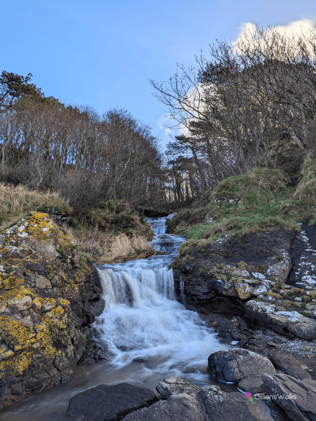
After going down a small gully you will emerge onto a pebble and sandy bay, with Drumbain Waterfall just around the bend. You need to ford the Drumbain Burn which spills out onto the beach – care required when in spate.
At the far end of the bay look for a large white arrow painted onto a rock, indicating where you should begin heading uphill by way of some steps built into the steep Fisherton Gully.
At the top of the gully go through a kissing gate onto a field.
Follow a desire line across the field to another kissing gate and into a second field. At the other side of this field is a kissing gate leading onto a disused railway line.
Walk along the disused railway line for 1km, enjoying spectacular views down onto Bracken Bay where you are headed next.
When you reach Heads of Ayr Caravan Park, follow the track along the edge of a field with a row of caravans on your right-hand side.
On reaching some farm tracks, turn left (N) to follow them between two fields. Keep left (W) at a fork 200m along, going through a kissing gate then descending to Bracken Bay.
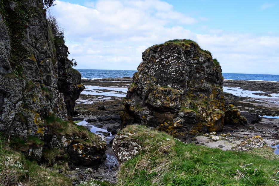
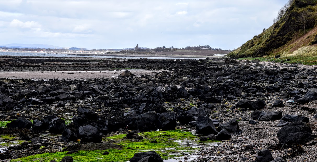
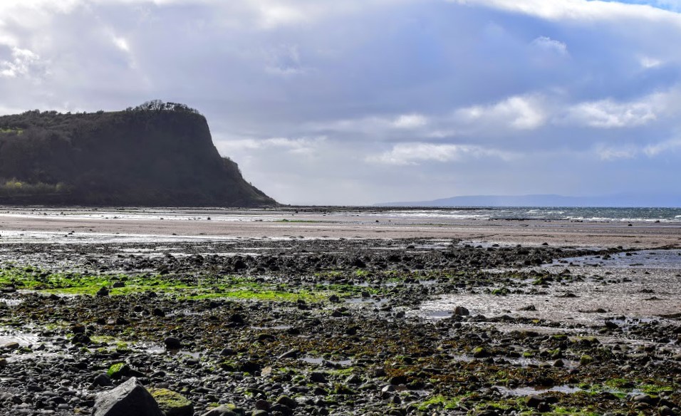
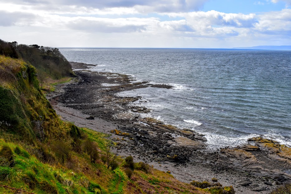
Turn right (NE) to walk along the beach. As you reach the north end 500m along, you will go around a rocky outcrop called Heads of Ayr. Note that for 2 hours either side of a high tide this section will be impassable.
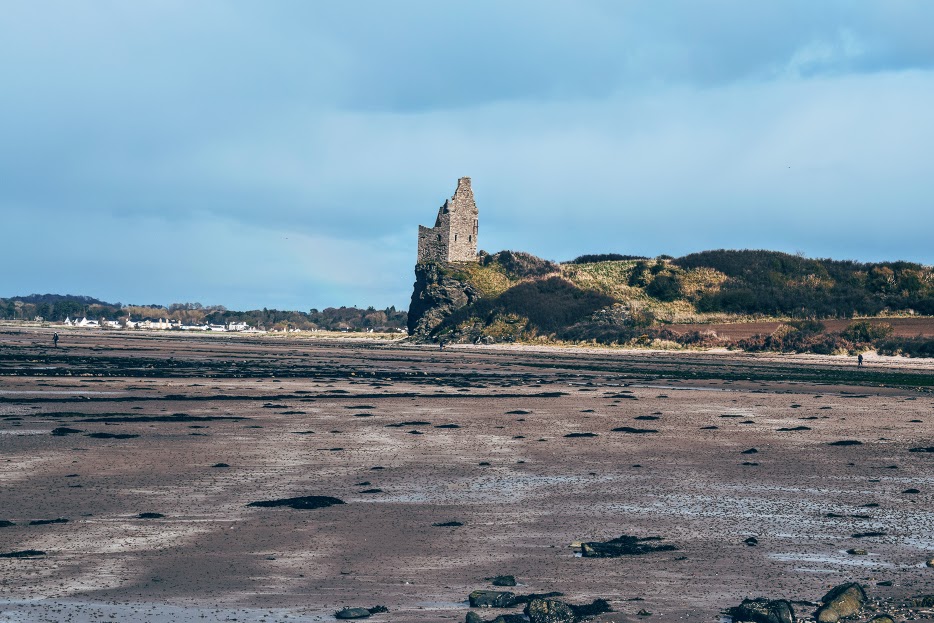
Follow the coastline for 3km, passing beneath Craig Tara Holiday Park and arriving at the foot of Greenan Castle.
1km further along the beach, shortly after passing a large pipe outflow, look out for an Ayrshire Coastal Path marker post on the edge of the dunes to your right (if you go as far as the River Doon, you’ve gone too far!) Come off the beach here to walk through the dunes to a car park.
Turn left to walk through the car park and cross the footbridge over the River Doon.
After crossing the bridge, continue ahead (N), to follow Ayr Esplanade for 1km to reach the car park at Seafield, just opposite Cafe India. Or continue into Ayr for onwards travel by bus/train.
WALK REVIEW
Having walked the whole 100 miles of the Ayrshire Coastal Path, this section is one I keep coming back to. I simply love it’s rugged beauty and the feeling of remoteness I get during it. To some degree you are at the mercy of Mother Nature since it is the type of walk on which there is little option for bailing out should conditions become less than favourable and there are several tidal stretches which become impassable at a high tide. It is definitely a walk best left for a dry day, preferably with clear visibility to make the most of the stunning views. Most definitely a walk which I would put into the challenging category thanks to the terrain involved; sturdy footwear is a must.
There are public toilets in Dunure at Kennedy Park which I recommend using before you set off (I believe they have won an award in the past!). They are closed at certain times of the year though so be sure to check the opening times. There are no other toilets on the route until you reach Ayr at the end.
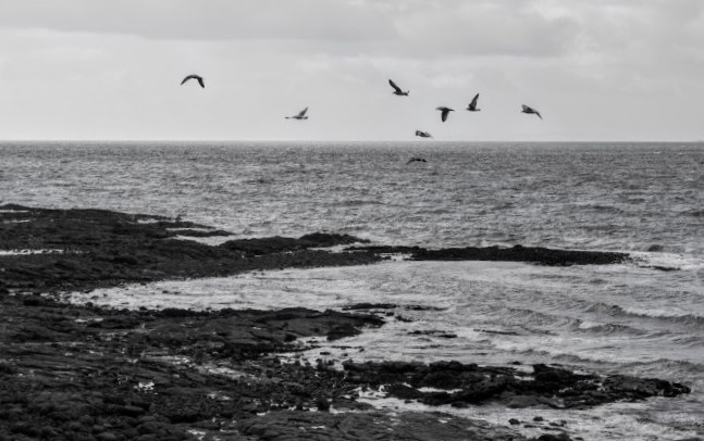
Look out for cows (sometimes ON the path near Fisherton), sheep & lambs (particularly along the disused railway), rabbits, pheasants and tons of seabirds!
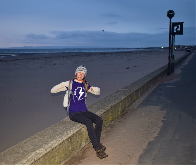
Enjoy my photo tour below!